Brief information about Greece
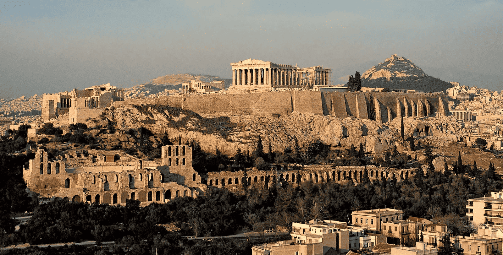
Greece is a country steeped in history, mythology, and stunning landscapes. From the ancient ruins of the Parthenon in Athens to the crystal-clear waters of the Aegean Sea, it offers visitors a glimpse into both its legendary past and vibrant present. Famous for its influence on Western civilization, Greece is considered the birthplace of democracy, philosophy, and the Olympic Games, making it a must-visit for history buffs and culture enthusiasts alike.
Greece Road Map
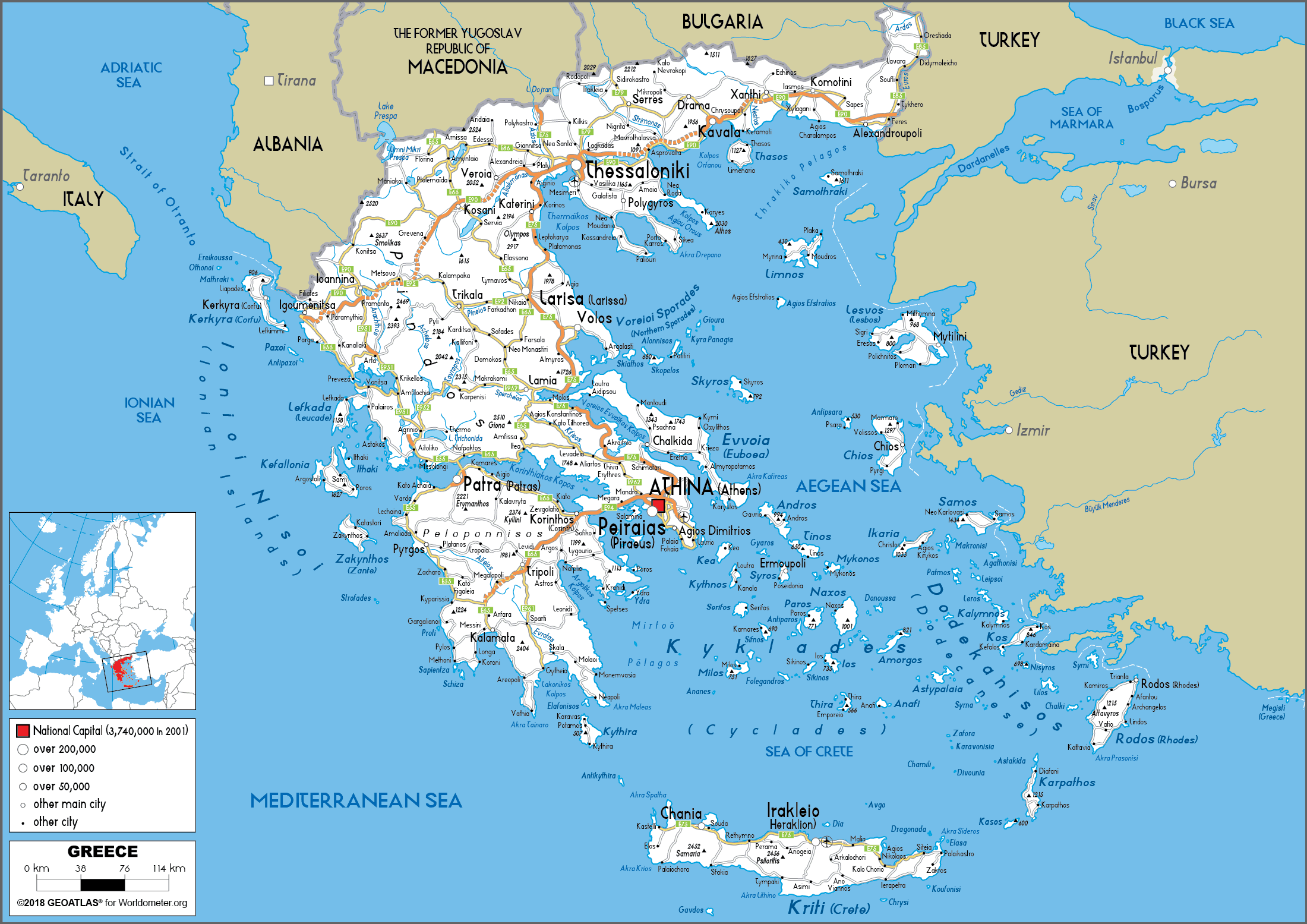 This detailed road map of Greece shows the main highways, cities and major routes across the country, linking the mainland with the islands of the Aegean and Mediterranean seas, with Athens and Thessaloniki as prominent hubs. It also highlights important geographical features such as mountains, rivers and coastlines, as well as the proximity of neighbouring countries such as Turkey, Bulgaria and Albania.
Beyond its historical significance, Greece is also known for its delicious Mediterranean cuisine and lively traditions. Whether you’re indulging in fresh seafood on the islands of Santorini or experiencing the lively atmosphere of traditional festivals, the country’s unique blend of old-world charm and modern vibrancy creates an unforgettable experience for travelers.
Where is located Greece on the World Map
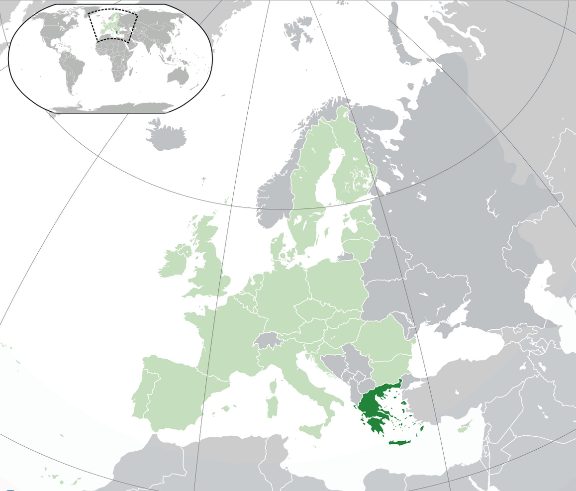
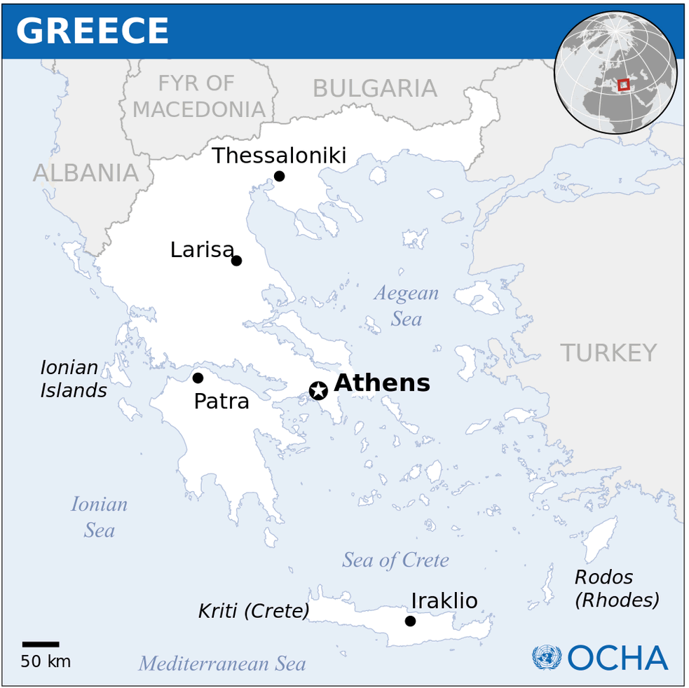
Greece is located in Southern Europe, on the southernmost tip of the Balkan Peninsula. It shares land borders with Albania, North Macedonia, and Bulgaria to the north, and Turkey to the northeast. To the south and west, Greece is surrounded by the Mediterranean Sea, and its eastern coast is bathed by the Aegean Sea, positioning it at a unique crossroads between Europe, Asia, and Africa.
The country’s location has historically played a crucial role in its cultural and political significance. Greece’s proximity to both the Mediterranean and Aegean seas made it a vital hub for ancient maritime trade routes, connecting different civilizations. This prime geographic position allowed Greece to influence a wide range of cultures, from the Middle East to Northern Europe, throughout history.
Today, Greece remains a popular travel destination, largely thanks to its stunning coastal landscapes and strategic location. The country’s mainland is complemented by thousands of islands scattered across the Aegean and Ionian Seas, making it a paradise for beach lovers, history buffs, and adventurers alike.
Here are some statistical information about Greece:
Map of Greece
Ancient Time Map Greece
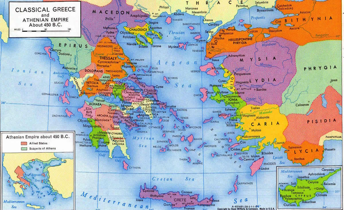
This map illustrates the regions and city-states of Classical Greece around 450 B.C., highlighting the extent of the Athenian Empire and its alliances.
Greece Location Map
Greece Division Map
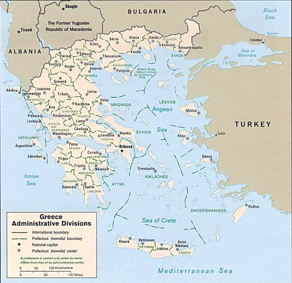
This map illustrates the administrative divisions of Greece, showing the international boundaries, prefectures, and major cities, as well as its neighboring countries, including Albania, North Macedonia, Bulgaria, and Turkey.
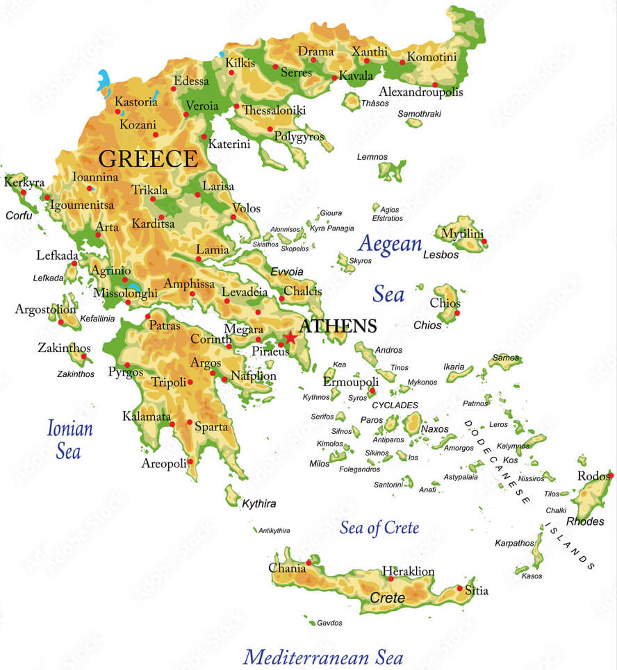
Greece Map
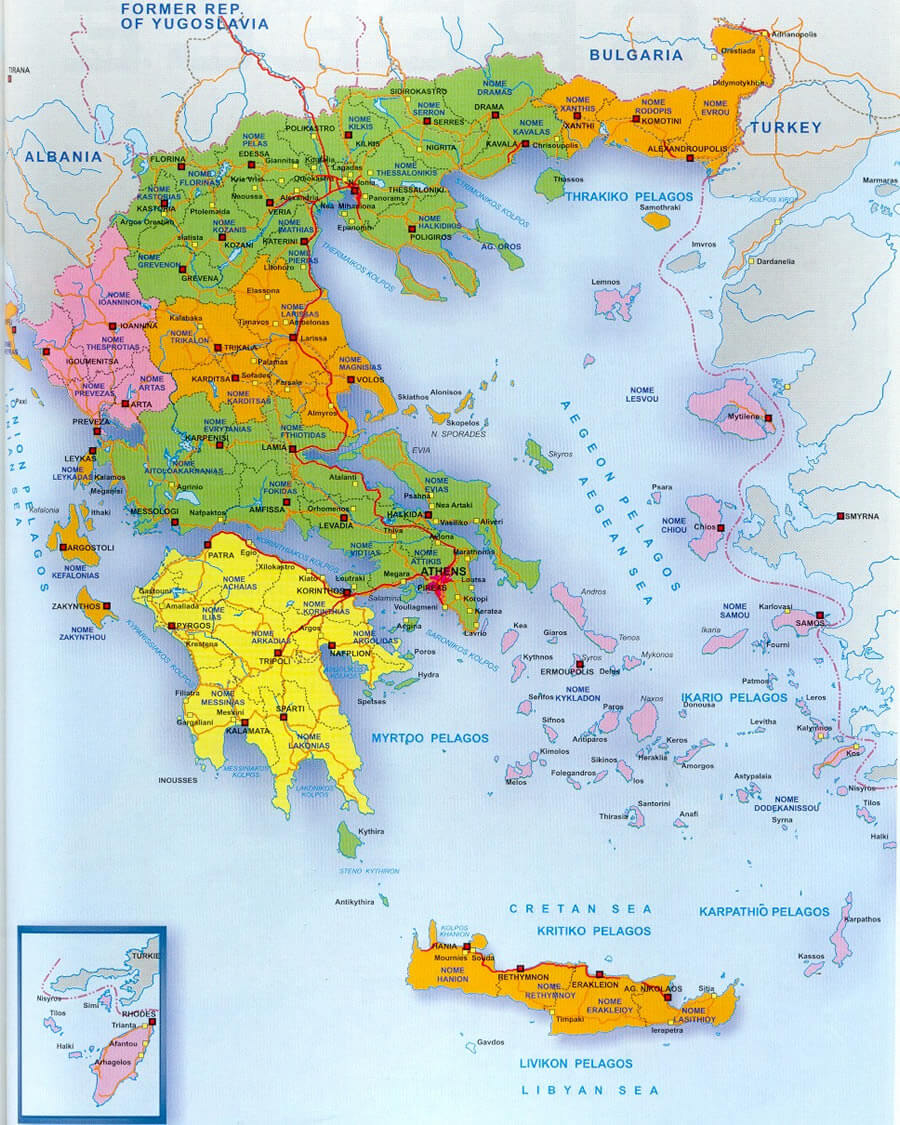
This map shows the geographical and administrative divisions of Greece, highlighting its regions, major cities, and surrounding seas, along with neighboring countries like Albania, North Macedonia, Bulgaria, and Turkey.
Greece Map Aegean Sea

Greece Map Hellas
This map shows the modern regions and administrative divisions of Greece, highlighting its mainland, surrounding islands, and neighboring countries such as Albania, North Macedonia, Bulgaria, and Turkey.
Greece Maps
Greece Map Islands
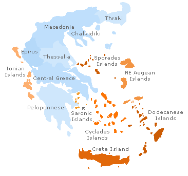
This map highlights the regions and island groups of Greece, including areas like Crete, the Cyclades, Dodecanese, NE Aegean Islands, and the mainland regions such as Macedonia, Epirus, and the Peloponnese.
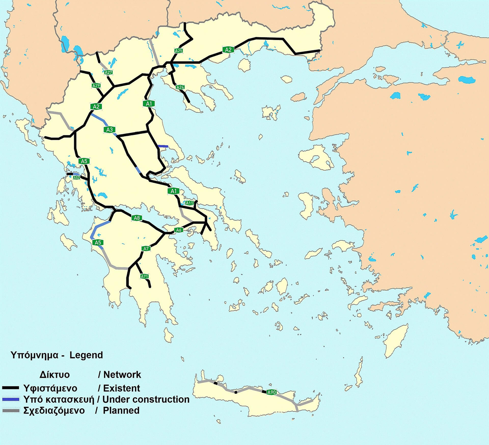
Greece Highways Map
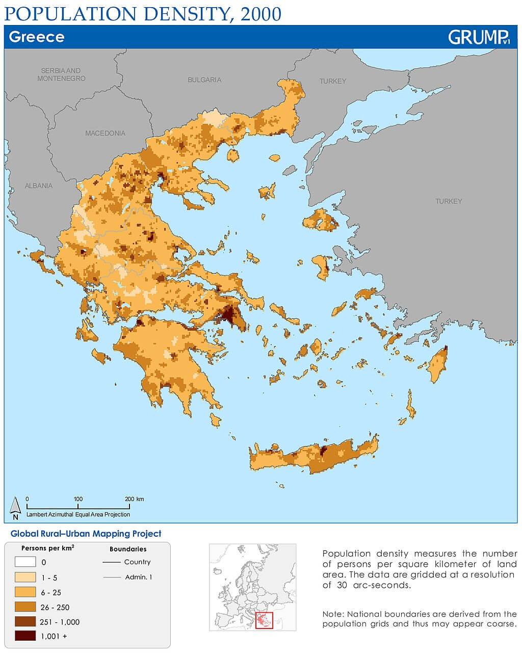
Greece Population Density Map in 2000
Greece Demography Map
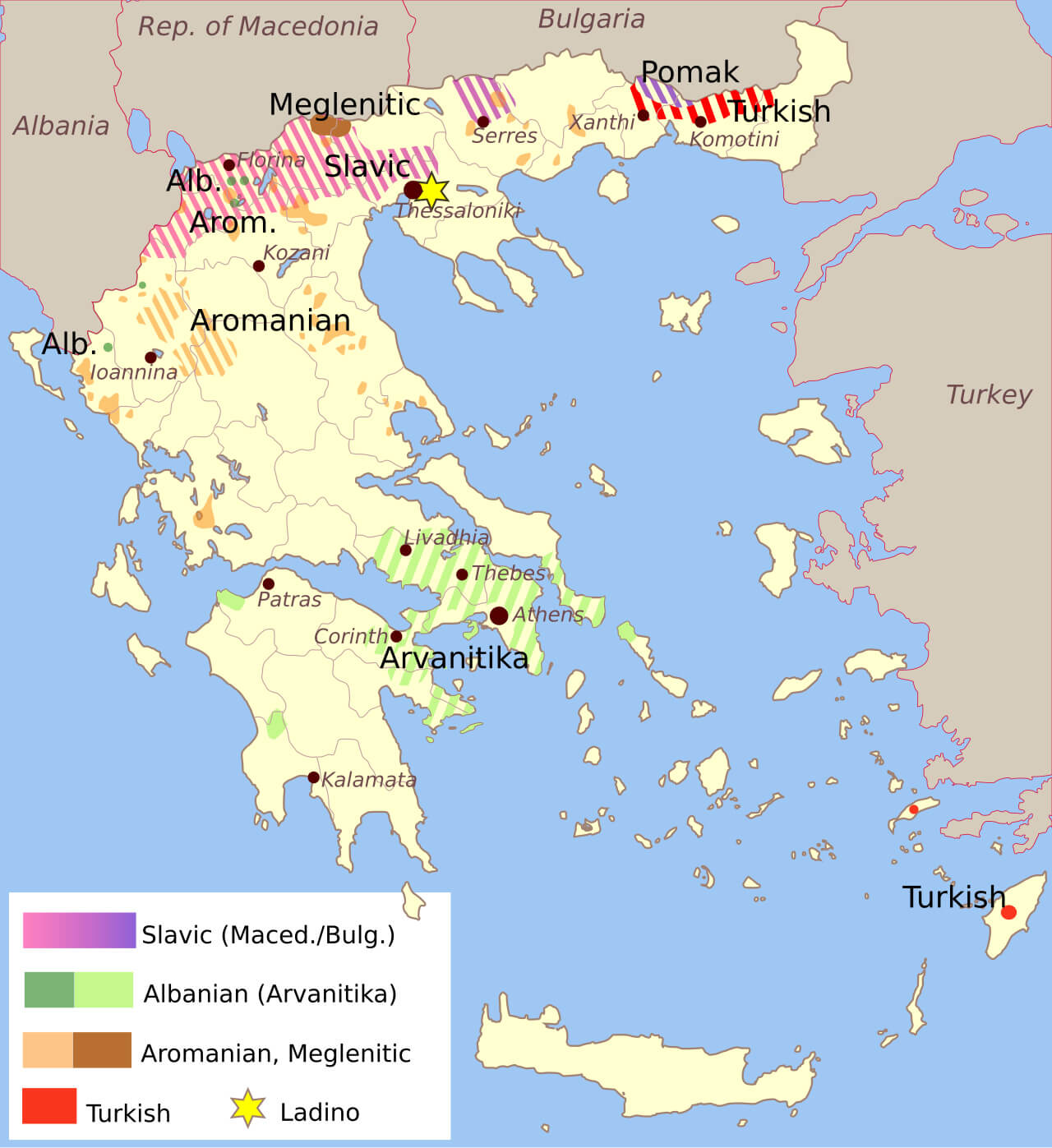 This map of Greece shows the ethnic and linguistic diversity of the country. Various regions are represented by different colors indicating the presence of Slavic-speaking communities (Macedonian/Bulgarian), Albanian-speaking (Arvanitika), Aromanian and Meglenitic, as well as Turkish-speaking populations. Additionally, small Jewish Ladino-speaking communities are marked with stars. For example, Arvanitika, a dialect of Albanian, is spoken in the southern and central parts of Greece, while Turkish-speaking communities are located in the northeast. This map highlights the rich cultural and linguistic mosaic of Greece, especially in its northern regions bordering Albania, Bulgaria, and Turkey.
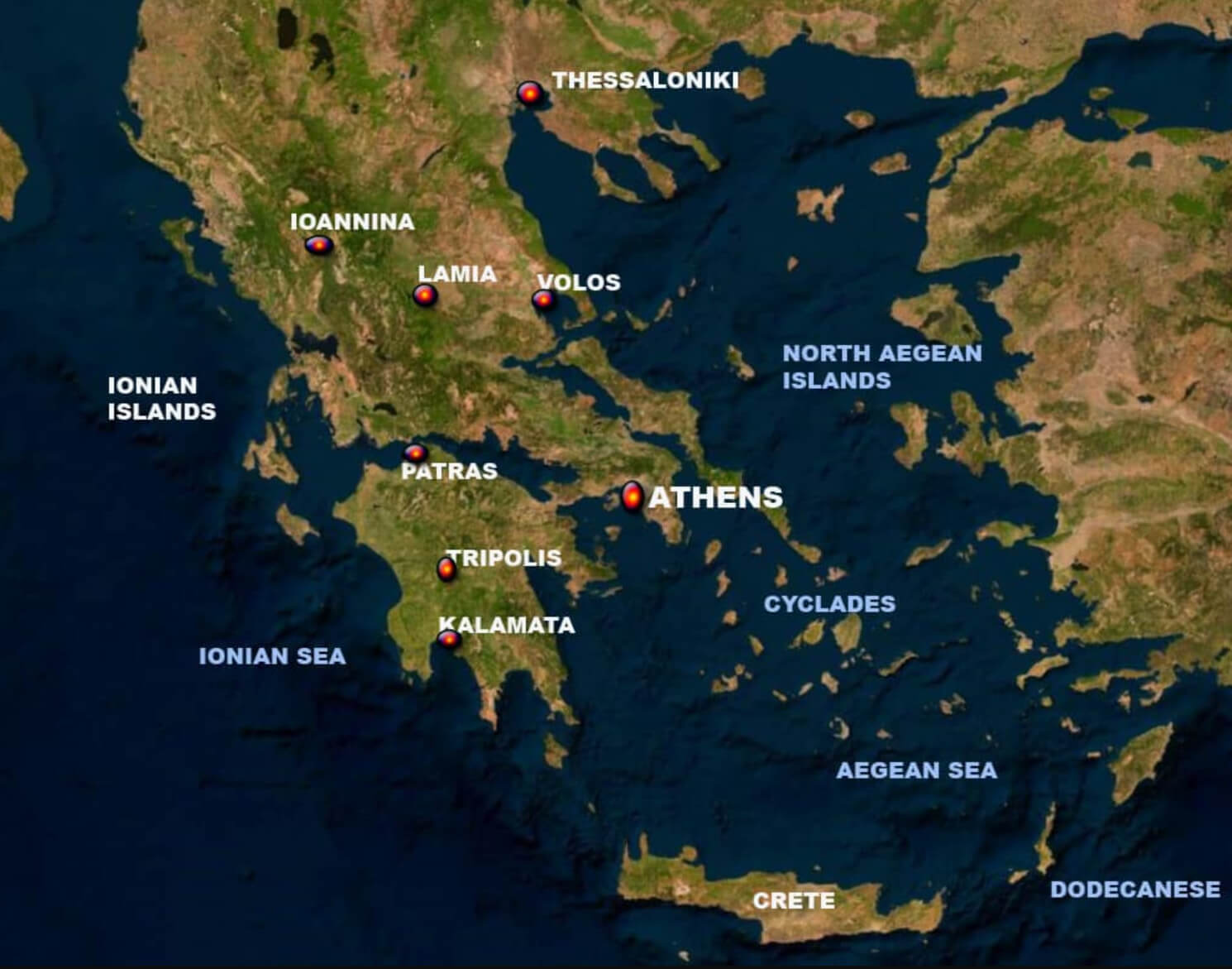
Greece Largest Cities Map
 This map of Greece highlights its largest cities and regions, including notable urban areas like Athens, Thessaloniki, and Patras. It also depicts the many islands scattered across the Aegean and Ionian Seas, such as Crete, Rhodes, and Corfu, providing a detailed view of Greece’s geographical and cultural diversity. The inclusion of mountain ranges like Mount Olympus and various island groups adds depth to understanding the country’s varied landscape.
Greece Balkans Turkey Map
 This map of Greece, the Balkans, and Turkey provides a detailed geographic overview of the region, highlighting major mountain ranges such as Mount Olympus, the islands in the Aegean Sea, and neighboring countries such as Northern Macedonia, Albania, and Bulgaria. The map also covers major bodies of water, including the Ionian Sea, the Mediterranean Sea and the Sea of Crete, reflecting Greece’s rich maritime landscape and strategic location in Southeastern Europe.
Greece Turkey Ancient Cities Map
 This Ancient Cities map highlights important historical sites in both Greece and Turkey, featuring well-known cities such as Athens, Sparta, and Corinth in Greece, and Troy, Smyrna (modern-day Izmir), and Ephesus in modern-day Turkey. These cities were important in ancient times, either for their political, cultural, or religious significance. The Aegean Sea, centrally located between Greece and Turkey, connected many of these cities through trade routes, contributing to the rich exchange of ideas and culture in ancient times. The region is famous for its contributions to classical history, mythology and ancient architecture.
The Byzantine Wastern Roman Empire Map in 1025
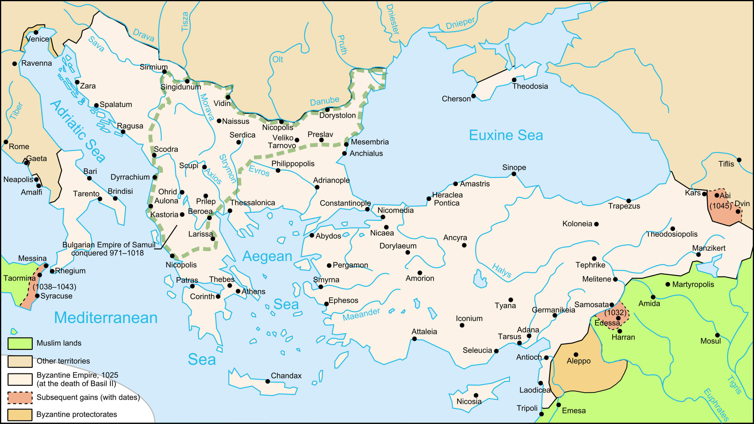 This map shows the Byzantine Empire at its territorial peak in 1025, during the reign of Emperor Basil II, known for his military successes and consolidation of Byzantine control. It highlights the major cities, provinces, and Byzantine strongholds, as well as the borders with Muslim territories. The Byzantine Empire at this time covered much of the eastern Mediterranean, including parts of modern Greece, Turkey, the Balkans, and parts of Italy. Major sites such as Constantinople, Athens, Ephesus, and Antioch are featured, demonstrating the empire’s dominance over key strategic and cultural centers in the region.
The Empire of Alexander Map between 334 and 323 BC
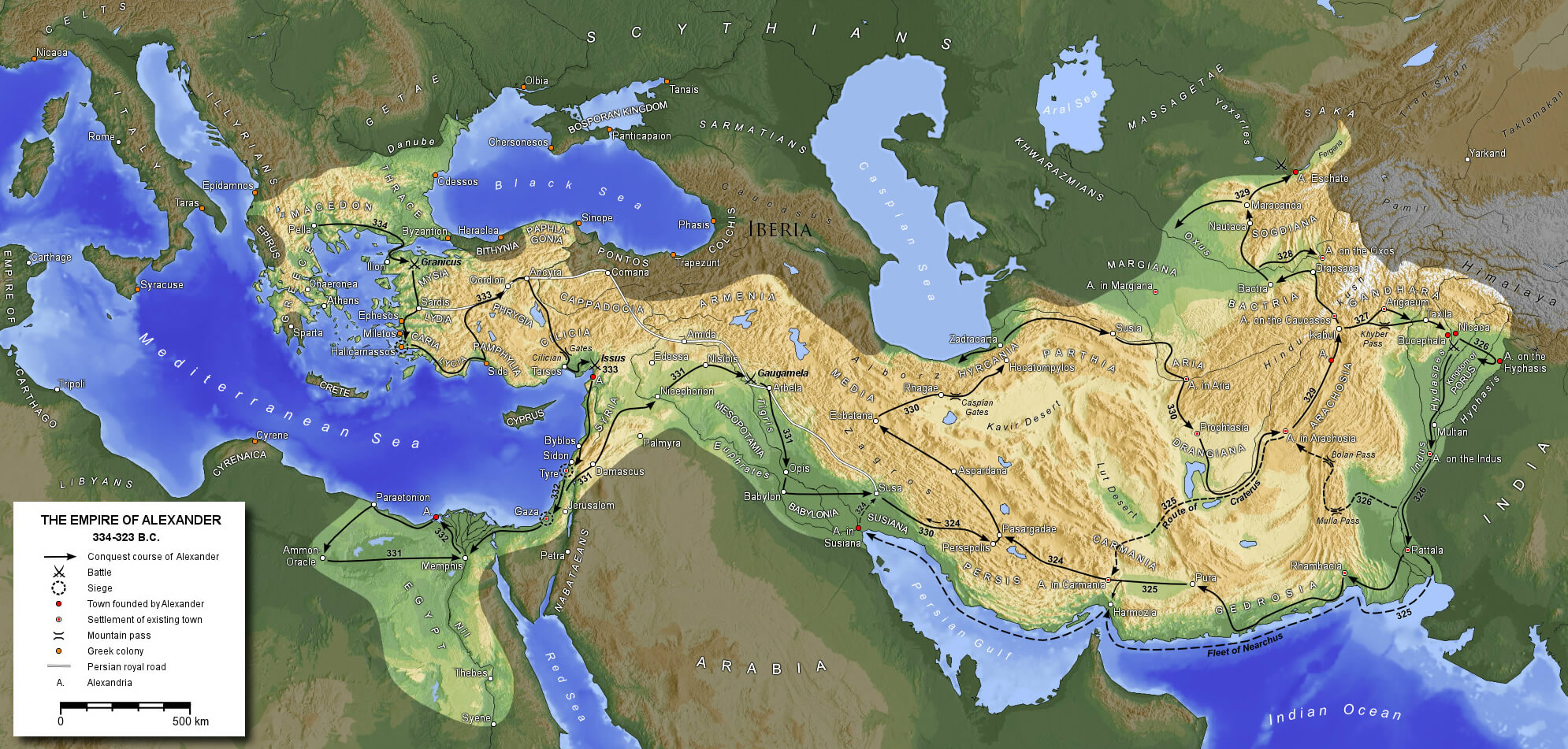 The map of The Empire of Alexander the Great shows the vast territories he conquered between 334 and 323 BC, stretching from Greece and Egypt in the west to the Indian subcontinent in the east. Alexander’s campaigns spanned several regions, including the Persian Empire, Egypt, Mesopotamia, and parts of India, with key battles such as the Battle of Issus (333 BC) and the Battle of Gaugamela (331 BC). His empire linked the Mediterranean world with the Middle East and fostered a fusion of Greek and local cultures, an era known as the Hellenistic period.
Kingdom of Greece Map
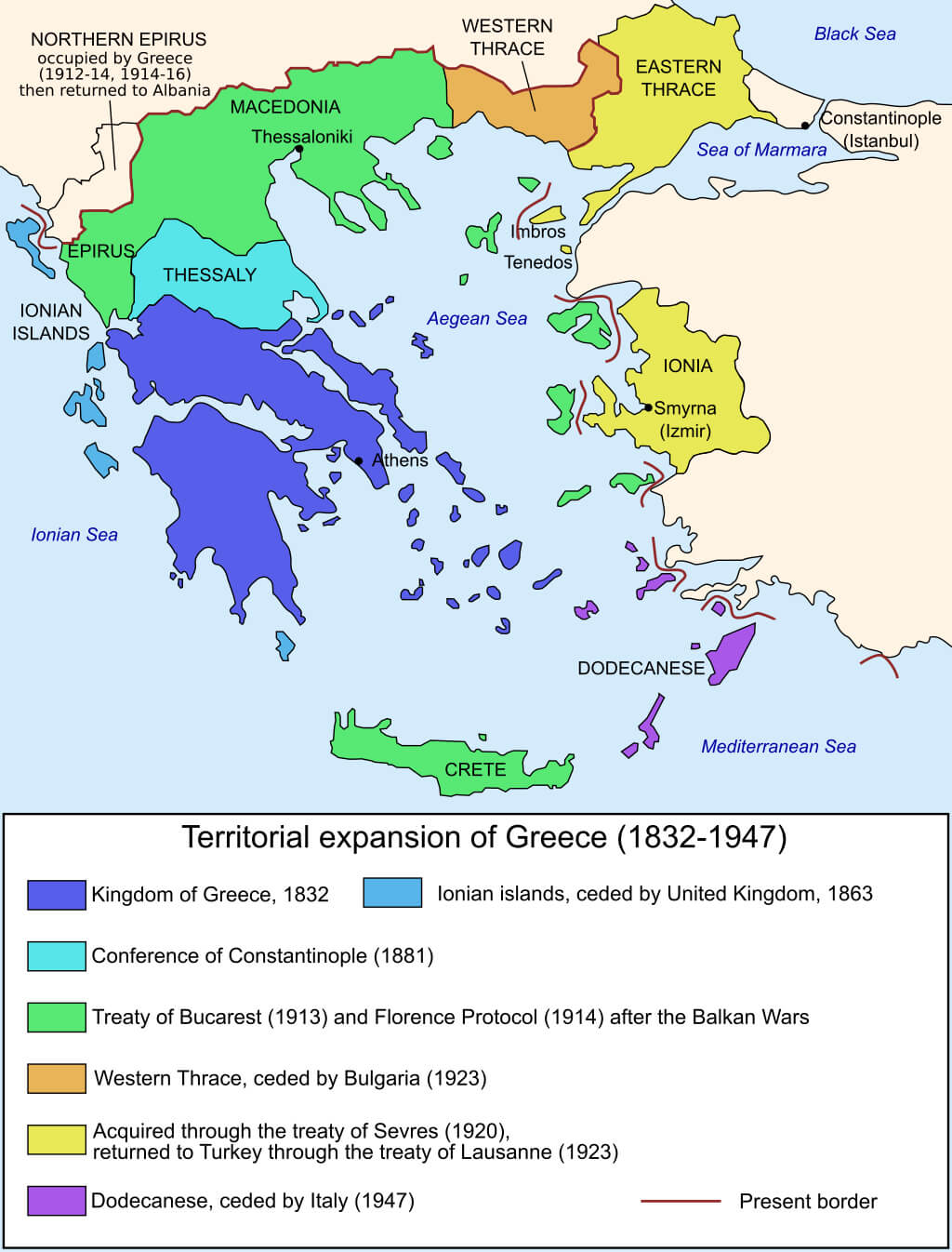 This map shows the territorial expansion of Greece between 1832 and 1947, highlighting the regions acquired through treaties and agreements. Greece’s territorial growth began with the Kingdom of Greece in 1832 (in dark blue) and continued with key acquisitions such as the Ionian Islands (ceded by the United Kingdom in 1863), Thessaly (gained through the Conference of Constantinople in 1881), and Macedonia, Epirus, and Crete (obtained after the Balkan Wars and through treaties in the early 20th century). Other regions like Western Thrace were ceded to Greece in 1923, while the Dodecanese Islands were returned by Italy in 1947, marking the last major territorial expansion in modern times. This map reflects Greece’s evolution as a nation over more than a century.
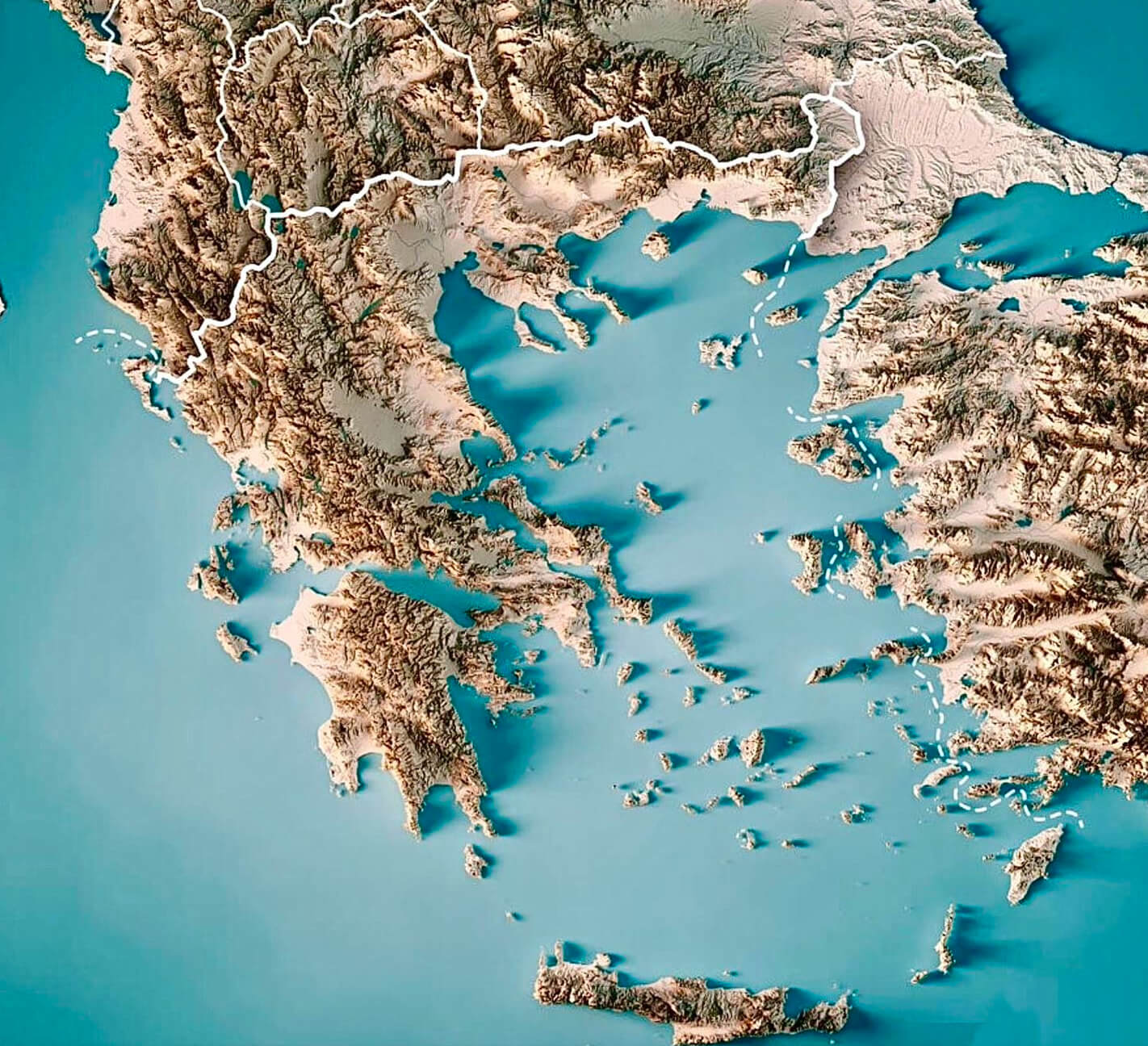
Topographic Map of Greece
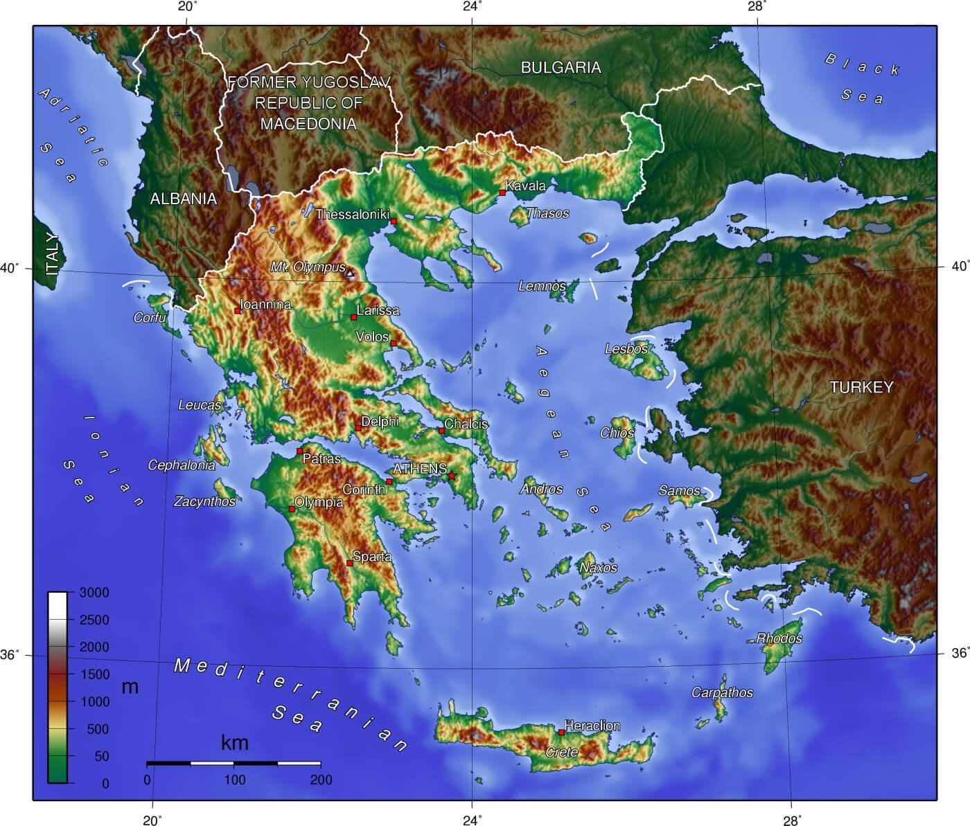 The topographic map of Greece displays the country’s varied terrain, highlighting its mountainous regions, including Mount Olympus, and its numerous islands in the Aegean and Ionian Seas. Mainland Greece is dominated by rugged mountains, while its coastline is dotted with smaller islands, emphasizing the country’s unique blend of land and sea features. This elevation map effectively shows how Greece’s topography has influenced its historical development, maritime culture, and economic reliance on trade routes and agriculture across different regions.
Greece Climate Map
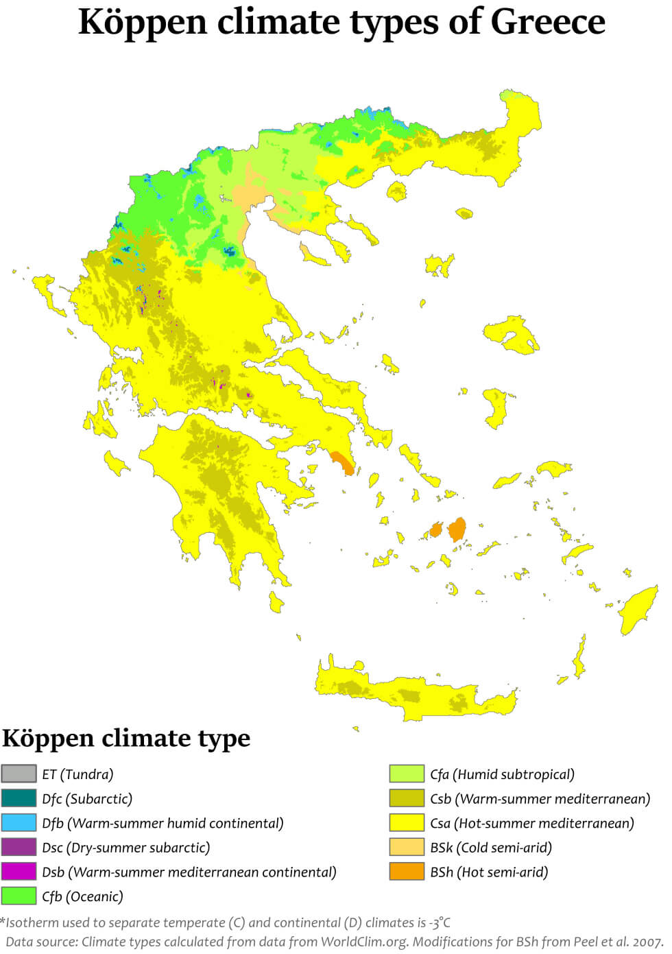 This map of Greece shows different climate types according to the Köppen classification. The northern and mountainous regions of Greece experience a humid subtropical climate (Cfa) and a warm summer Mediterranean continental climate (Dsb). In contrast, most of the country, including the islands and southern regions, enjoys a hot summer Mediterranean climate (Csa), characterized by dry summers and mild, wet winters.
Greece Solar Resource Map
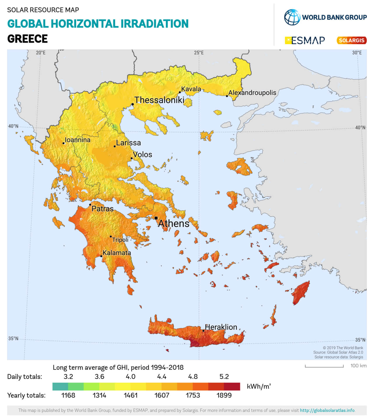 The Greece Solar Resource Map shows the global horizontal irradiance (GHI) across Greece, indicating the potential for solar energy production in different regions. The map highlights areas with higher solar irradiance, such as southern Greece, including parts of Crete and the Peloponnese, which receive higher levels of solar energy, making them ideal for solar power generation. Northern regions, such as Thessaloniki, receive relatively lower levels of insolation but still offer significant potential for solar development. This resource can guide energy policy and infrastructure planning, highlighting the solar potential in Greece.
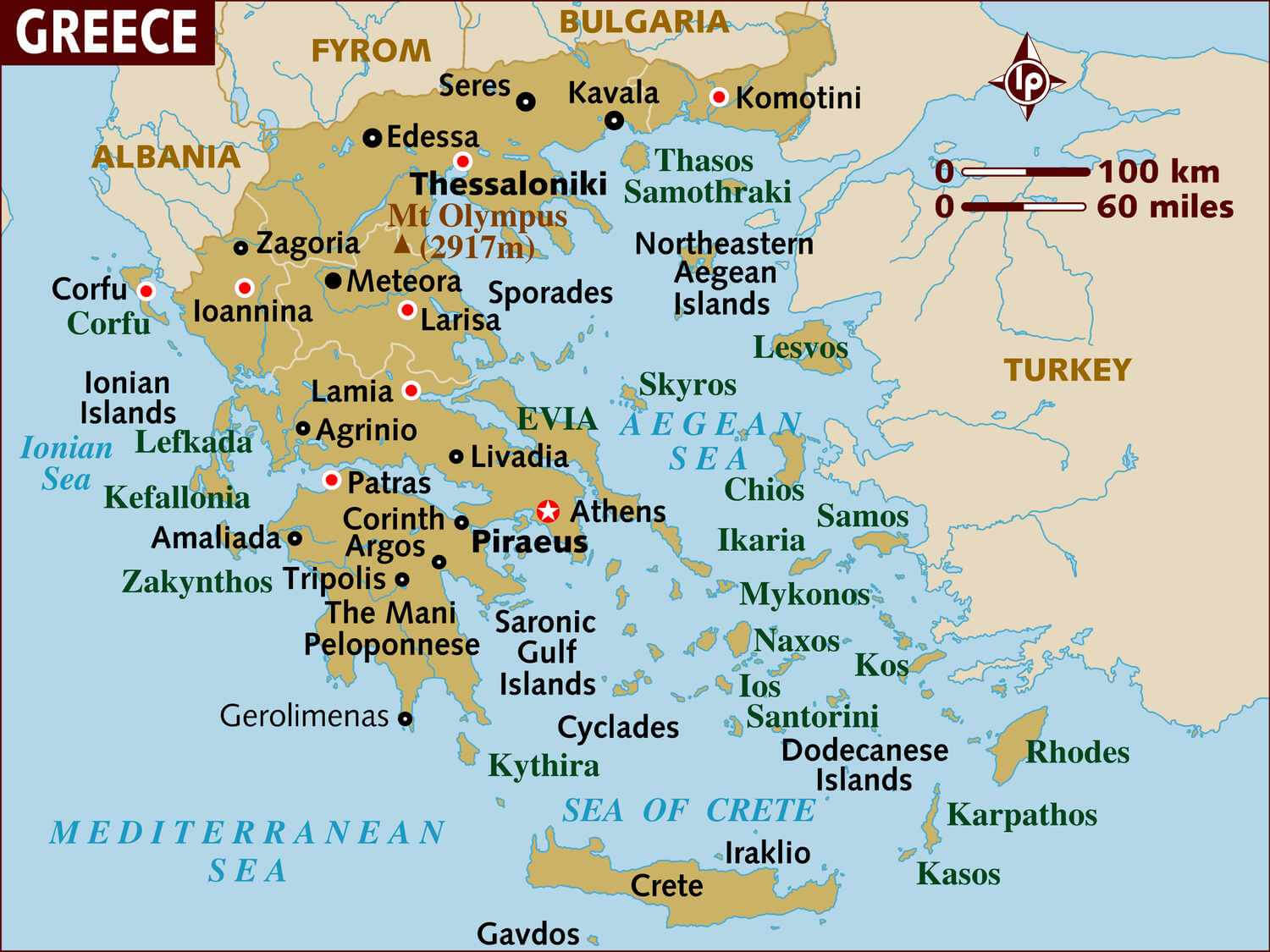
Greece Athens Islands Map
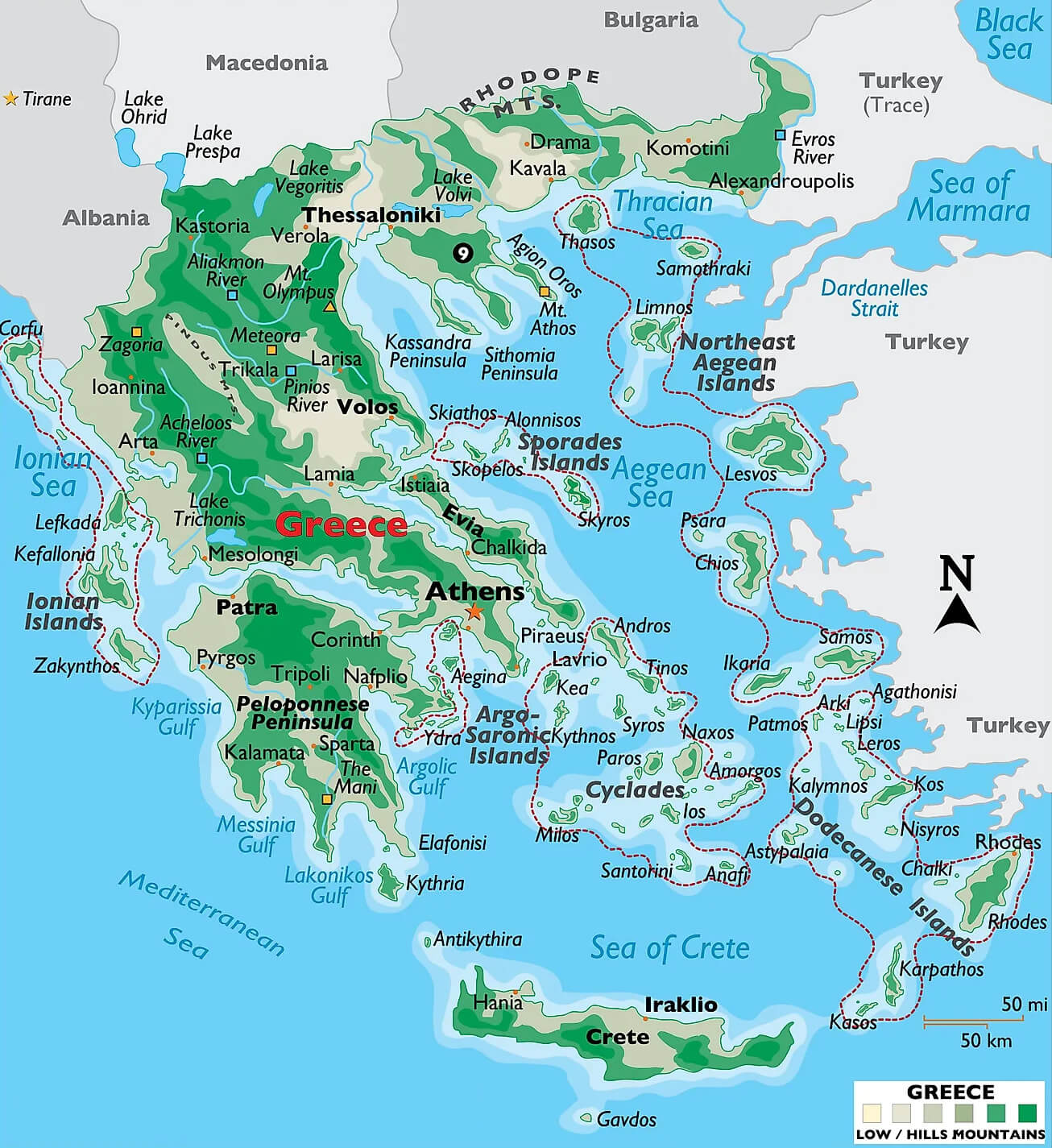 This map of Greece highlights major geographic features, including mountainous regions such as the Rhodope Mountains, Mount Olympus, and the Pindus Mountains, as well as prominent cities such as Athens, Thessaloniki, and Patra. It also shows the many Greek islands, such as the Ionian Islands, the Cyclades, the Dodecanese, and Crete, giving a clear picture of Greece’s varied terrain, which includes lowlands, hills, and mountains, surrounded by seas such as the Aegean, Mediterranean, and Ionian.
Greece Largest Islands Map
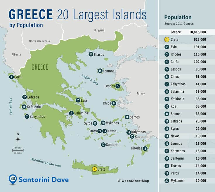 The map shows the 20 largest Greek islands by population, according to the 2011 census. Crete, the largest and most populous island, is home to 623,000 people, followed by Evia with 191,000, Rhodes with 115,000, and Corfu with 102.000. These islands are spread across several seas, including the Aegean, Ionian and Mediterranean.
Greece Provinces Map
 This map shows the administrative regions and provinces of Greece, highlighting major cities and island areas. Greece is divided into several regions, such as Macedonia, Thessaly, and Epirus, as well as the numerous Aegean islands and Crete. Each region is color-coded to indicate its administrative boundaries, which include key areas such as Athens, Thessaloniki, and Crete. This visualization helps distinguish mainland areas from island regions and provides a clear representation of the provincial layout of Greece.
Greece National Borders Map
 This map of Greece’s national boundaries highlights major cities, regions, and islands, illustrating the diversity of the country’s geography. Mainland Greece shares prominent borders with Albania, North Macedonia, Bulgaria, and Turkey, while its numerous islands, such as Crete and the Cyclades, extend into the Mediterranean and Aegean seas. The map highlights Greece’s strategic location at the crossroads of Europe, Asia, and Africa, making it a historically significant region for trade, culture, and geopolitics. The surrounding seas further illustrate Greece’s extensive coastline and maritime importance.
Greece Travel Map
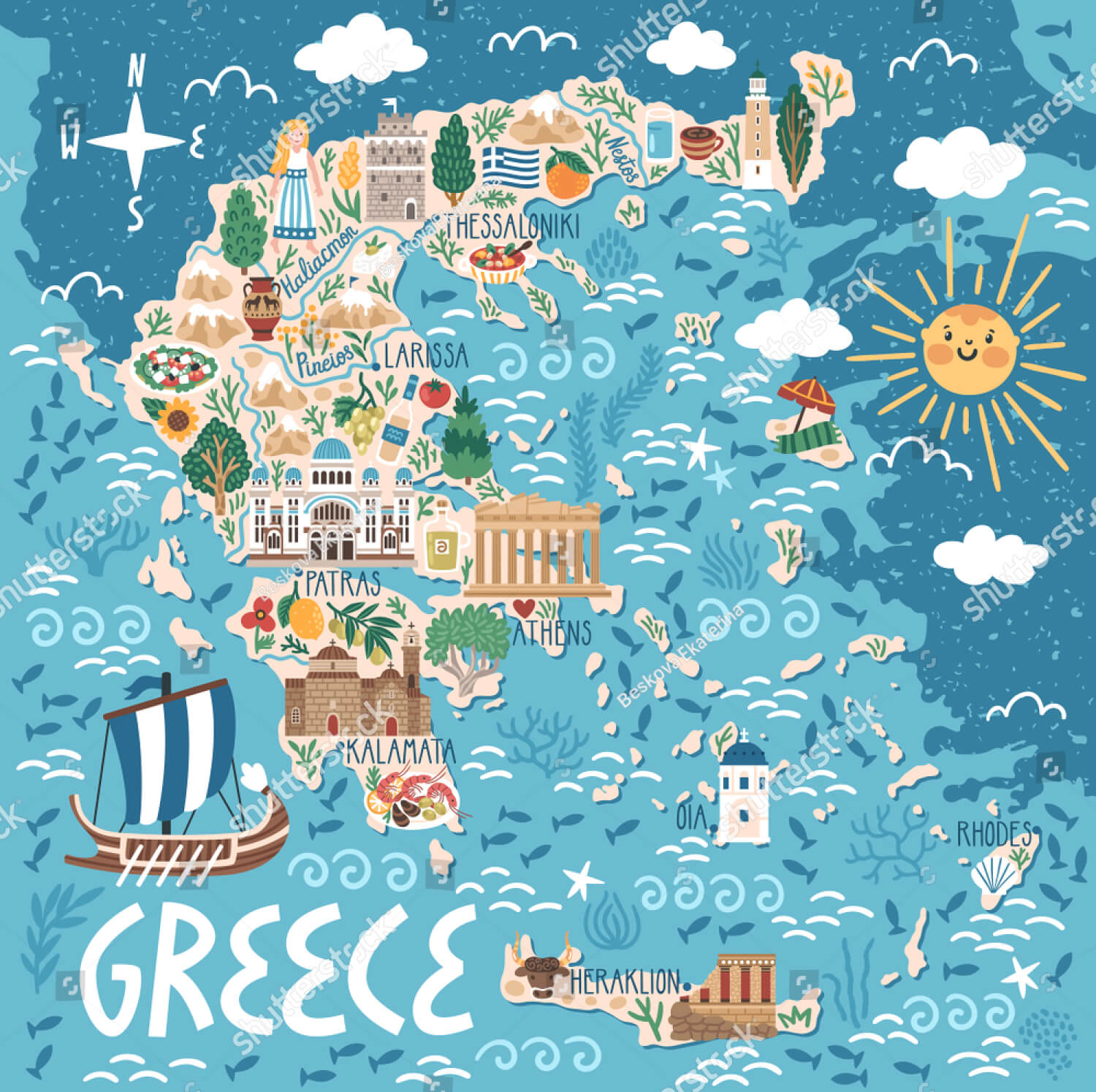 This illustrated travel map of Greece shows various key locations and landmarks of Greece, including famous cities such as Athens, Thessaloniki and Heraklion. Iconic sites such as the Parthenon in Athens, the traditional white buildings of Oia in Santorini, and the medieval castle of Rhodes are featured. The map also highlights unique cultural aspects of the regions, such as local cuisine, traditional dress and famous Greek myths, providing a vibrant and inviting overview of Greece as a popular tourist destination.
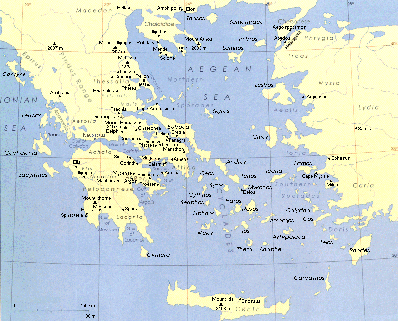
Greece Ancient Period Map
 This map depicts ancient Greece during a significant period in history, highlighting various city-states, regions, and territories that played a crucial role during classical antiquity. Key locations such as Sparta, Athens, and Mycenae are labeled to show the geographic distribution of power and influence in the Greek world. This map also includes legendary cities and regions associated with Greek mythology, such as Troy and Mycenae, which were featured in famous epics such as the Iliad. It provides a detailed look at the regions, showing how the complex landscape influenced Greek history, politics, and military strategy.
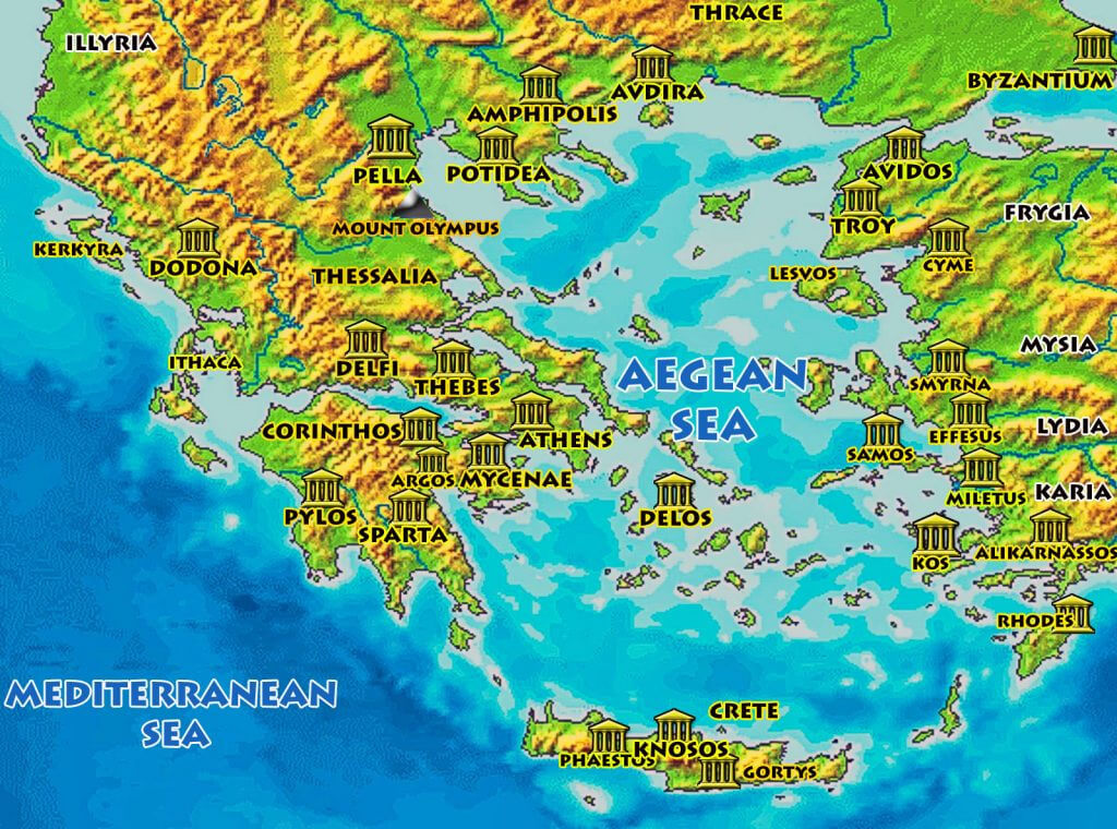
Map of Ancient Greece
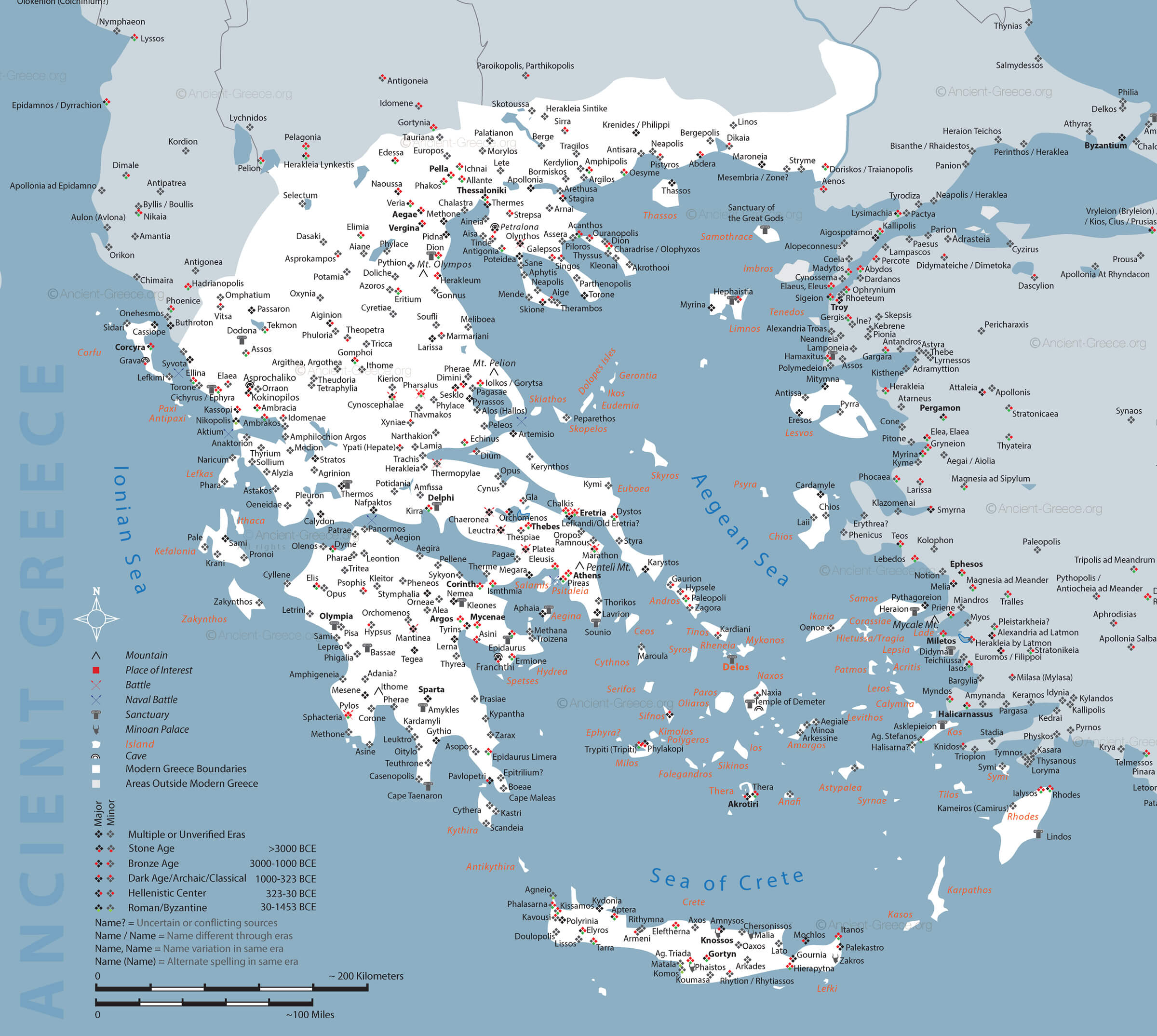 This map of Ancient Greece highlights significant sites, including notable cities, battlefields, and sanctuaries throughout mainland Greece, the Aegean islands, and surrounding regions. It provides a visual overview of important historical and mythological sites such as Athens, Sparta, Olympia, Delphi, and many others that played a central role during the different eras, from the Bronze Age to the Hellenistic period. The map also marks the boundaries of ancient territories and features both geographic and historical landmarks relevant to the development of ancient Greece.
Greece Satellite Map
 This satellite map of Greece highlights major cities and regions such as Athens, Thessaloniki, Patras, and Kalamata, as well as island groups such as the Ionian Islands, the Cyclades, and Crete. The Aegean and Ionian seas surround the mainland, highlighting Greece’s diverse geography and network of islands in the Mediterranean. The strategic placement of cities and islands reflects the country’s long-standing importance in maritime history and its role as a bridge between Europe and Asia.
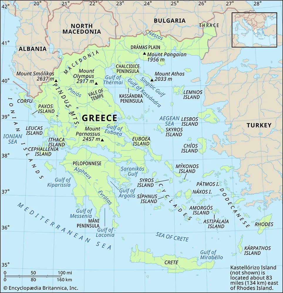
Greece Physical Map
 This physical map of Greece highlights the country’s diverse topography, which includes rugged mountains, fertile plains, and a large number of islands. Major landmarks such as Mount Olympus, the highest peak in Greece, and significant mountain ranges such as Pindus dominate the mainland. The map also depicts major cities, including Athens and Thessaloniki, and highlights the Ionian and Aegean seas, which frame the country’s extensive coastline. The islands of Crete and the Cyclades are also clearly marked, demonstrating the geographic diversity that characterizes Greece.
Greece Relief Map
 This relief map of Greece depicts the country’s varied topography, highlighting its rugged mountainous regions, extensive coastline, and scattered islands. The mainland is dominated by mountain ranges, including the Pindus Mountains, often referred to as the “spine” of Greece, while the coastline is deeply indented, creating numerous peninsulas and bays. The map also includes the famous islands of the Aegean and Ionian seas, with Crete, Greece’s largest island, standing out in the southern part of the country. The contrast between the highlands and lowlands gives a clear picture of Greece’s rich geographical diversity.
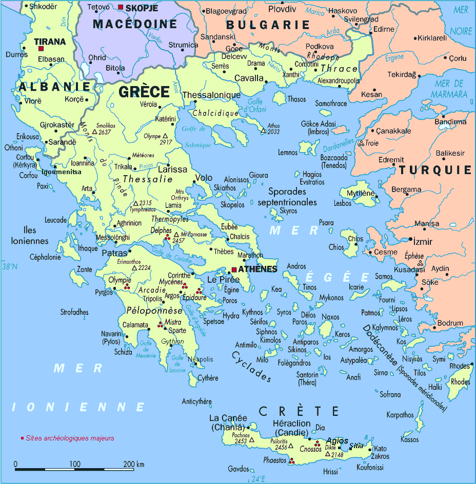
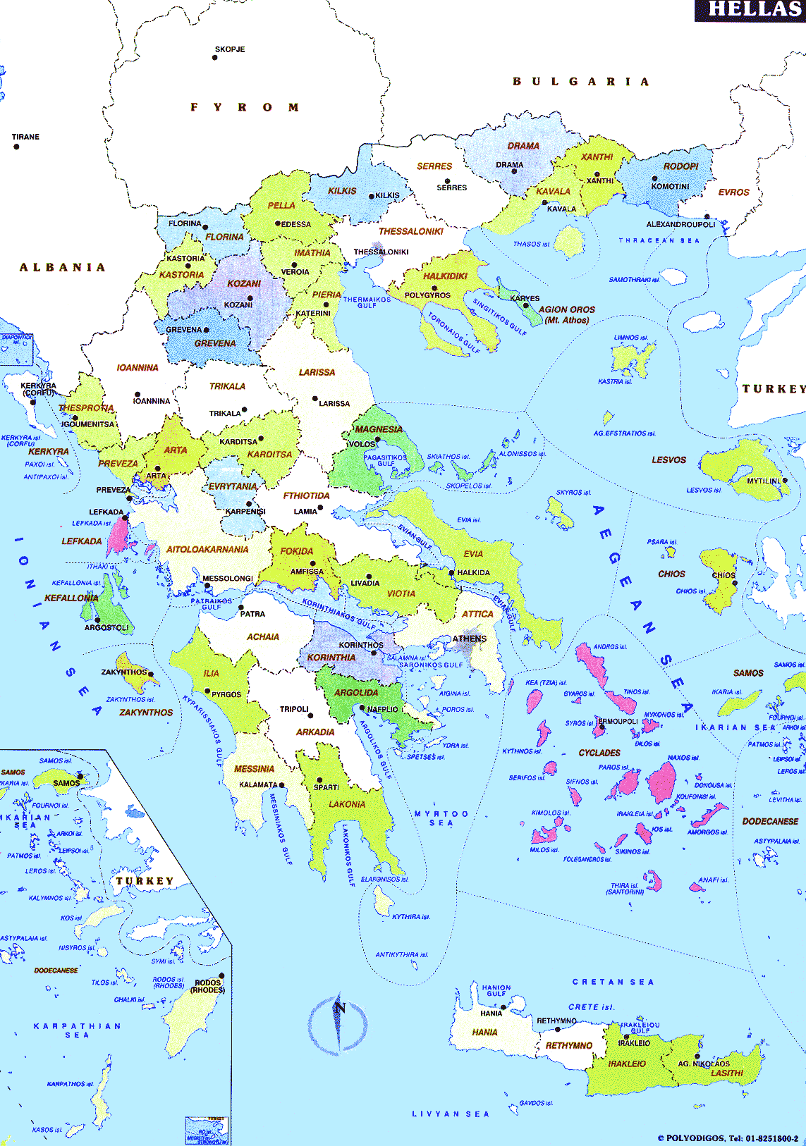
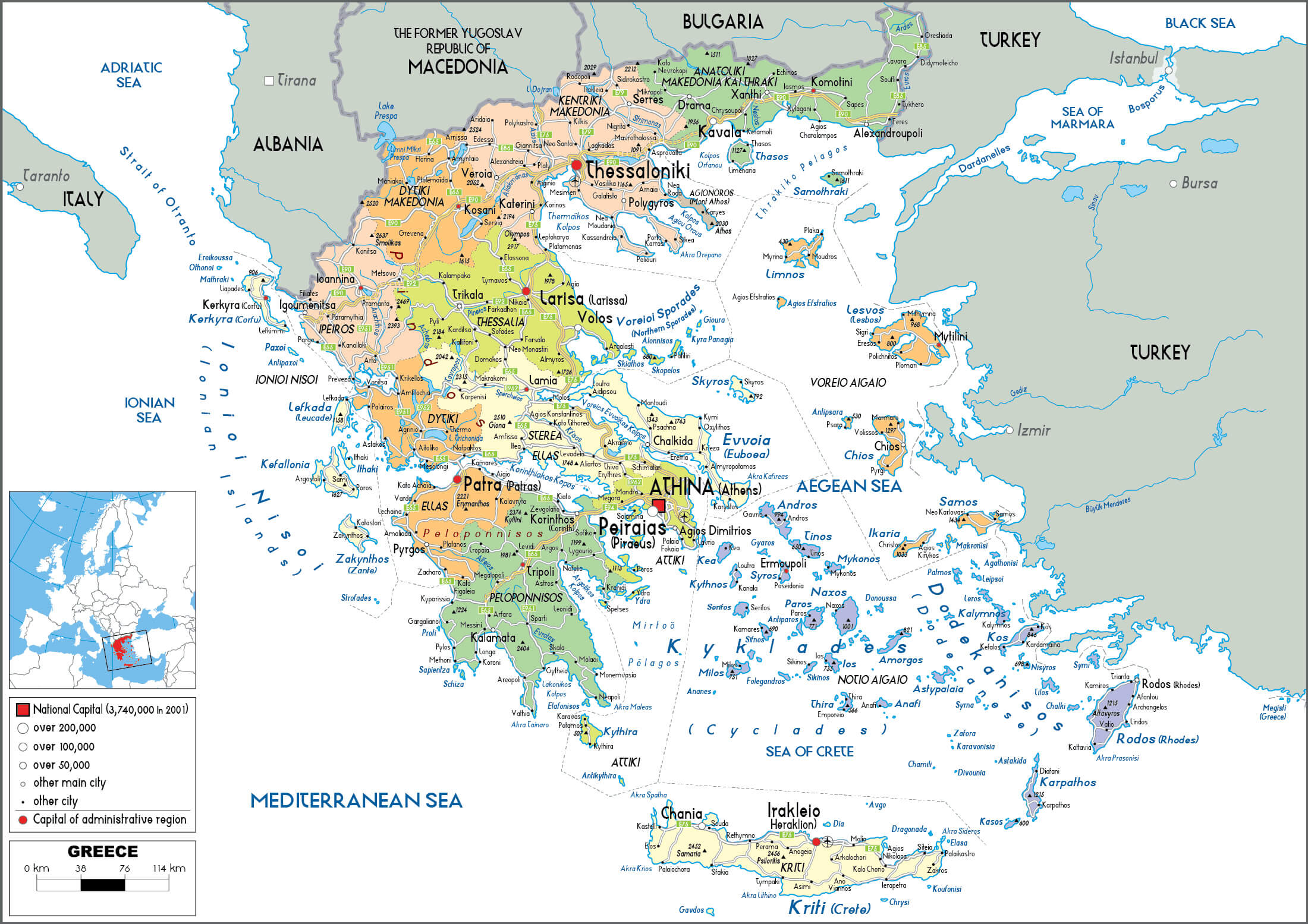
Greece Map with Cities Regions
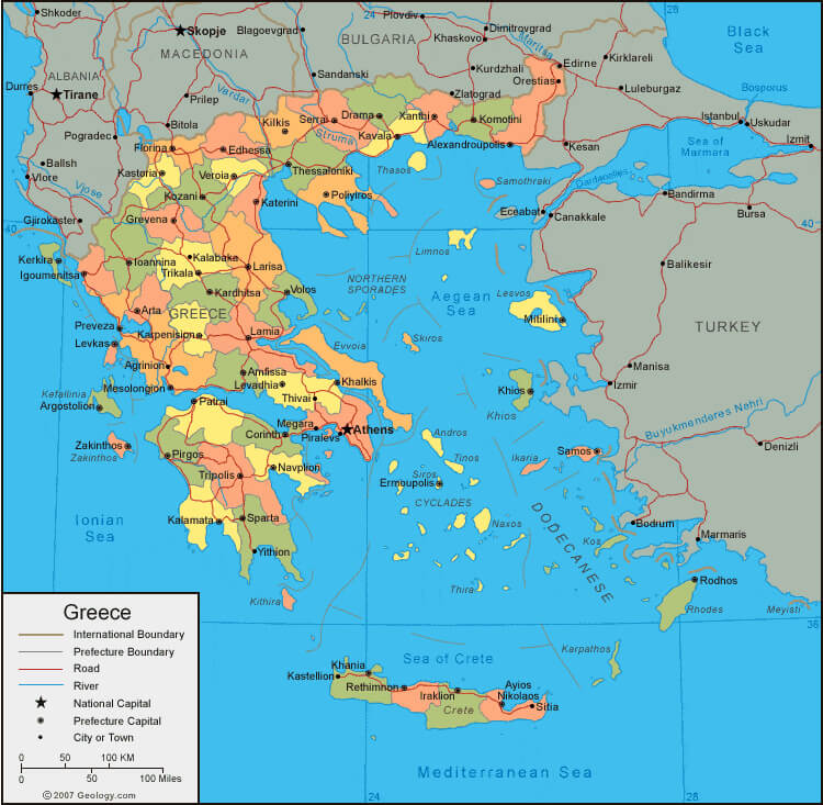 This map of Greece shows the country’s administrative regions, prefectural capitals, cities, and major roads, as well as international boundaries with neighboring countries such as Albania, North Macedonia, Bulgaria, and Turkey. It shows the geographic distribution of major urban areas such as Athens, Thessaloniki, and Patras, as well as important islands such as Crete and Rhodes in the Aegean and Mediterranean Seas. The map is useful for understanding Greece’s political divisions and transportation network within the broader regional context of Southeastern Europe.
Where is Greece on the Europe Map?
Show Google map, satellite map, where is the country located.
Get directions by driving, walking, bicycling, public transportation and travel with street view.
Feel free to explore these pages as well:
- Greece Map ↗️
- Discover the Timeless Charm of Athens: The Heart of Ancient Greece ↗️
- A Collection of Cyprus Maps ↗️
- Best Mediterranean Cruises Routes 2020 & Best Time to Cruise ↗️
- Top Places to Visit in Athens & Things to do in Athens ↗️
- Discover Bulgaria Through Maps ↗️
- Map of Europe ↗️
- Europe Map ↗️
- A Collection of Europe Maps ↗️