The diverse landscapes, vibrant cities, and rich history of Germany have been meticulously mapped out over the years, providing us with a vast array of tools to understand and explore this European gem. Whether you’re an avid traveler, a student, or someone with a keen interest in cartography, our curated Germany Map Collection will guide you through every facet of this nation. From its physical geography to its linguistic diversities, there’s a map for every inquisitive mind here. Dive into the world of maps and let’s travel through Germany, one map at a time!
1. Germany Physical Map
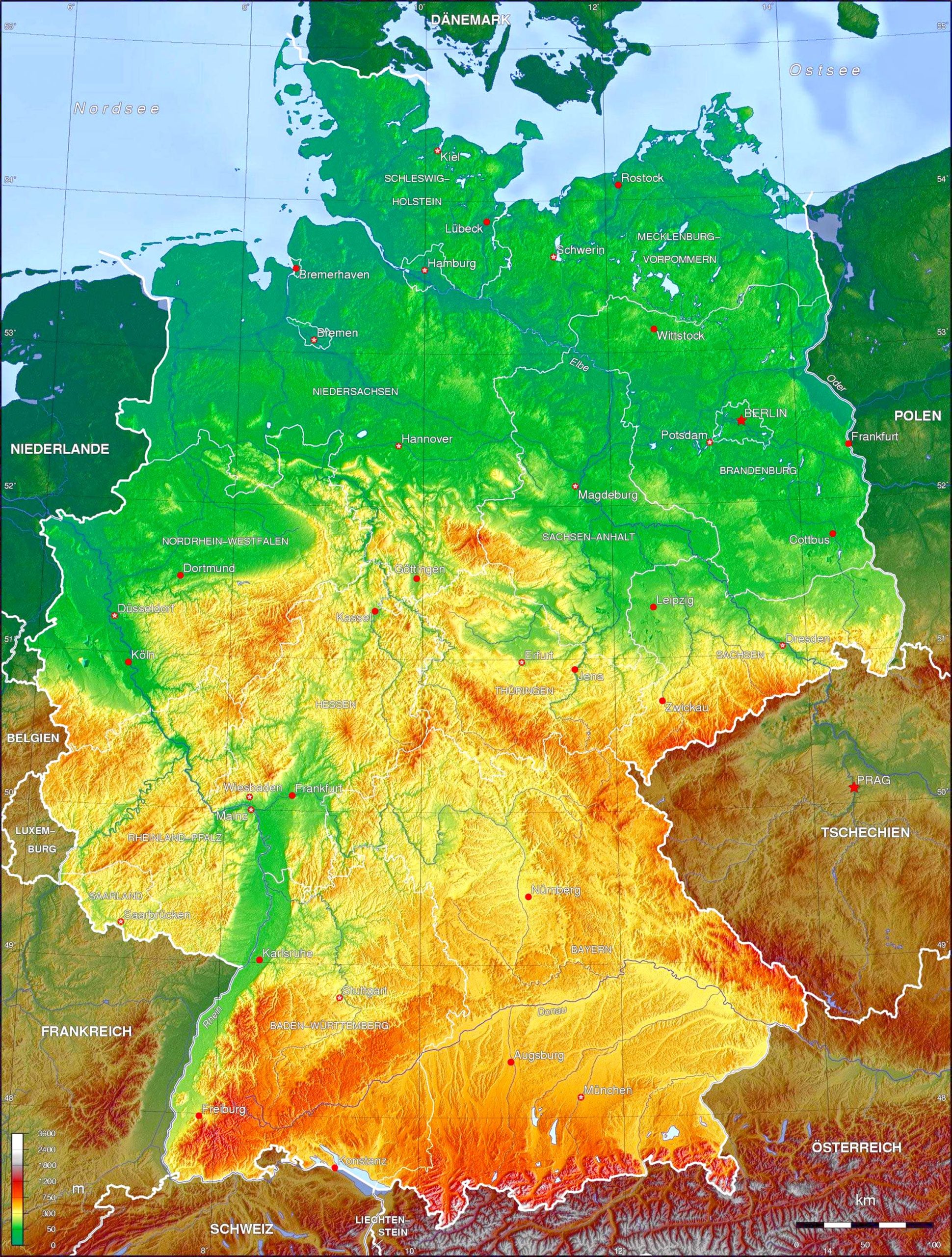
A glance at Germany’s physical map will show you the diverse topography, from the flatlands of Northern Germany to the mountainous terrains of the Bavarian Alps.
2. Germany Political Map
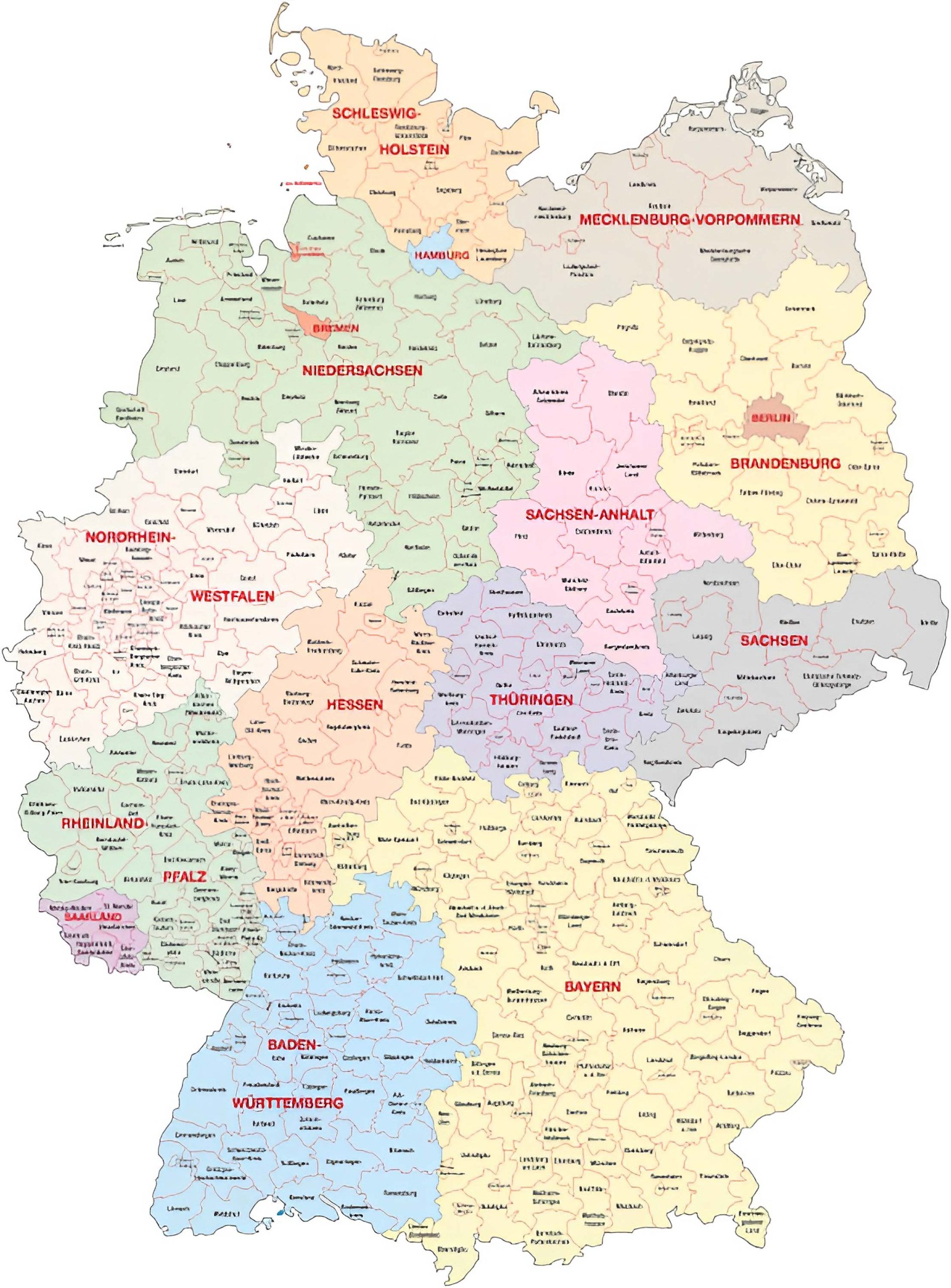
Delve into the administrative boundaries of Germany. See where each state lies, and familiarize yourself with major cities and capitals.
3. Germany Topographic Map
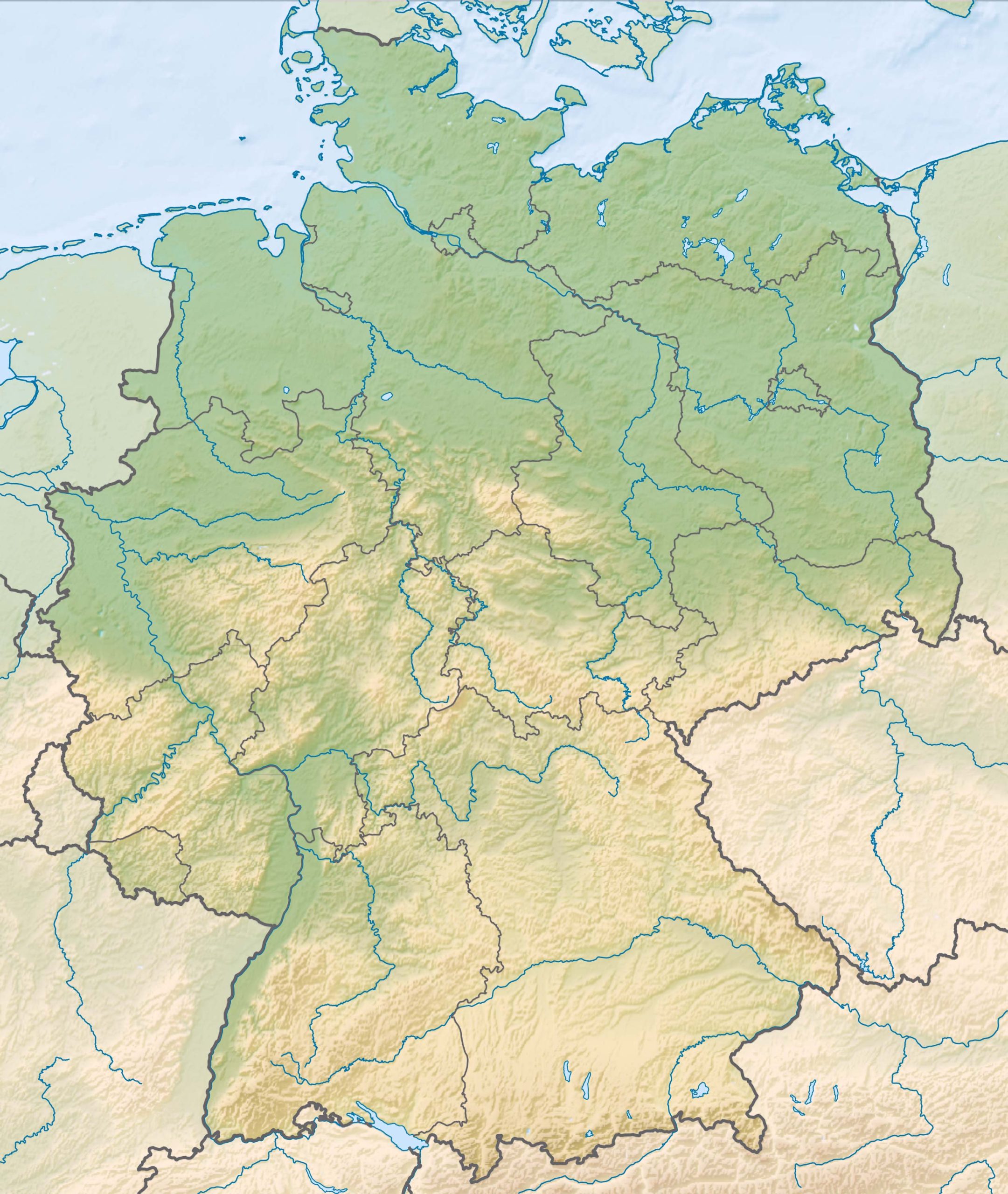
Observe the detailed elevation data, contours, and understand the lay of the land. From the Rhine River valley to the Harz Mountains, it’s all laid out.
4. Germany Geological Map
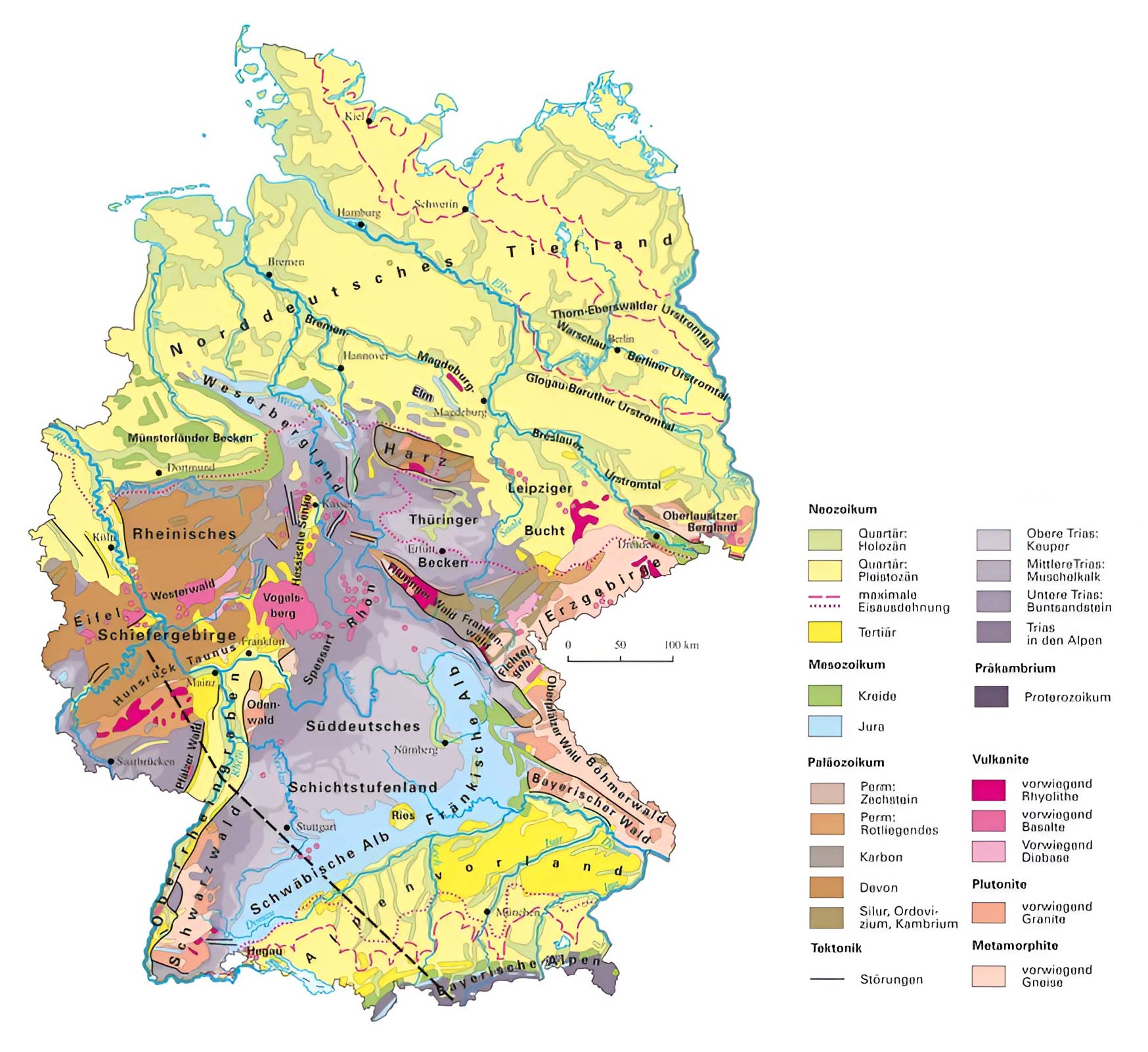
Explore the underlying rock formations and structures, giving a deeper understanding of Germany’s geological history.
5. Germany Cities (Urban) Map
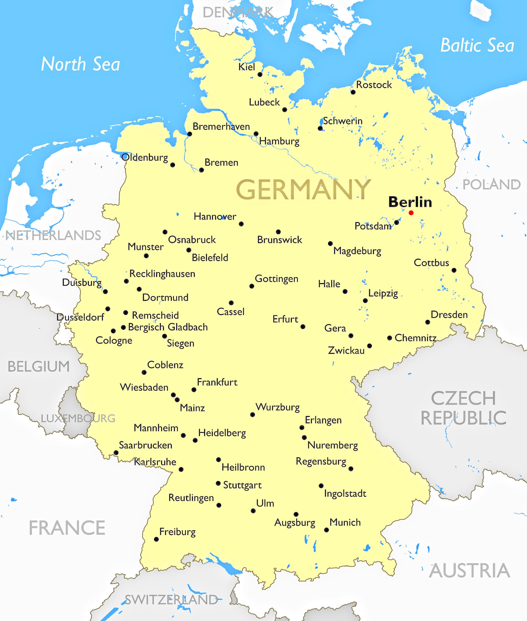
Zoom into Germany’s urban landscapes. Discover major cities like Berlin, Munich, Hamburg, and more, and see their boundaries and key landmarks.
6. Germany Regions Map
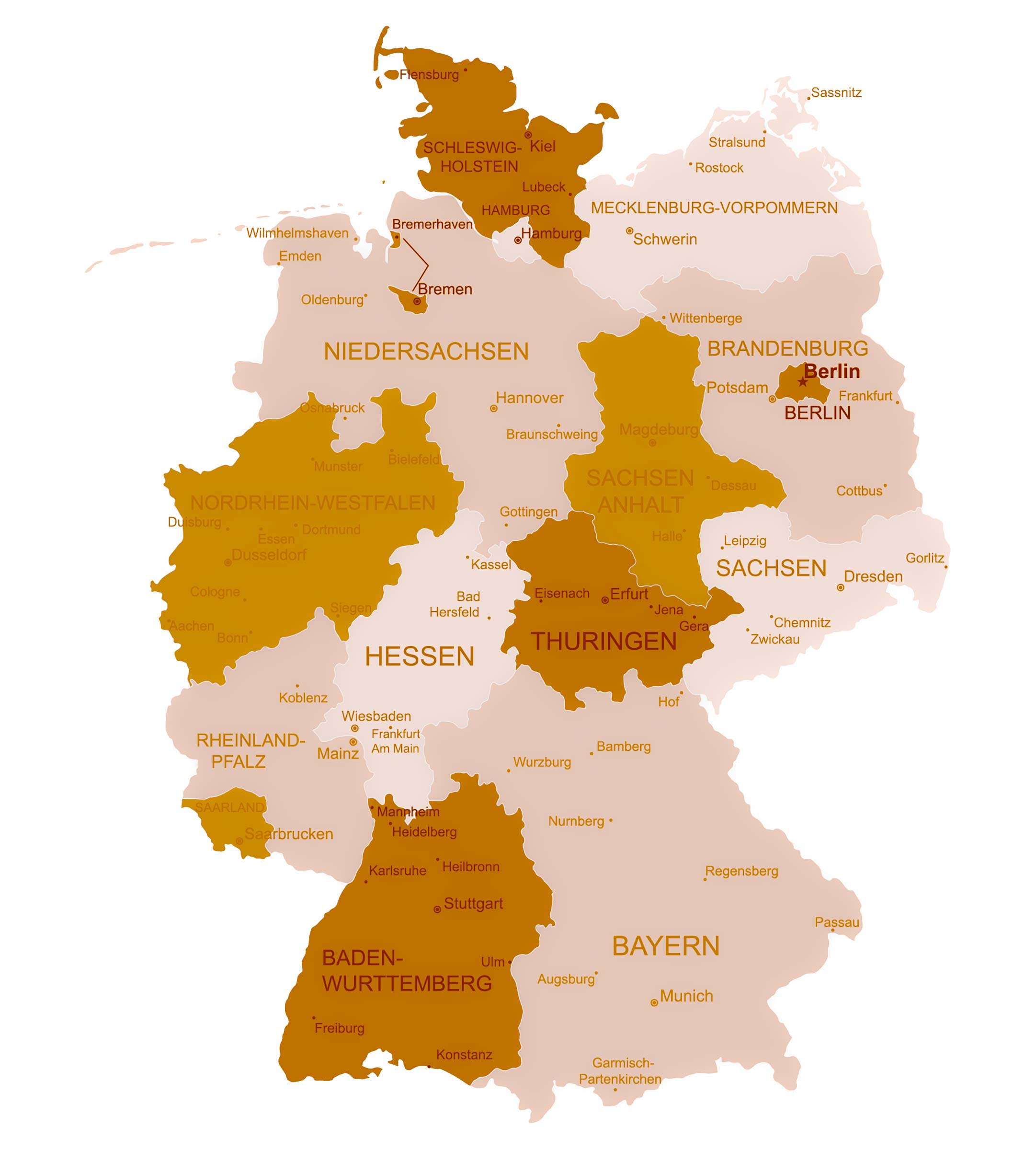
Germany is divided into various regions, each with its own distinct culture and traditions. This map helps in recognizing these regional differences.
7. Germany Relief Map
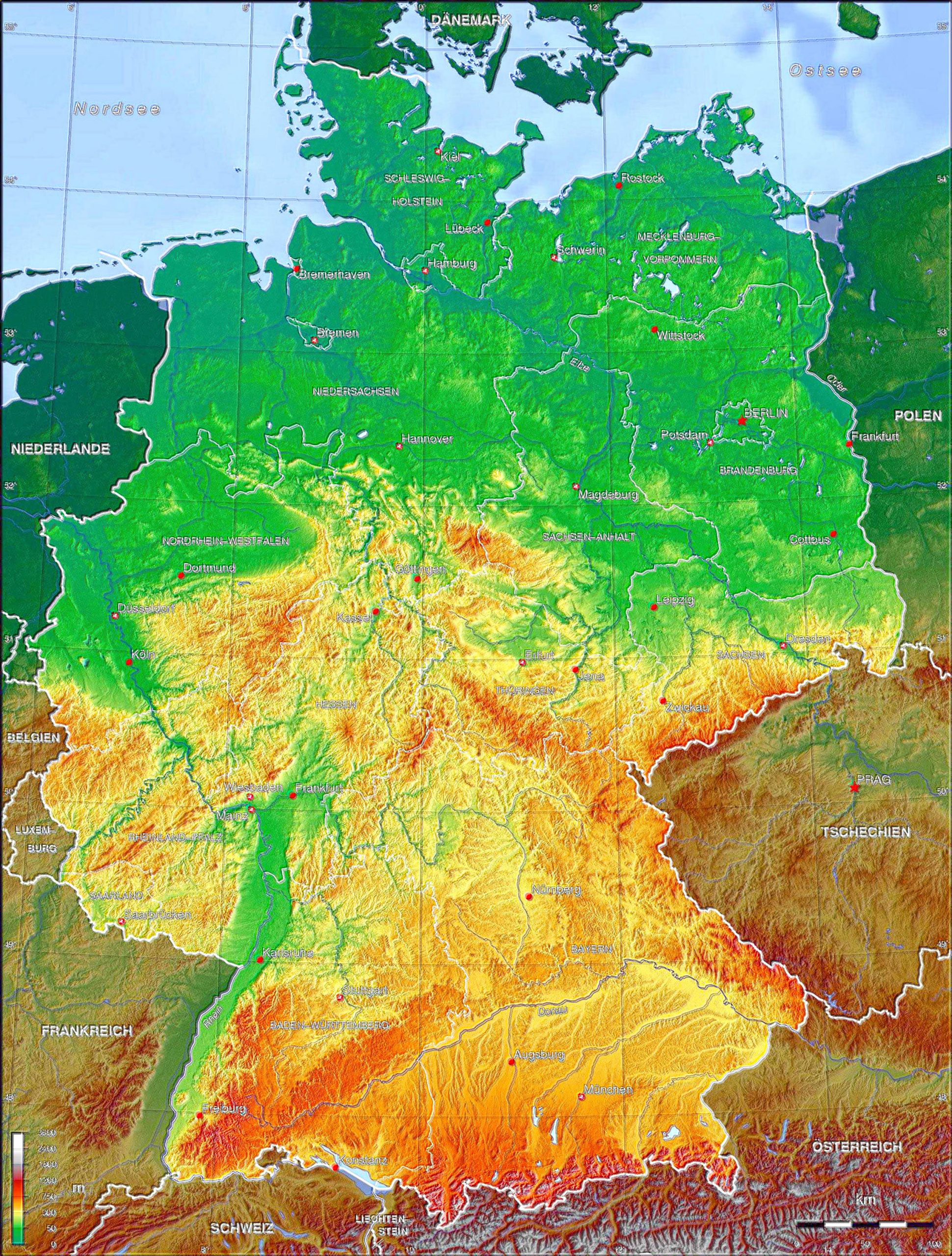
A visual treat! The relief map gives a 3D representation of Germany’s topography.
8. Germany Transit Map
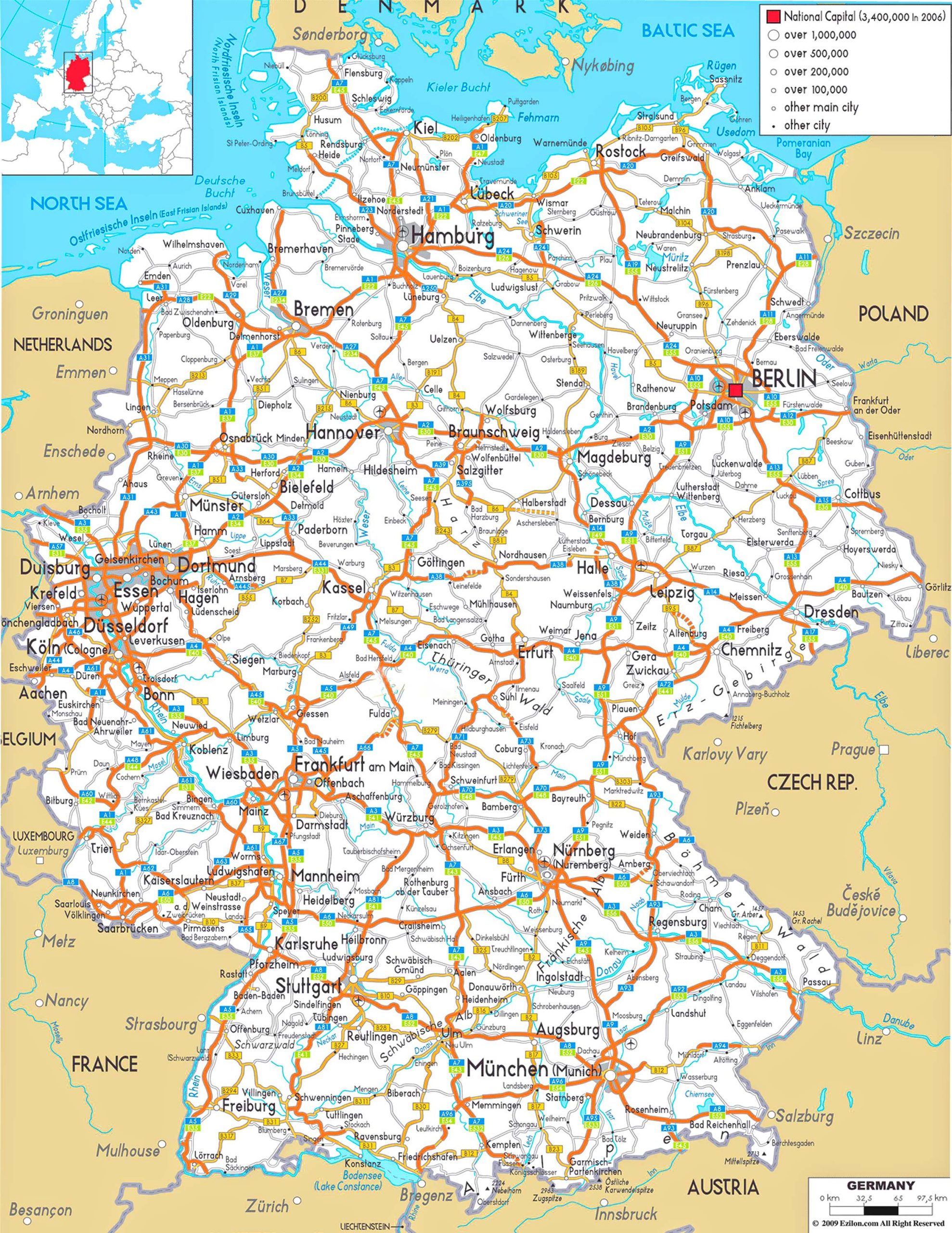
Navigate Germany’s complex and efficient public transportation system, from buses to trams to metros.
9. Germany Historical Map
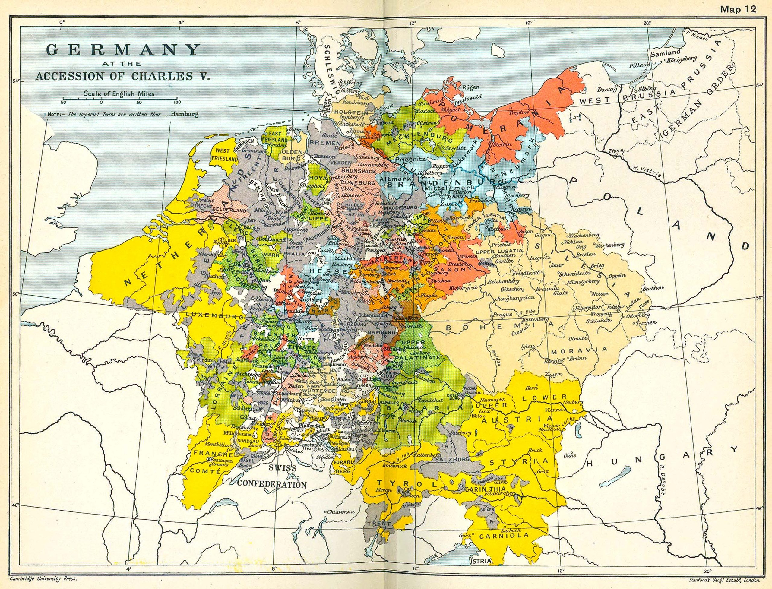
Journey through time and understand Germany’s past – its kingdoms, wars, and changing boundaries.
10. Germany Road Map
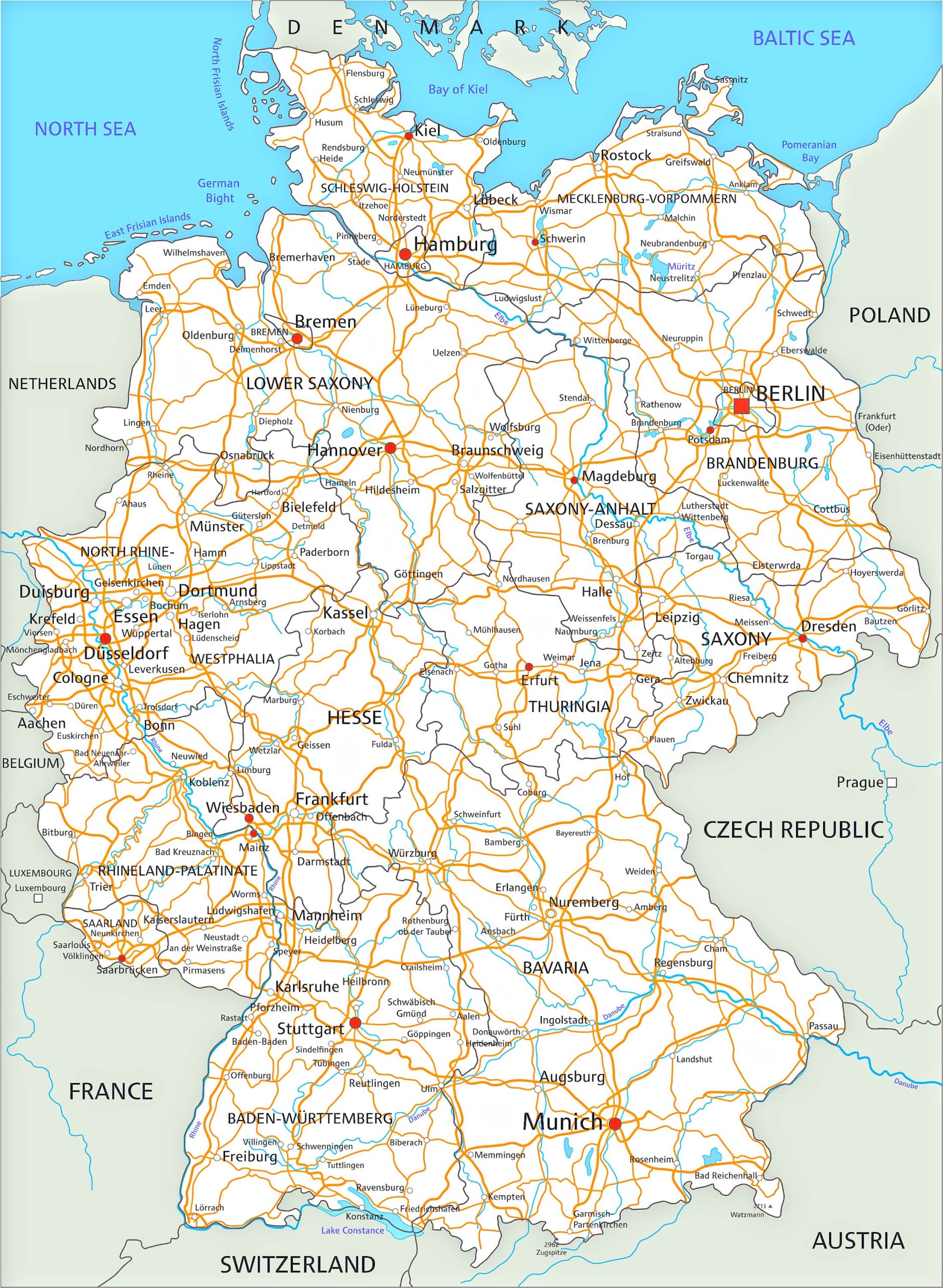
Planning a road trip? This map provides details on highways, major roads, and scenic routes.
11. Germany Train-Rail Map
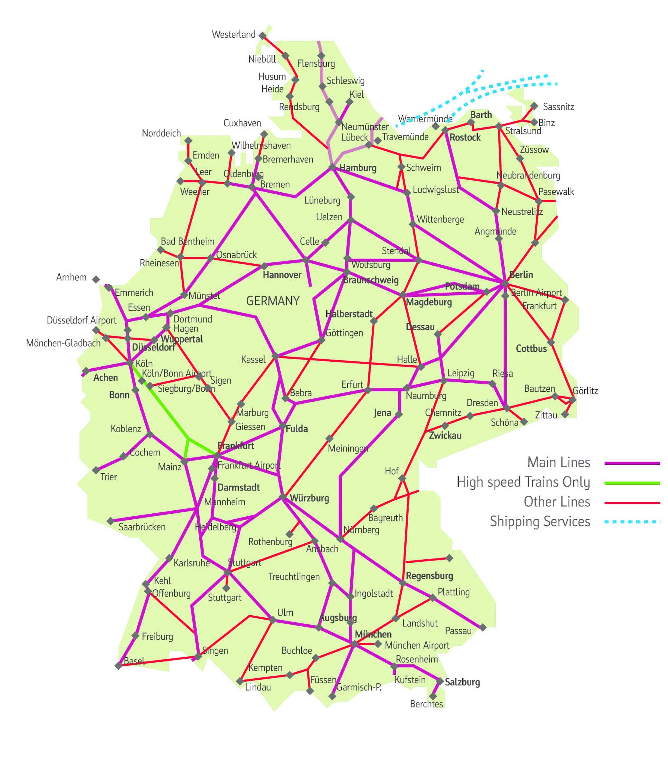
Germany’s railway system is one of the best in the world. Navigate routes, major stations, and connections.
12. Germany Climatic Map
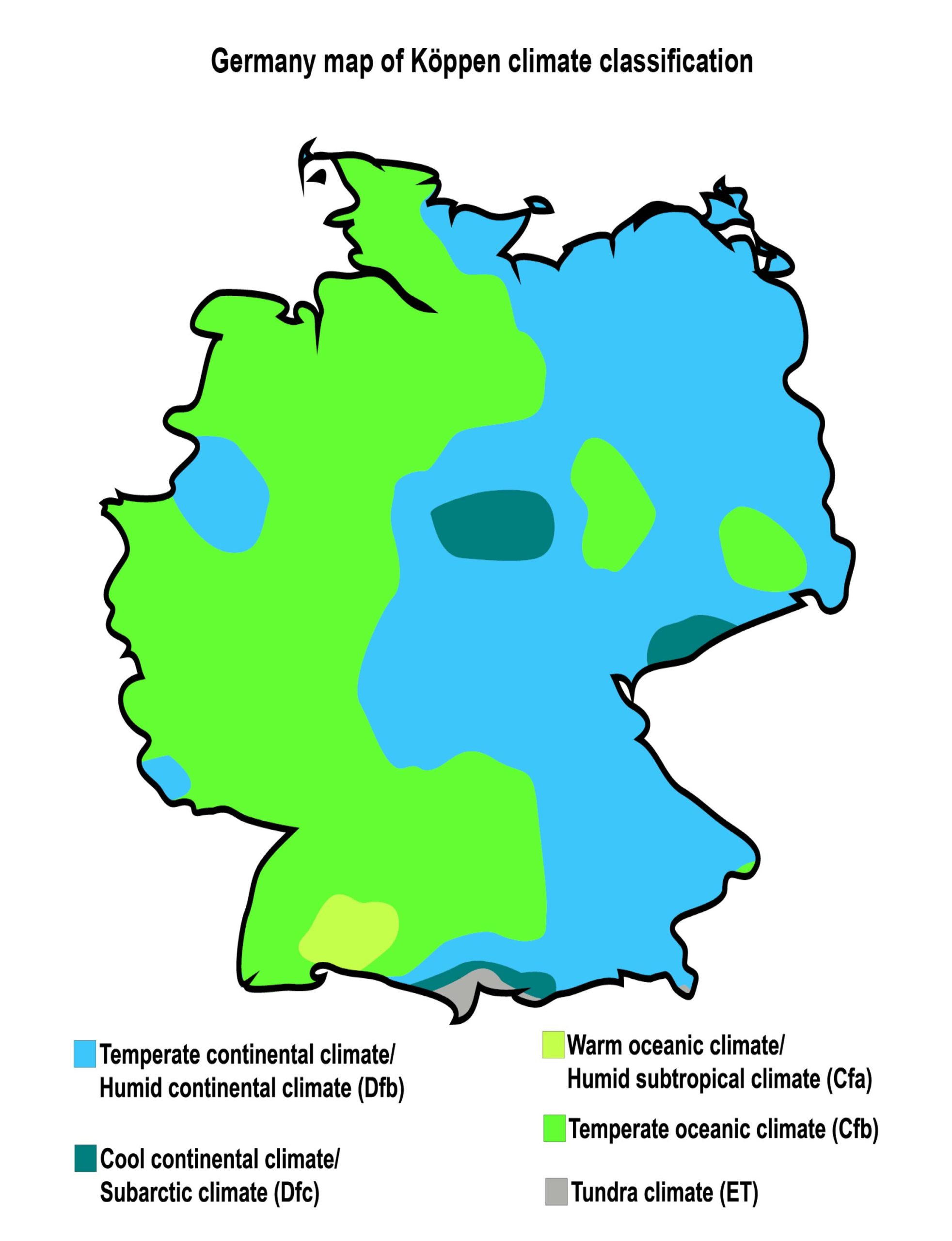
Understand the varying climate zones of Germany, from its cold northern regions to its temperate southern parts.
13. Germany Flag Map
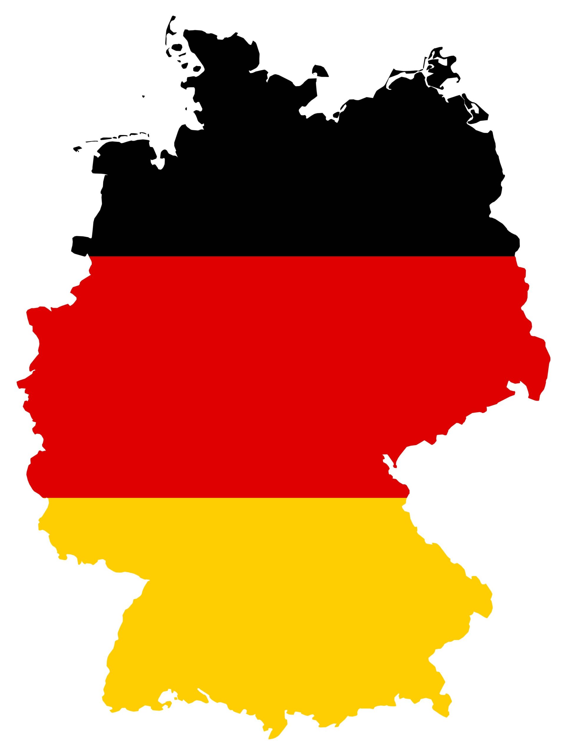
A creative representation of Germany using its national flag. See the nation painted in the colors of black, red, and gold.
14. Germany Travel Map
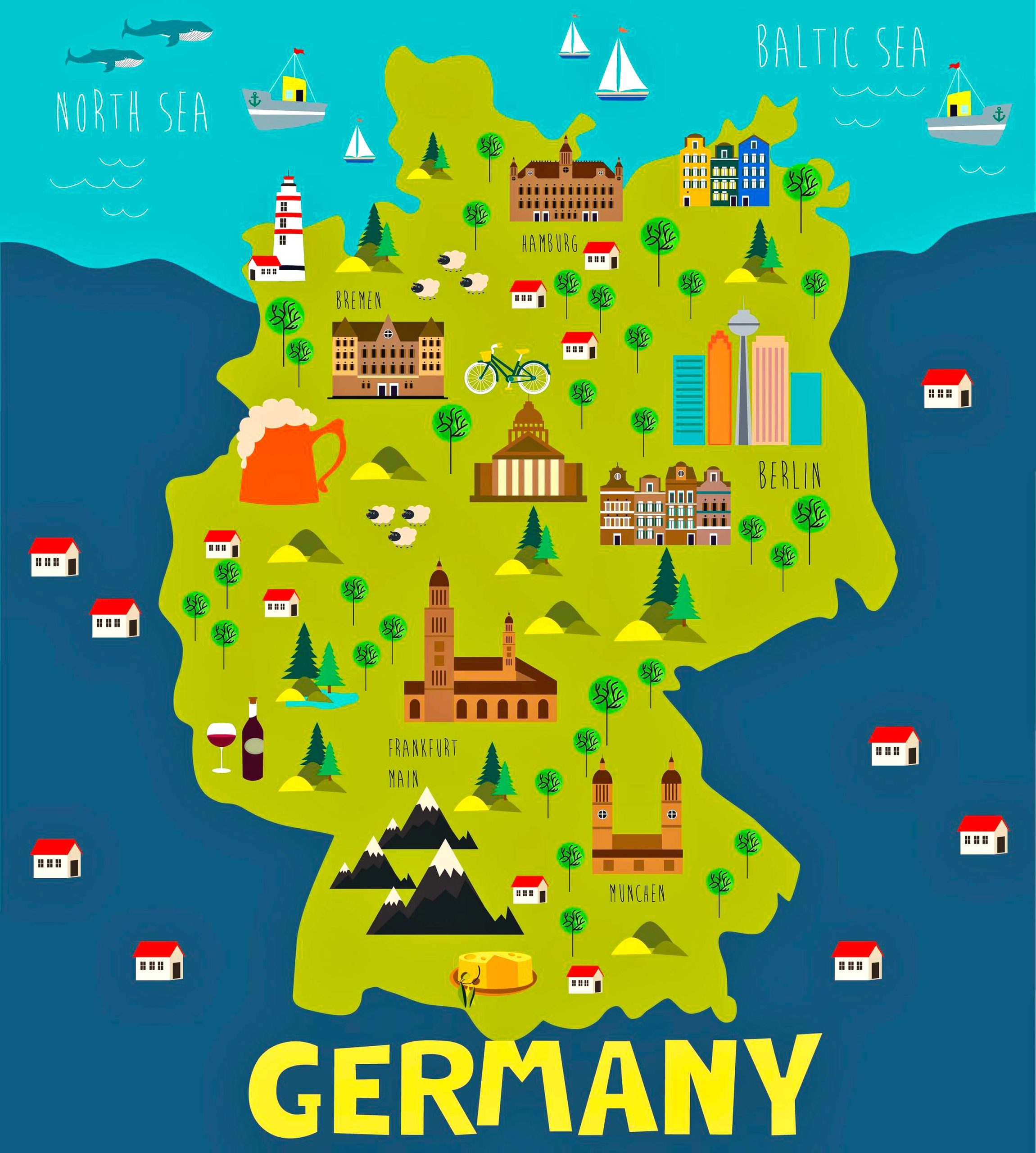
Ideal for tourists! Find points of interest, tourist attractions, and travel routes to make the most of your German adventure.
Feel free to explore these pages as well:
Top Best 10 Attractions in Berlin for the Tourist ↗️
Top 10 Best Frankfurt Attractions Every Traveler Must See ↗️
In conclusion, maps are not just tools; they are stories, tales of lands waiting to be explored, histories waiting to be told. This comprehensive guide on Germany’s maps is your key to understanding the multifaceted nature of Deutschland. Whether you want to drive through the autobahns, catch a train to a quaint village, or delve deep into the nation’s history, there’s a map to guide you. And remember, every journey starts with a map, so pick yours and embark on your German adventure!
Where is Germany on the World Map?
Show Google Maps and satellite maps of where the country is located.
Get directions by driving, walking, bicycling, public transportation, and travel with street view.
