A Collection of Malta Maps offers an in-depth look at the beautiful Mediterranean island, highlighting its rich history, diverse landscapes, and key locations, making it an essential resource for travelers and geography enthusiasts alike.
Brief information about Malta
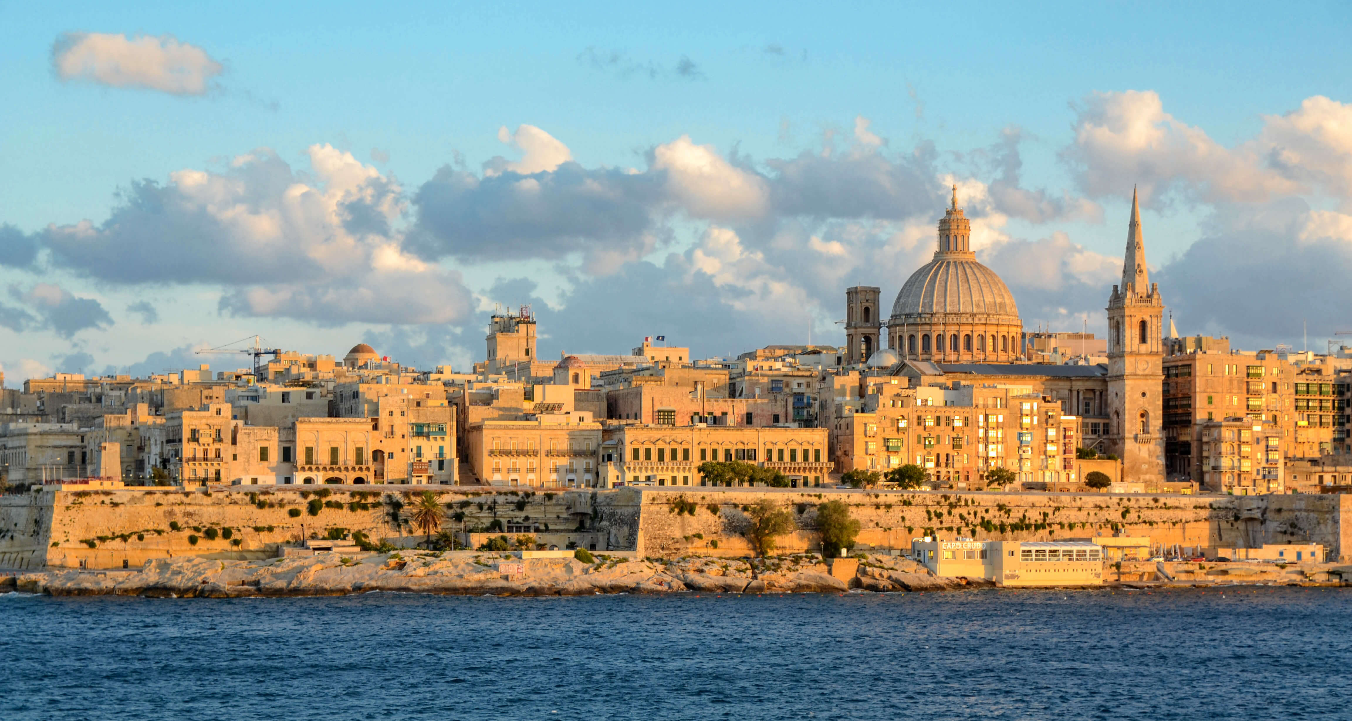
Malta is a small island nation located in the Mediterranean Sea, south of Italy. Known for its rich history, stunning beaches, and vibrant culture, Malta has been influenced by various civilizations, including the Romans, Moors, Knights of St. John, and the British. Its capital, Valletta, is a UNESCO World Heritage site filled with historical landmarks, such as the Grandmaster’s Palace and St. John’s Co-Cathedral.
Malta Road Map
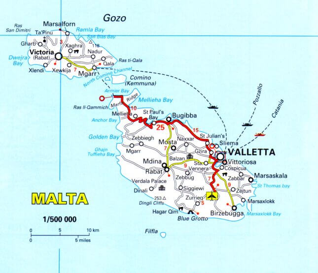
This road map of Malta shows the main routes connecting key cities and towns, such as Valletta, Mdina, and Victoria in Gozo. It highlights major tourist spots like Mellieha Bay, Golden Bay, and St. Julian’s, as well as ferry routes between Malta, Gozo, and Comino.
Despite its small size, Malta offers a mix of natural beauty and urban attractions, making it a popular destination for tourists. The island’s warm climate, crystal-clear waters, and lively festivals attract visitors year-round, while its strategic location has made it a crossroads of cultures for centuries.
Where is located Malta on the World Map
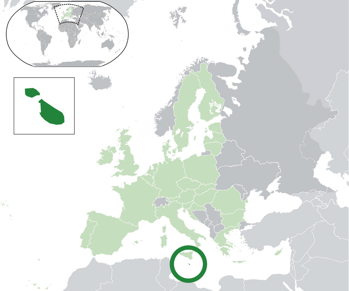
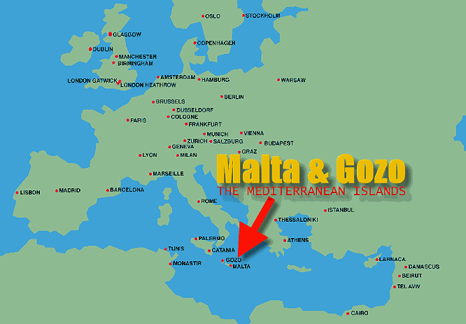
Malta is located in the heart of the Mediterranean Sea, just south of Italy and north of Libya. This tiny island nation lies between Europe and North Africa, making it a strategic and cultural crossroads throughout history. Despite its small size, it holds a significant place on the world map due to its unique position.
On a world map, Malta can be found around 93 kilometers south of Sicily, Italy, and about 300 kilometers north of Tunisia. Its proximity to these regions has shaped its history, as different empires and cultures have sought control over the island for centuries, from the Phoenicians to the British.
Although it may seem small, Malta’s central location makes it a vital stopover point for travelers, traders, and maritime activities in the Mediterranean. Its location has not only influenced its culture but also made it an important player in both European and global history.
Here are some statistical information about Malta:
Malta Location Map
Europe Malta Map
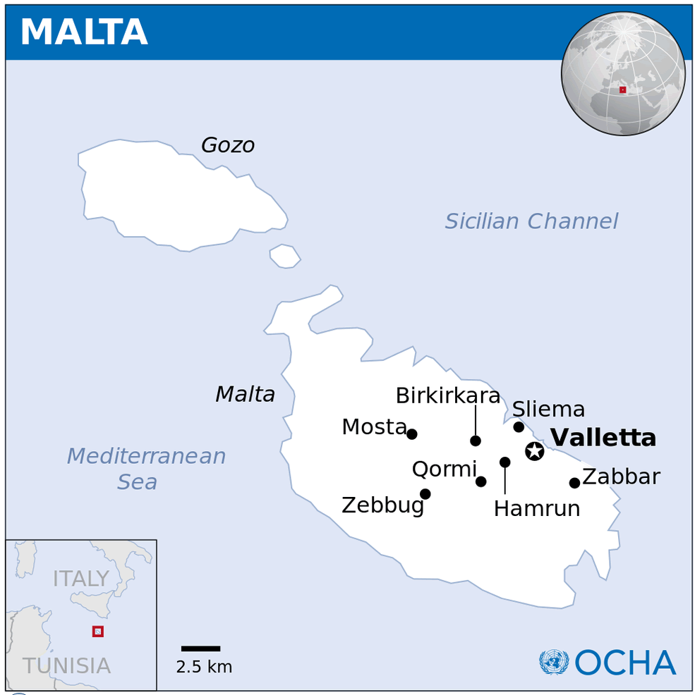
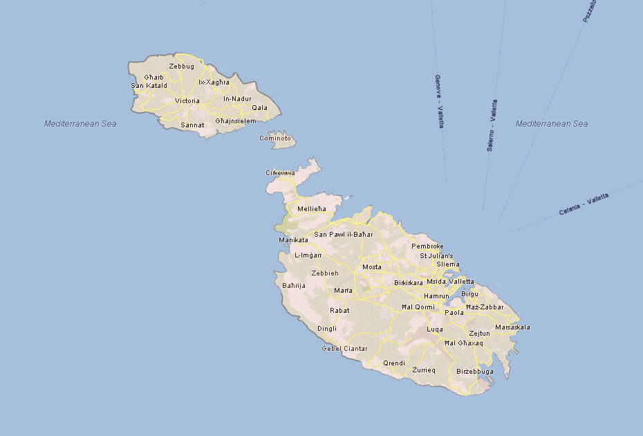
Malta Island Map Gozo Comino
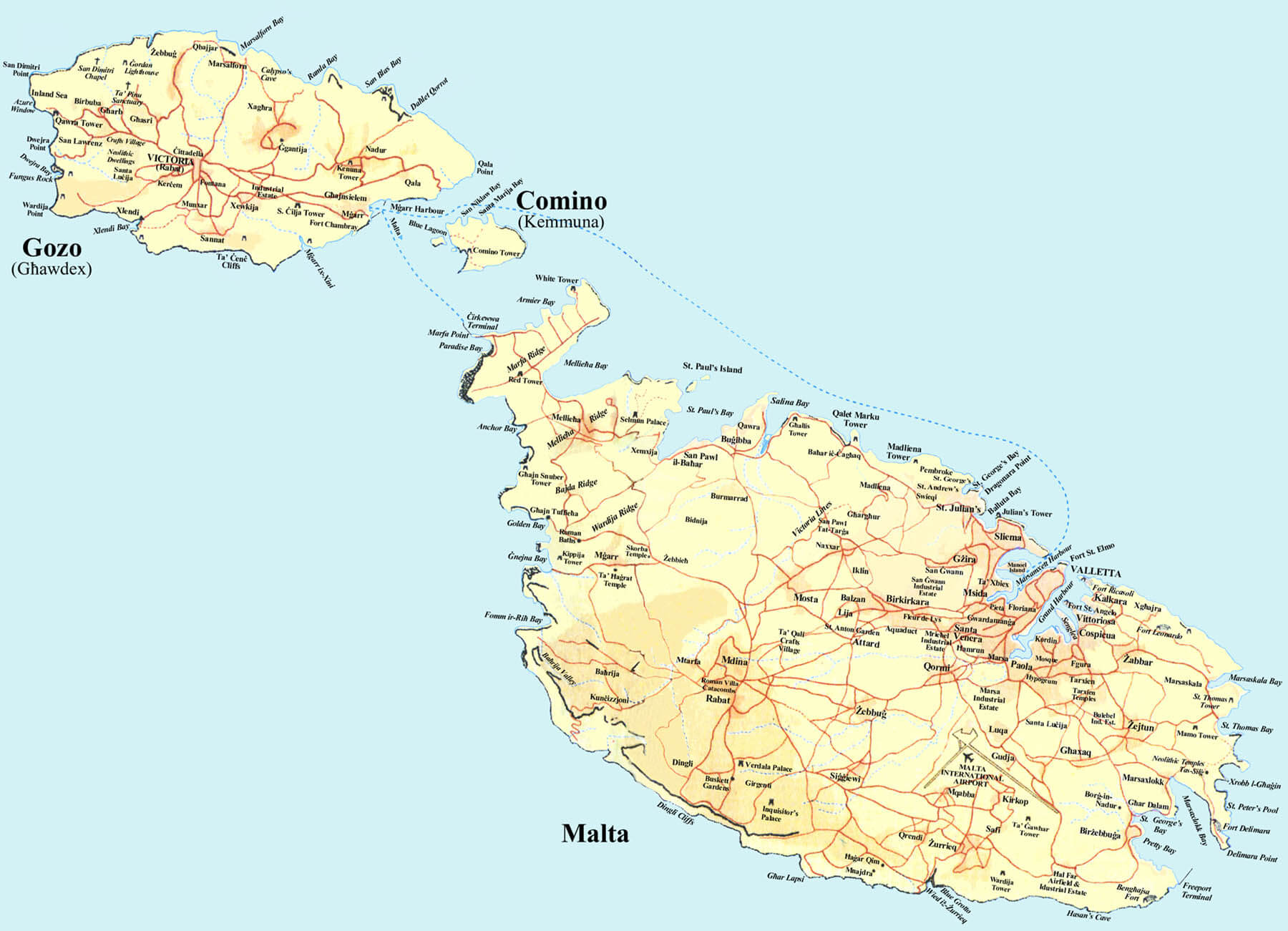
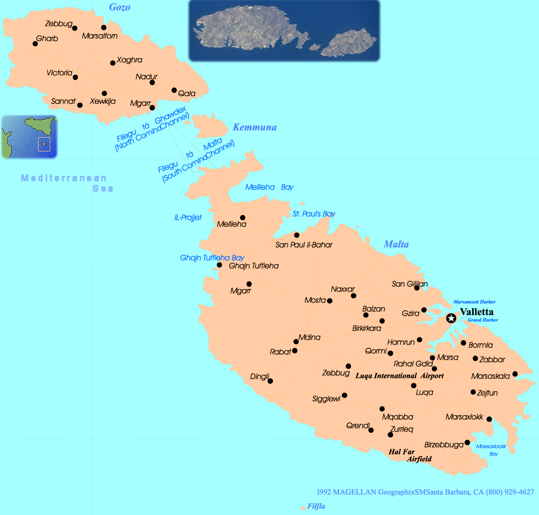
This map shows the islands of Malta, Gozo, and Comino, highlighting the major towns, roads, and bays. Valletta, the capital, is located on the eastern side of Malta, while Gozo’s main town, Victoria, is in the center of the island. Comino, the smallest of the three, lies between Malta and Gozo.
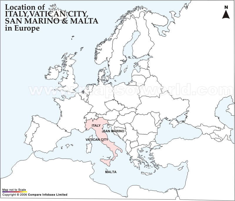
Malta Map Italy Europe
Malta Travel Map
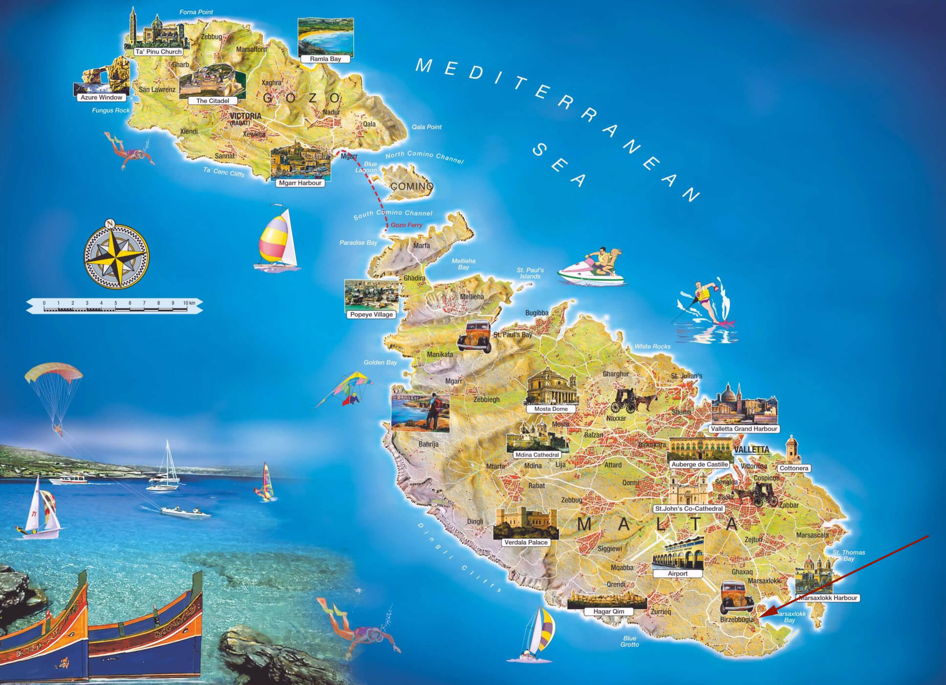 This illustrated travel map of Malta showcases its beautiful islands, highlighting key tourist attractions like Valletta, the Blue Grotto, and Popeye Village. The map emphasizes coastal activities such as sailing, snorkeling, and jet skiing in the Mediterranean Sea, making it a perfect guide for travelers eager to explore Malta’s scenic landscapes and rich cultural heritage. It also features landmarks like Mdina Cathedral and various picturesque bays, offering a comprehensive view of what Malta has to offer for a vacation.
Malta Road Map with Cities
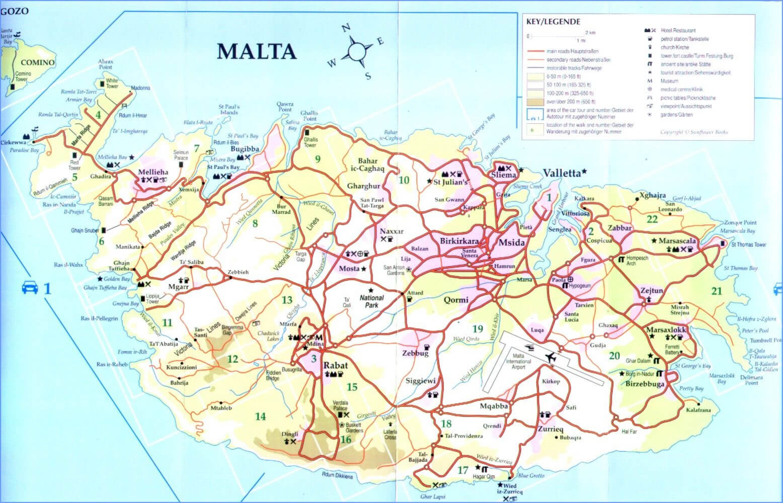 This road map of Malta highlights the main routes on the island, including major highways, secondary roads and routes between popular towns such as Valletta, Mdina and Mellieha. The map also features tourist attractions, key landmarks and areas of interest for travellers, providing a comprehensive overview for those planning to explore Malta by car. With detailed place names and road numbers, it’s an essential guide for navigating Malta’s winding roads and discovering hidden gems throughout the island.
Malta Provinces Map
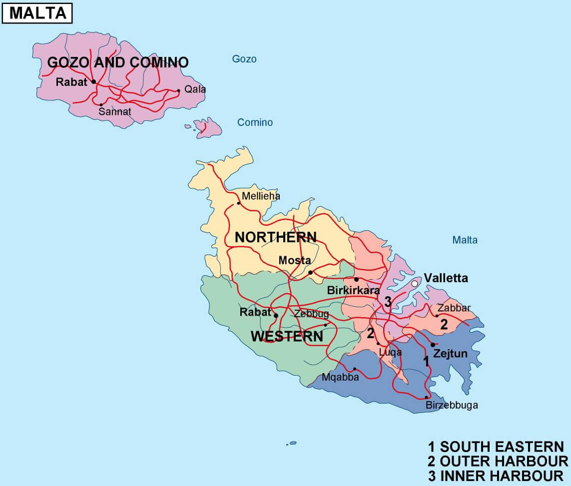
Malta Administrative Map
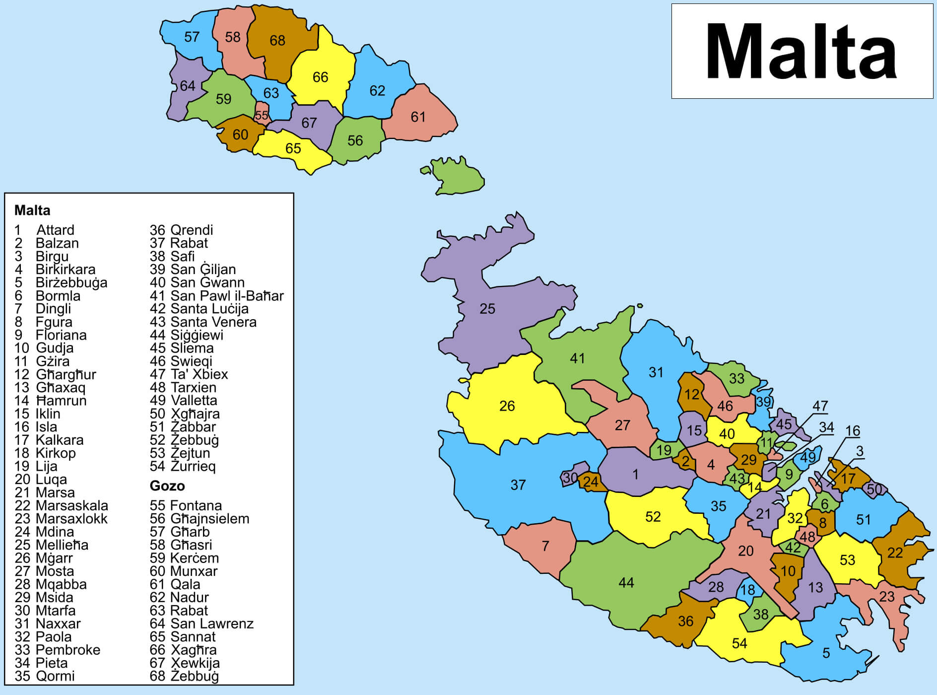 This map of Malta shows the country’s administrative regions, with each location highlighted using a numbering system for easy identification. It covers both the main island of Malta and the islands of Gozo and Comino, providing a clear view of the various towns and villages such as Valletta, Mdina and Mellieħa, as well as Gozo’s centres such as Victoria and Xewkija. The map provides an overview of Malta’s administrative divisions, helping users to understand the layout of local government across the islands.
Malta Satellite Map
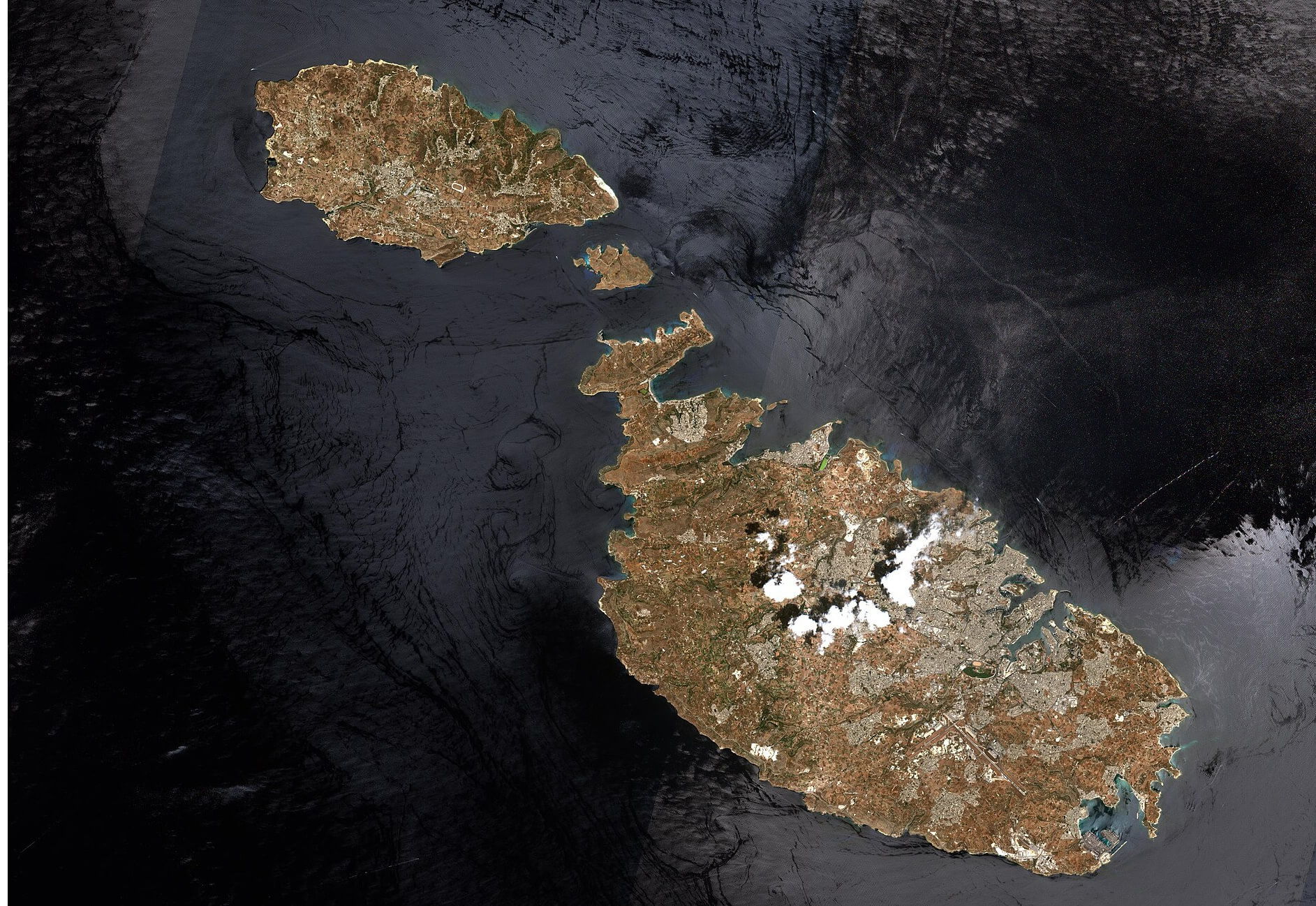 This satellite map of Malta provides a detailed view of the Maltese archipelago, showing the main island of Malta and its smaller companions, Gozo and Comino. It highlights the varied terrain, urban areas and the stark contrast between the densely populated coastal regions and the more rugged, natural landscapes. The surrounding Mediterranean Sea is a deep blue, framing the islands and emphasising their strategic location at the heart of the Mediterranean. This type of map is particularly useful for understanding Malta’s geographical context and how its natural features coexist with urban development.
Malta Rivers Map with Largest Cities
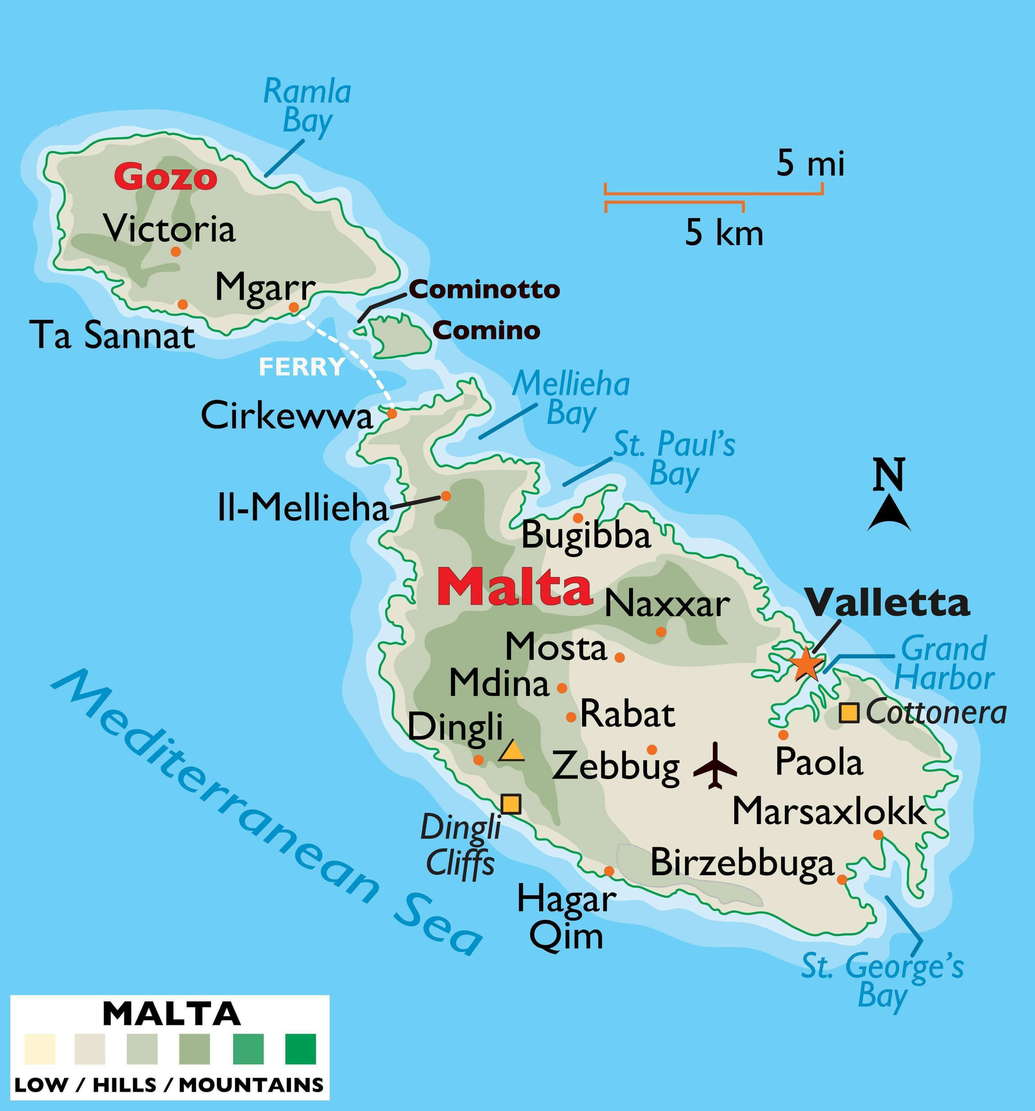 This illustrated map of Malta highlights the main cities, towns and geographical features, including Gozo, Comino and the main island of Malta. It features Valletta, the capital, as well as other notable locations such as Mdina, Marsaxlokk and Mellieha. The map highlights the natural terrain of the islands, such as the Dingli Cliffs and various bays such as Mellieha Bay and St Paul’s Bay. This presentation helps travellers to visualise the main transport routes, ferry connections between the islands and popular tourist spots in Malta’s Mediterranean landscape.
Malta Byzantine Map in 555
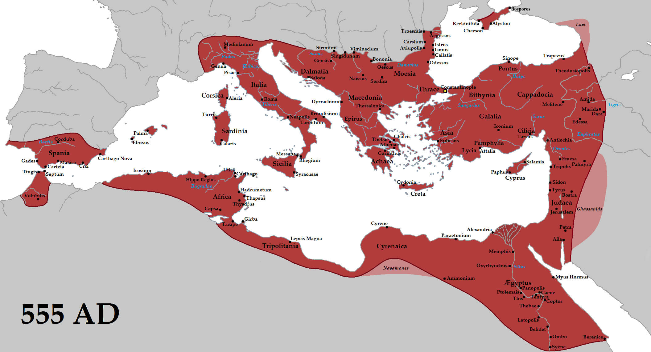 This map illustrates the extent of the Byzantine Empire around 555 AD, showing its control over key territories including parts of southern Europe, North Africa and the eastern Mediterranean. At this time, the empire reached its territorial peak under Emperor Justinian I, encompassing regions such as Italy, the Balkans, Egypt and Asia Minor. The map also highlights the inclusion of Malta, which played a strategic role in the Mediterranean sea routes. Byzantine influence extended across a wide range of cultures and landscapes, reflecting the complexity of the empire during this period.
Malta Physical Map
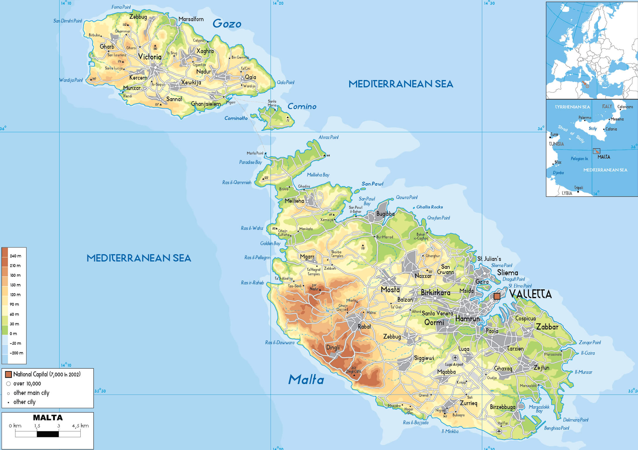 This physical map of Malta highlights the country’s varied terrain, including the rolling hills, valleys and coastal cliffs of the main island and Gozo. It shows the highest points, such as the Dingli Cliffs, and major urban centres, including the capital, Valletta, and towns such as Sliema, Mosta and Mdina. The map also includes ferry routes between Malta, Gozo and Comino, illustrating the archipelago’s links across the Mediterranean.
Malta Cities Map
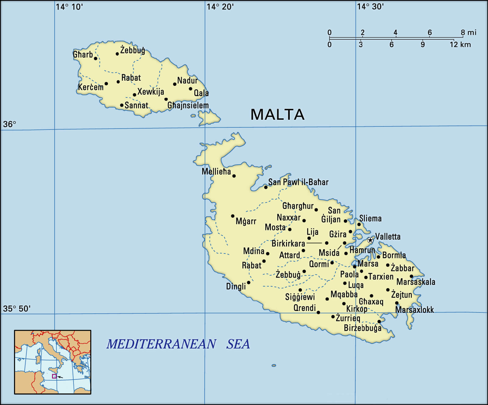 This map of Malta shows the islands of Malta and Gozo, highlighting major cities such as Valletta, Mdina and Birgu, as well as smaller towns such as Rabat and Sliema. It provides an overview of the island’s urban centres and is a useful reference for understanding the geographical distribution of Malta’s settlements and its surrounding Mediterranean location.
Malta Map Satellite
Malta Map Tourism
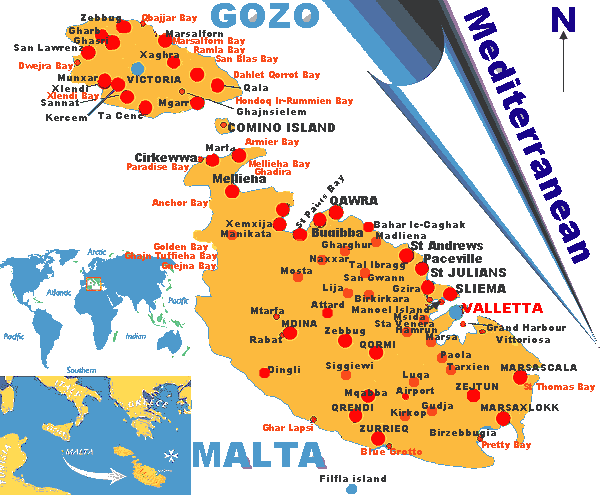
The map of Malta shows key areas like Valletta, Gozo, and Comino, along with popular tourist spots such as St. Julian’s and beaches like Golden Bay.
Malta Touristic Map
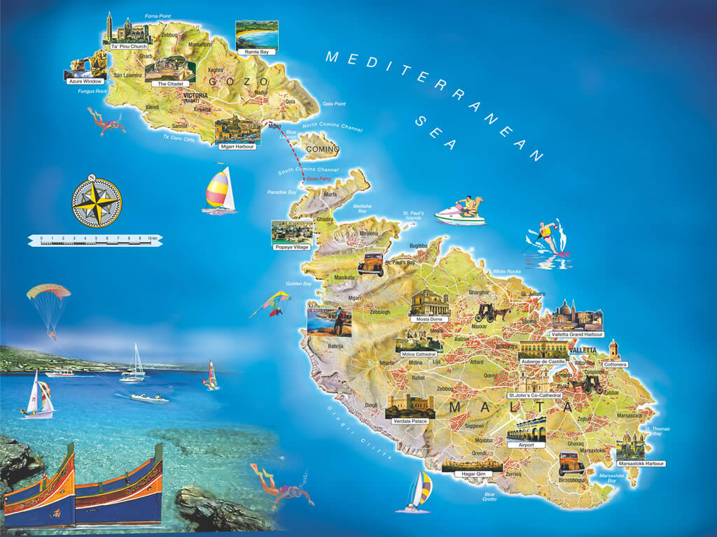
This tourist map of Malta highlights key attractions like Valletta, the Azure Window in Gozo, and popular spots like Golden Bay, Popeye Village, and St. John’s Co-Cathedral. It showcases the islands of Malta, Gozo, and Comino, along with various activities such as boating, jet skiing, and sightseeing.
Map of Malta Europe
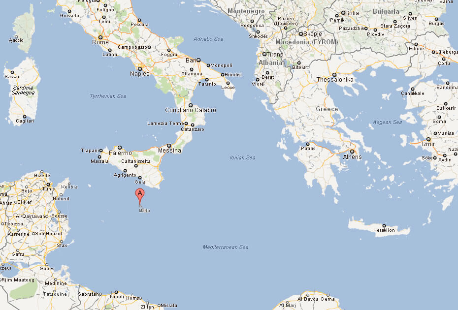
Map of Malta
Where is Malta on the Europe Map?
Show Google map, satellite map, where is the country located.
Get directions by driving, walking, bicycling, public transportation and travel with street view.
div>Feel free to explore these pages as well:
- Italy Map ↗️
- Map of Italy ↗️
- The 10 Best Things to Do in Venice ↗️
- A Tourist’s Guide to Venice’s Top 10 Attractions ↗️
- A Collection of Italy Maps ↗️
- Experience Venice: A Complete Guide for the Adventurous Traveler ↗️
- Discover Croatia: A Comprehensive Map Collection of Its Stunning Coastlines and Historic Cities ↗️
- A Collection of Europe Maps: Exploring the Continent in Detail ↗️
- Map of Europe ↗️
- Europe Map ↗️
- Map of Europe ↗️
- France Map ↗️
- Map of Spain ↗️
- United Kingdom Map ↗️
- Germany Map ↗️
- Turkey Map ↗️
- Map of Portugal ↗️
- Switzerland Map ↗️
