Explore this beautiful island’s detailed maps, from physical geography to political boundaries, and see how Guernsey’s landscape has evolved. From Coastlines to Countryside: View various Guernsey maps, including topographical, and satellite images, offering insights into its stunning geography and infrastructure.
Brief information about Guernsey
Guernsey is a small island located in the English Channel, and although it’s a British Crown Dependency, it operates with its own government. Nestled between England and France, this charming island offers stunning coastal views, a peaceful atmosphere, and a rich history influenced by both nations. While it’s not technically part of the UK, it has strong ties with Britain and uses the British pound as its currency.
Guernsey Provinces Map
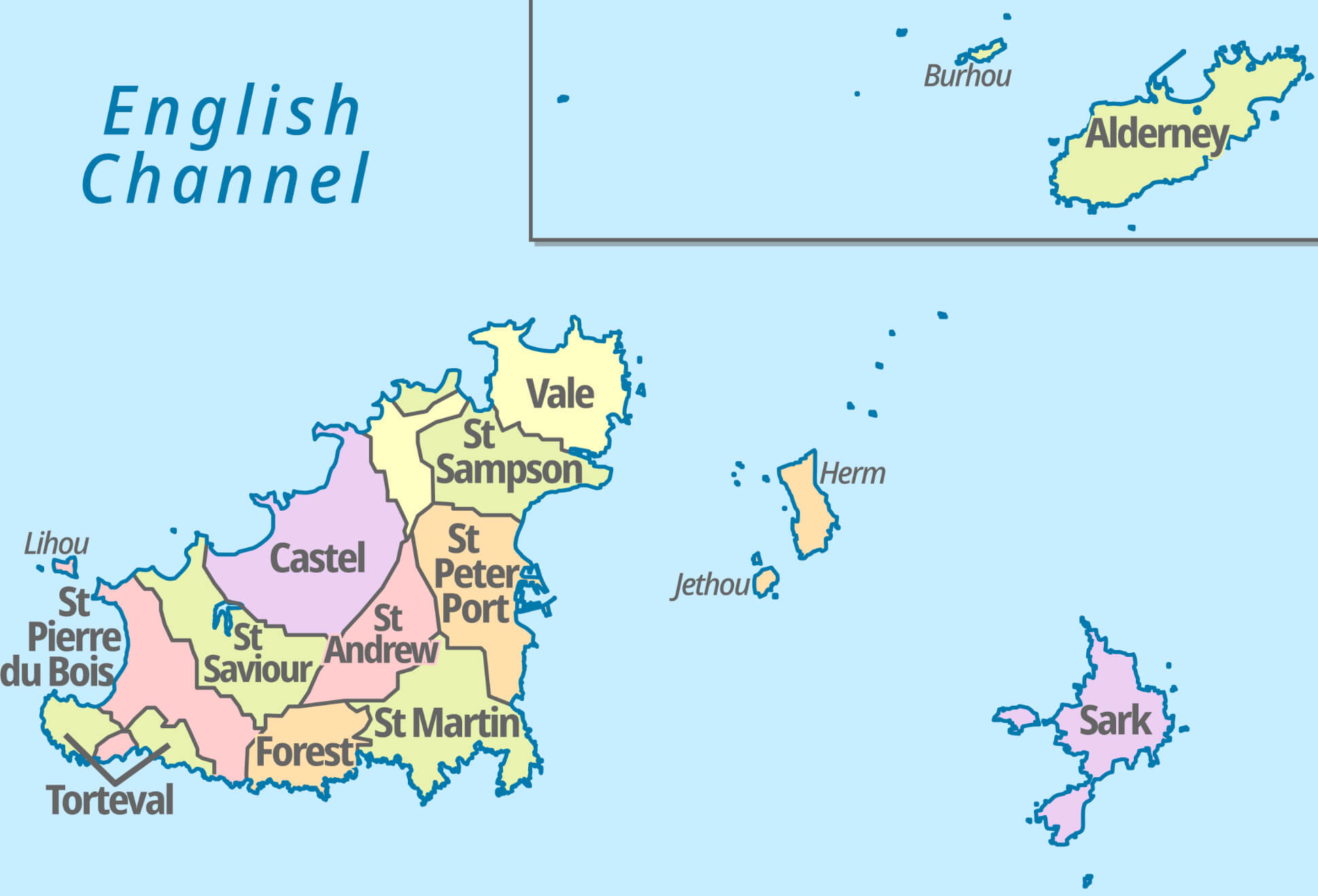 This map of Guernsey shows its various parishes (or provinces), such as St. Peter Port, Vale, St. Sampson, Castel, St. Andrew, and more. In addition to the main island, smaller surrounding islands such as Alderney, Sark, Herm and Jethou are also shown. These parishes serve as the administrative and historical divisions within Guernsey, part of the Channel Islands located in the English Channel. Each parish has its own unique charm and attractions, ranging from coastal cliffs to quaint village scenes.
Historically known for its farming and fishing industries, Guernsey has evolved into a hub for finance and tourism. Visitors are drawn to its picturesque landscapes, historic castles, and sandy beaches, making it a perfect escape for nature lovers and history buffs alike. The island’s unique cuisine and relaxed vibe add to its appeal, offering a tranquil retreat from busy city life.
Where is located Guernsey on the World Map
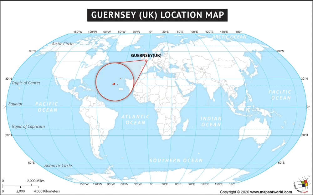
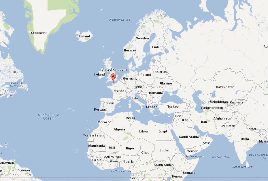
Guernsey is a small island located in the English Channel, near the coast of Normandy, France. Though closer to France, it’s a British Crown Dependency, not part of the UK. It’s one of the Channel Islands, alongside Jersey and a few smaller ones.
On the world map, you’ll spot Guernsey between England and France, just 30 miles off the Normandy coast. Its position has been historically important, especially during World War II, and is now easily accessible by ferry or short flights.
Today, Guernsey attracts visitors with its natural beauty and relaxed atmosphere. Its location makes it a great base for exploring both the UK and continental Europe, blending French and British influences.
Here are some statistical information about Guernsey:
Administrative Map of Guernsey
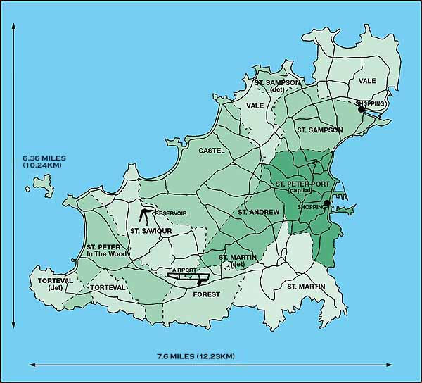
This map shows Guernsey’s administrative parishes, including St. Peter Port (capital), St. Sampson, and Vale, with key landmarks like the airport and shopping areas. The island is about 7.6 miles long.
Where is Guernsey UK in the World
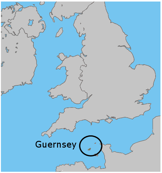
This map shows the location of Guernsey in the English Channel, situated between the southern coast of England and the northern coast of France. It highlights Guernsey’s position relative to both countries.
Guernsey Regions Map
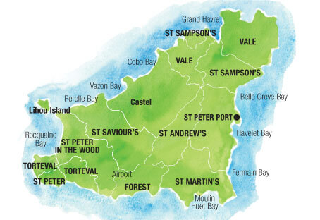
This map depicts the island of Guernsey, outlining its various parishes, including St. Peter Port, St. Sampson’s, Vale, and others, along with key geographical features such as Lihou Island, Cobo Bay, and Vazon Bay.
Cities Guernsey Map
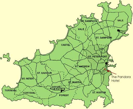
This map shows Guernsey with its major parishes, roads, and key landmarks, including the location of The Pandora Hotel in St. Peter Port. Other parishes like St. Sampson, Vale, and St. Martin are also highlighted.
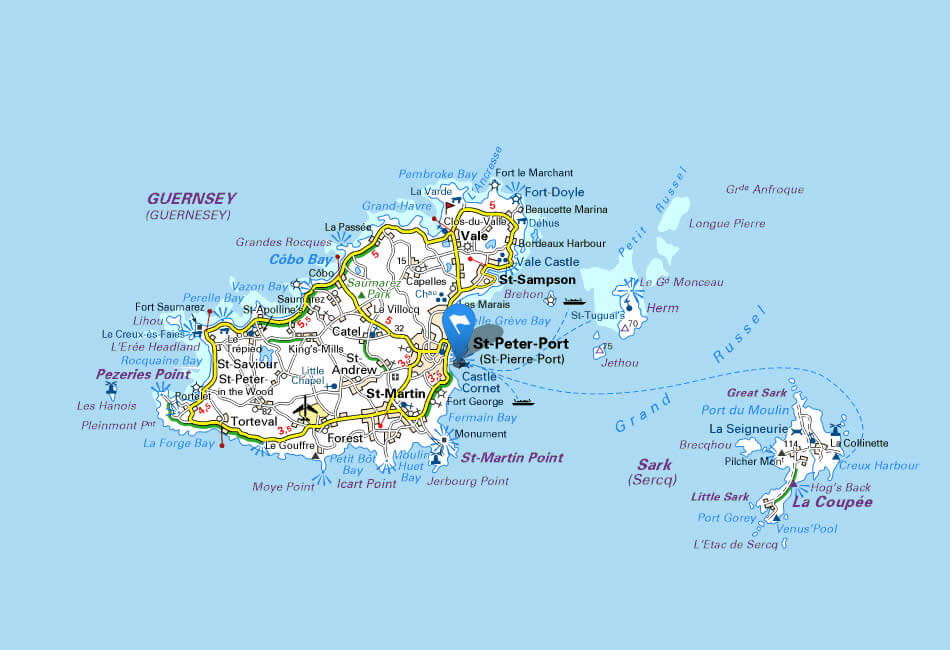
Guernsey Road Map
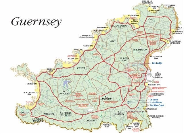
This map illustrates the island of Guernsey, highlighting its main roads, bays, and parishes, along with key locations such as St. Peter Port, St. Sampson, and notable landmarks across the island.
Guernsey Travel Map
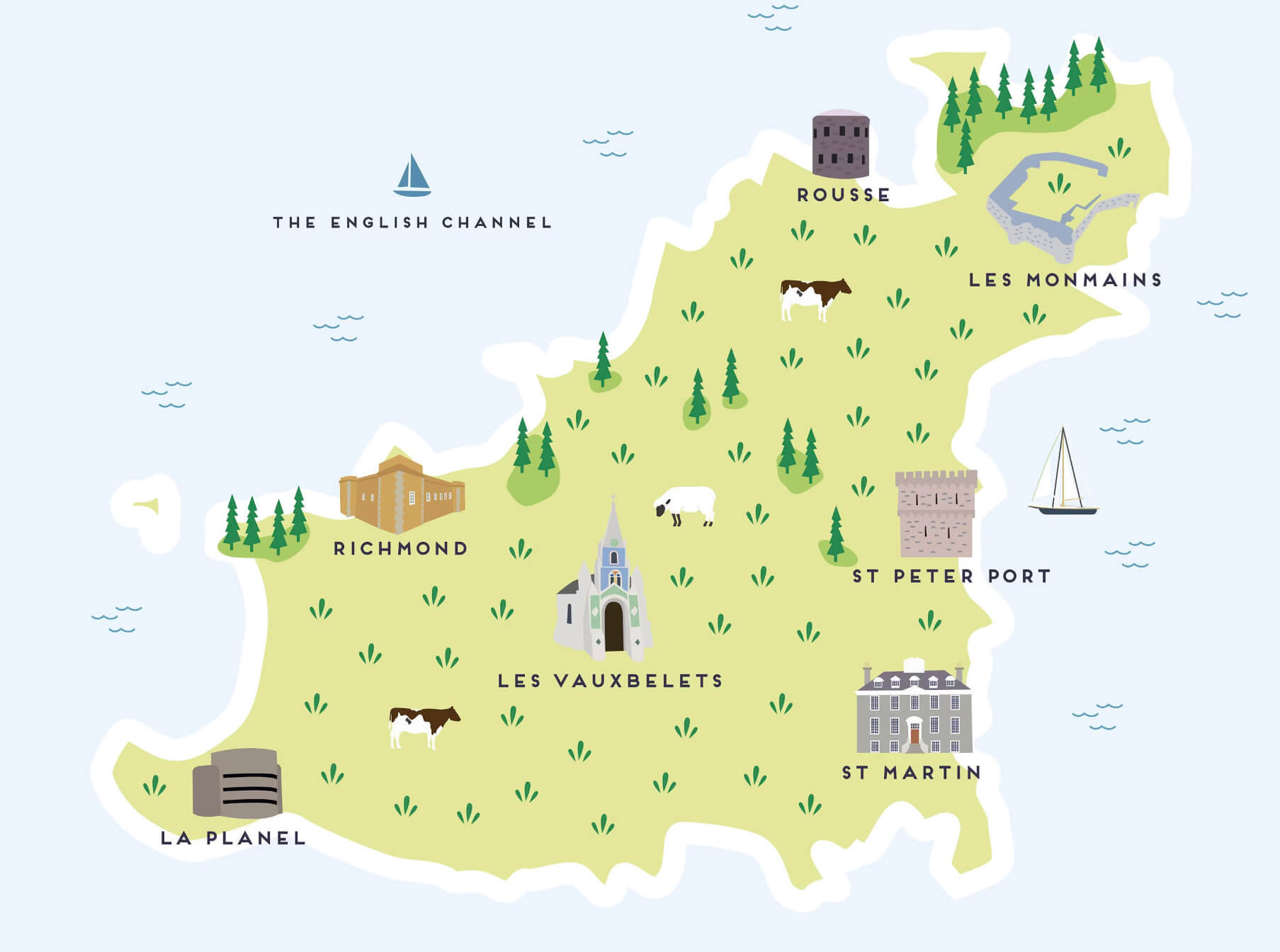 The illustrated map of Guernsey highlights various points of interest on the island, including key landmarks such as St Peter Port, St Martin and Les Vauxbelets. It shows a mix of natural beauty, historical sites and cultural attractions, making it a delightful representation for travelers planning to explore the island’s charms.
Detailed Map of Guernsey
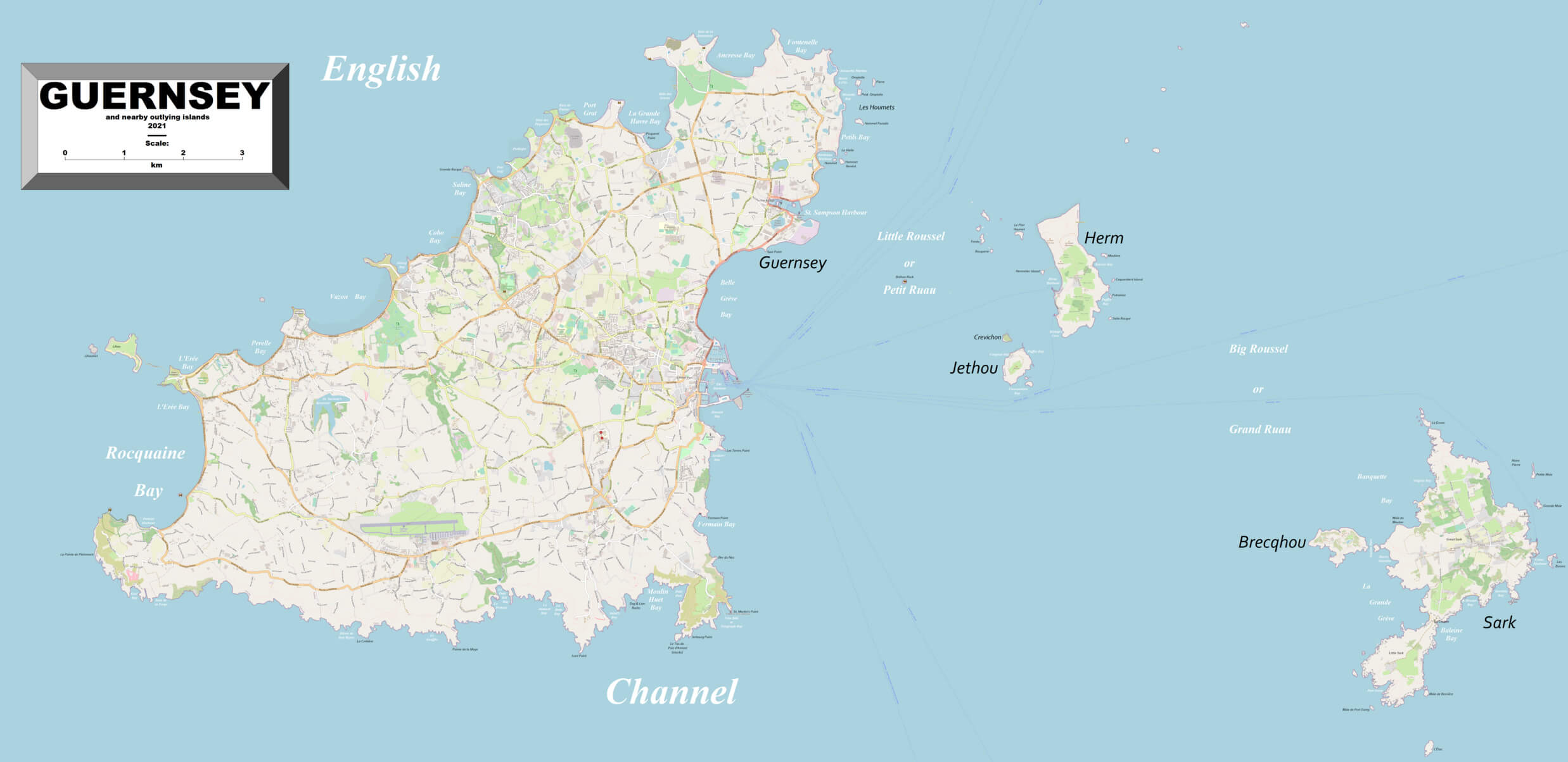
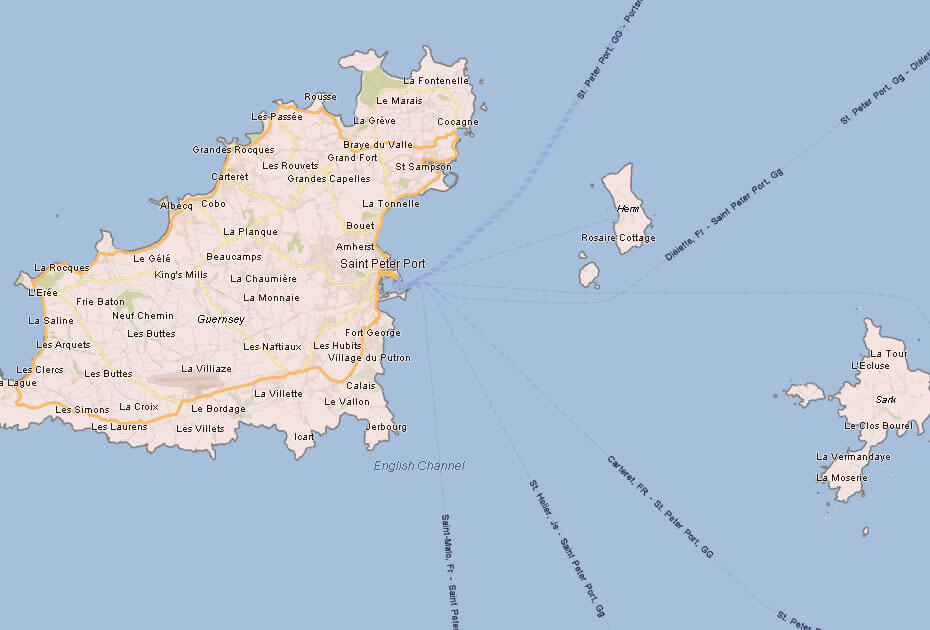
The Islands of Guernsey Map, Herm and Sark
 This map shows the islands of Guernsey, Herm, and Sark in the English Channel. Guernsey is the largest of the islands, with clear urban areas visible, while Herm and Sark are smaller islands located to the east of Guernsey. The islands are part of the Channel Islands, known for their beautiful coastlines and unique blend of British and French cultural influences. Guernsey, the main island, has an airport and more developed infrastructure, while Herm and Sark are more rural, with a focus on tourism and nature.
Guernsey Map within the Bailiwick
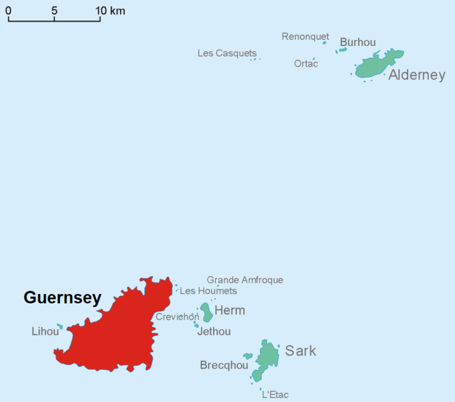 The map of Guernsey within the Bailiwick highlights the various islands that make up the jurisdiction. The Bailiwick of Guernsey consists of Guernsey itself, Herm, Sark, Jethou and Alderney, and smaller islands such as Burhou and Les Casquets. Each of these islands is self-governing but part of the larger Bailiwick, and they all lie in the English Channel. The map illustrates the geographical relationship between the islands within this unique British Crown Dependency.
Map of Guernsey World
Map of Guernsey
Guernsey Earth Map
Map Guernsey
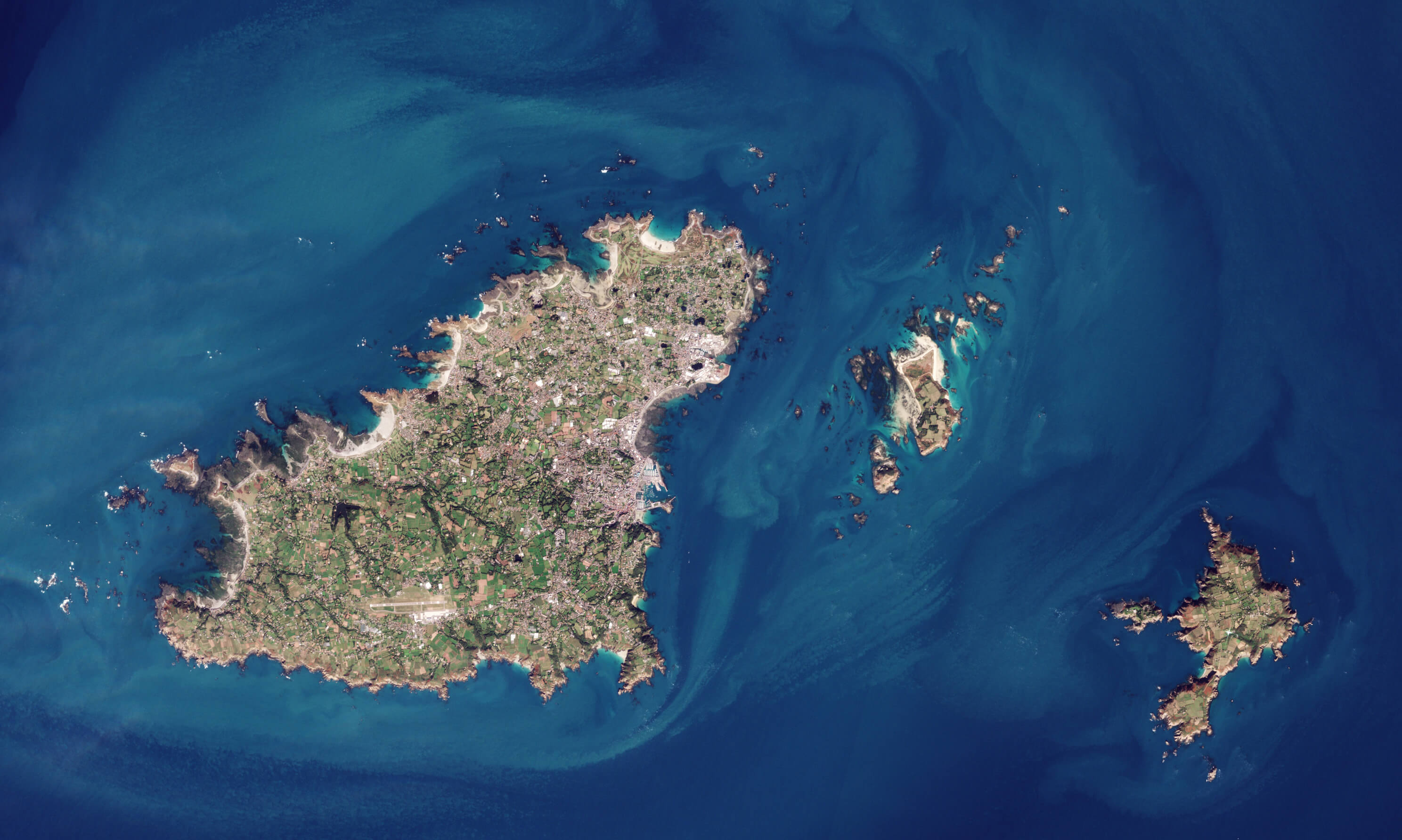
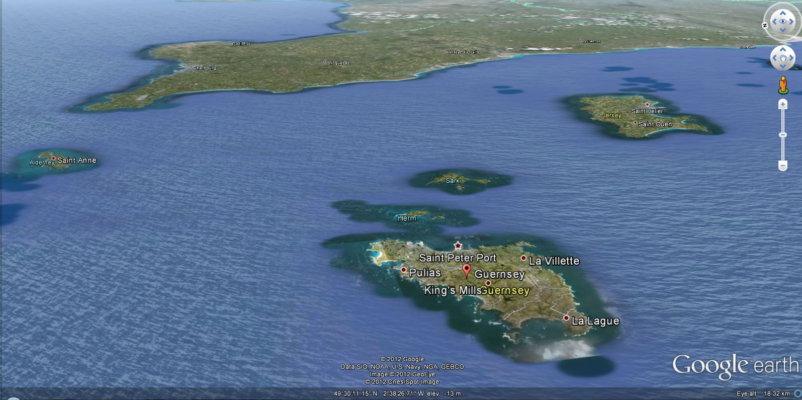
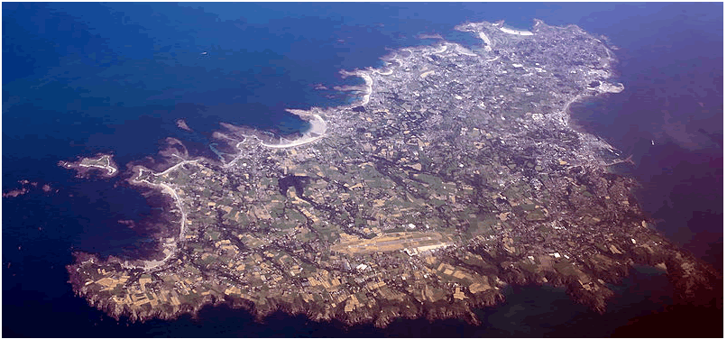
Guernsey Aerial View
Where is Guernsey on the Europe Map?
Show Google map, satellite map, where is the country located.
Get directions by driving, walking, bicycling, public transportation and travel with street view.
Feel free to explore these pages as well:
- France Map ↗️
- A Collection of United Kingdom Maps ↗️
- Map of United Kingdom ↗️
- United Kingdom Map ↗️
- Discovering Cardiff: A Gem in the Heart of Wales ↗️
- Birmingham Unveiled: The Heart of England’s Hidden Gems ↗️
- Discovering Belfast: The Northern Gem of the UK ↗️
- Bradford, United Kingdom: A Vibrant Tapestry of Culture and History ↗️