Discover the island of Cyprus through this diverse map collection, showcasing everything from its bustling cities to its ancient ruins. Whether planning a trip or exploring from home, these maps provide a detailed view of Cyprus’s rich cultural and geographic landscapes. From its picturesque villages to lively cities, these maps will help you navigate Cyprus’s most fascinating locations.
Brief information about Cyprus
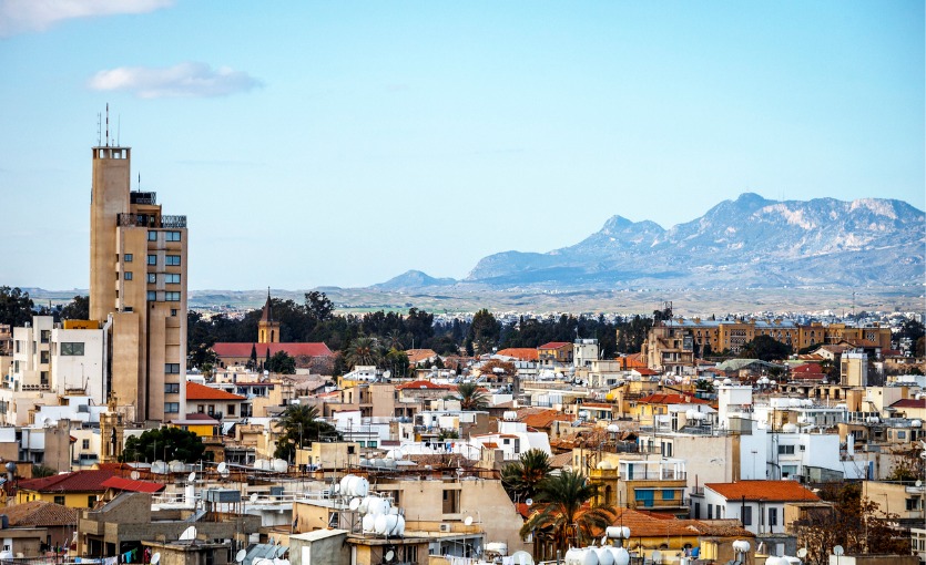
Cyprus is an island nation located in the eastern Mediterranean, known for its rich history and beautiful landscapes. It’s a popular tourist destination with stunning beaches, ancient ruins, and charming villages. The island is divided into two main parts: the Republic of Cyprus in the south and the Turkish-controlled Northern Cyprus, each with its own culture and attractions. Nicosia, the capital, is the last divided city in Europe, symbolizing the ongoing political complexities of the island.
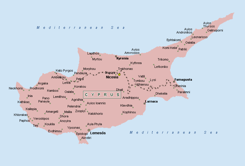
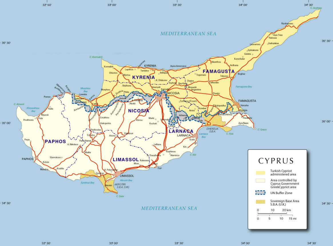
Cyprus Map
 This map of Cyprus illustrates the geographical division of the island, highlighting key cities like Nicosia, Larnaca, and Kyrenia. It also shows the buffer zone that separates the northern and southern parts of the island, as well as the British Sovereign Base Areas of Akrotiri and Dhekelia. The map is a detailed representation of the topography, urban areas, and political boundaries, providing a clear view of the various regions and territories within Cyprus.
Historically, Cyprus has been influenced by a variety of civilizations, including the Greeks, Romans, Byzantines, and Ottomans. This mix of cultural influences is reflected in its architecture, cuisine, and traditions. Visitors can explore archaeological sites like the Tombs of the Kings, stroll through lively markets, or simply relax by the Mediterranean Sea, making Cyprus a unique blend of ancient and modern worlds.
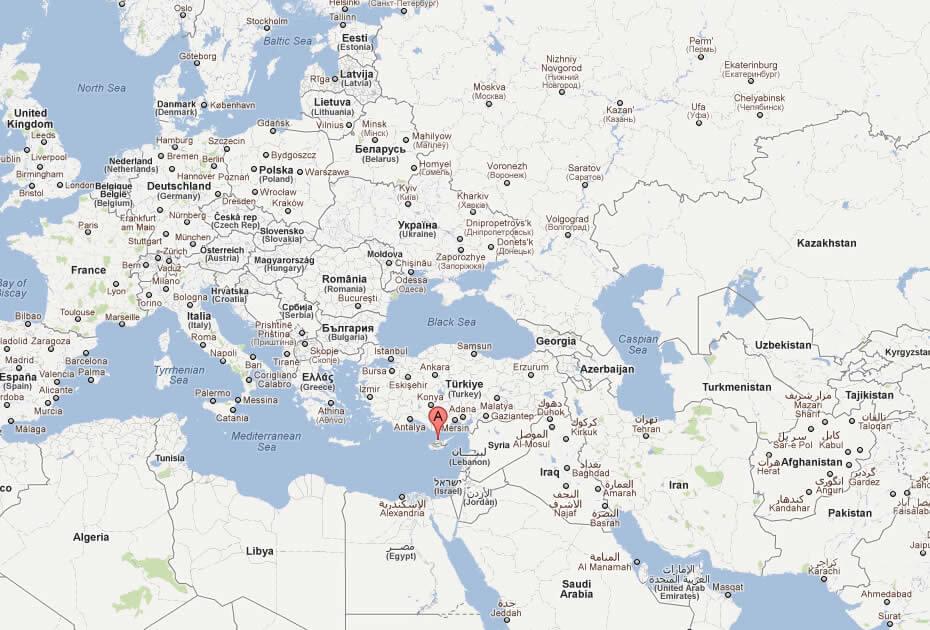
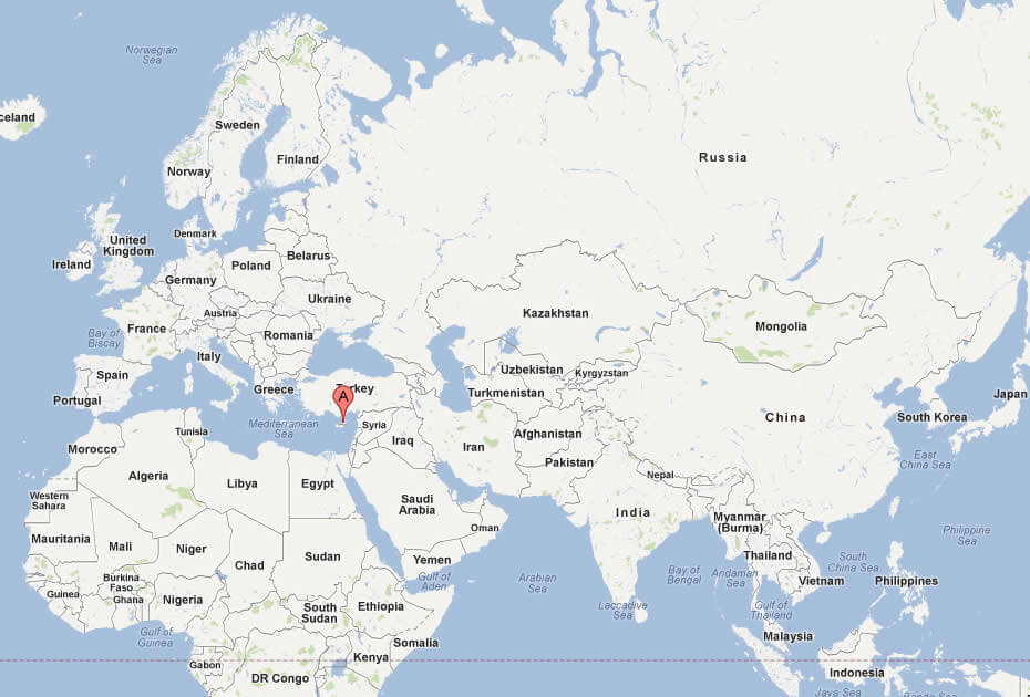
Where is located Cyprus on the World Map
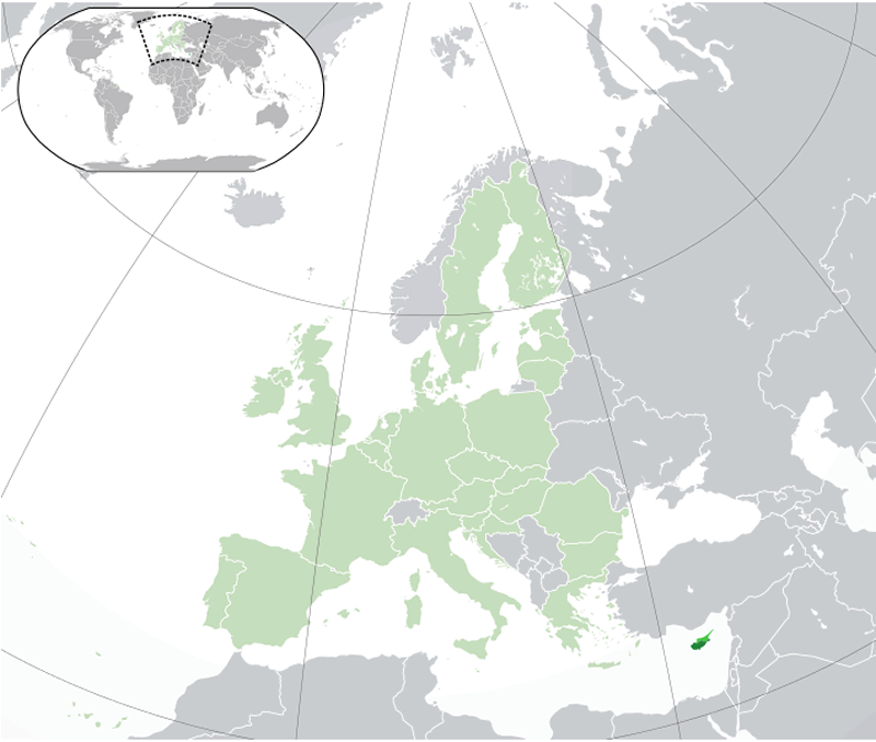
Cyprus is located in the eastern Mediterranean Sea, south of Turkey and west of Syria and Lebanon. It sits at the crossroads of Europe, Asia, and Africa, giving it historical and strategic importance.
Although close to the Middle East, Cyprus is part of Europe and a member of the European Union. The island lies about 75 kilometers south of Turkey, with Greece about 800 kilometers to the northwest.
As the third largest island in the Mediterranean, Cyprus covers around 9,251 square kilometers. Its coastal location makes it a popular tourist destination, known for its beaches and historical sites.
Here are some statistical information about Cyprus:
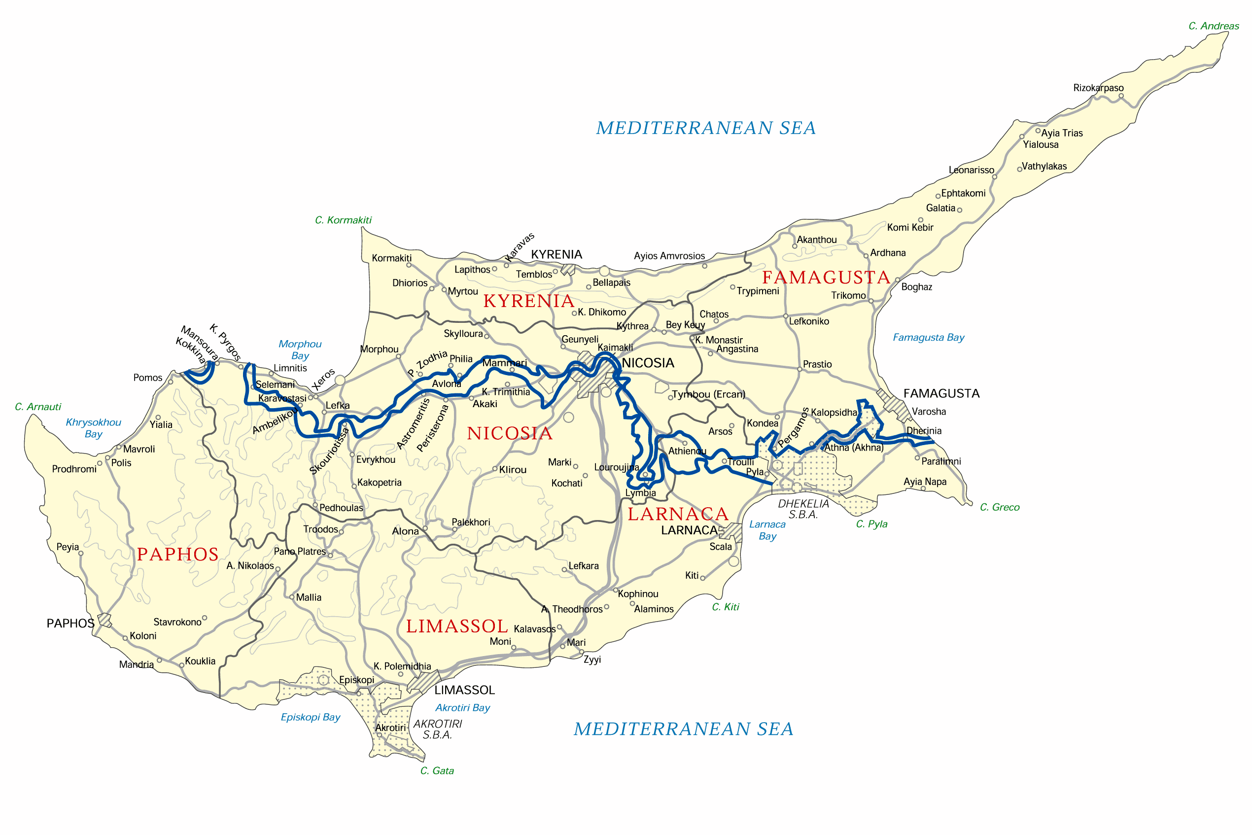
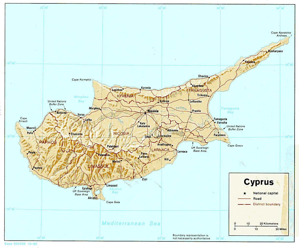
Map of Cyprus
This map of Cyprus shows major cities and roads, including the capital Nicosia (Lefkosia), with Kyrenia (Girne) in the north and Famagusta (Magosa) in the east, highlighting the division between the Turkish-controlled north and the Republic of Cyprus in the south.
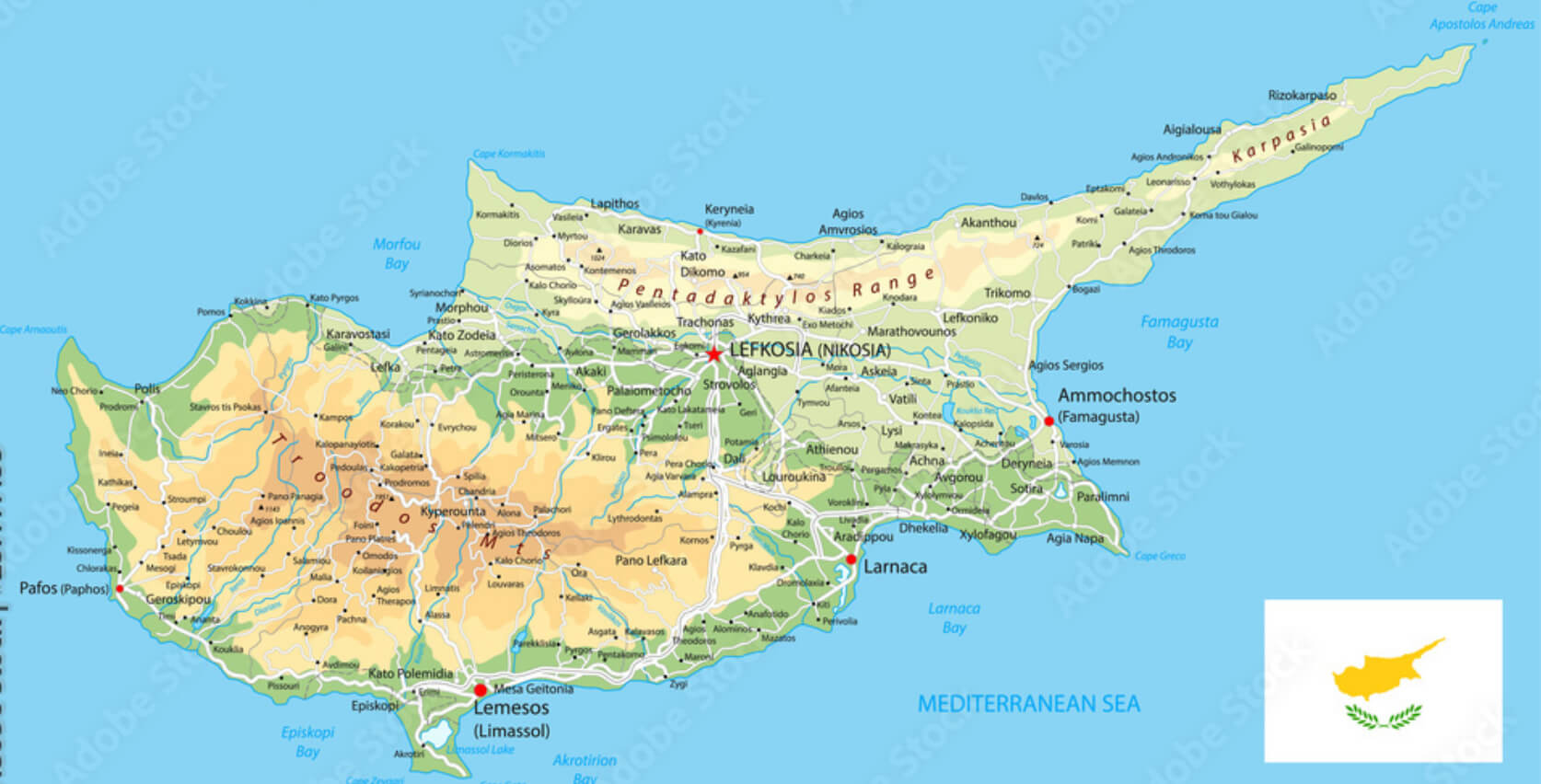
Cyprus Cities Map
This map of Cyprus displays the major cities and towns across the island, including Nicosia, Larnaca, Limassol, Paphos, Kyrenia, and Famagusta. It highlights the road connections between these locations and provides a geographical overview of the island, bordered by the Mediterranean Sea.
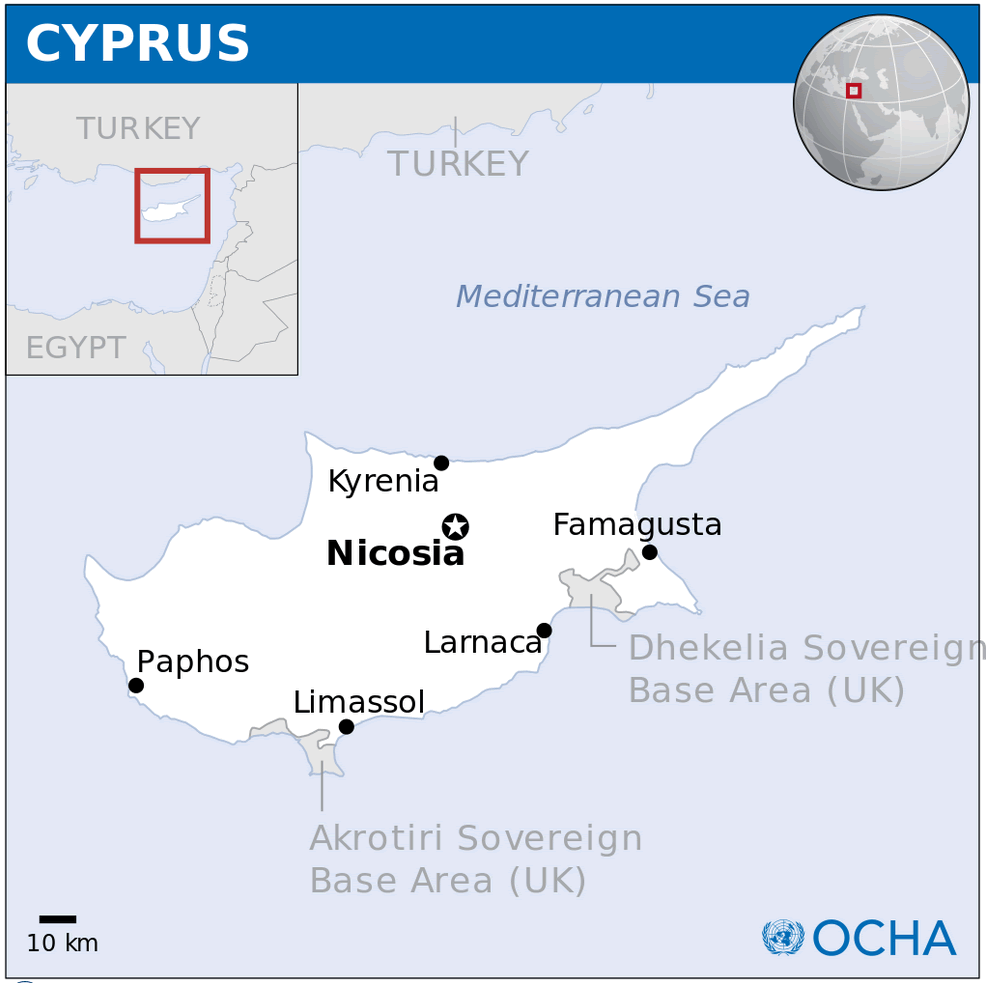
Cyprus Location Map
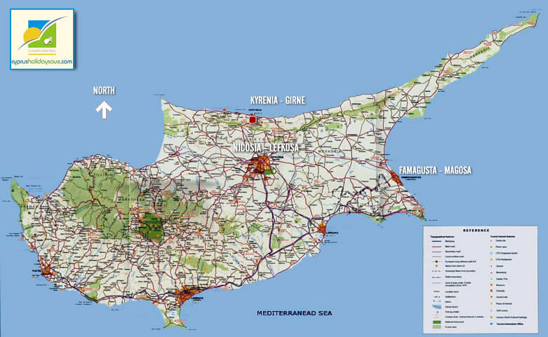
Visitor’s Map of Cyprus
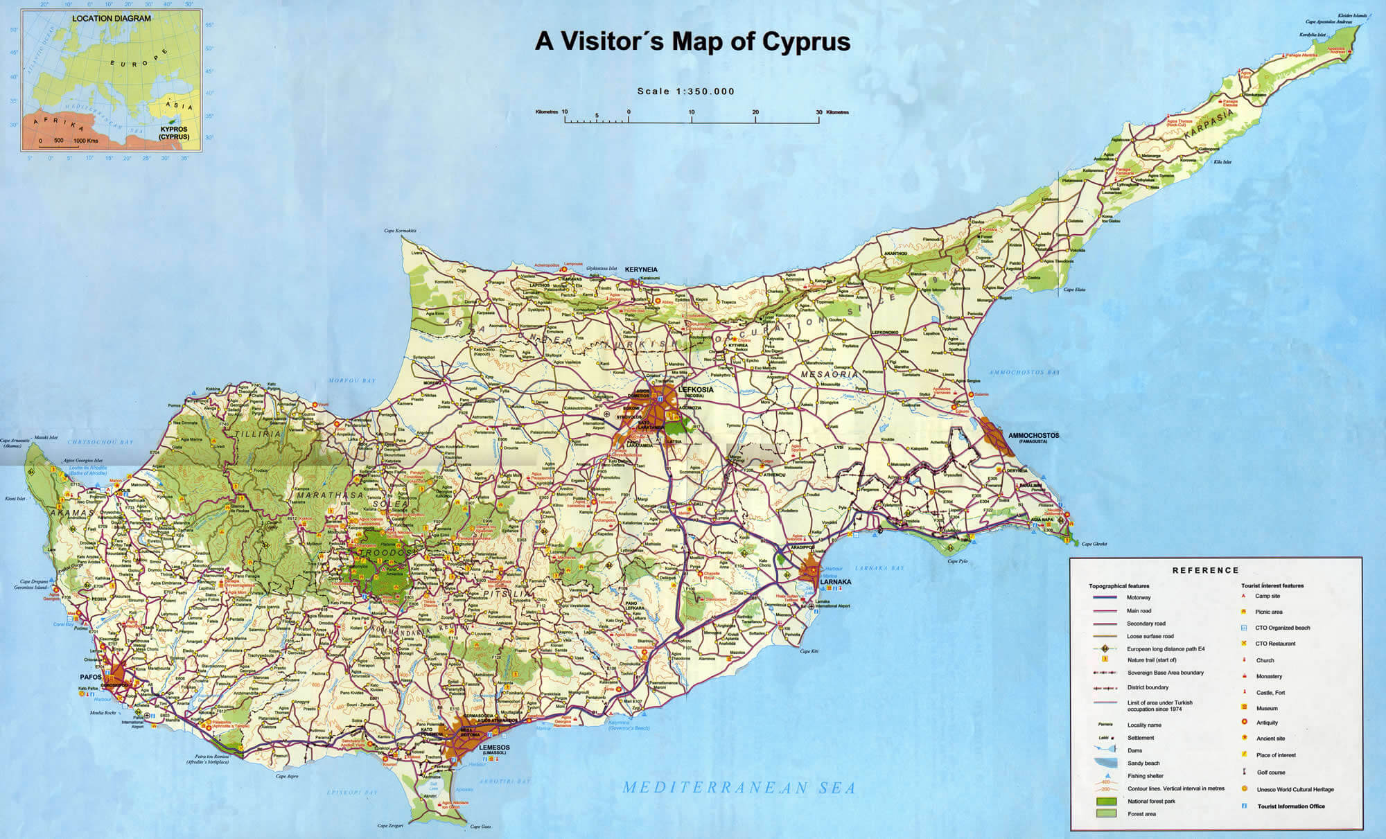
This visitor’s map of Cyprus highlights major cities, including Nicosia (Lefkosia), Larnaca, Limassol, Paphos, and Famagusta, as well as key roadways and tourist landmarks. It shows natural features like forests, mountains, and beaches, along with cultural sites such as churches, monasteries, and UNESCO World Heritage areas. The map provides a clear guide for tourists to navigate the island’s attractions.
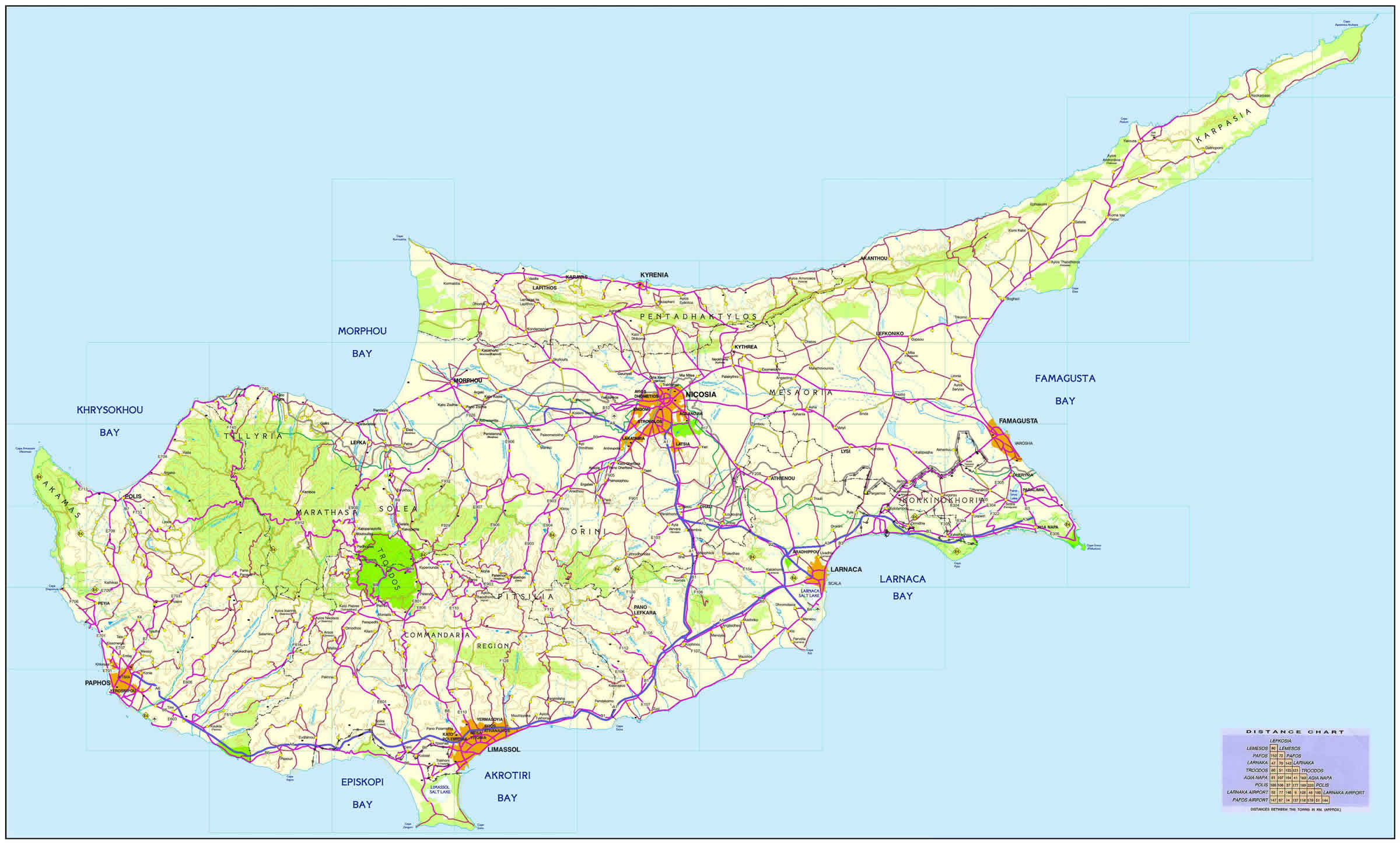
Cyprus Road Map
Cyprus Country Map
This map of Cyprus shows the division between the Turkish Cypriot-administered north and the Greek Cypriot-controlled south, with the UN Buffer Zone running through the island, including the capital Nicosia. Major cities such as Paphos, Limassol, Larnaca, Kyrenia, and Famagusta are also marked, along with British Sovereign Base Areas.
Physical Map Cyprus
Cyprus National Borders Map
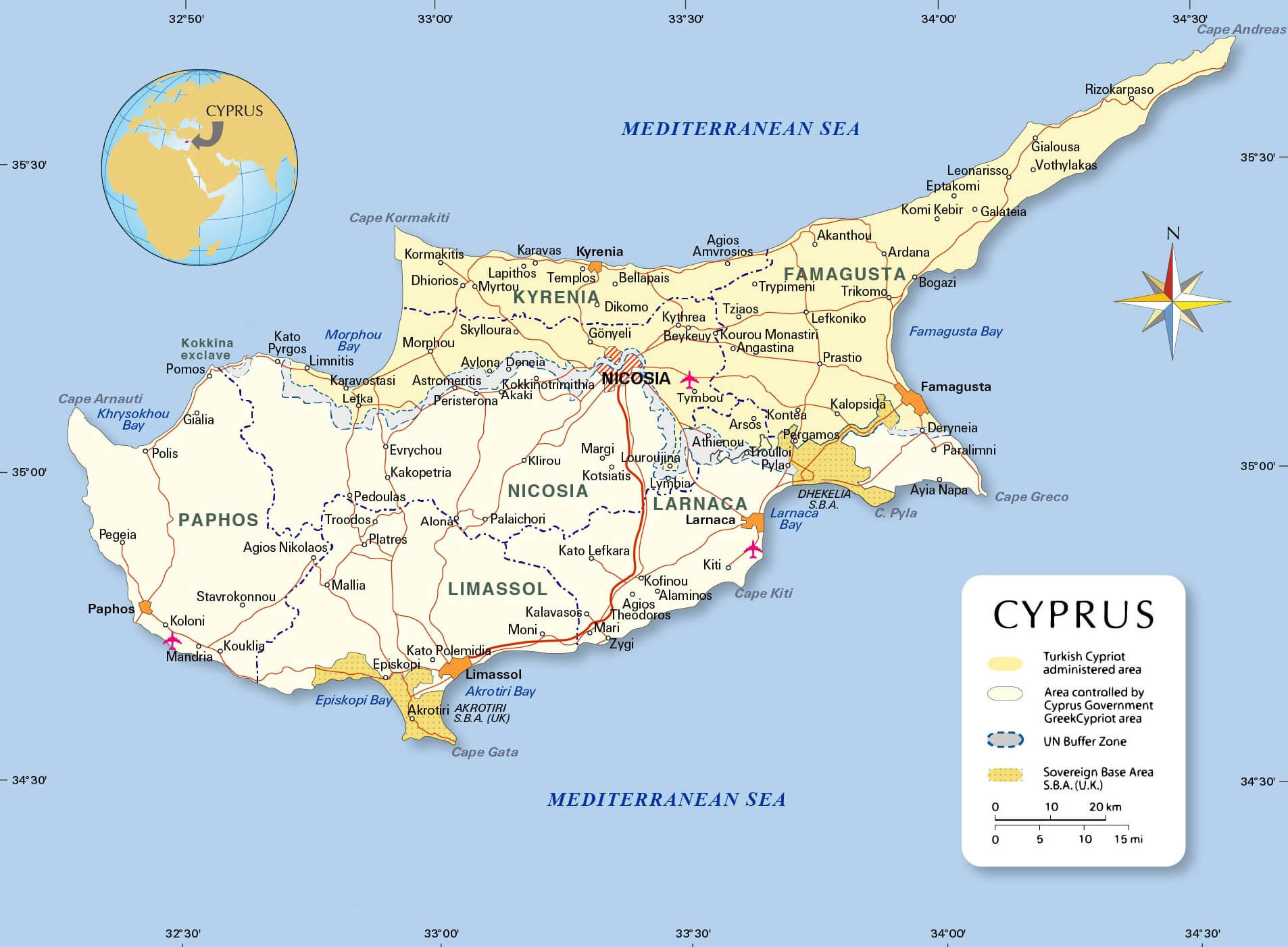 This map of Cyprus shows the island’s national borders, including the division between the Turkish Cypriot-administered area in the north and the area controlled by the Republic of Cyprus in the south. It highlights key regions such as Nicosia (the capital), Paphos, Larnaca, and Limassol, and it also marks the United Nations Buffer Zone, which separates the two regions. Additionally, the map indicates the British Sovereign Base Areas of Akrotiri and Dhekelia along the southern coast, showcasing the island’s strategic location in the eastern Mediterranean.
Greek Cyprus and Turkish Cyprus Map with Cities
 This map of Cyprus shows the geographical division between Greek Cyprus and Turkish Cyprus, with major cities such as Nicosia, Kyrenia, Larnaca and Limassol. It also marks the British administered areas along the southern coast, illustrating the political and administrative complexity of the island. The division between the Greek and Turkish areas is clearly delineated, reflecting the political division that has existed since the 1970s.
Cyprus Districts and Capitals Map with Major Cities
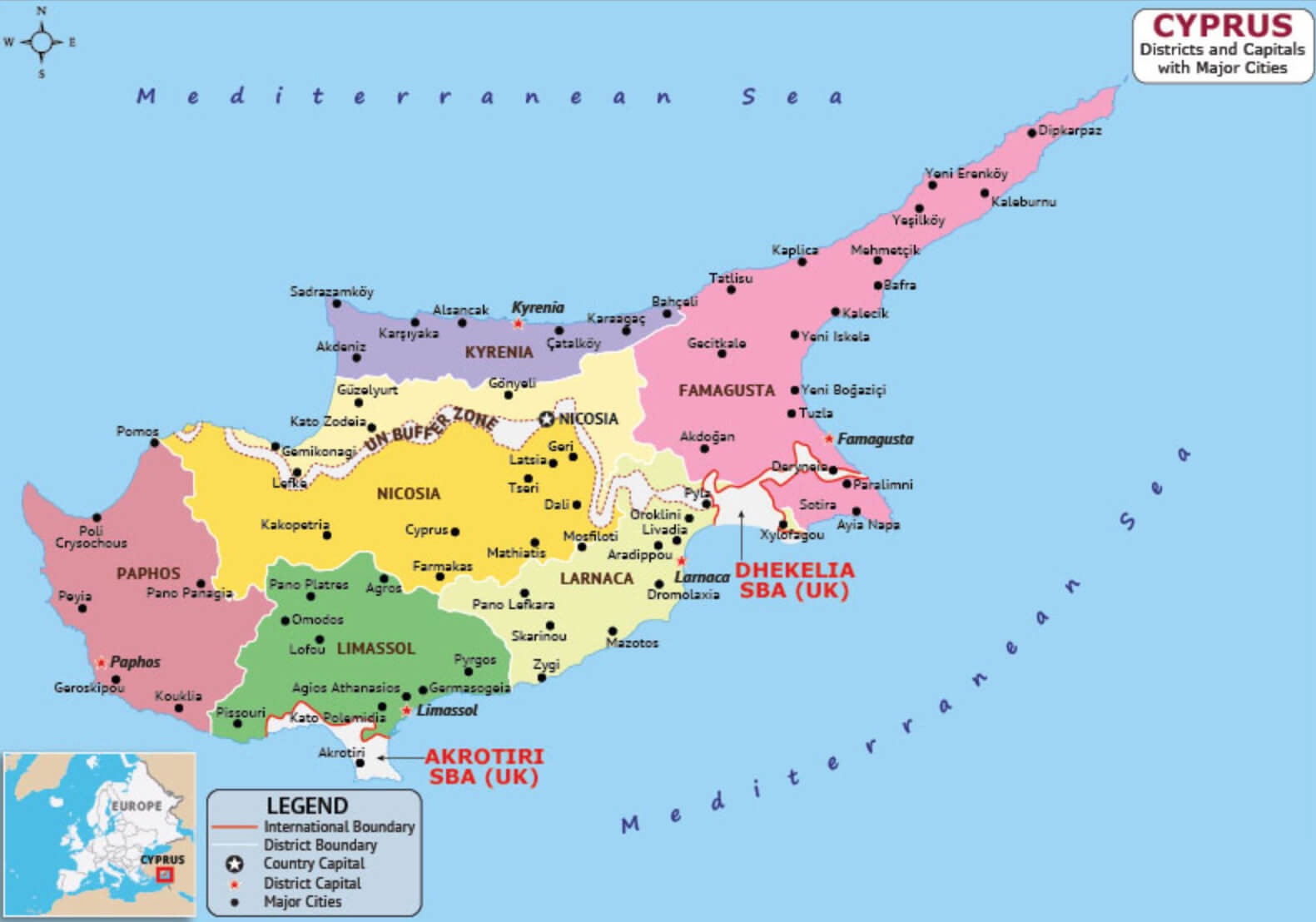 This map of Cyprus shows the division of the island into its main districts, highlighting key areas such as Nicosia, Limassol and Paphos. It also shows the capitals of each district and the main cities in both the Greek Cypriot-controlled and Turkish Cypriot-administered areas. In addition, the map shows the UN buffer zone separating the two communities, as well as the British Sovereign Base Areas (SBAs) of Akrotiri and Dhekelia, illustrating the complex geopolitical landscape of the island.
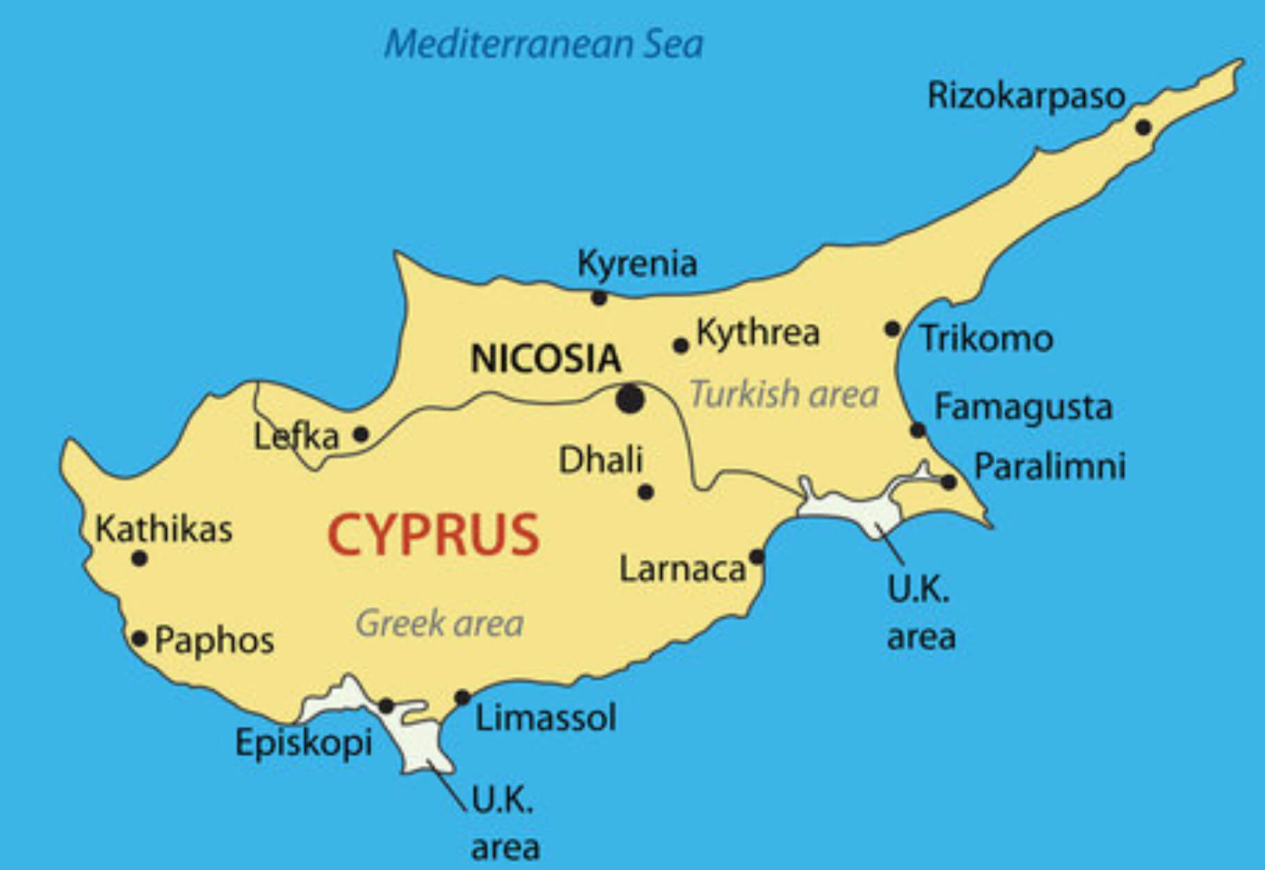
North Cyprus and South Cyprus Map
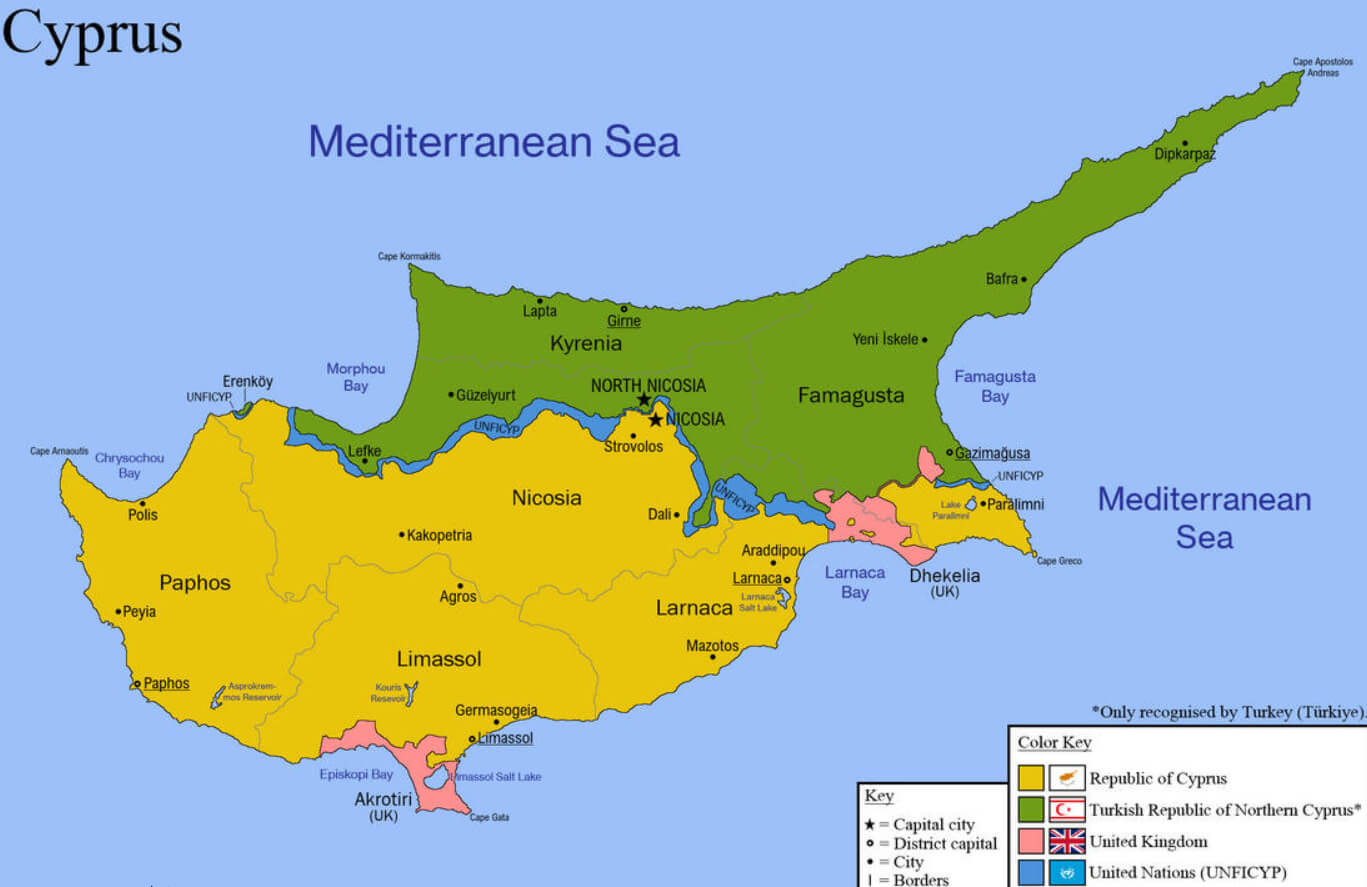 This map illustrates the political division of Cyprus, showing the Republic of Cyprus in the south and the Turkish Republic of Northern Cyprus (recognized only by Turkey) in the north. It highlights the buffer zone managed by the United Nations (UNFICYP) separating the two areas and includes British sovereign base areas such as Akrotiri and Dhekelia. The map clearly marks the capital city, Nicosia, as divided between the two territories, reflecting the ongoing division of the island.
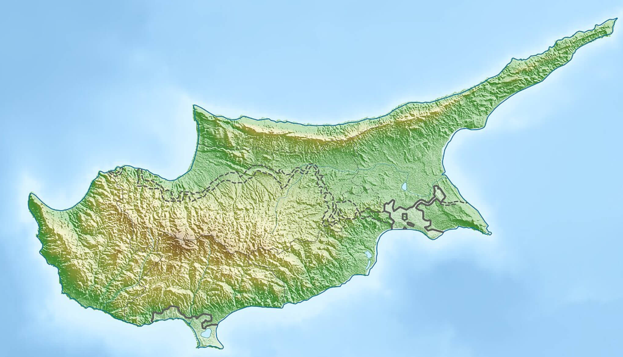
Cyprus Physical Map
 This physical map of Cyprus highlights the island’s diverse terrain, including mountain ranges such as the Troodos Mountains in the southwest and the Kyrenia Range (Pentadaktylos) in the north. It also features important cities like Nicosia, Limassol, and Larnaca, and the coastal plains stretching along the Mediterranean Sea. The map provides a detailed view of the natural landscape, showcasing valleys, rivers, and coastal regions that define Cyprus’s geography.
Cyprus Terrain Map
 The map of Cyprus shows the varied terrain of the island, with major mountain ranges such as the Troodos Mountains in the southwest and the Pentadaktylos Mountains along the northern coast. It highlights the geographical division between the Republic of Cyprus in the south and the Turkish Republic of Northern Cyprus, with a United Nations buffer zone running through Nicosia, the divided capital of the island. The map also shows coastal plains, higher elevations in the interior and lowlands near the Mediterranean Sea.
Cyprus Physical Map with Turkey
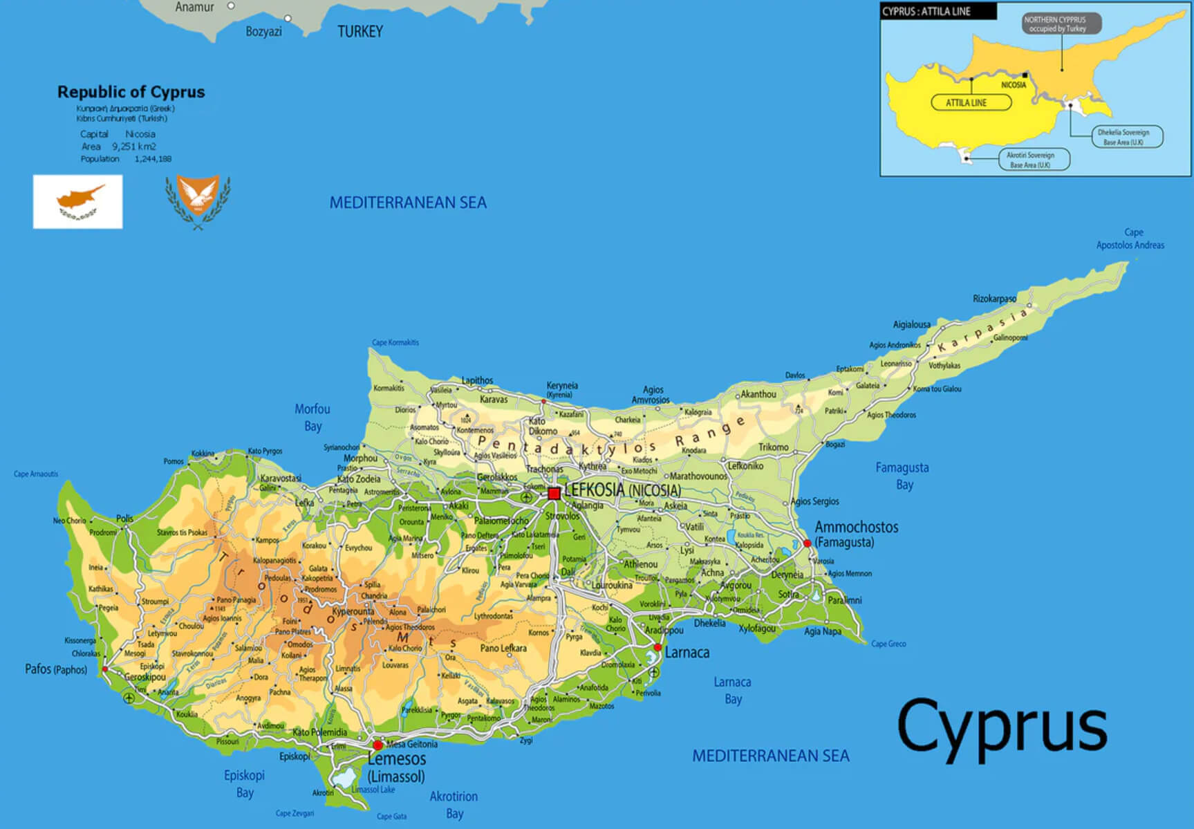 This map of Cyprus shows the island’s physical features, including the mountainous regions like the Troodos and Pentadaktylos ranges, as well as the coastal areas along the Mediterranean Sea. It also highlights key cities such as Nicosia (Lefkosia), Limassol (Lemesos), and Larnaca, along with the separation line between the Republic of Cyprus and the area administered by Turkish Cypriots, known as the Attila Line. The map provides a clear visual of the island’s topography in relation to its surrounding sea and neighboring Turkey to the north.
Cyprus Agriculture Map
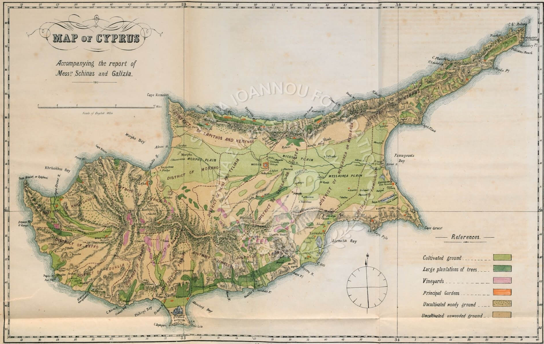 This map of Cyprus highlights the agricultural zones of the island, showing areas of arable land, large tree plantations, vineyards and areas used for gardens. It also distinguishes between different types of uncultivated land, providing a detailed view of how the land is used for agricultural activities in different districts, including Paphos, Nicosia and Famagusta.
Cyprus Map by Johannes van Deutecom in 1573
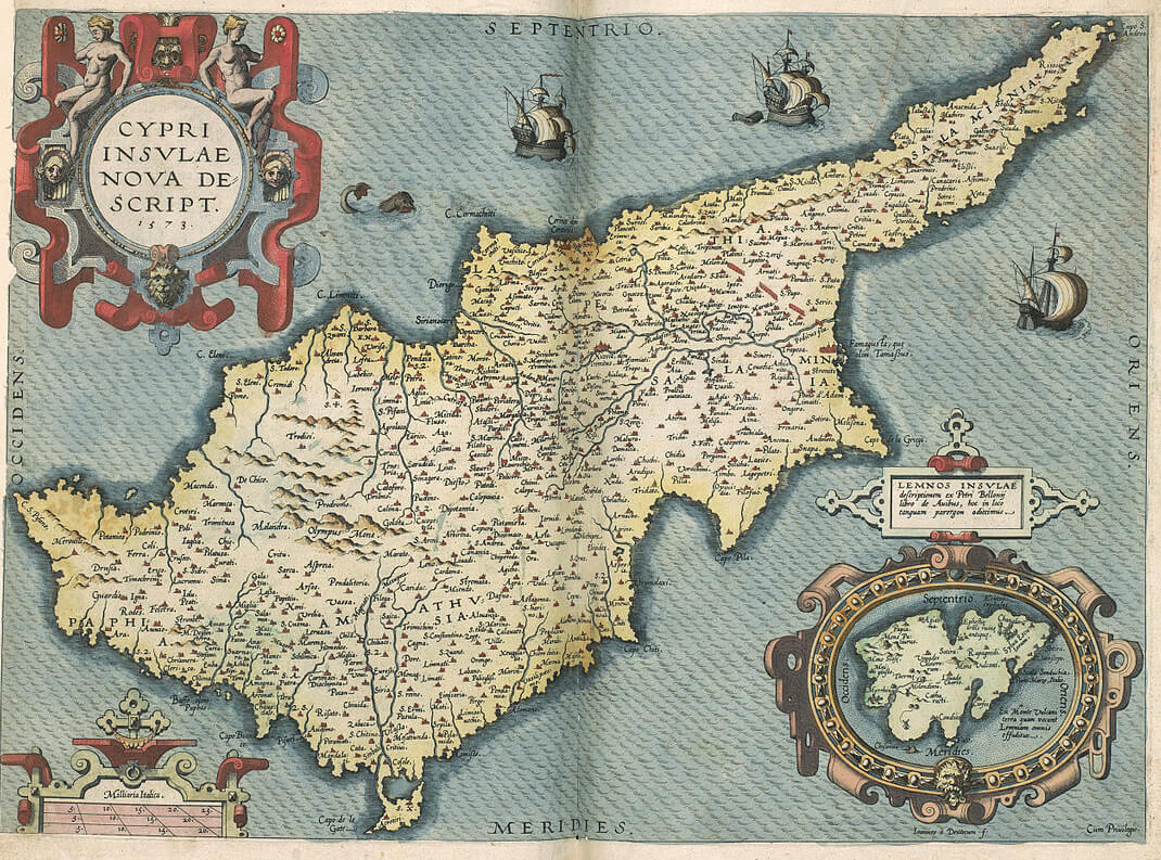 This map of Cyprus, created by Johannes van Deutecom in 1573, shows the geographical and administrative details of the island from the Renaissance period. The detailed engravings highlight various towns, regions and coastal features of Cyprus, along with illustrations of ships that emphasise its importance in the Mediterranean trade routes of the time. The decorative cartouches and intricate designs reflect the artistic style of early cartography, combining geographical accuracy with artistic flair, and provide an insight into how 16th-century mapmakers viewed and depicted this strategic island in the Mediterranean.
Cyprus Ethnic Groups Map in 1960 Census
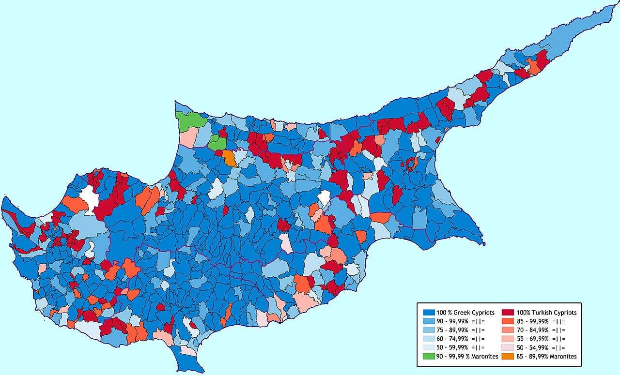 This map shows the distribution of ethnic groups in Cyprus as recorded in the 1960 census, with areas dominated by Greek Cypriots (in shades of blue) and Turkish Cypriots (in shades of red). The darker the colour, the higher the concentration of each ethnic group in that particular region. The map also includes distinctions for the Maronite communities, highlighting the complex demographic composition of Cyprus just before intercommunal tensions escalated, leading to the events of the 1960s and the eventual partition of the island.
Cyprus Satellite Provinces
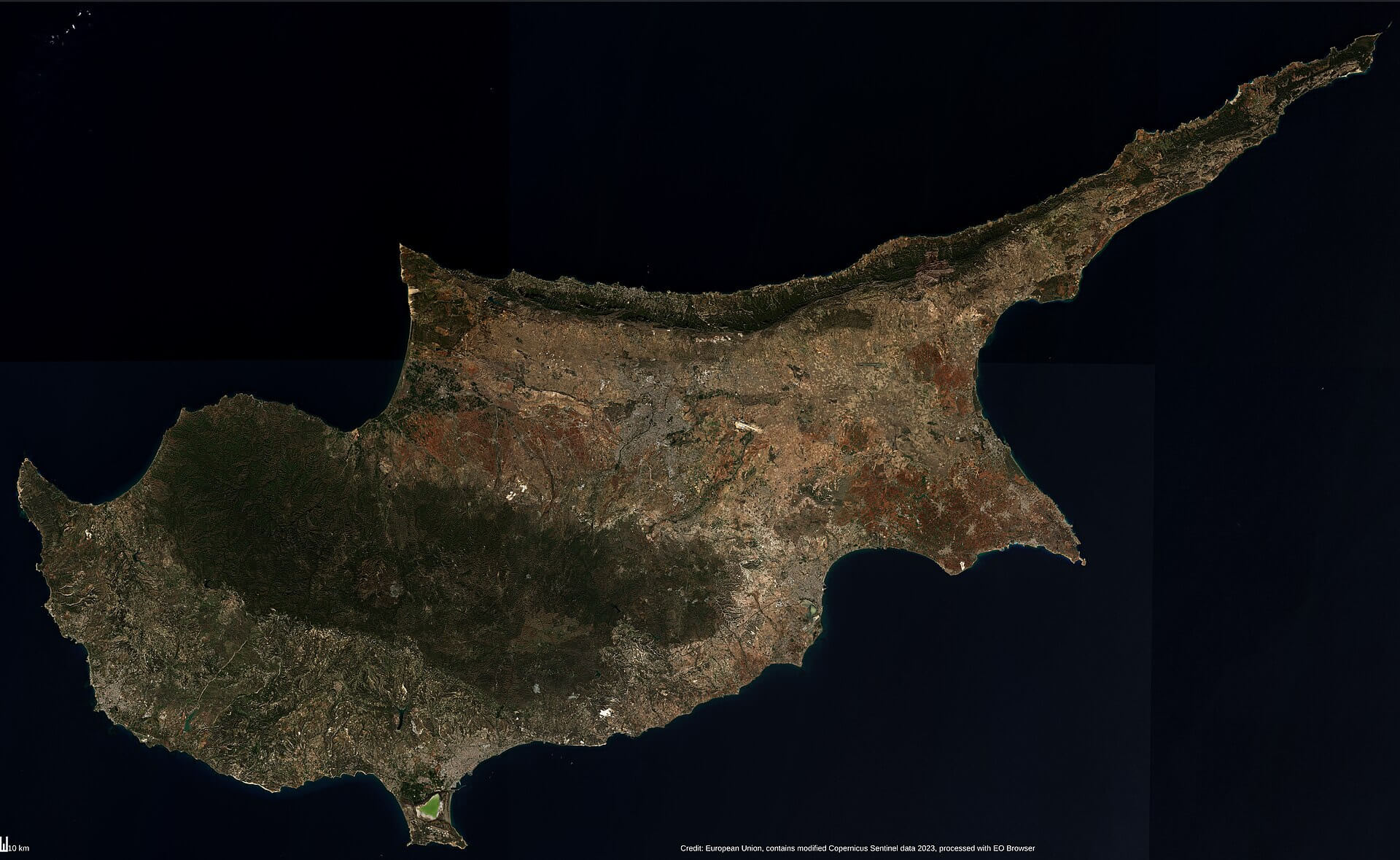 The satellite map of Cyprus highlights the island’s varied landscape, from coastal regions to mountainous areas such as the Troodos Mountains in the southwest. The map provides a detailed view of the natural features and terrain, showing the variations in elevation and the rich geographical features of Cyprus. Satellite imagery provides a clear view of the island’s natural contours, vegetation and urban areas.
Cyprus Blank Map with Provinces
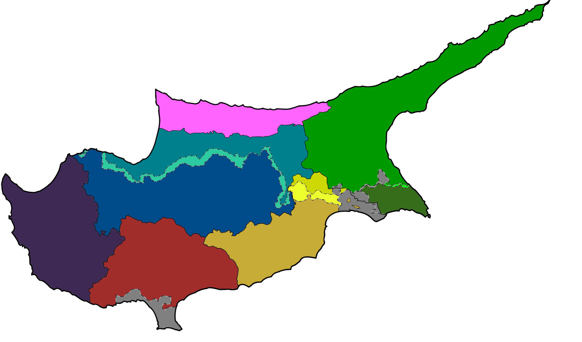 This map of Cyprus displays the island’s division into different provinces, with each region color-coded for easy identification. It shows the territorial boundaries without labeling the specific names of the provinces, making it a useful reference for understanding the overall layout of the island’s administrative regions. The map highlights the shape and geographic placement of each area, giving a clear view of the internal divisions of Cyprus.
Map of Cyprus Europe
Map of Cyprus World
Where is Cyprus on the Europe Map?
Show Google map, satellite map, where is the country located.
Get directions by driving, walking, bicycling, public transportation and travel with street view.
Feel free to explore these pages as well:
- Greece Map ↗️
- Discover the Timeless Charm of Athens: The Heart of Ancient Greece ↗️
- A Collection of Cyprus Maps ↗️
- Best Mediterranean Cruises Routes 2020 & Best Time to Cruise ↗️
- Top Places to Visit in Athens & Things to do in Athens ↗️
- Discover Bulgaria Through Maps ↗️
- Map of Europe ↗️
- Europe Map ↗️
- A Collection of Europe Maps ↗️