Discover the heart of the Balkans with our extensive collection of Bosnia & Herzegovina maps. From political borders to natural landmarks, these maps offer a window into the complex history and diverse geography of this fascinating country. Whether you’re planning a visit or deepening your understanding of the region, these maps will serve as your guide to Bosnia & Herzegovina’s landscape, cities, and cultural sites
Brief information about Bosnia & Herzegovina
Bosnia & Herzegovina is a beautiful Balkan country known for its rich history and cultural diversity. Its capital, Sarajevo, once called the “Jerusalem of Europe,” reflects a blend of Eastern and Western influences, with mosques, churches, and synagogues coexisting side by side. The country’s stunning landscapes, from lush mountains to clear rivers, make it a perfect destination for nature lovers.
Bosnia and Herzegovina Political Map
This political map of Bosnia and Herzegovina shows the country divided into two main entities: the Federation of Bosnia and Herzegovina and the Republika Srpska. The map highlights major cities like Sarajevo, Mostar, and Banja Luka, along with the country’s borders with Croatia, Serbia, and Montenegro. It also marks the Adriatic Sea coastline near Neum, Bosnia’s only access to the sea.
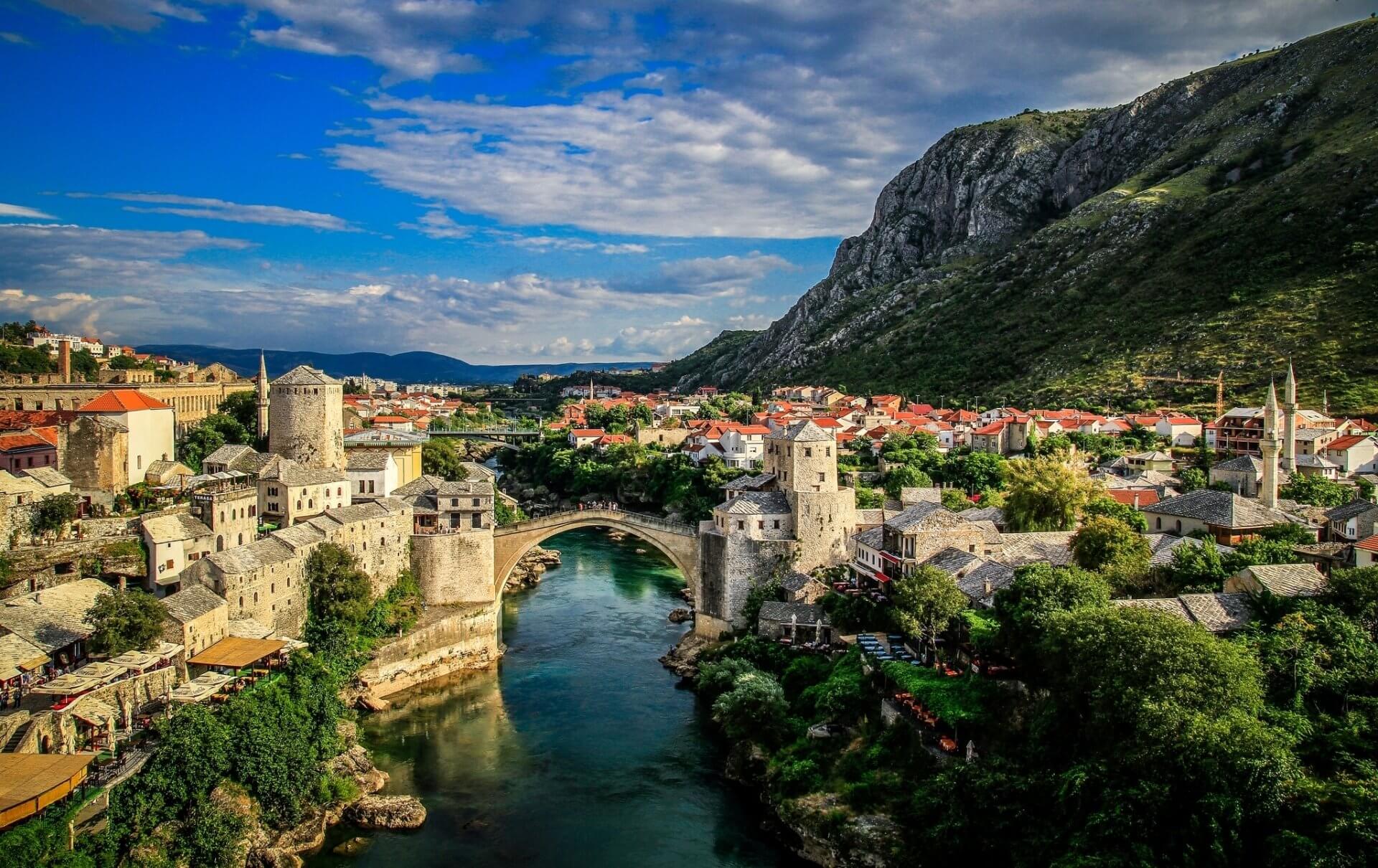
Despite its troubled past, especially during the Bosnian War of the 1990s, Bosnia & Herzegovina is now a peaceful and welcoming place. Visitors can explore historic sites like the famous Stari Most in Mostar and enjoy the vibrant, resilient spirit of its people.
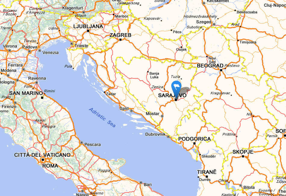
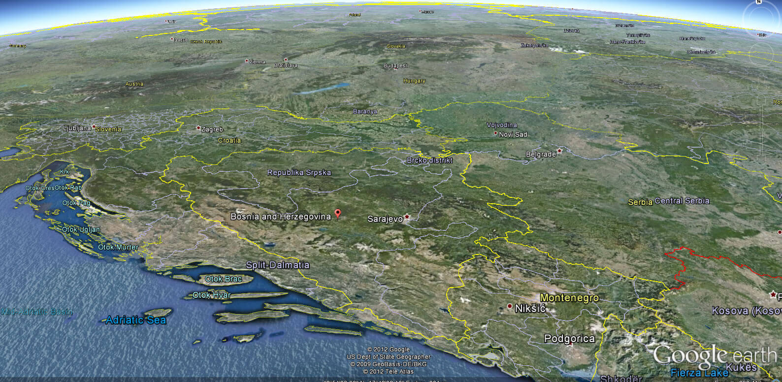
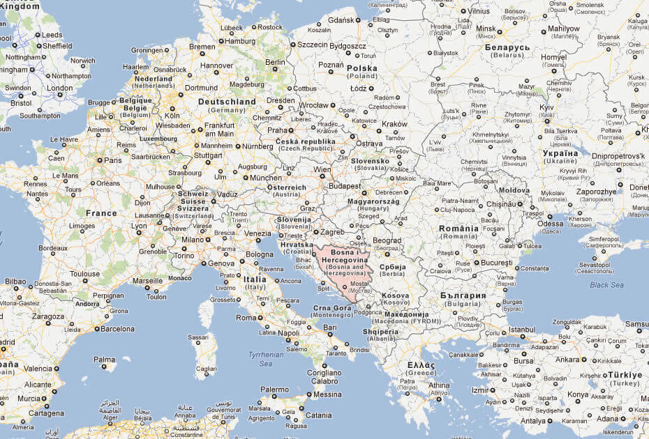
Where is located Bosnia & Herzegovina on the World Map
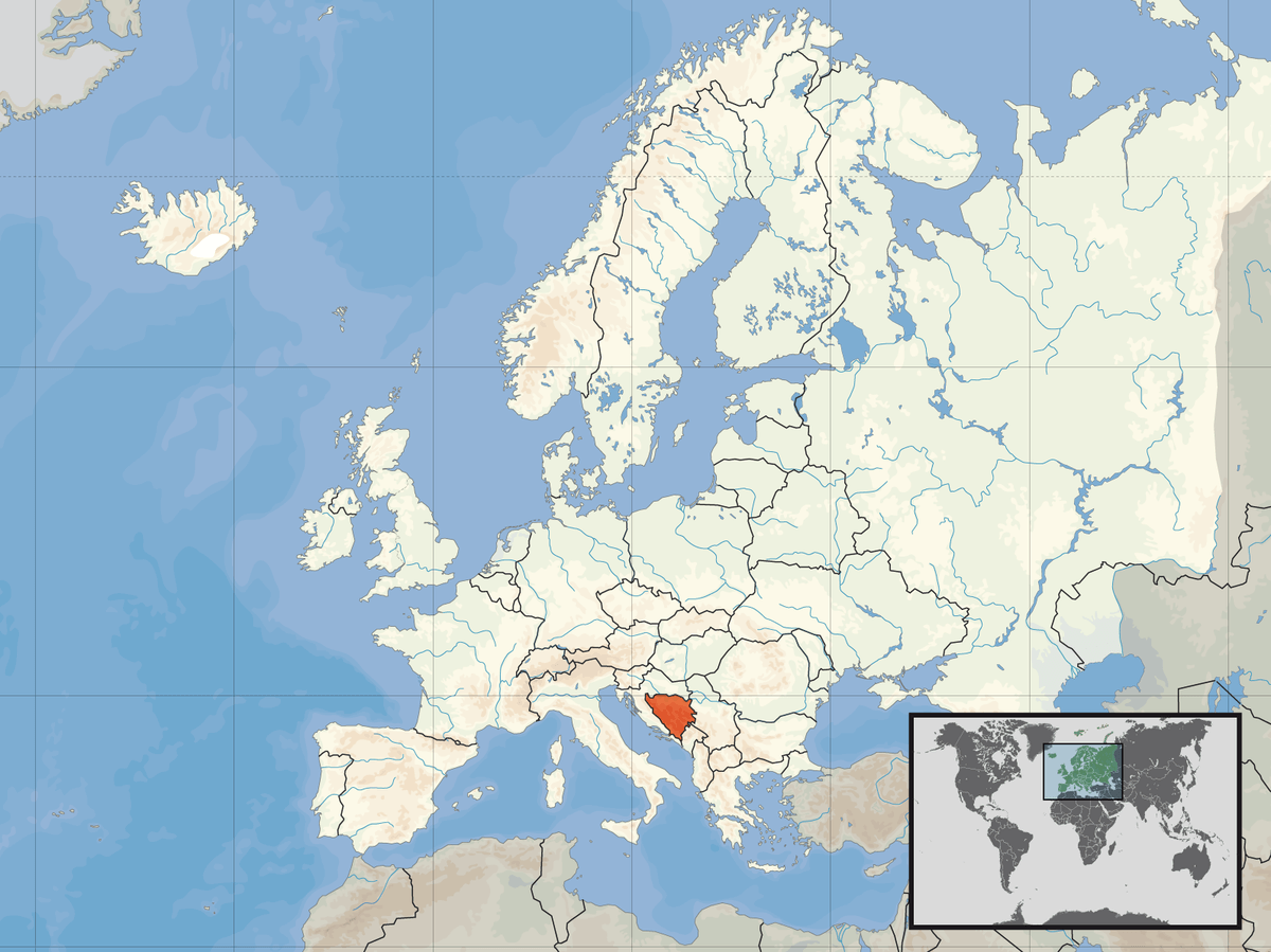
Bosnia & Herzegovina is located in southeastern Europe on the Balkan Peninsula. It shares borders with Croatia to the north and west, Serbia to the east, and Montenegro to the southeast. The country also has a small, scenic coastline along the Adriatic Sea.
Strategically placed between Central and Eastern Europe, Bosnia & Herzegovina has long been a meeting point for various cultures and civilizations. This mix of influences is reflected in its rich history and architecture.
Despite its small size, the country offers diverse landscapes, from lush mountains to historic towns. It’s a unique destination for travelers looking to experience both natural beauty and cultural heritage.
Here are some statistical information about Bosnia & Herzegovina:
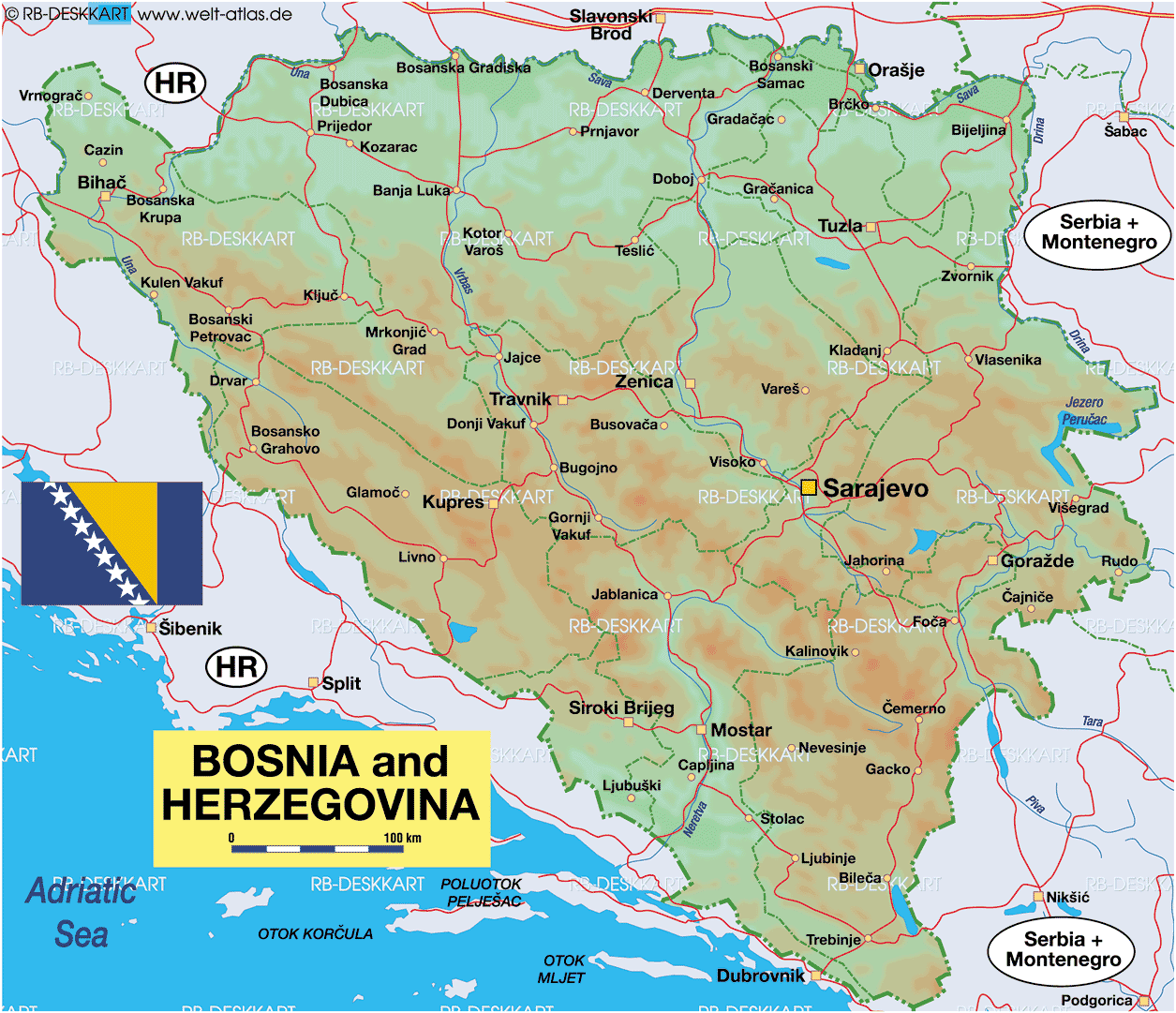
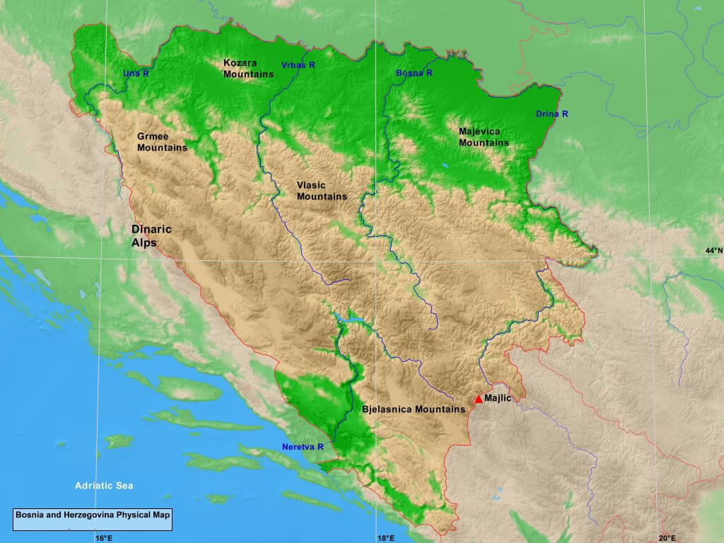
Physical Map of Bosnia and Herzegovina
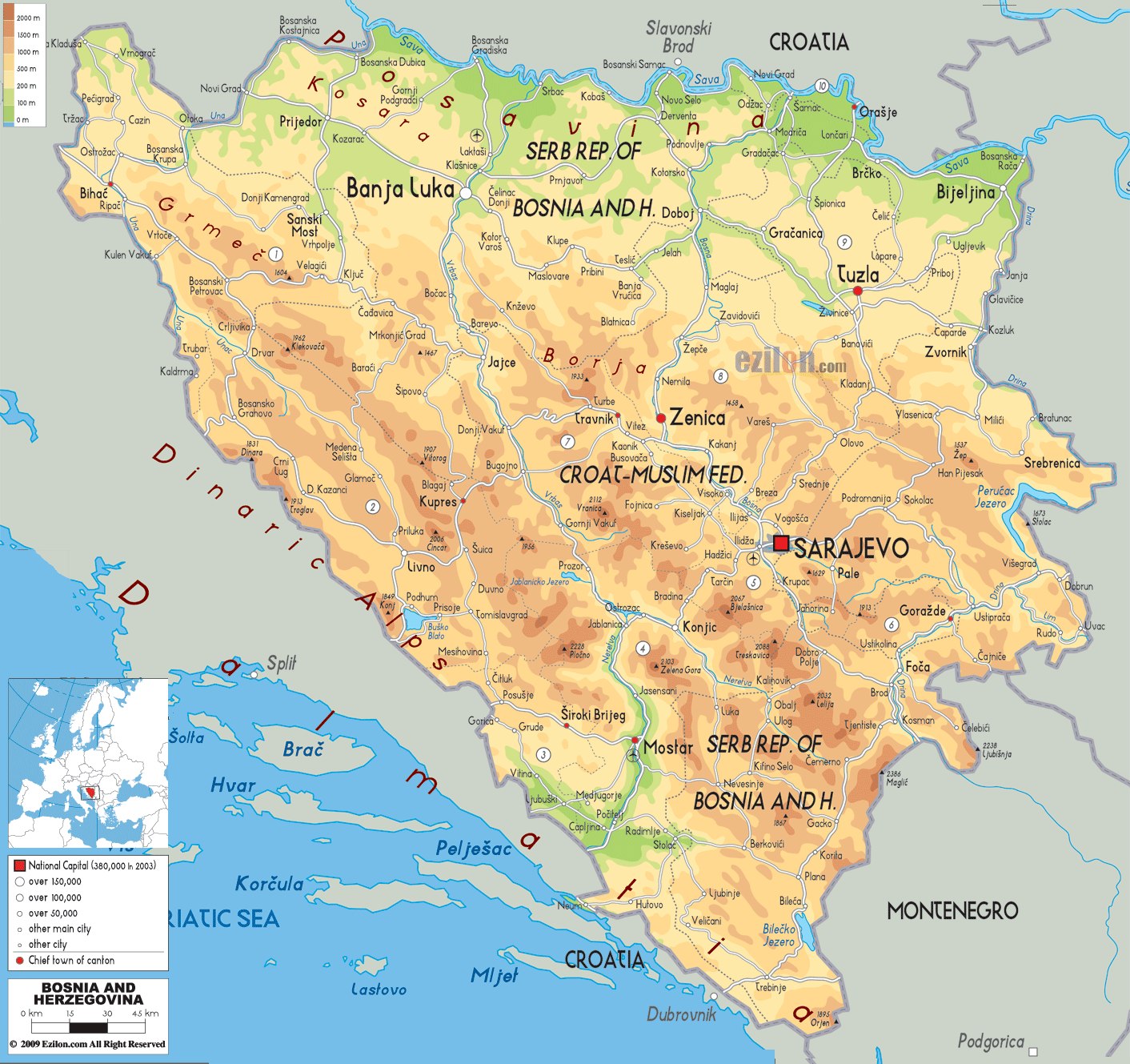
A physical map of Bosnia and Herzegovina shows its rugged terrain, dominated by the Dinaric Alps, with mountains, hills, and river valleys. The northern part has fertile plains, while major rivers like the Neretva and Drina flow through the country. It also has a small Adriatic coastline near Neum.
Bosnia and Herzegovina Road Map
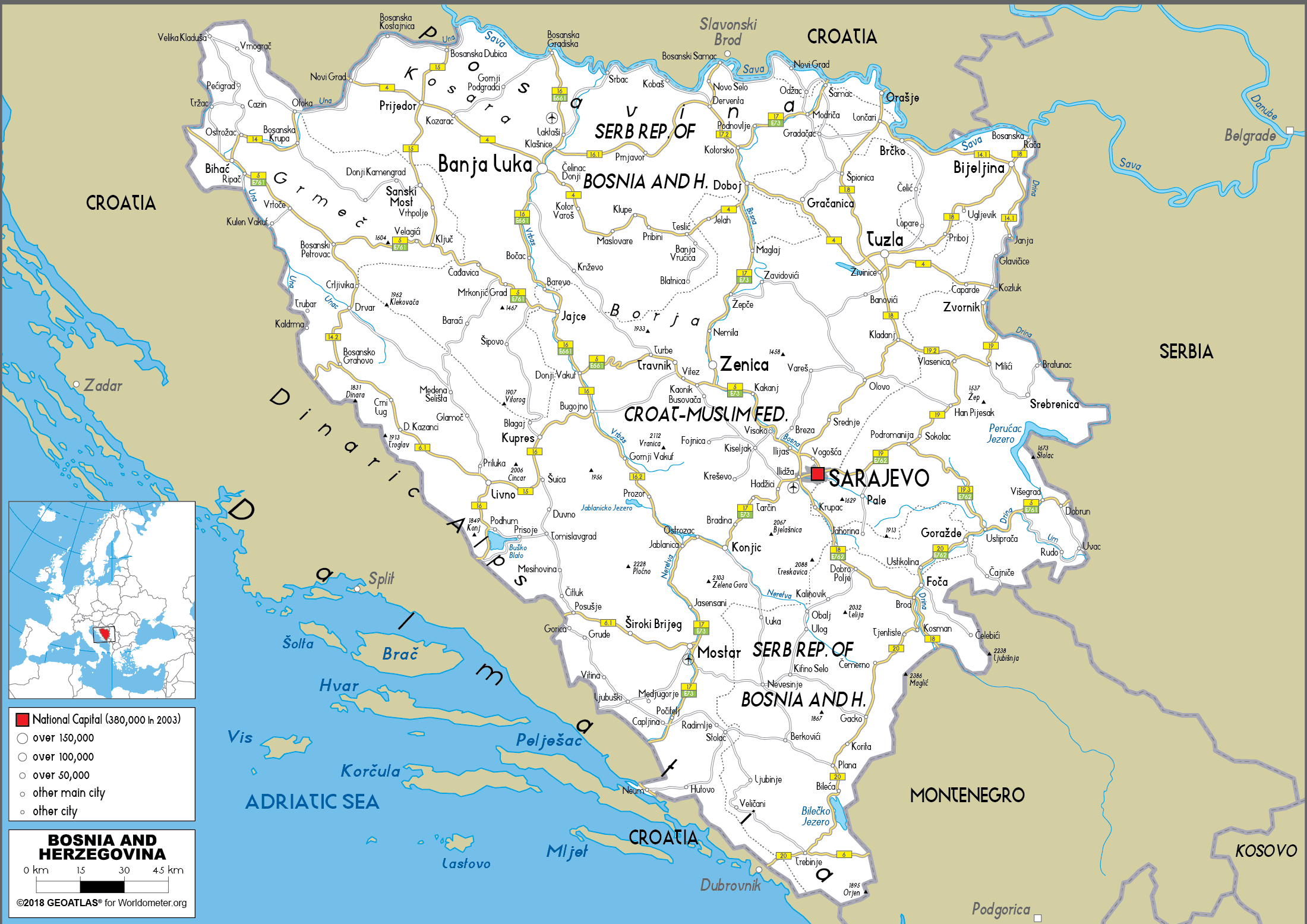
This map shows the road network of Bosnia and Herzegovina and its major cities such as Sarajevo, Banja Luka and Mostar. The country is divided into two main regions, the Federation of Bosnia and Herzegovina and the Republika Srpska. Important roads pass through the Dinar Alps, connecting these cities to each other and to neighboring countries such as Croatia, Serbia and Montenegro.
Bosnia and Herzegovina Map
1885 Map of Bosnia and Herzegovina
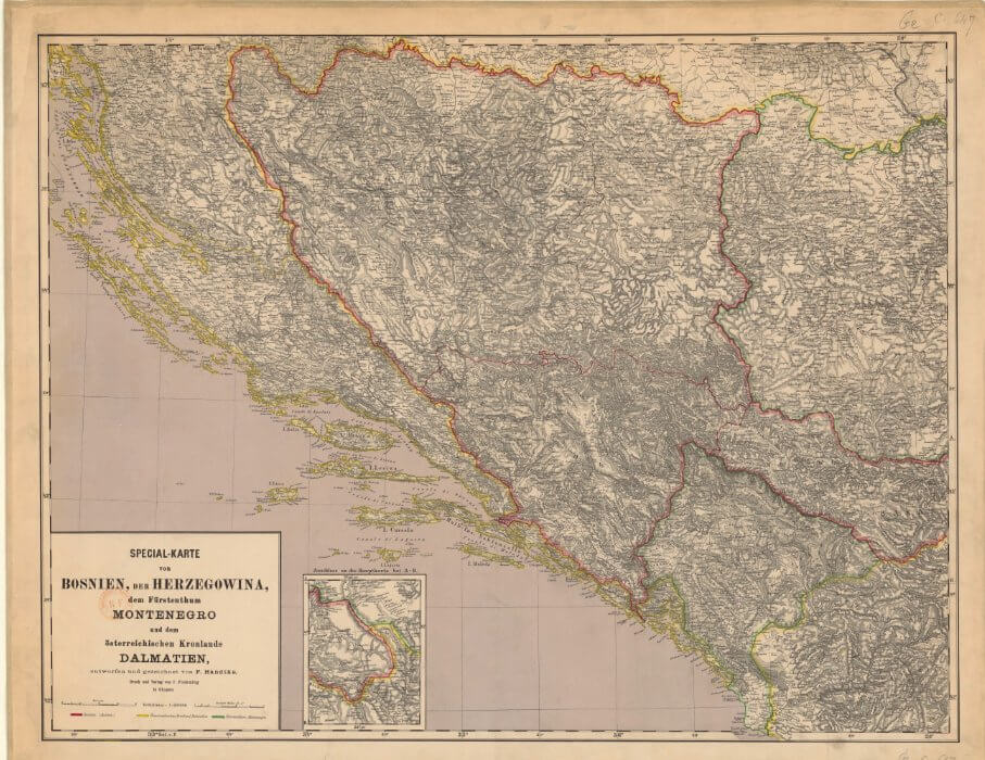
This map shows Bosnia and Herzegovina from the late 1800s, along with Montenegro and Dalmatia. It highlights the region’s mountainous landscape and the borders of that time, giving a snapshot of the area’s historical geography under Austro-Hungarian rule.
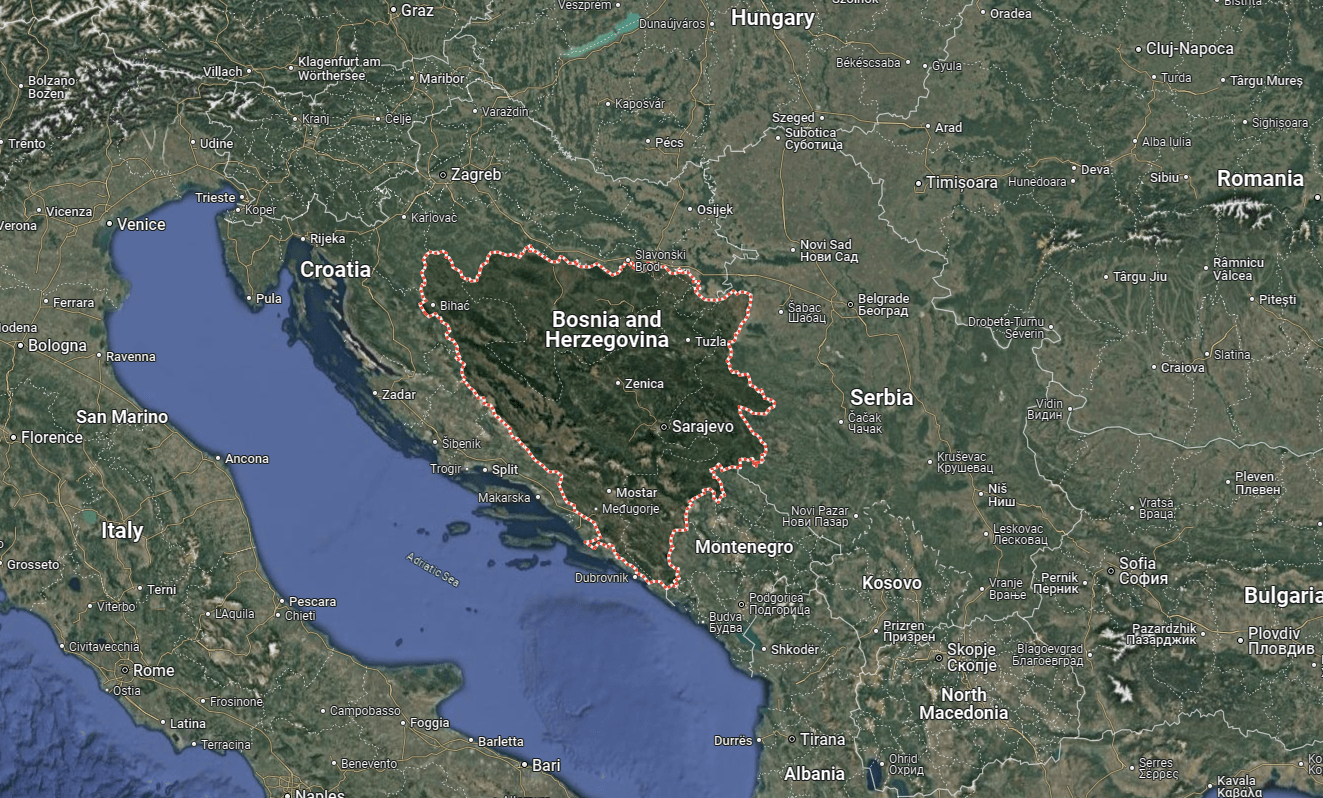
Map Bosnia & Herzegovina
Bosnia and Herzegovina is located in southeastern Europe, with Sarajevo as its capital. It is bordered by Croatia to the west, Serbia to the east, and Montenegro to the southeast, with a small access point to the Adriatic Sea. Major cities in the surrounding region include Zagreb, Belgrade, and Podgorica.
Bosnia & Herzegovina Largest Cities Map
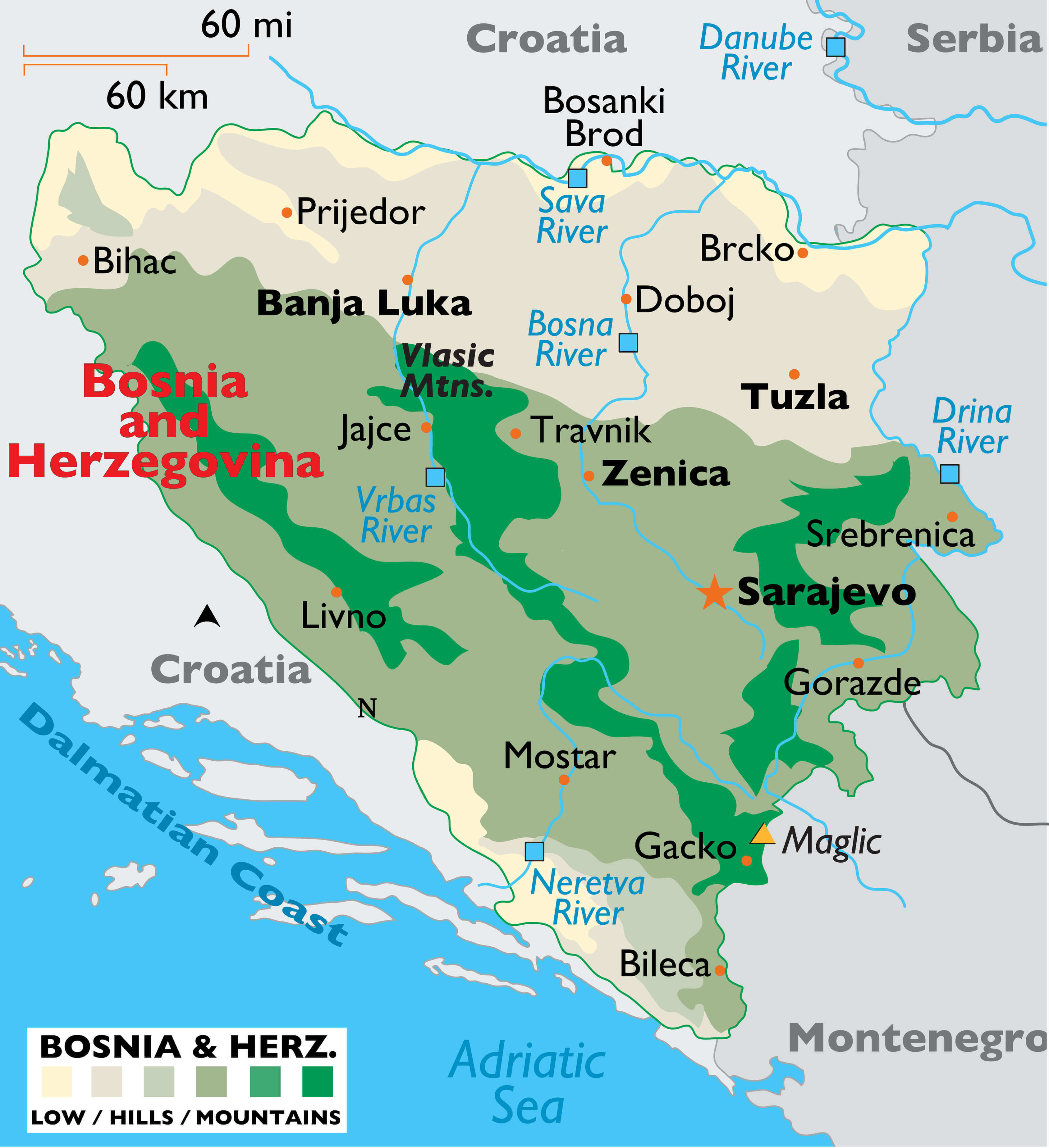 This map of Bosnia and Herzegovina highlights the country’s largest cities, including Sarajevo, Banja Luka, Tuzla, and Zenica. It also showcases major rivers like the Sava, Bosna, and Neretva, along with notable mountain ranges such as the Vlašić Mountains. The map provides a clear geographical overview, emphasizing the varied terrain from lowlands to mountainous regions and the country’s proximity to neighboring Croatia, Serbia, and Montenegro
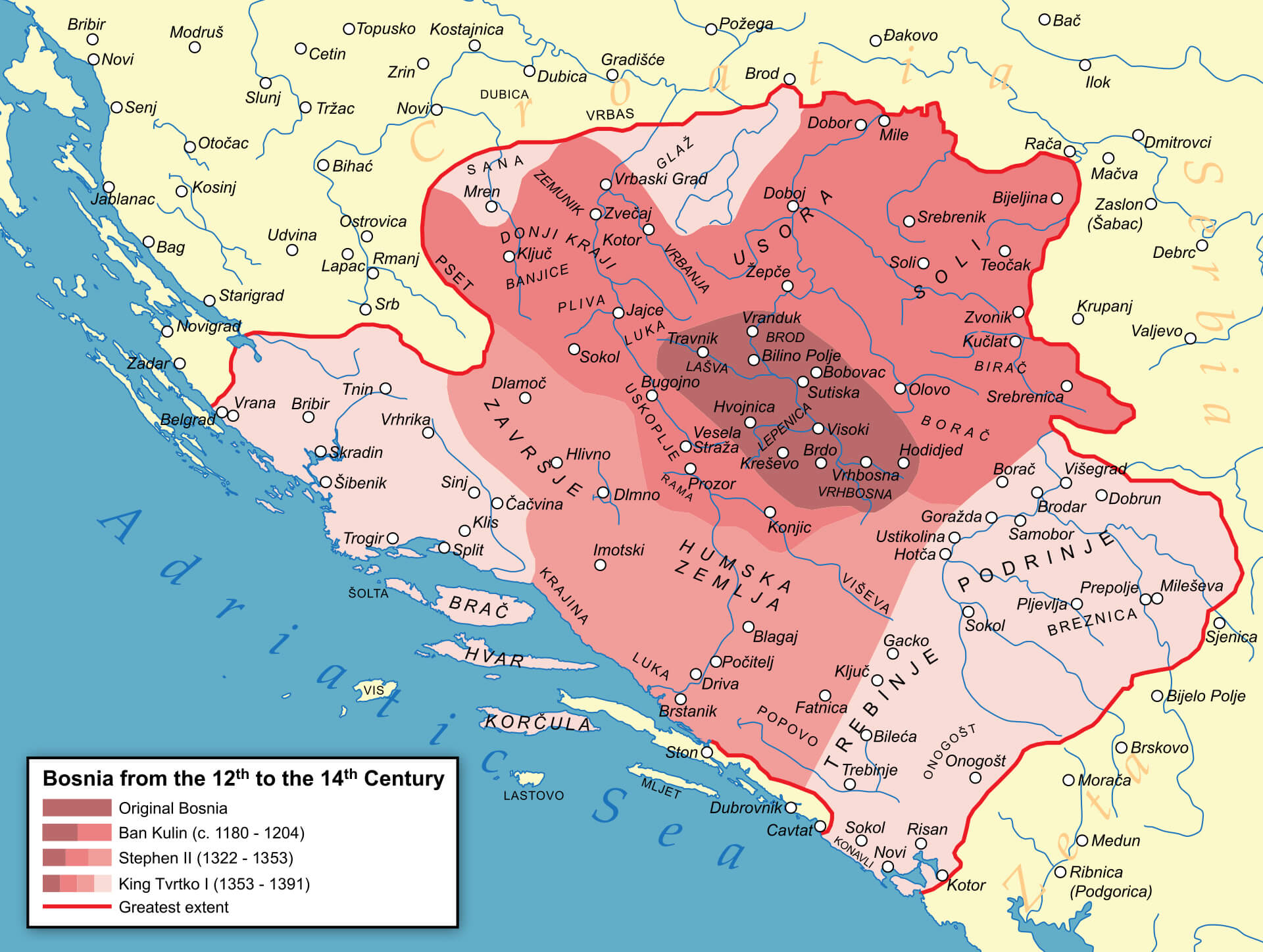
Bosnia Map in the Middle Ages
Bosnia State Map Ottoman Empire in 1683
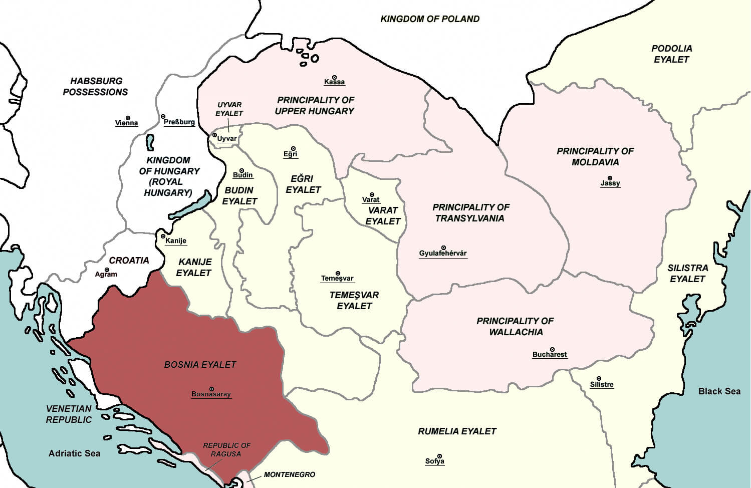 The map of the Ottoman Eyalet of Bosnia in 1683 shows the administrative division of the Ottoman territories in the Balkans at that time. The Bosnian Eyalet, highlighted in red, includes the region around Bosnasaray (now Sarajevo) and extends into neighbouring areas, bordered by other Ottoman Eyalets and the Republic of Ragusa (now Dubrovnik). This map illustrates the political boundaries within the Ottoman Empire and the relative position of Bosnia to surrounding regions such as the Habsburg-controlled territories and neighbouring Ottoman provinces.
Federation of Bosnia & Herzegovina Map
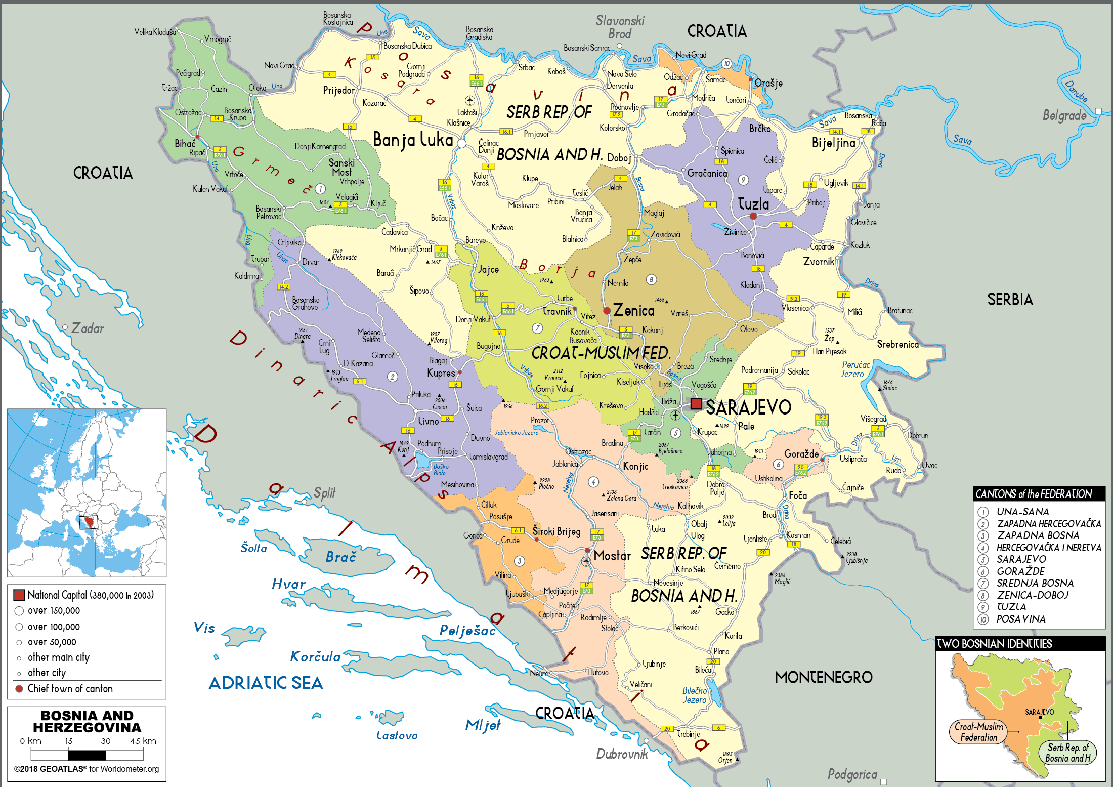
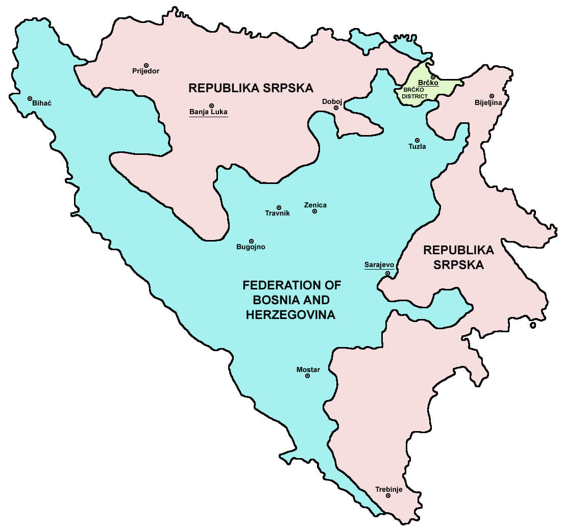 This map of the Federation of Bosnia and Herzegovina shows the two political entities within the country: the Federation of Bosnia and Herzegovina, which is mainly inhabited by Bosniaks and Croats, and the Republika Srpska, which is mainly inhabited by Serbs. The map also shows the Brčko district, a self-governing administrative unit under joint sovereignty. This political division resulted from the Dayton Peace Agreement, which ended the Bosnian War in 1995 and established a complex governmental structure to maintain peace and cooperation between the region’s diverse communities.
Bosnia & Herzegovina Regions Map
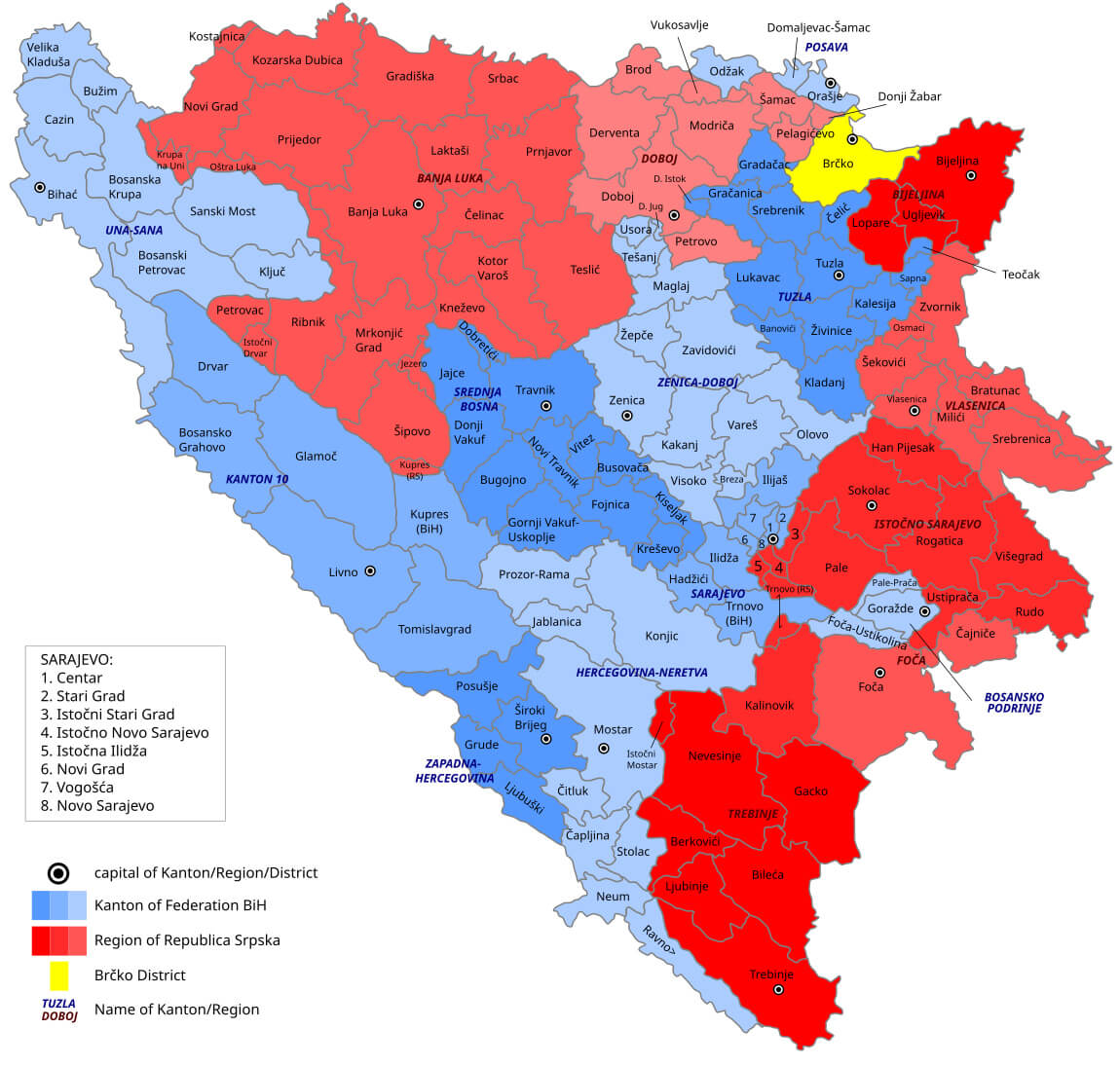 This map of Bosnia and Herzegovina highlights the regional divisions within the country, distinguishing between the Federation of Bosnia and Herzegovina (shown in blue), the Republika Srpska (in red), and the Brčko District (in yellow). The map also indicates the locations of major cities and towns across these regions, providing a clear overview of the administrative and territorial layout of Bosnia and Herzegovina.
Bosnia & Herzegovina Administrative Map
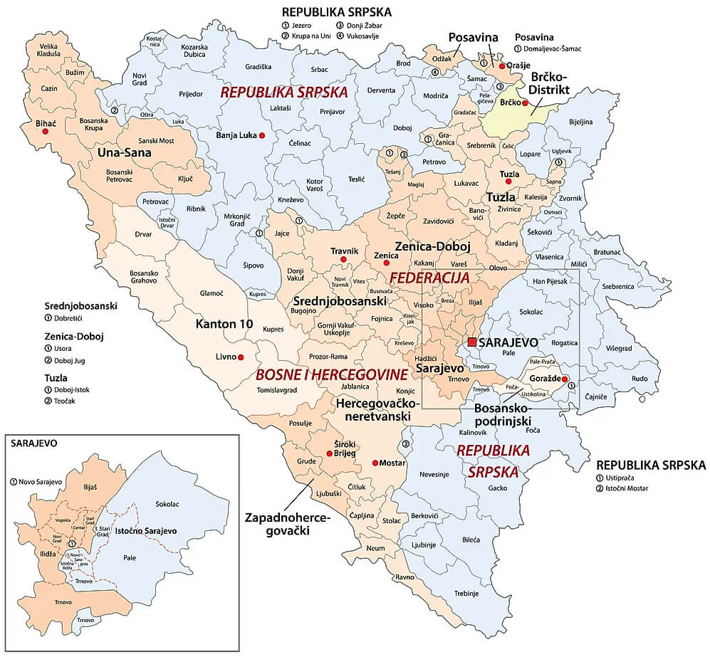 This map of Bosnia and Herzegovina shows its administrative divisions, highlighting the Federation of Bosnia and Herzegovina, the Republika Srpska and the Brčko district. The borders between these entities are clearly marked, along with major cities such as Sarajevo, Mostar and Banja Luka. The map also includes an inset of the Sarajevo region, highlighting the country’s complex post-Dayton political structure.
Bosnia & Herzegovina Travel Map
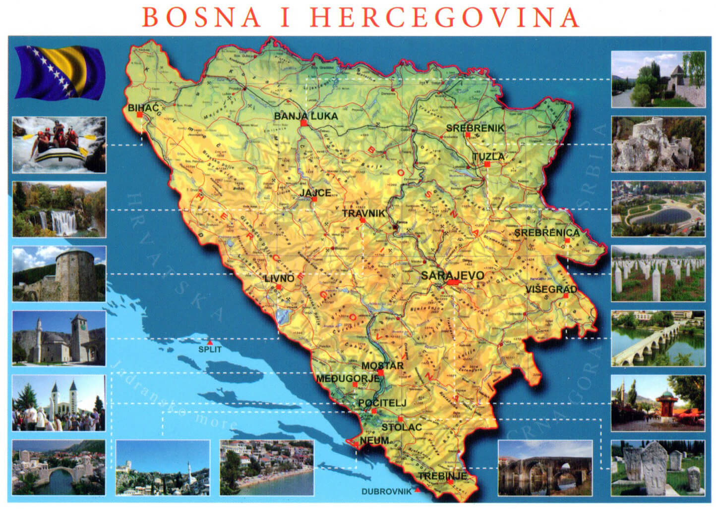 This map of Bosnia and Herzegovina highlights key travel destinations, showcasing cities like Sarajevo, Mostar, and Banja Luka, as well as significant cultural and historical landmarks. It serves as a guide for visitors, emphasizing the rich diversity of landscapes and attractions, from the Neretva River in Mostar to the medieval town of Jajce, while also providing insights into the country’s natural beauty and heritage sites.
Bosnia & Herzegovina Relief Map
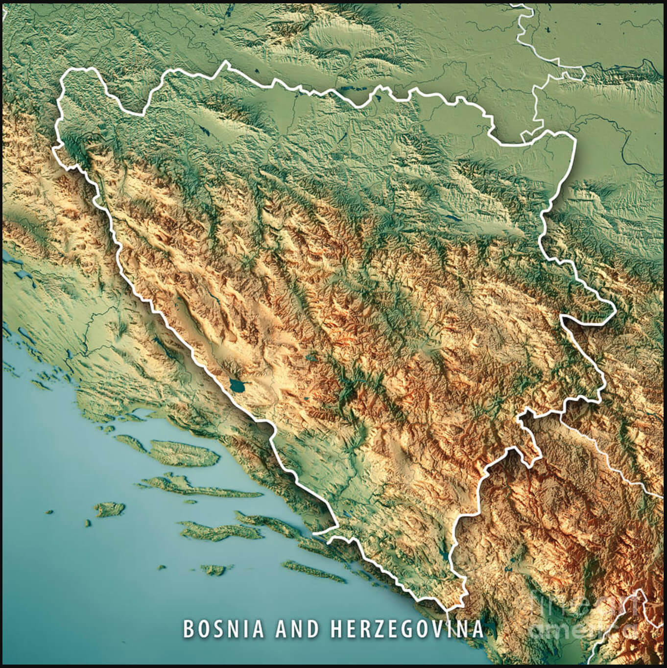 This relief map of Bosnia and Herzegovina highlights the country’s varied topography, showing its rugged mountain ranges, valleys and plateaus. The mountainous terrain, particularly prominent in the central and eastern regions, includes the Dinaric Alps, while the flatter areas in the north near the border with Croatia have lower elevations, providing a visual contrast between the rugged interior and the gentler slopes. This map is ideal for understanding the physical landscape that shapes the climate and geography of Bosnia and Herzegovina.
Bosnia & Herzegovina Topographic Map
 This topographical map of Bosnia and Herzegovina shows the country’s varied topography, from the mountainous terrain of the Dinaric Alps to the lower-lying areas near the Sava River in the north. The capital, Sarajevo, is located in a hilly region surrounded by the rugged landscapes that characterise much of the country’s topography. The map highlights changes in elevation, making it easy to identify the highlands and valleys that make up Bosnia and Herzegovina’s diverse natural landscape.
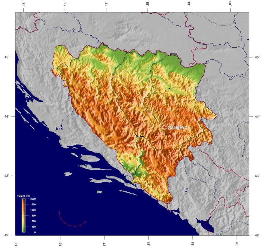
Bosnia & Herzegovina Physical Map
 This physical map of Bosnia and Herzegovina highlights the country’s diverse terrain, including the Dinaric Alps that dominate the western and central regions, as well as other mountain ranges like the Grmeč, Vlašić, and Bjelašnica Mountains. The map also shows major rivers such as the Neretva, Bosna, and Drina, which shape the country’s landscape, flowing through its valleys and providing key water sources. The green areas represent forested and lower-elevation zones, while the brown shades depict higher altitudes and rugged mountain terrain. This varied geography plays a significant role in Bosnia and Herzegovina’s natural beauty and ecological diversity.
Map of Bosnia and Herzegovina

Bosnia and Herzegovina Earth Map
Bosnia and Herzegovina Satellite Map
Map of Bosnia and Herzegovina Europe
Bosnia and Herzegovina is in southeastern Europe on the Balkan Peninsula, bordered by Croatia, Serbia, and Montenegro. While mostly landlocked, it has a small Adriatic Sea coastline near Neum. The country is mountainous, with the Dinaric Alps, and its capital, Sarajevo, is centrally located.
Where is Bosnia & Herzegovina on the Europe Map?
Show Google map, satellite map, where is the country located.
Get directions by driving, walking, bicycling, public transportation and travel with street view.
Feel free to explore these pages as well:
- Italy Map ↗️
- Croatia Map ↗️
- Kosovo Map ↗️
- Europe Map ↗️
- Map of Europe ↗️
- A Collection of Europe Maps ↗️