- Advertisement -
A collection maps of Finland; View a variety maps of Finland physical, political, relief map. Satellite image of Finland, higly detalied maps, blank map of Finland, World and Earth. And find more Finland’s country, regions, topography, cities, road, rivers, national, directions maps and atlas.
Map of Finland with Highways
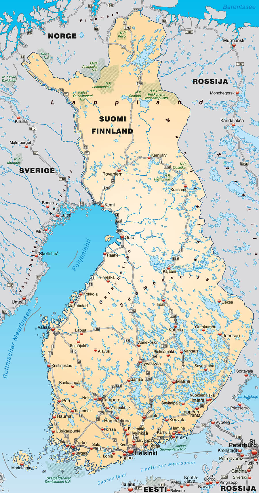 Map of Finland with highways in pastel orange.
Map of Finland with Autoroutes
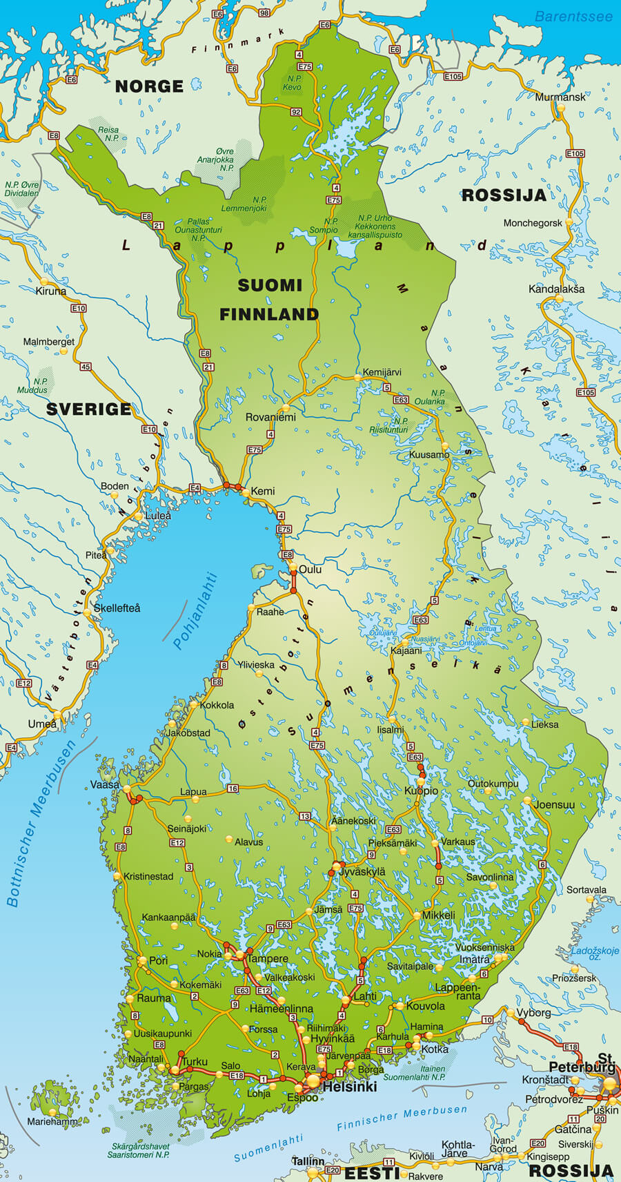
Map of Finland with autoroutes.
Finland Cities Map in Finnish and Swedish
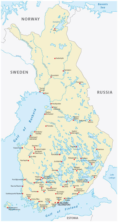
Finland map, cities in Finnish and Swedish language.
Finland Country Map
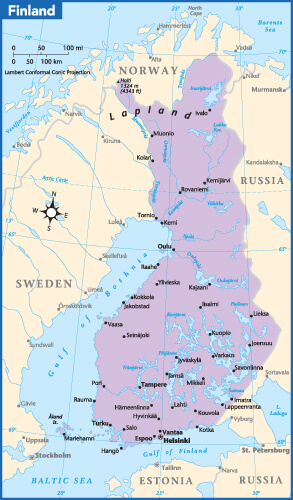
Finland Country Map with main Cities Map.
Travel Map of Finland
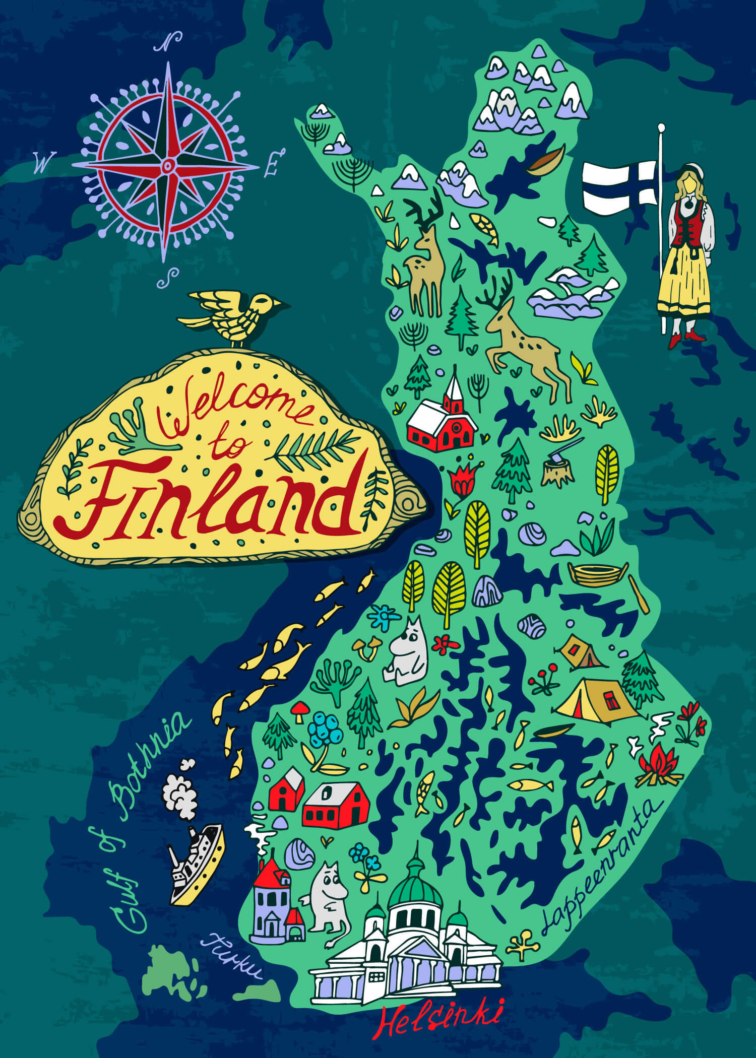
Illustrated Travel map of Finland.
Finland Brexit European Union Map
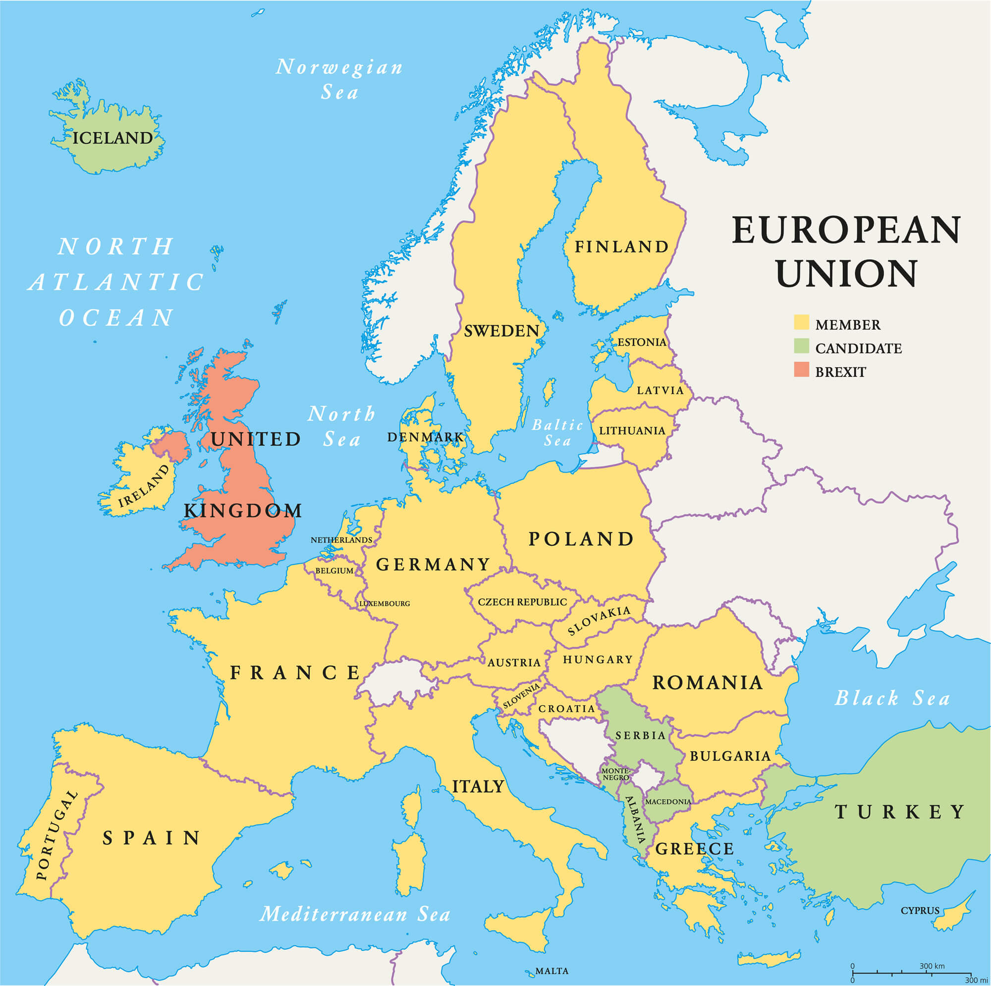
Finland Brexit European Union map. Outline political map with European Union member states and British withdrawal from the European Union, shortened to Brexit.
Finland Europe Map
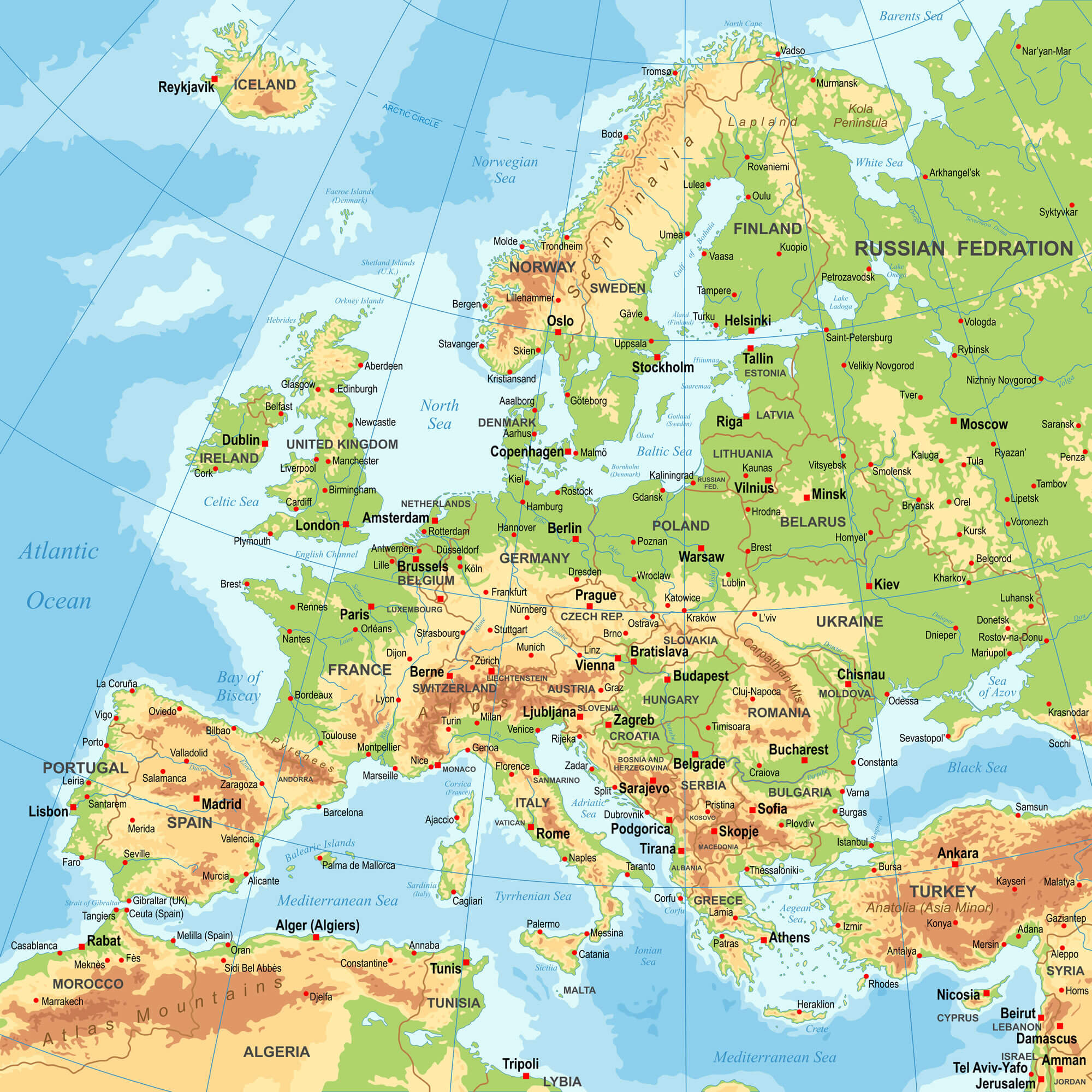
Highly detailed colored vector illustration of Europe map – borders, countries, and cities – illustration.
Where is Finland on the Europe Map?
Show Google map, satellite map, where is the country located.
Get directions by driving, walking, bicycling, public transportation and travel with street view.
Feel free to explore these pages as well:
- Map of Sweden ↗️
- Sweden Map ↗️
- Ultimate Guide to Stockholm’s 10 Must-Visit Attractions ↗️
- Aland Islands Map ↗️
- Map of Norway ↗️
- Norway Map ↗️
- Finland ↗️
- Map of Finland ↗️
- Finland Map ↗️
- Advertisement -