- Advertisement -
A Collection of Utah Photos
Horseshoe Bend Grand Canyon National Park
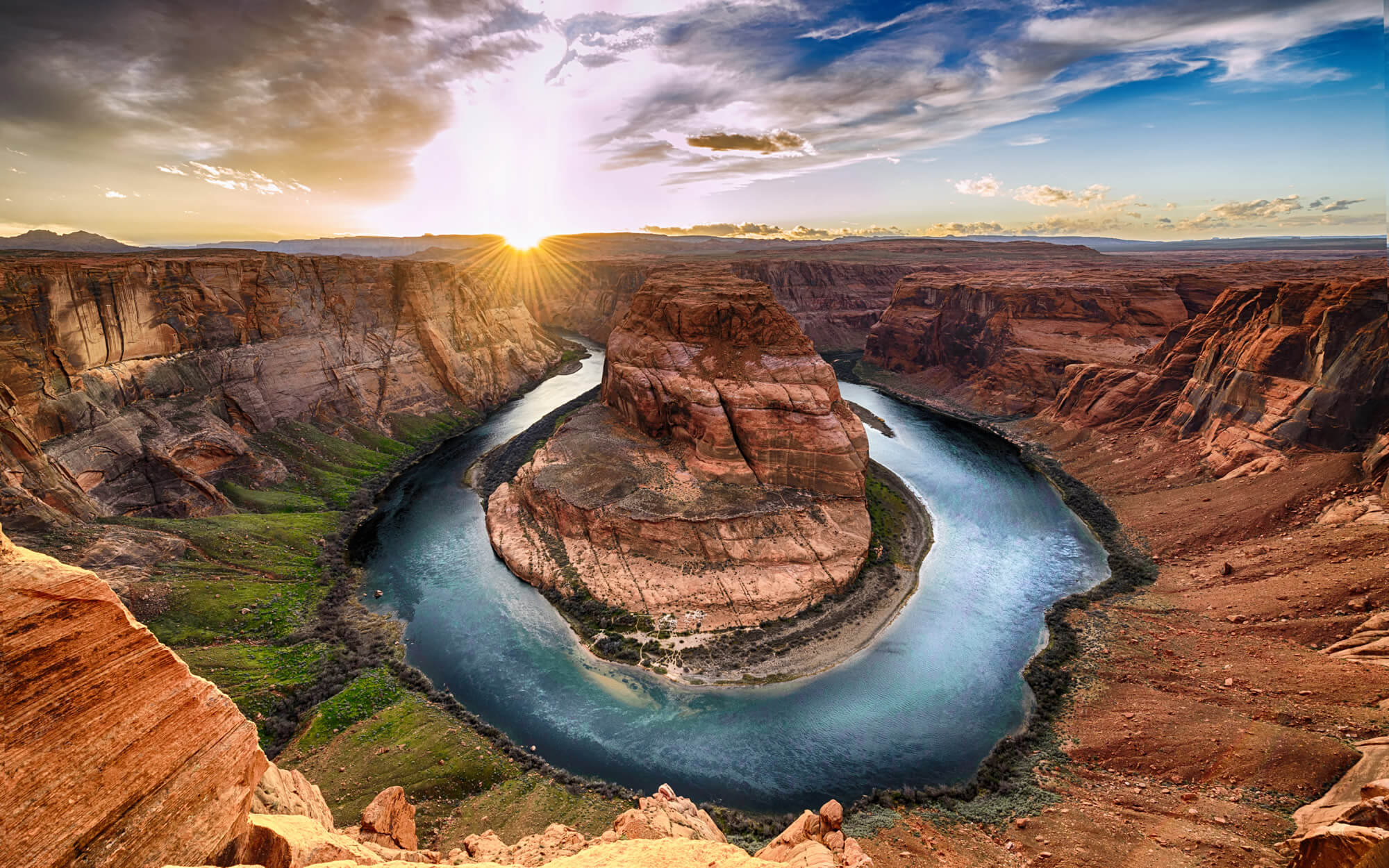
Sunset moment at Horseshoe bend Grand Canyon National Park. Colorado River. famous view point.
John Ford Point, Utah
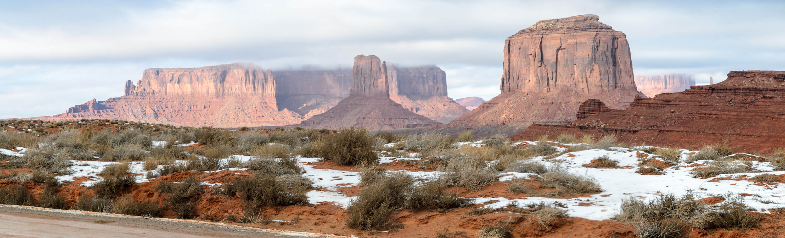
Panoramic view of the John Ford Point rock formation in Monument Valley, Arizona / Utah, USA. Desert landscape of red mountains in winter. Scenery of snow in the valley, misty sky as background.
Lake Powell, Utah
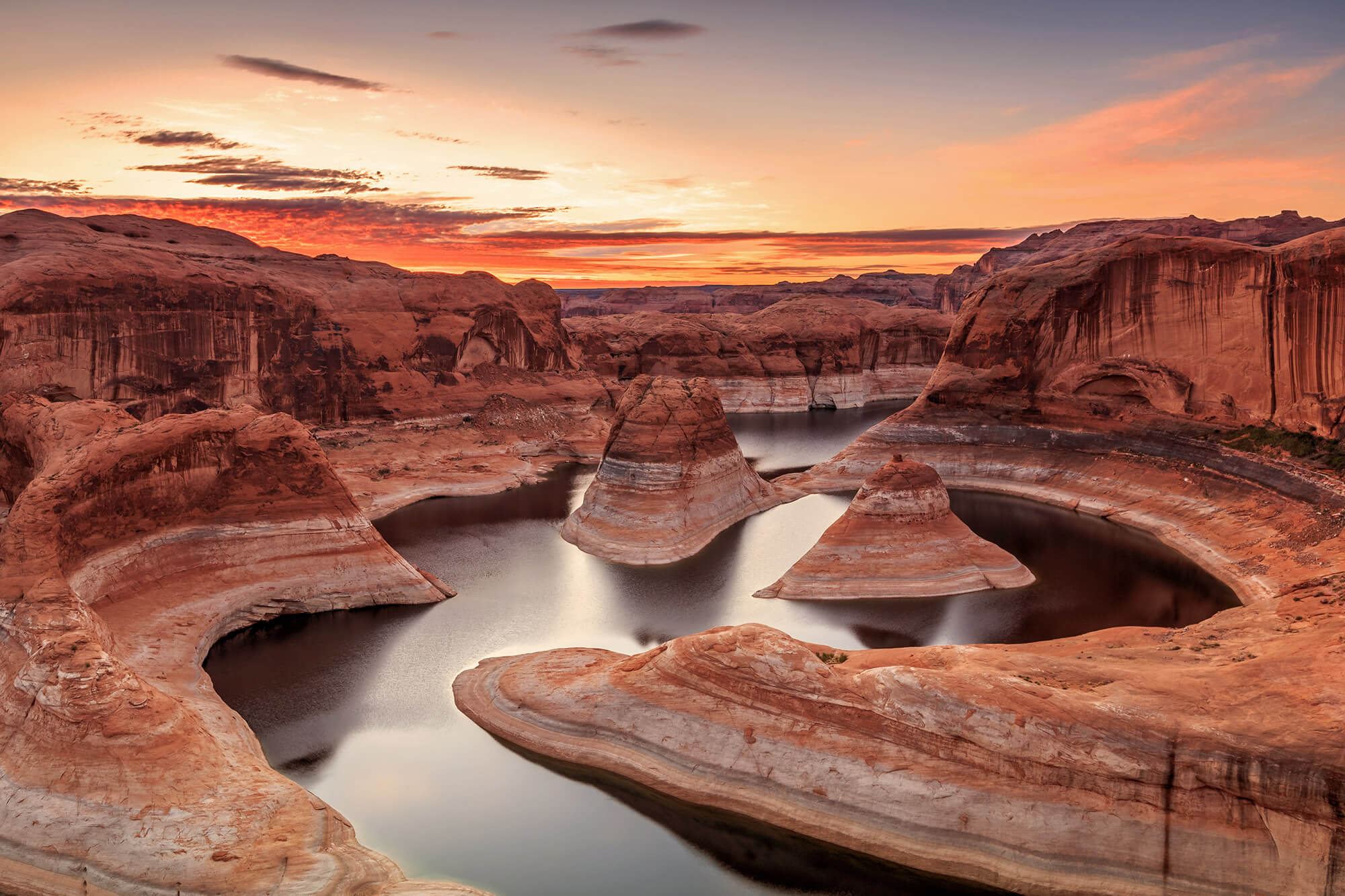
Amazing sunrise at Lake Powell, Utah, USA.
Antelope Canyon, Lake Powell
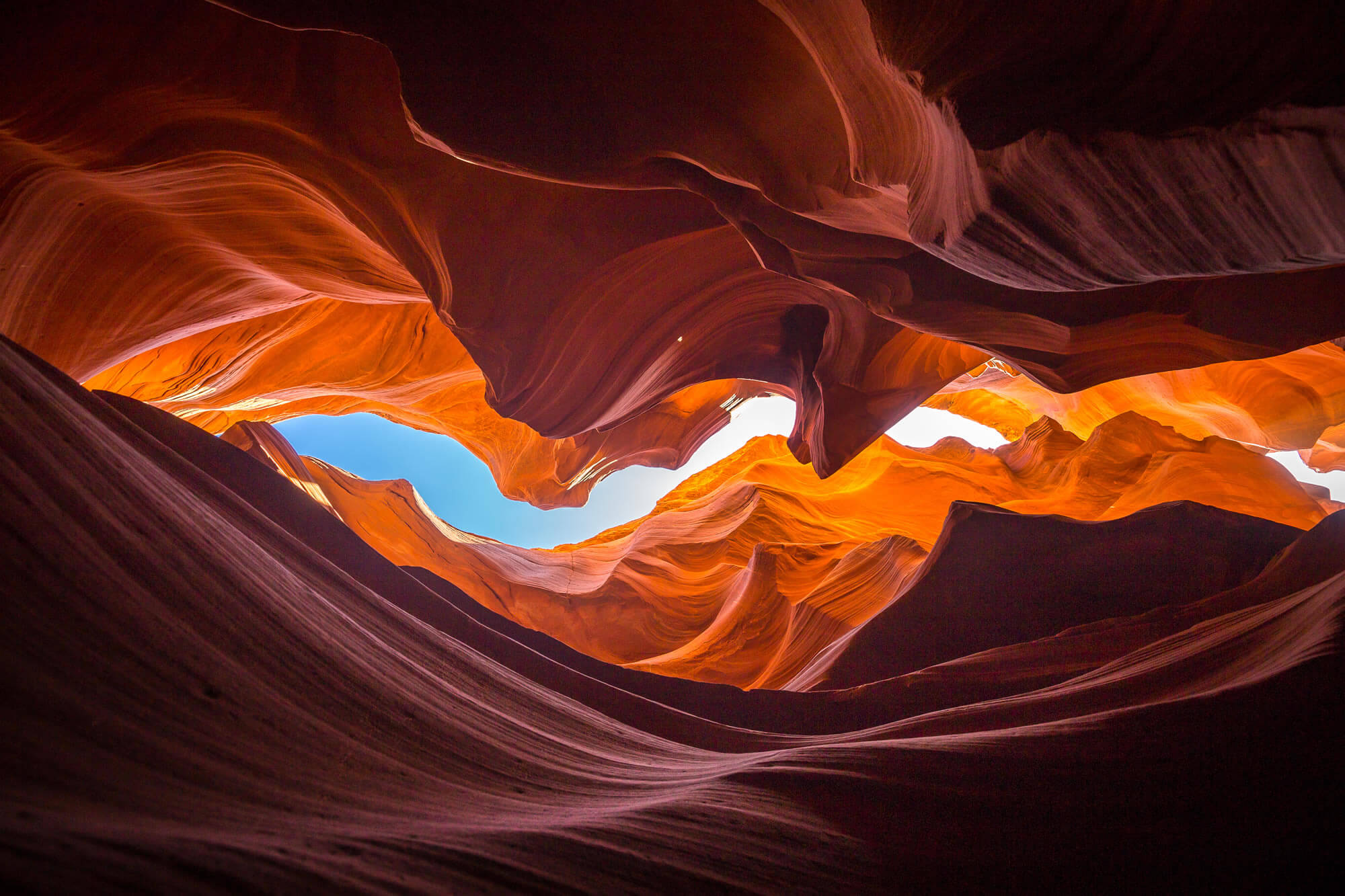
Beautiful wide angle view of amazing sandstone formations in famous Antelope Canyon near the historic town of Page at Lake Powell, American Southwest, Arizona, USA
Utah’s State Capitol
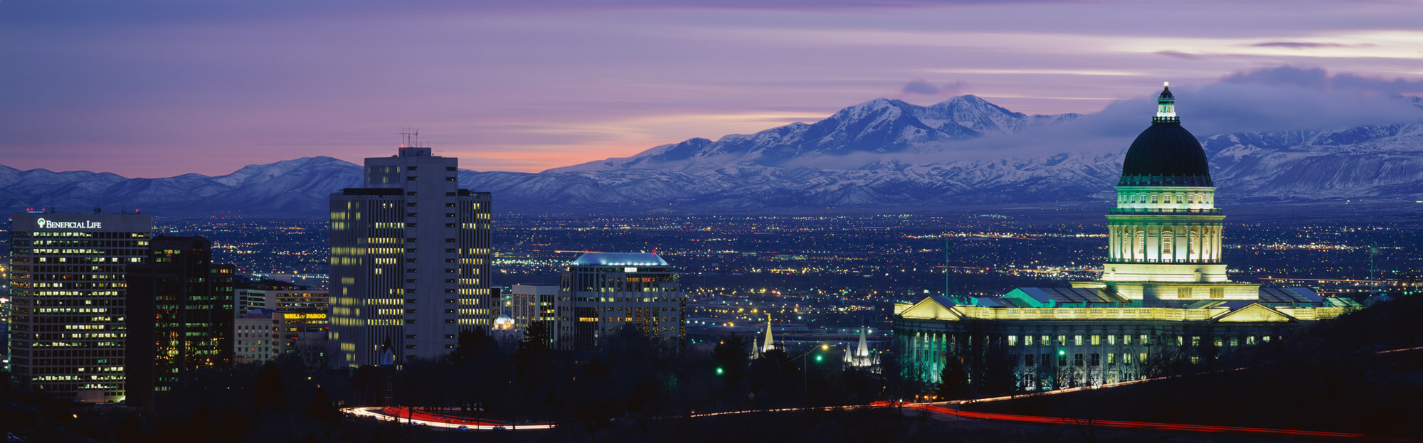
This is Utah’s State Capitol, Great Salt Lake and Snow Capped Wasatch Mountains at sunset.
Where is Utah in the US?
Show Google map, satellite map, where is the country located.
Get direction by driving, walking, bicycling, public transportaion and travel with street view.
[gmap-embed id=”2042″]
Utah Maps and Photos
- Please Click for more Utah Map
- Please Click for more Info About Map of Utah
- Please Click for more About Utah
- Please Click for more Utah Photos
- Advertisement -