Nagorno Karabakh 2020 Conflict; Azerbaijan vs Armenia and Histories. Demographics of Nagorno-Karabakh, Azerbaijan and Armenia, Clashes Timeline, Why do Azerbaijan and Armenia Hate each Other? Does Turkey Recognize Armenia? Are Russia and Armenia Allies? Which countries do not recognize Armenia? Can an Armenian go to Azerbaijan?
Nagorno Karabakh 2020 Conflict, History & Demographics – 4K Drone – Youtube Video
Please subscribe on “World Guide” channnel on Youtube at youtube.com/c/WorldGuide
About Nagorno-Karabakh
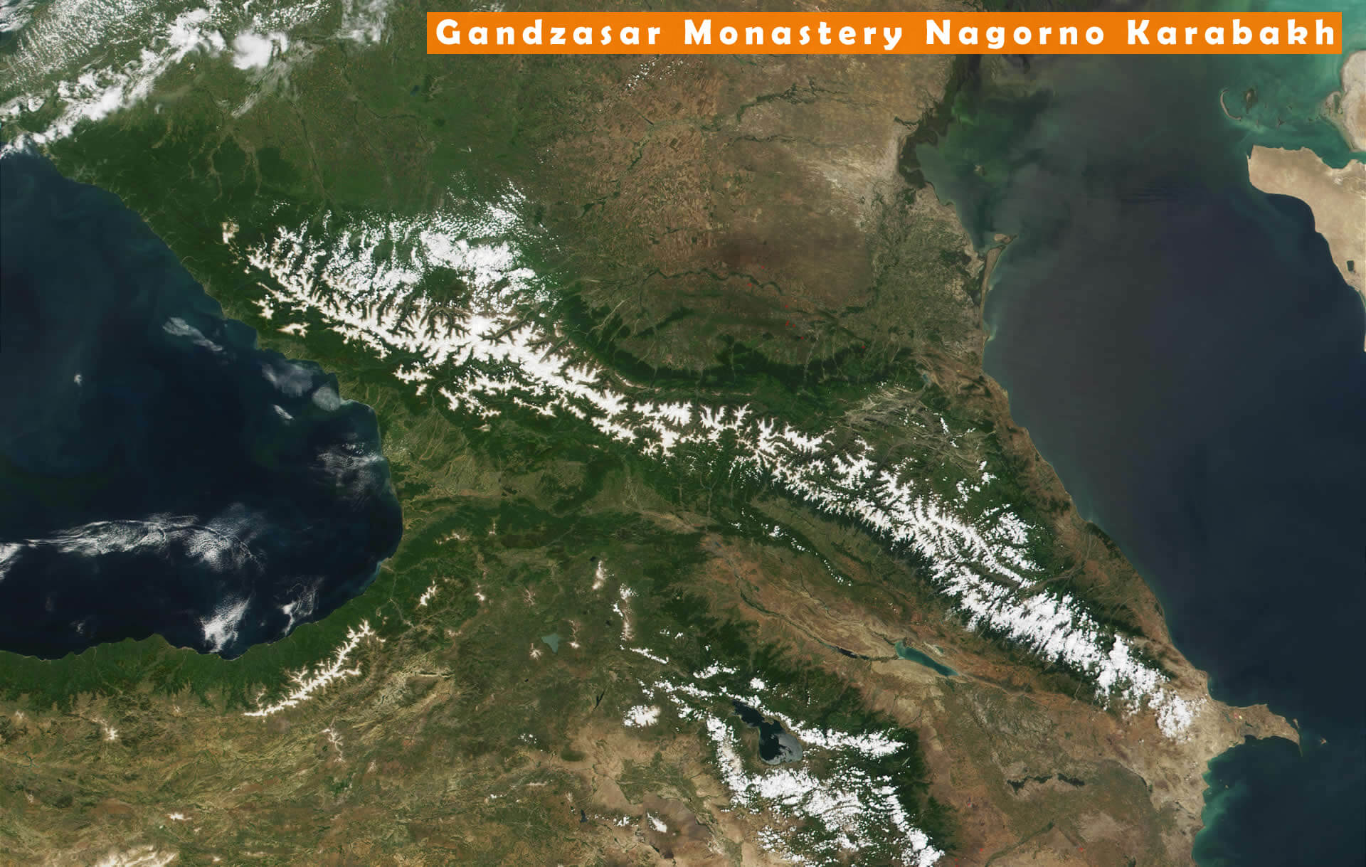
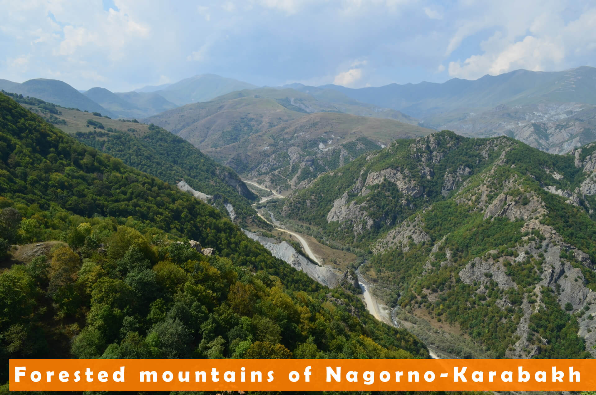
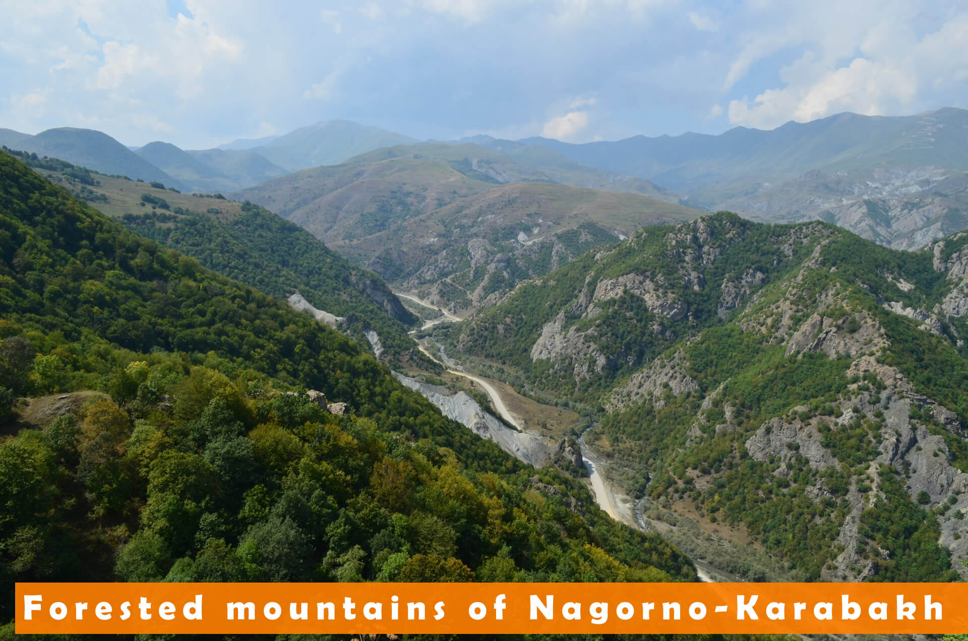
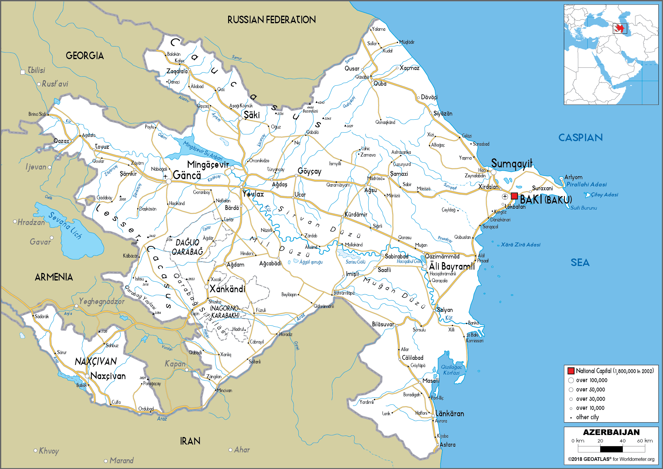
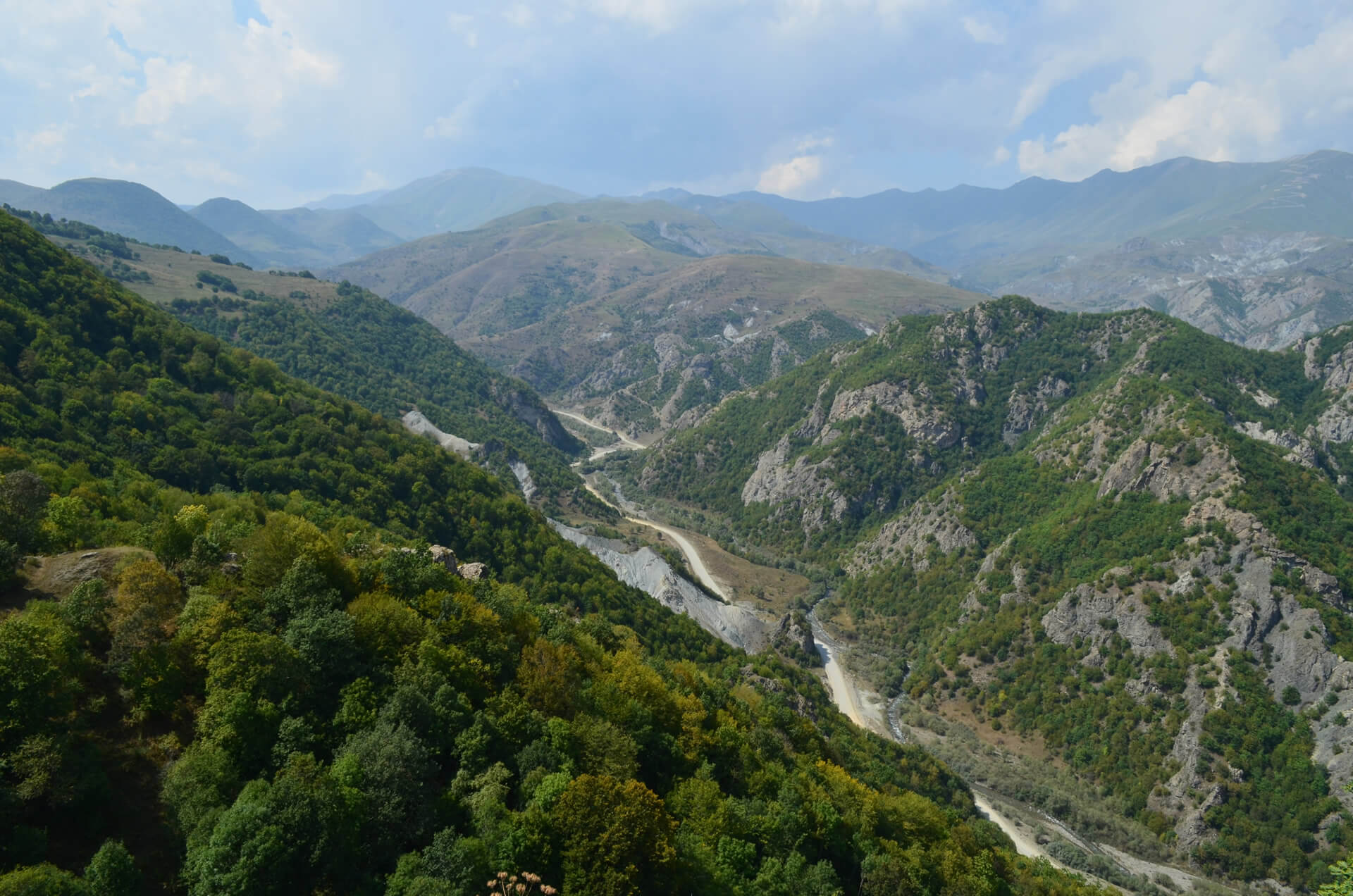
Nagorno-Karabakh is located between Lower Karabakh and Zangezur, and covering the southeastern range of the Lesser Caucasus mountains. Nagorno-Karabakh region is mostly mountainous and forested.
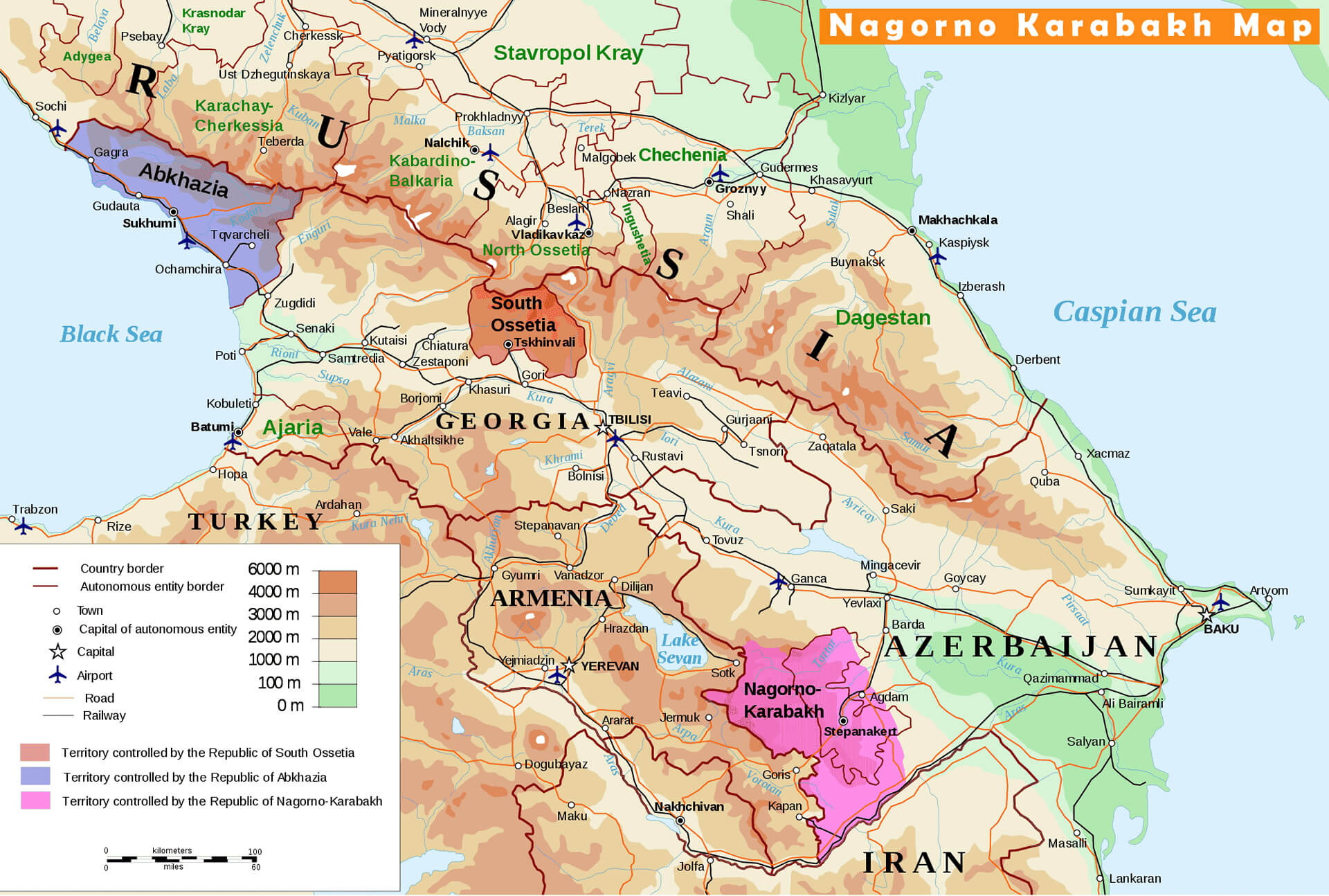
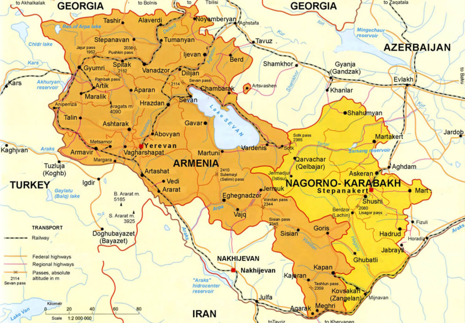
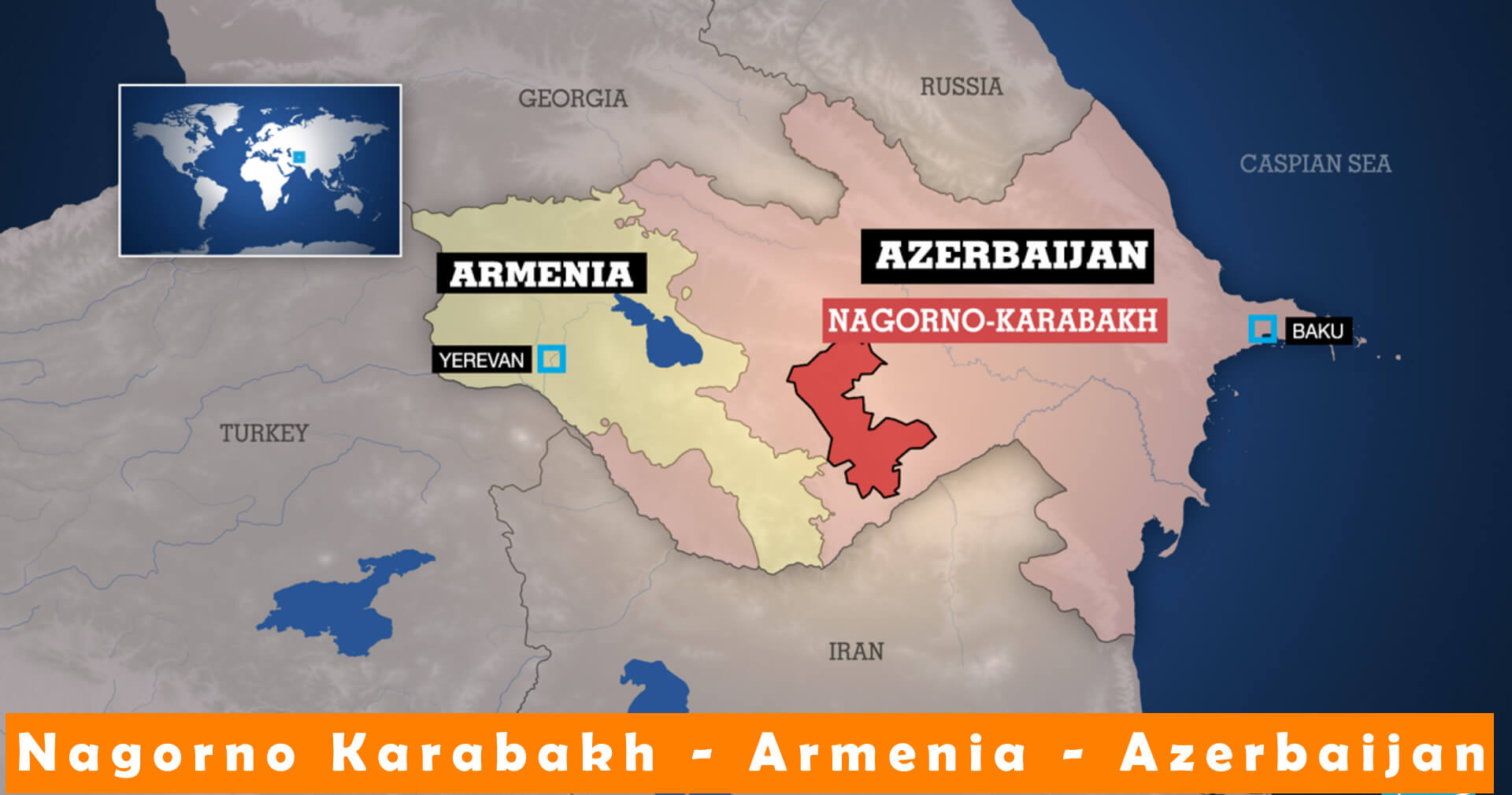
Nagorno-Karabakh is a disputed territory, internationally recognized as part of Azerbaijan,but mostly governed by the Republic of Artsakh which was formerly named Nagorno-Karabakh Republic.
Azerbaijan has not exercised political authority over the region since 1988. Since 1194 Nagorno-Karabakh War, representatives of the governments of Armenia and Azerbaijan have been holding peace talks mediated by the OSCE Minsk Group on the region”s disputed status.

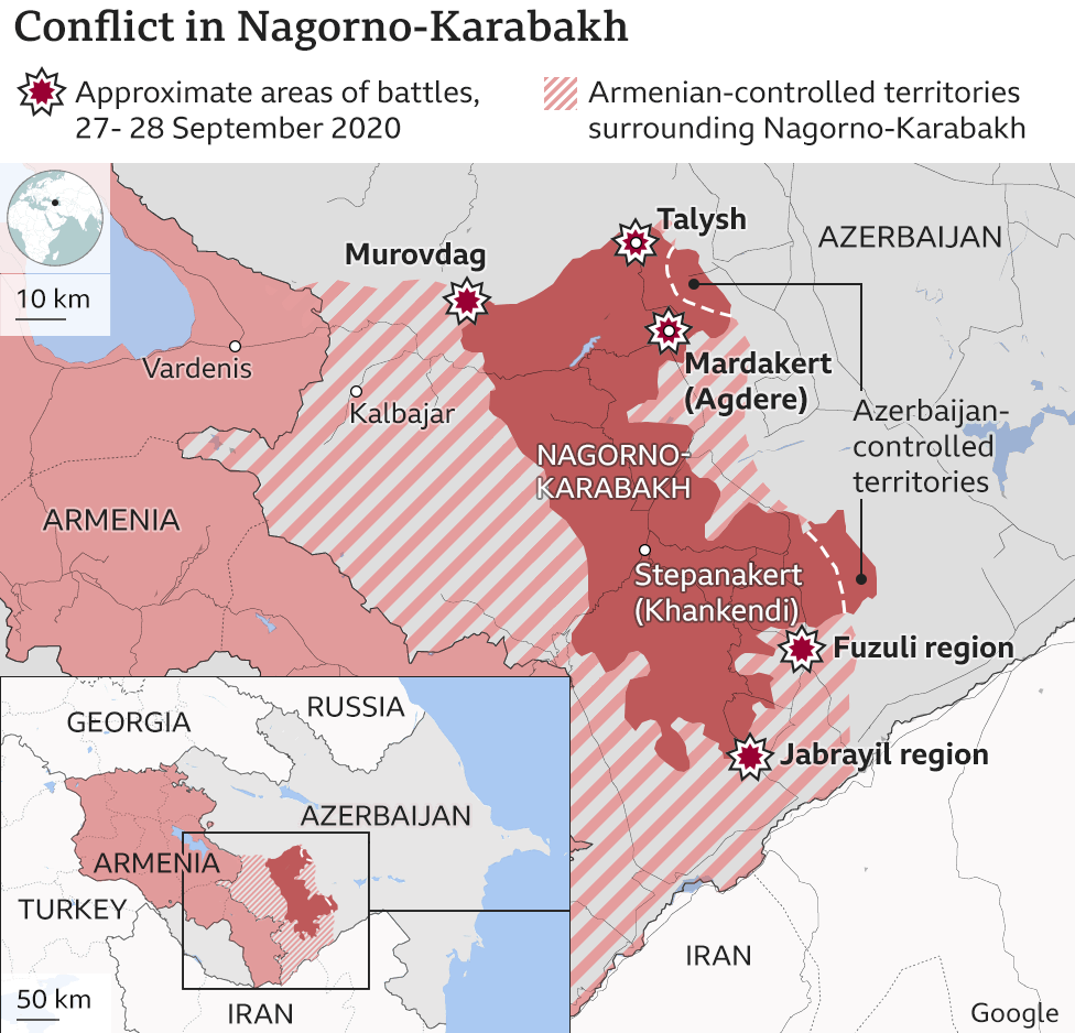
Conflict resumed along the Nagorno-Karabakh Line on 27 September 2020. Both Azerbaijan and Armenia reported military and civilian casualties.
Nagorno-Karabakh History
The Amaras Monastery was founded in the 4th century by St Gregory the Illuminator. In the 5th century, Mesrop Mashtots, inventor of the Armenian alphabet, established at Amaras the first school to use his script.
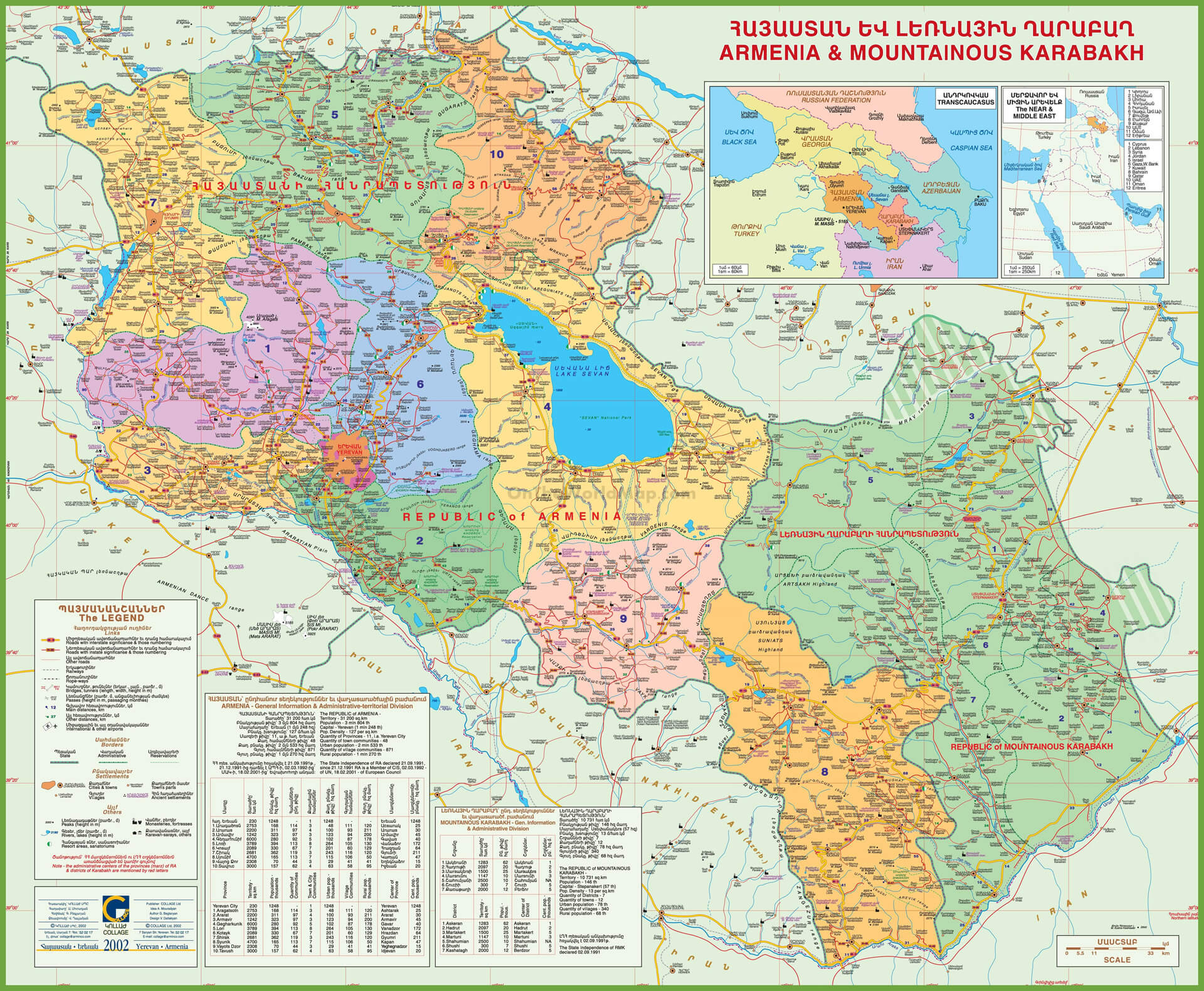
In 387 AD, after the partition of Armenia between the Roman Empire and Sassanid Persia, two Armenian provinces Artsakh and Utik became part of the Sassanid satrapy of Caucasian Albania, which, in turn, came under strong Armenian religious and cultural influence.
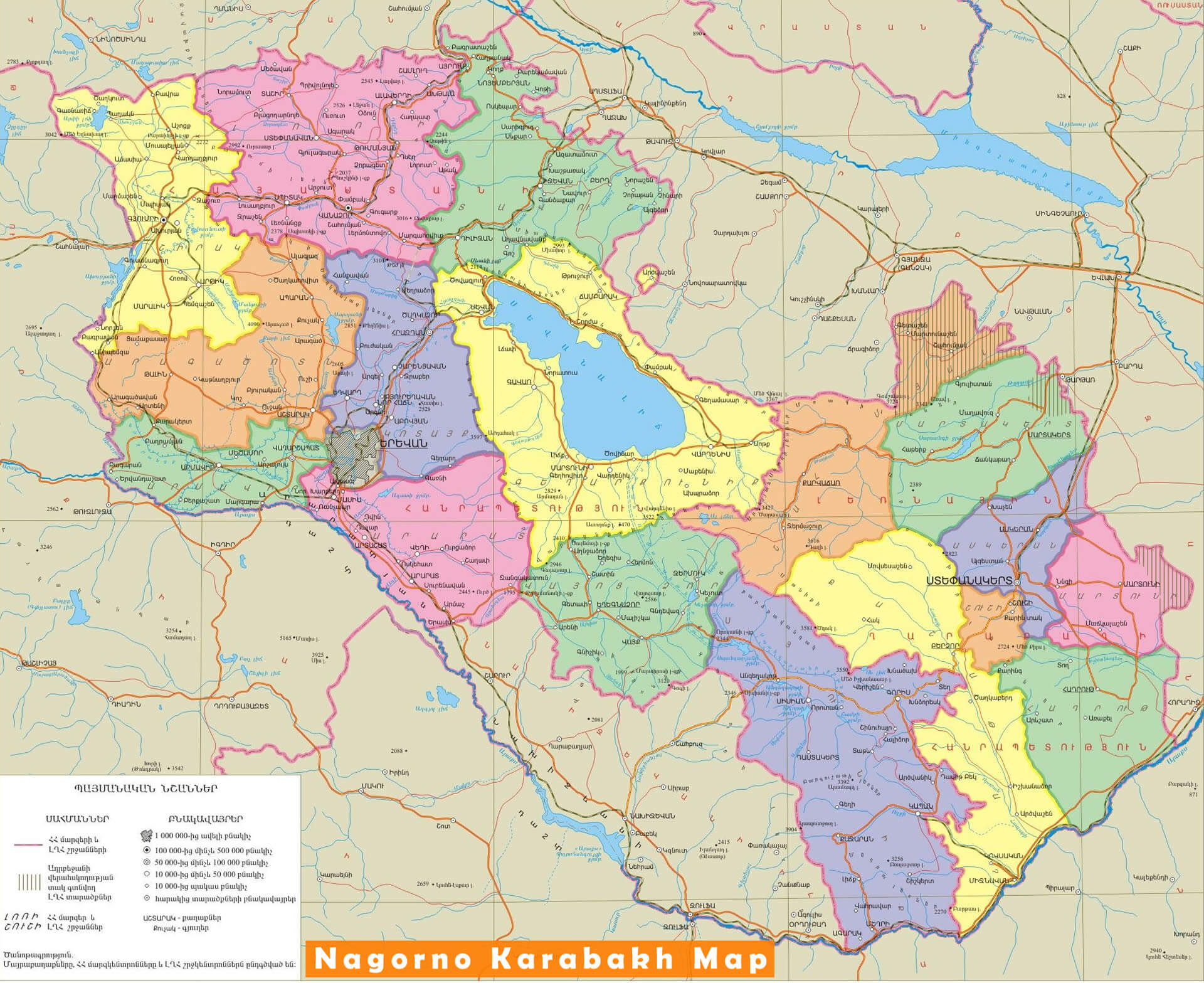
Around the mid 7th century, the region was conquered by the invading Muslim Arabs through the Muslim conquest of Persia.
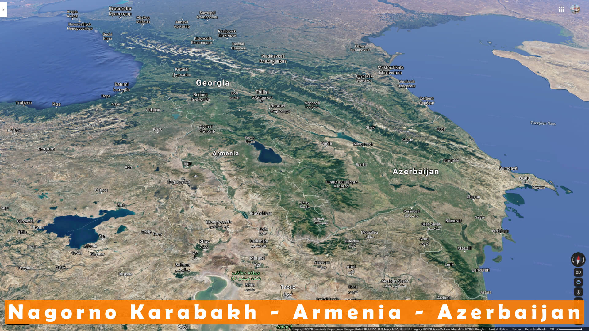
In the 15th century, the territory of Karabakh was part of the states ruled subsequently by the Kara Koyunlu and Ak Koyunlu Turkic tribal confederations.
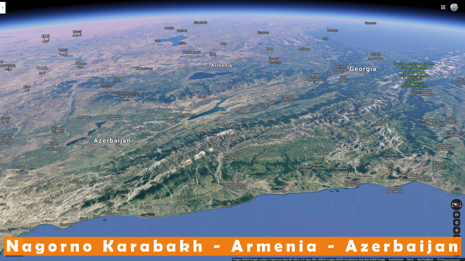
The Armenian meliks were granted supreme command over neighbouring Armenian principalities and Muslim khans in the Caucasus by the Iranian king Nader Shah, in return for the meliks” victories over the invading Ottoman Turks in the 1720s.
In the early 18th century, Iran”s Nader Shah took Karabakh out of control of the Ganja khans in punishment for their support of the Safavids, and placed it under his own control.

In 1822, 9 years after passing from Iranian to Russian control, the Karabakh Khanate was dissolved, and the area became part of the Elisabethpol Governorate within the Russian Empire.
After the defeat of the Ottoman Empire in World War I, British troops occupied Karabakh.
In February 1920, the Karabakh National Council preliminarily agreed to Azerbaijani jurisdiction, while Armenians elsewhere in Karabakh continued guerrilla fighting, never accepting the agreement.
In April 1920, while the Azerbaijani army was locked in Karabakh fighting local Armenian forces, Azerbaijan was taken over by Bolsheviks.
Nagorno-Karabakh Demographics

In the territory of the former Armenian principalities, 90.8% of villages were recorded as being Armenian, while 9.2% were recorded as Tatar or Kurd. The population of the former Armenian principalities accounted for approximately 8.4% of the population of the whole of Karabakh.
In the census of 2015, Artsakh had a population of 145,053, consisting of 144,683 Armenians and 238 Russians, and others.
Nagorno-Karabakh Conflict
The Nagorno-Karabakh conflict is an ethnic and territorial conflict between Armenia and Azerbaijan over the disputed region of Nagorno-Karabakh and seven surrounding districts, which are de facto controlled by the self-declared Republic of Artsakh, but are internationally recognized as de jure part of Azerbaijan. The conflict has its origins in the early 20th century. Under the Soviet Union, Joseph Stalin decided to make the Nagorno-Karabakh region an autonomous oblast of Soviet Azerbaijan.

The present conflict began in 1988, when the Karabakh Armenians demanded that Karabakh be transferred from Soviet Azerbaijan to Soviet Armenia. The conflict escalated into a full-scale war in the early 1990s.
A ceasefire signed in 1994 provided for two decades of relative stability, which significantly deteriorated along with Azerbaijan”s increasing frustration with the status quo, at odds with Armenia”s efforts to cement it. A four-day escalation in April 2016 became the deadliest ceasefire violation until the 2020 crisis.
The Nagorno-Karabakh Conflict Timeline
The Nagorno-Karabakh War was an armed conflict that took place in the late 1980s to May 1994, in the enclave of Nagorno-Karabakh in southwestern Azerbaijan, between the majority ethnic Armenians of Nagorno-Karabakh backed by the Republic of Armenia, and the Republic of Azerbaijan.
Nagorno-Karabakh Border Clashes (1994–2016)
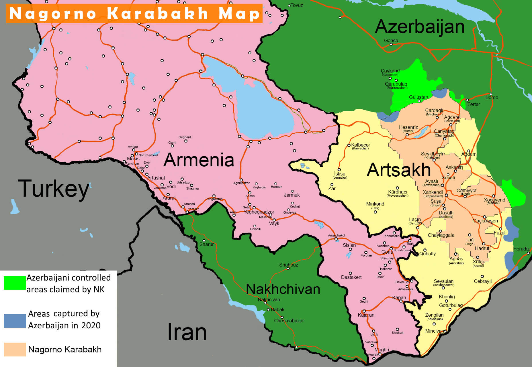
The 2008 Mardakert clashes began on 4 March after the 2008 Armenian election protests. It involved the heaviest fighting between ethnic Armenian and Azerbaijani forces over the disputed region of Nagorno-Karabakh since the 1994 ceasefire after the Nagorno-Karabakh War.
Nagorno-Karabakh 2010 Violence
The 2010 Nagorno-Karabakh clash was a scattered exchange of gunfire that took place on February 18 on the line of contact dividing Azerbaijani and the Karabakh Armenian military forces. Azerbaijan accused the Armenian forces of firing on the Azerbaijani positions near Tap Qaraqoyunlu, Qiziloba, Qapanli, Yusifcanli and Cavahirli villages. As a result, three Azerbaijani soldiers were killed and one wounded.
2011–2013 Continued Fighting
The 2010 Nagorno-Karabakh clash was a scattered exchange of gunfire that took place on February 18 on the line of contact dividing Azerbaijani and the Karabakh Armenian military forces. Azerbaijan accused the Armenian forces of firing on
In late April 2011, border clashes left three Nagorno-Karabakh soldiers dead, while on 5 October, two Azerbaijani and one Armenian soldier were killed. In all during the year, 10 Armenian soldiers were killed.
2014 Clashes and Helicopter Shootdown
In 2014, several border clashes erupted that had resulted in 16 fatalities on both sides by 20 June.
2015 Sporadic Fighting

In 2015, 42 Armenian soldiers and 5 civilians were killed as border clashes continued. In addition, at least 64 Azerbaijani soldiers also died.
Nagorno-Karabakh Four-Day War (2016)
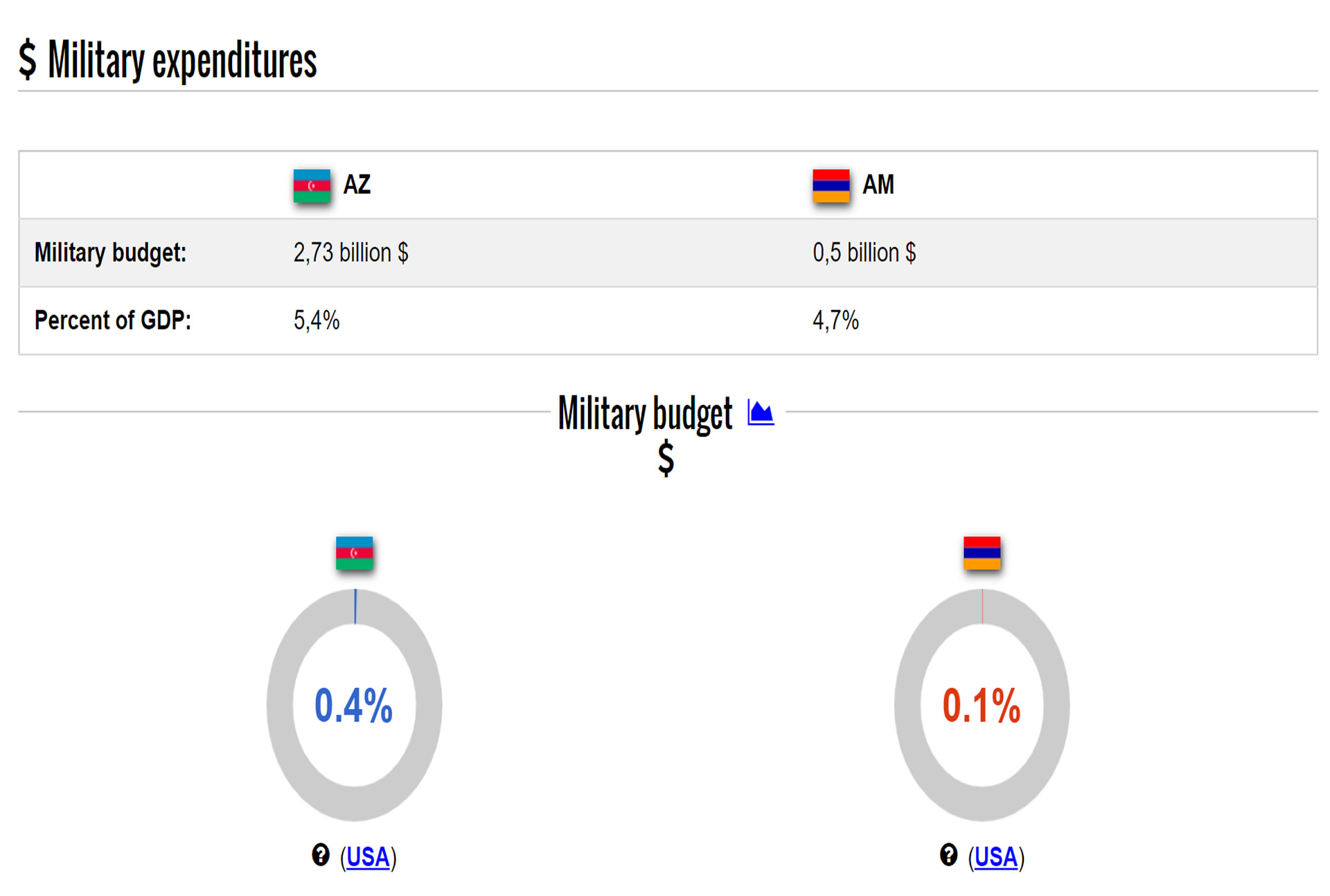
Over the years, Azerbaijan had been growing impatient with the status quo. In this regard, propelled by oil and gas windfall, the country embarked in a military build-up. In 2015 alone, Baku spent $3bn on its military, more than Armenia”s entire national budget.
Nagorno-Karabakh 2018 Clashes
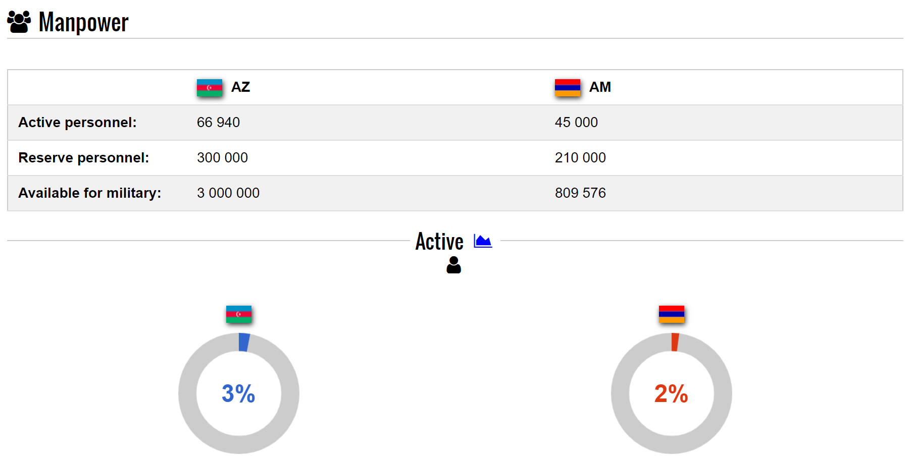
A Nagorno-Karabakh soldier was killed by an Azerbaijani sniper near the line of contact on 7 January 2018. A Nagorno-Karabakh soldier was killed by Azerbaijani fire on 7 February 2018. Three civilian volunteers were killed in a demining operation in Nagorno-Karabakh on 29 March 2018.
Nagorno-Karabakh 2020 Conflict
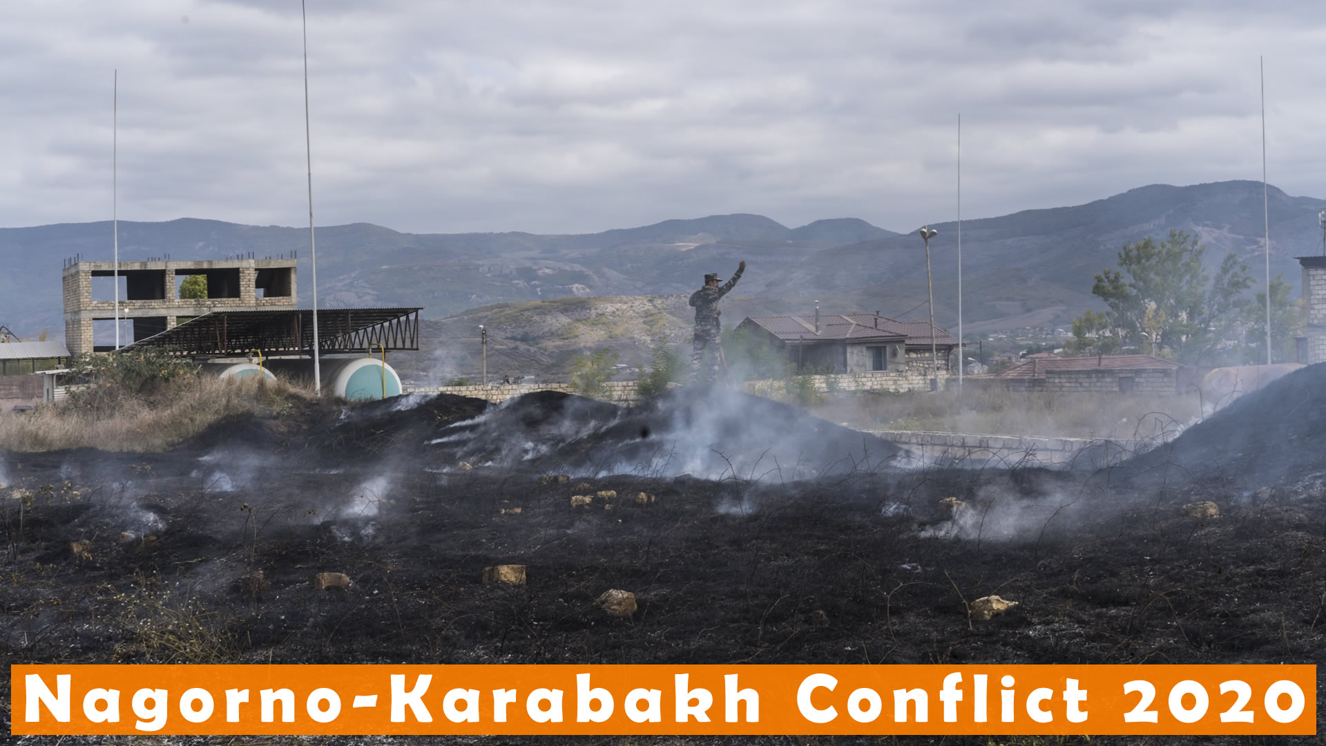
Further clashes near Tavush took place in July 2020. Thirteen Azeris, including one civilian, and five Armenians were killed.
In a minor border skirmish on 16 September, one Armenian soldier was killed; five days later, an Azerbaijani soldier was killed.
On 27 September, serious clashes in Nagorno-Karabakh re-erupted, leading to Armenia declaring martial law and mobilization. On the same day, Azerbaijan”s Parliament declared a state of war against Armenia and established curfews in several cities and regions following the clashes. In terms of casualties, the clashes were the worst since 2016 and caused alarm in the international community, with most international actors urging both sides to return to the table and to the United Nations Security Council condemning the resumption of hostilities.
Is Nagorno Karabakh Part of Armenia?
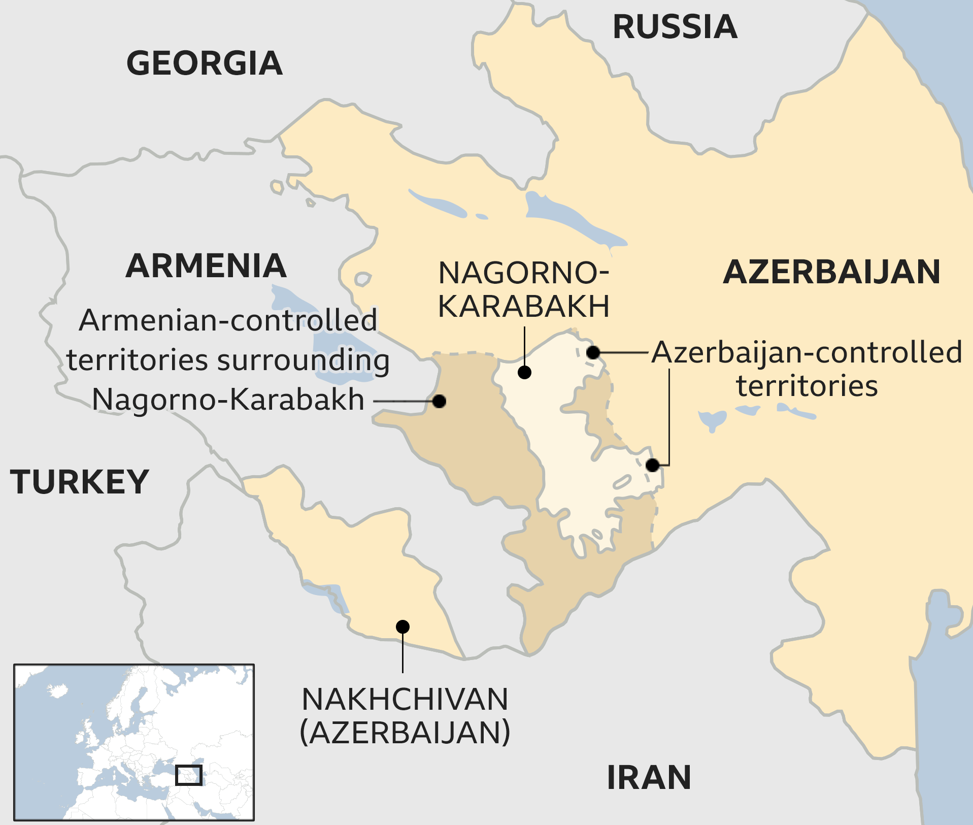
Nagorno-Karabakh is part of Azerbaijan, but its population is majority Armenian. As the Soviet Union saw increasing tensions in its constituent republics in the 1980s, Nagorno-Karabakh voted to become part of Armenia – sparking a war which stopped with a ceasefire in 1994.
Why do Azerbaijan and Armenia Hate each Other?
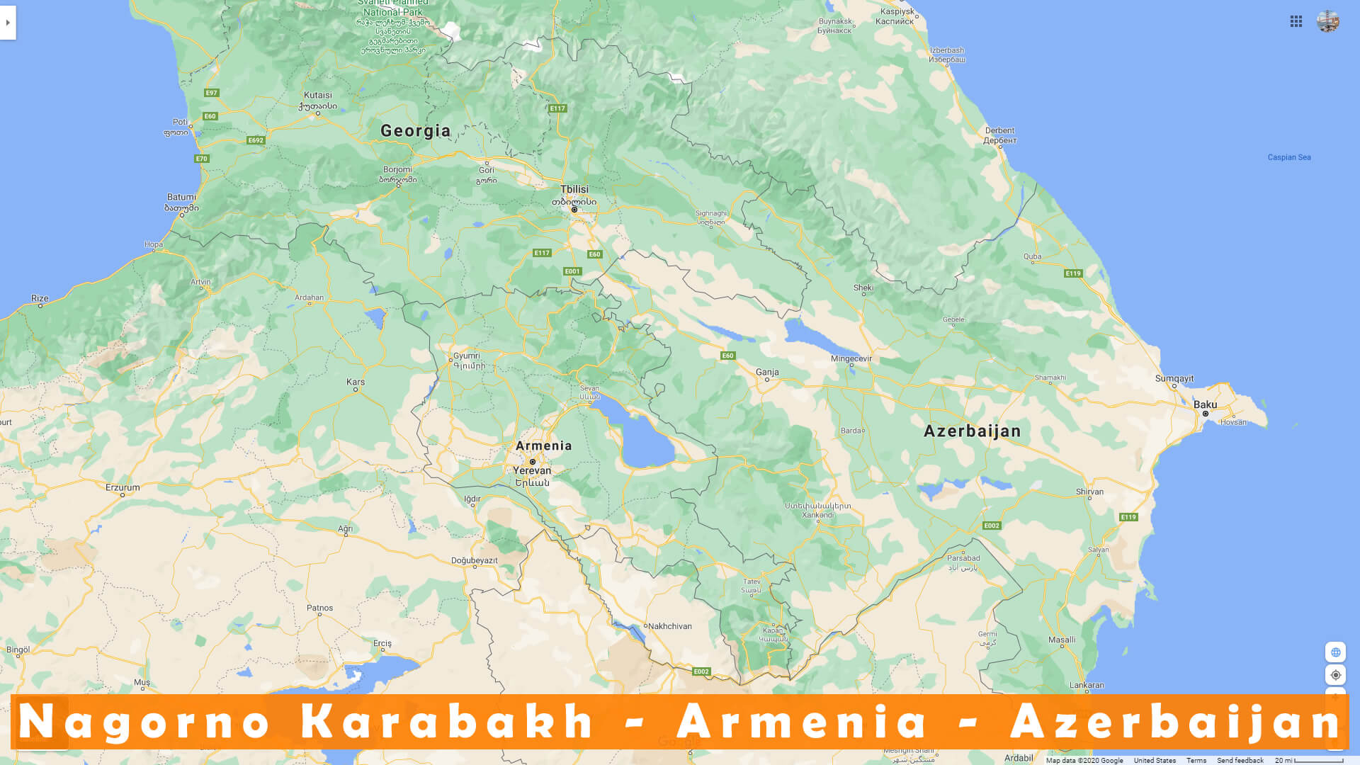
Anti-Armenian sentiment or Armenophobia is widespread in Azerbaijan, mainly due to the conflict over Nagorno-Karabakh. Throughout the 20th century, Armenians and the Muslim inhabitants of the Caucasus—Azerbaijanis were called “Caucasian Tatars” before 1918— had been involved in numerous conflicts.
Who is Armenia at War with?

The ethnic Armenian majority in the region fought a bloody war of secession from Azerbaijan as the Soviet Union fell apart three decades ago. A tense cease-fire has since kept tensions high in the Caucasus, an area where Russia, Turkey and Iran have historically competed.
Does Turkey Recognize Armenia?
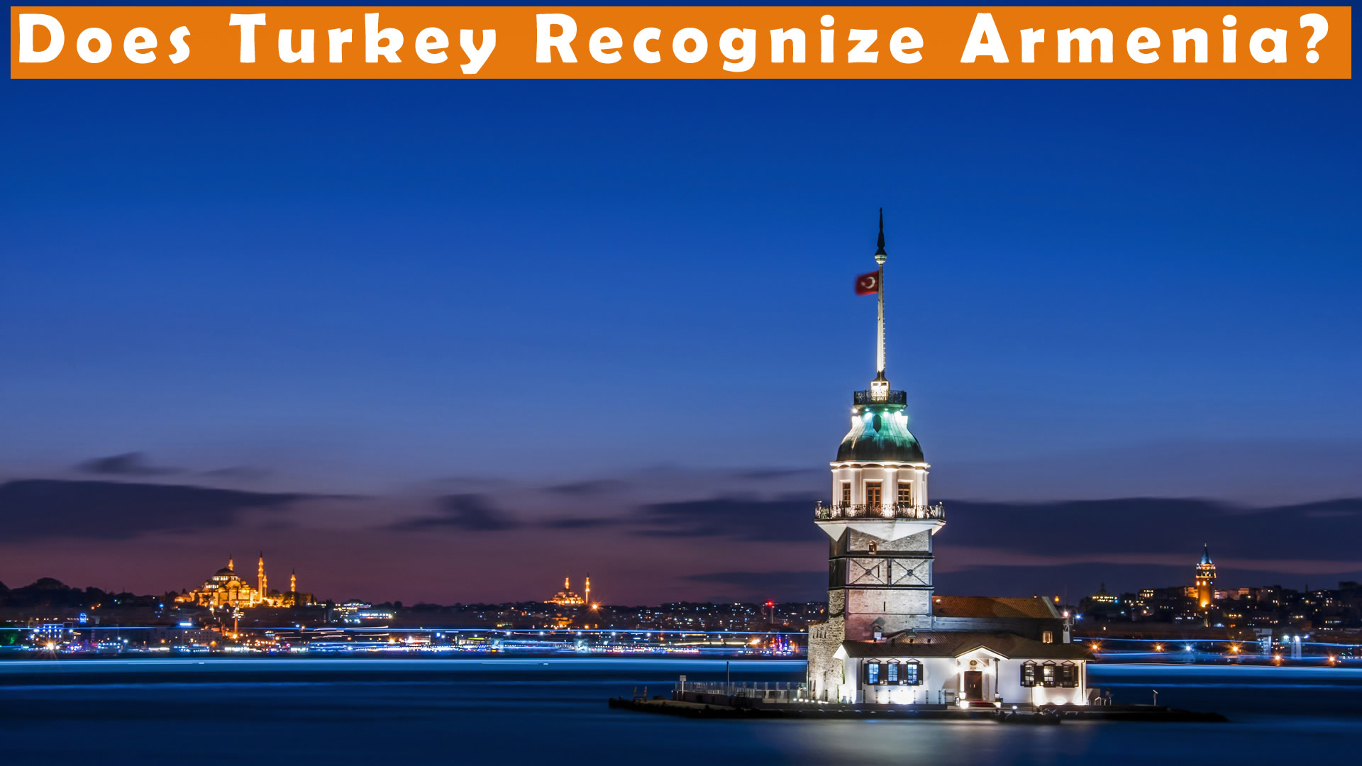
Armenia–Turkey relations are officially non-existent and have historically been hostile. Whilst Turkey recognised Armenia (in the borders of the Armenian Soviet Socialist Republic) shortly after the latter proclaimed independence in September 1991, the two countries have failed to establish diplomatic relations.
Are Russia and Armenia Allies?
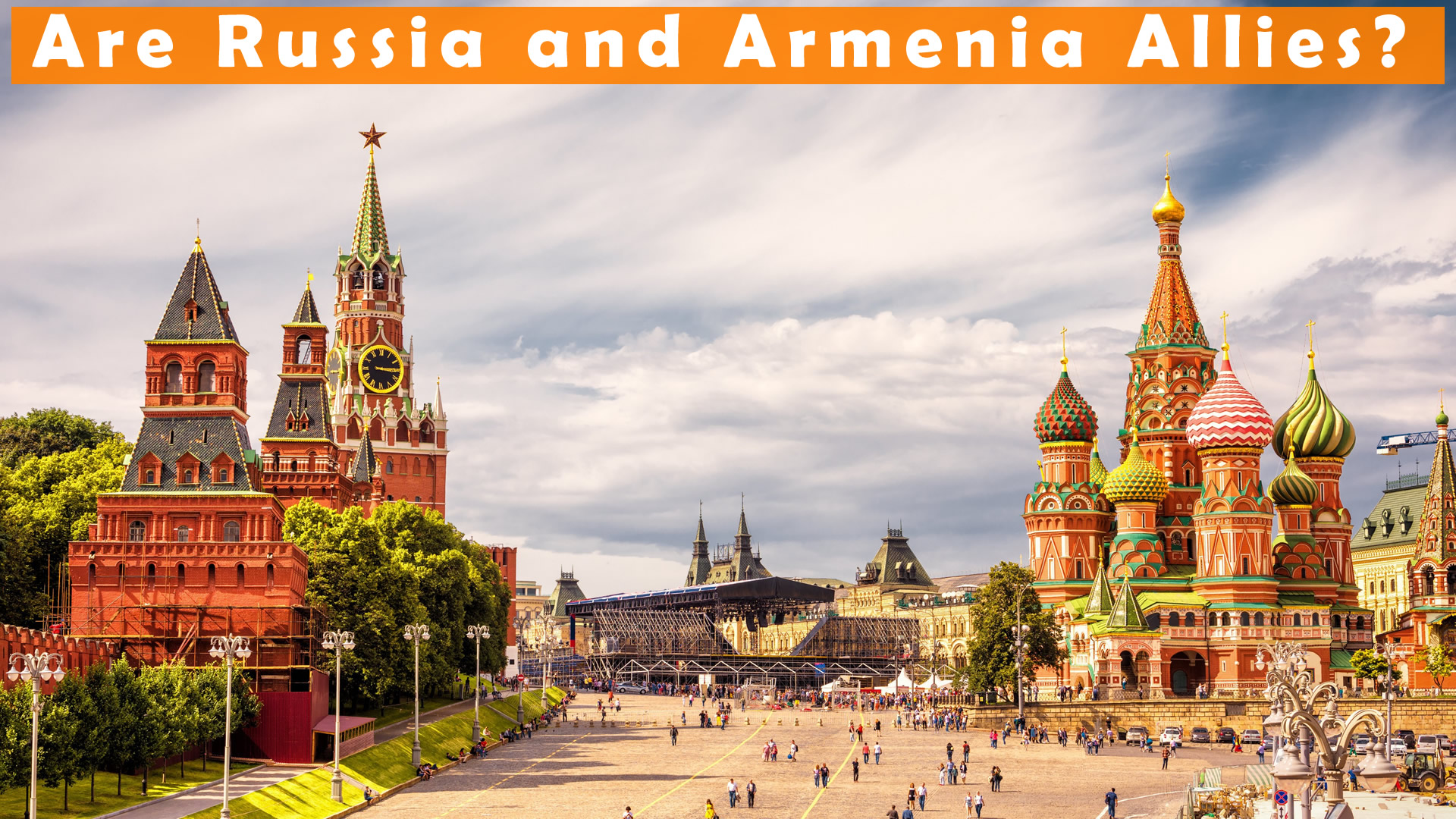
Armenia and Russia are both members of a military alliance, the Collective Security Treaty Organization (CSTO), along with four other ex-Soviet countries, a relationship that Armenia finds essential to its security.
Which countries do not recognize Armenia?
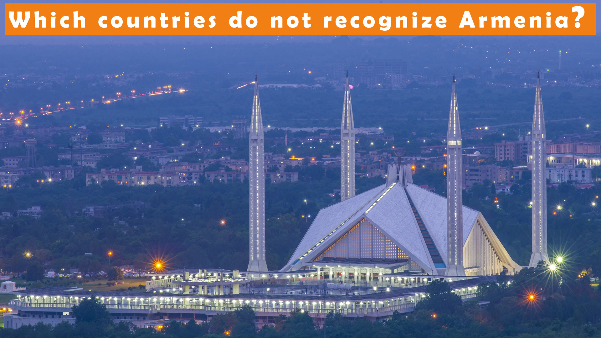
Pakistan is the only country in the world that does not recognize Armenia as a state. Primary causes of the two countries” diplomatic rift are the Armenian Genocide and the Nagorno-Karabakh conflict.
Can an Armenian go to Azerbaijan?
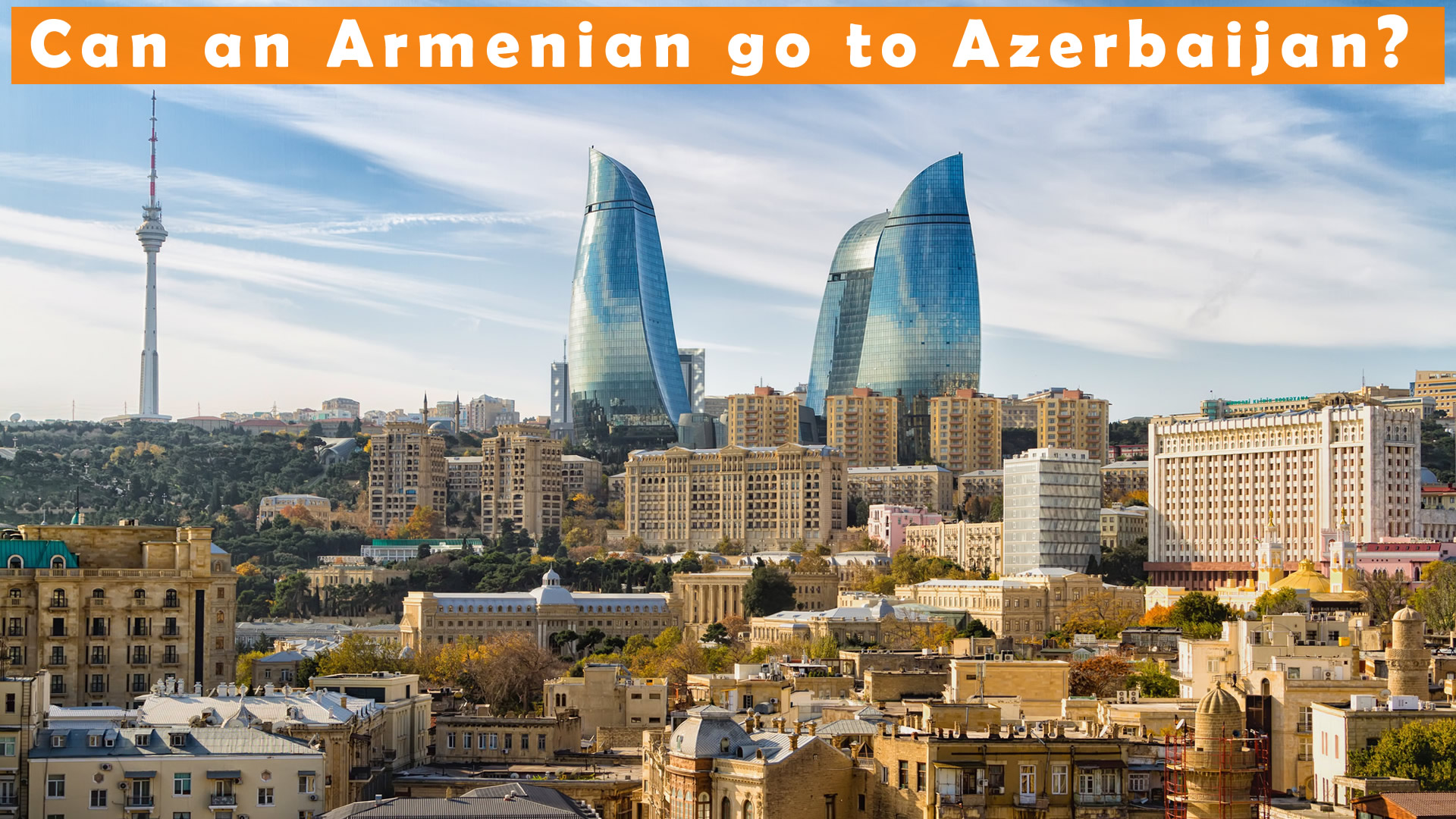
Due to a state of war with Armenia, the government of Azerbaijan has banned the entry of citizens from Armenia, as well as citizens of any other country who are of Armenian descent (including Armenian Russians, Turkish Armenians, etc.), to the Republic of Azerbaijan.
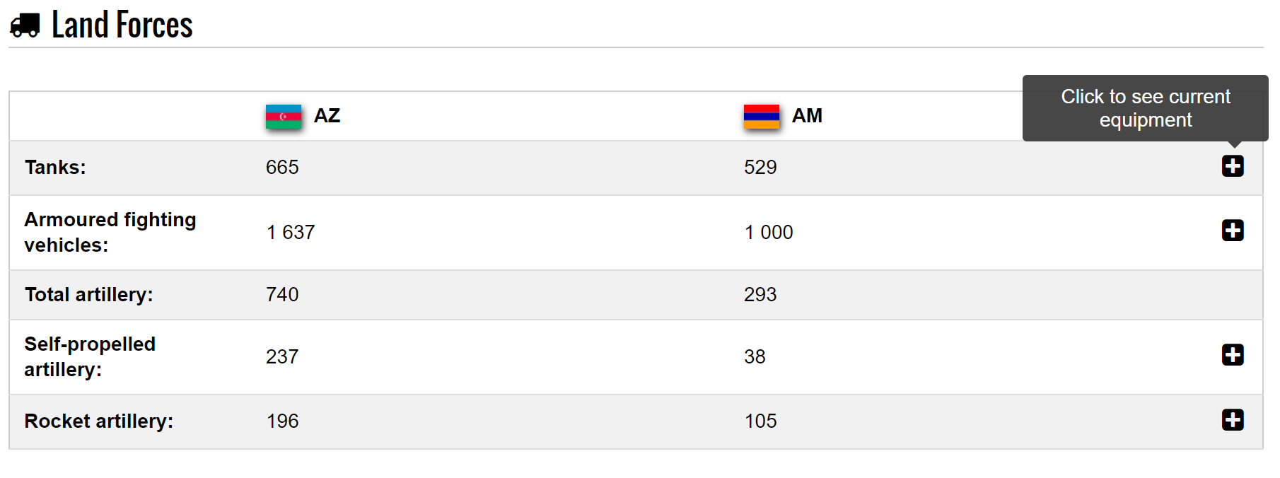
Armenia vs Azerbaijan Land Forces Comparison
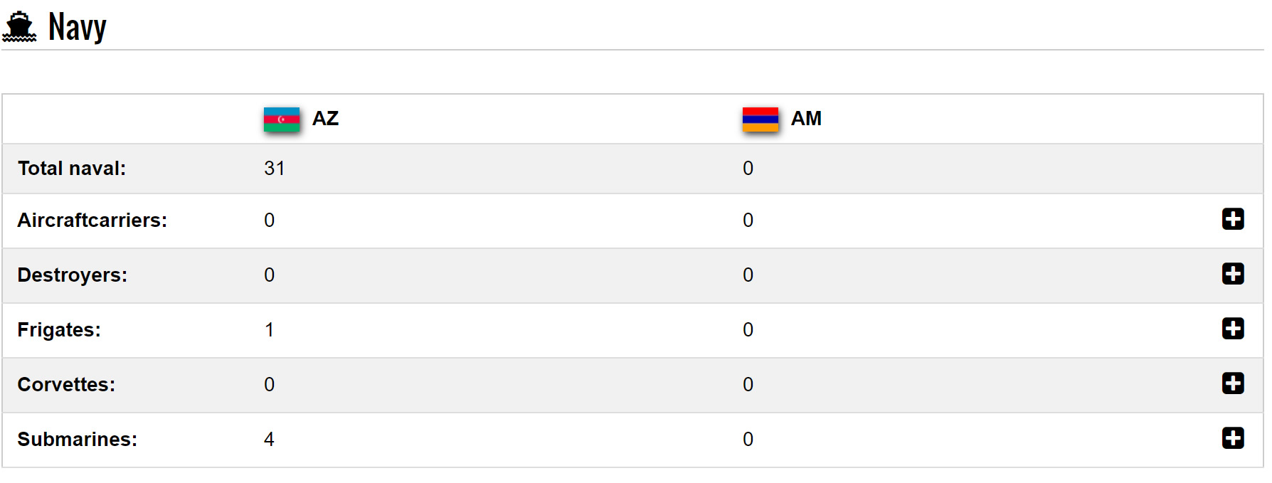
Armenia vs Azerbaijan Navy Forces Comparison
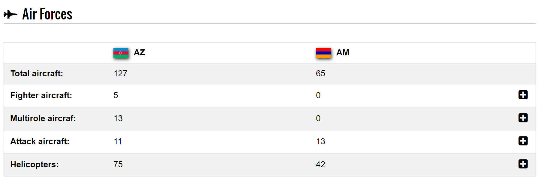
Armenia vs Azerbaijan Air Forces Comparison
Nagorno Karabakh Fatalities 1994 – Present

Where is Nagorno Karabakh on the Asia Map?
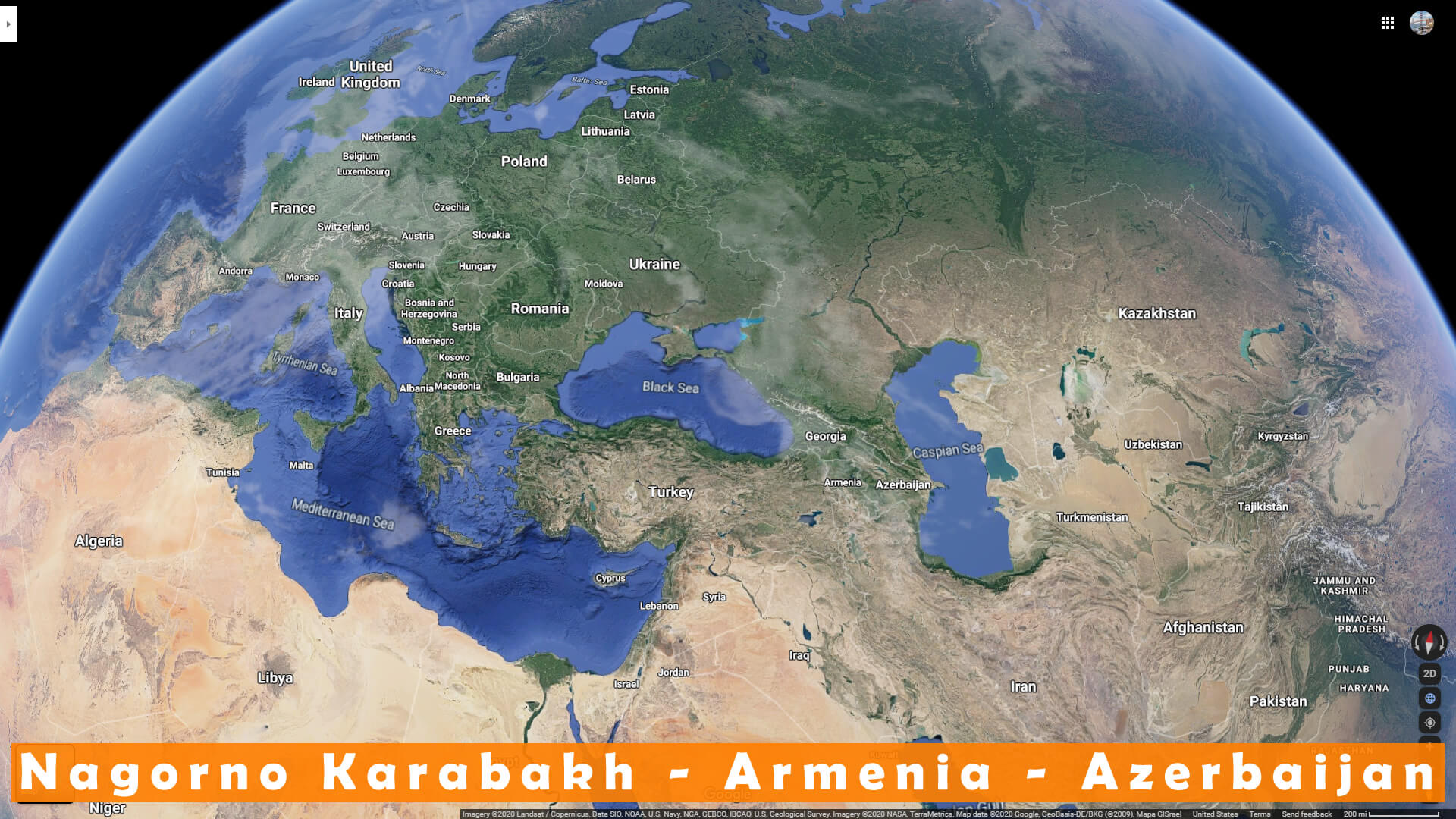
Show Google map, satellite map, where is the country located.
Get directions by driving, walking, bicycling, public transportation and travel with street view.
