Stepping onto the vast landscapes of North America, one is immediately struck by its sheer diversity – from its awe-inspiring natural wonders, bustling cities, to the rich tapestry of its history and cultures. Yet, to truly appreciate and understand this expansive continent, we need to look at it from multiple lenses, each offering a unique glimpse into its soul. Today, through this compilation of meticulously curated maps, we aim to offer just that. From the towering peaks of the Rocky Mountains to the rhythmic hustle of cities like New York and Toronto, these maps will take you on a journey across terrains, time, politics, and more. So, grab your virtual compass and let’s navigate together!
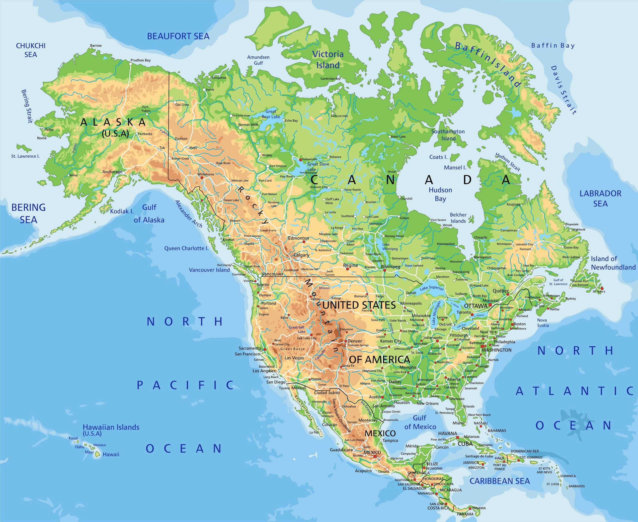
1. North America Physical Map
Our journey starts with a Physical Map that showcases the mountains, rivers, plains, and other natural features of North America. Admire the vastness of the Great Plains and the majestic Rockies!
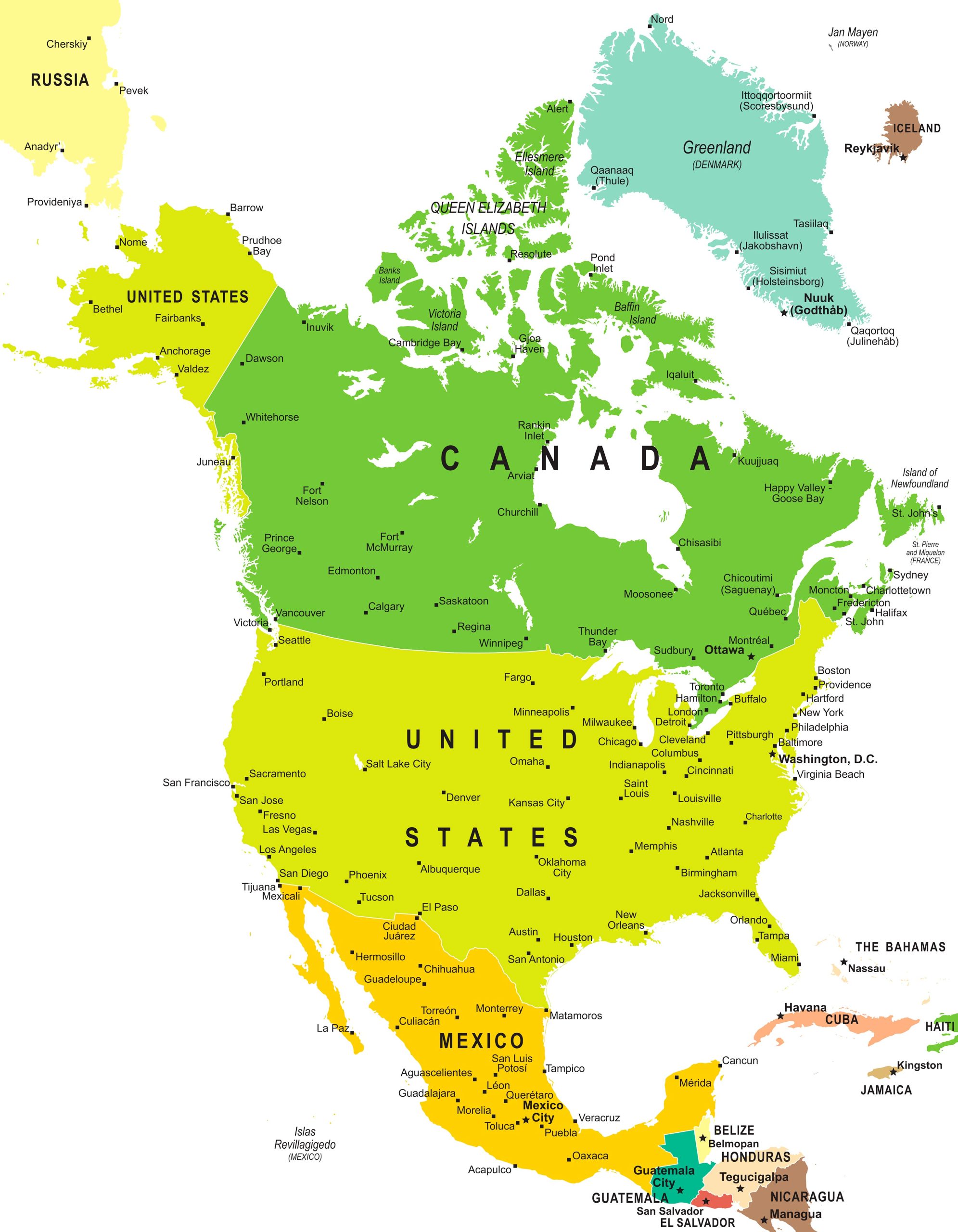
2. North America Political Map
Moving on, our Political Map lays out the countries, their boundaries, and their state or provincial divisions. You’ll get a comprehensive overview of how North America is politically organized.
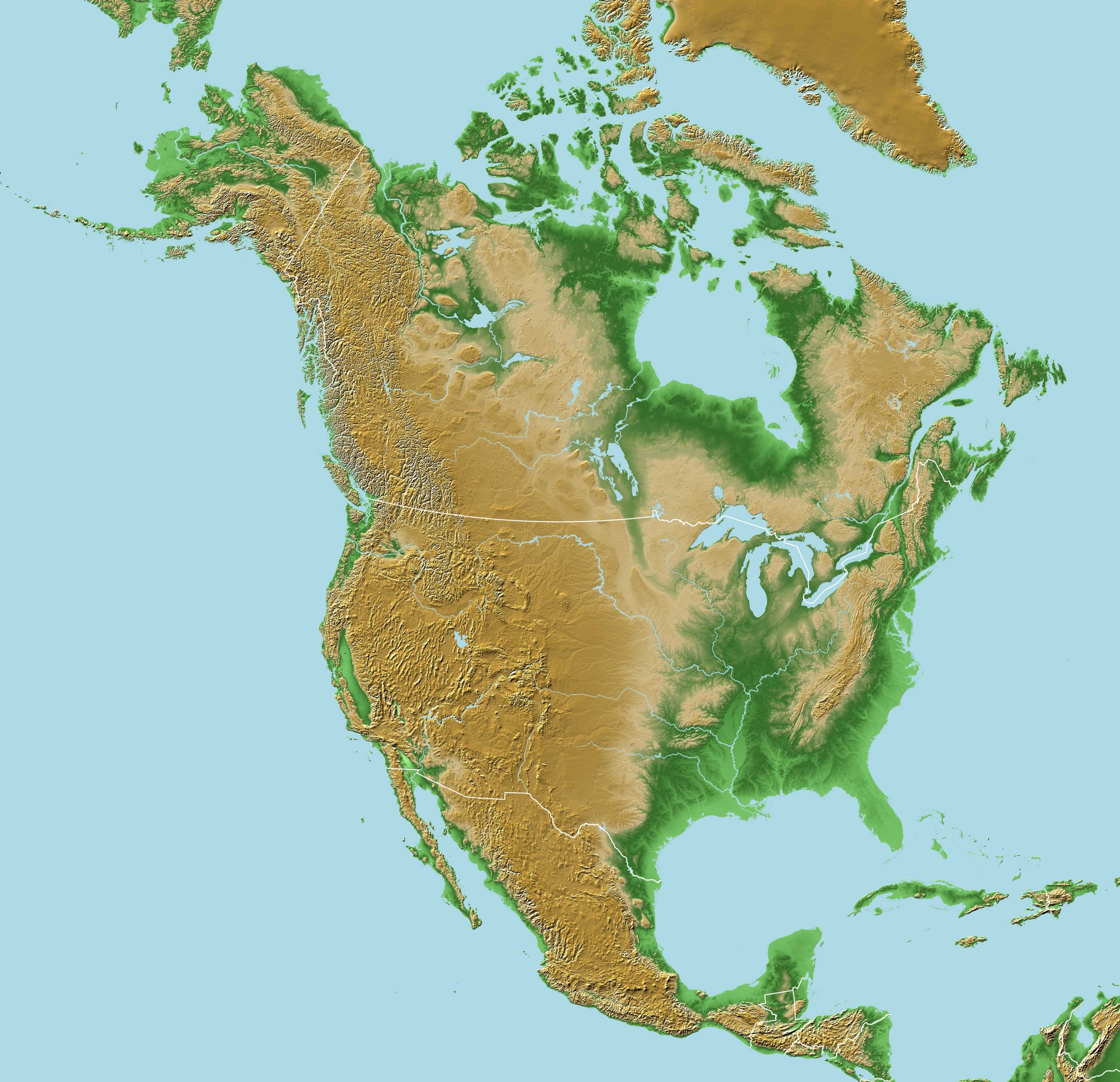
3. North America Topographic Map
Love elevations? Our Topographic Map provides a detailed representation of the continent’s relief, depicting height variations and landform patterns.
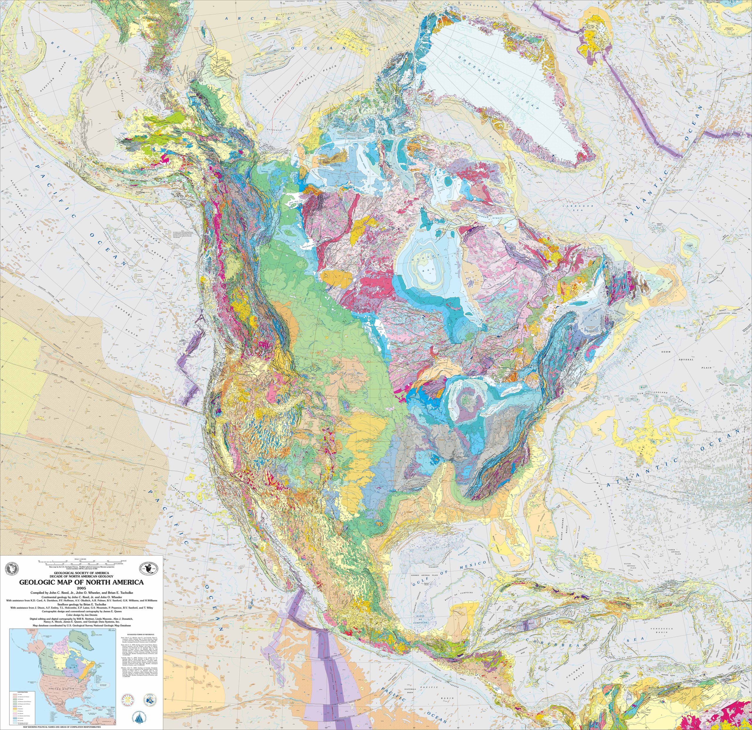
4. North America Geological Map
Dig a little deeper (pun intended!) with the Geologic Map, highlighting the rock formations and their ages. Perfect for the geology buffs out there!
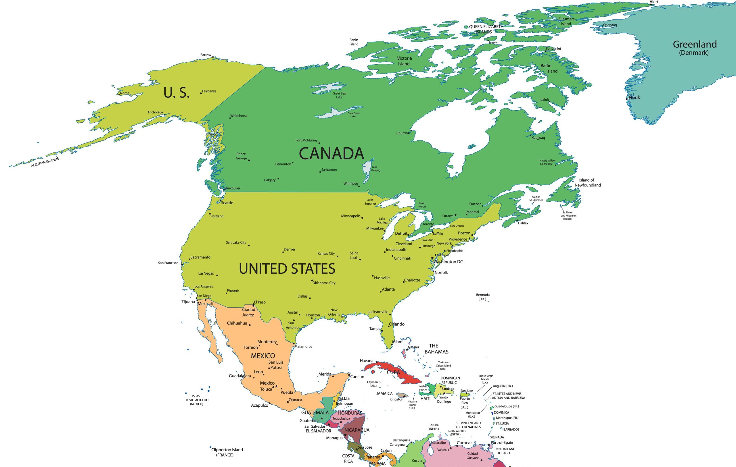
5. Countries, Capitals and Major Cities of the North America Map
This map is a guide to all the countries, their capitals, and major cities. Handy for those quiz nights!
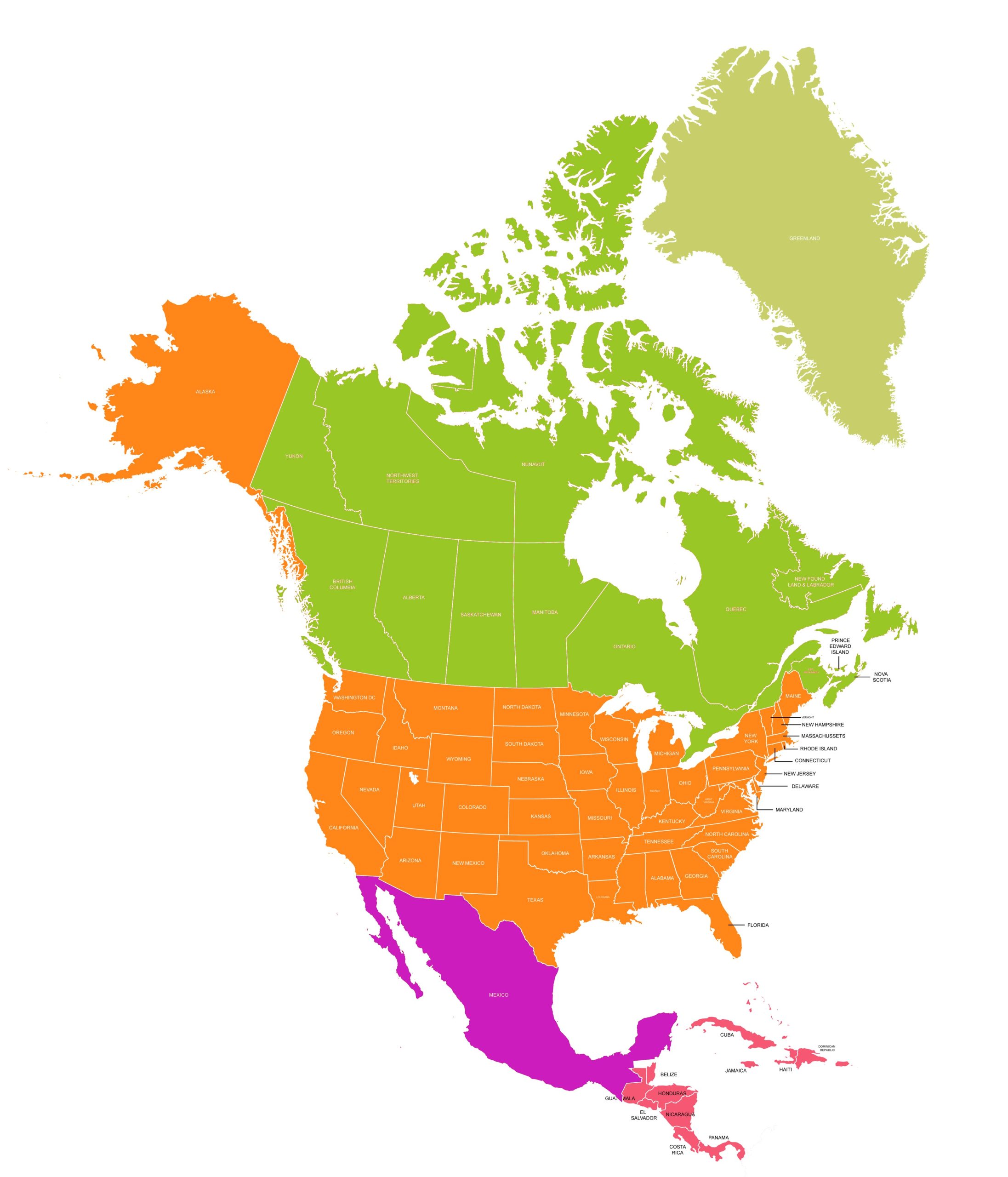
6. North America Map With States and Countries
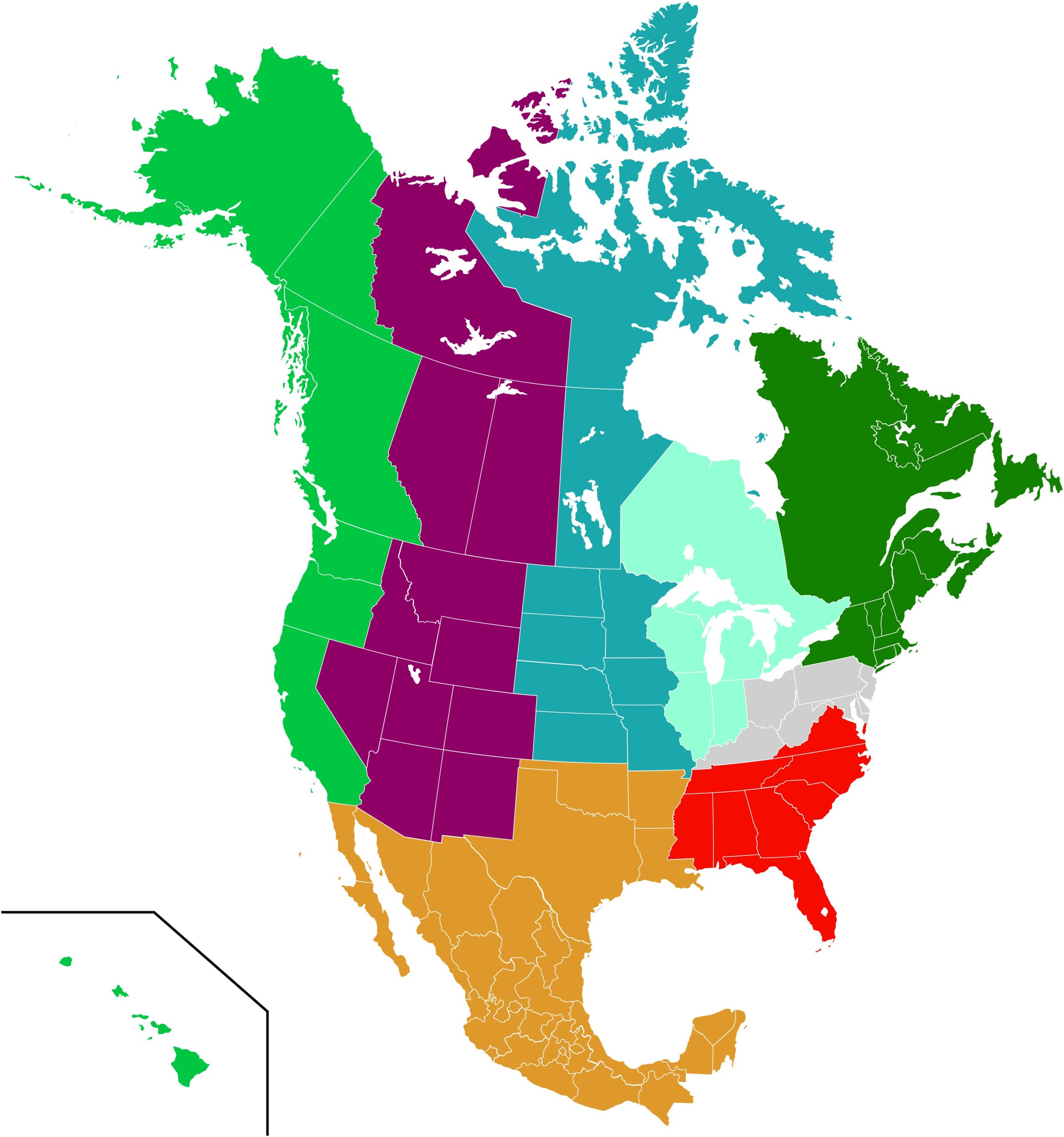
7. North America Regions Map
Discover how North America is divided into distinct regions, each with its unique characteristics.
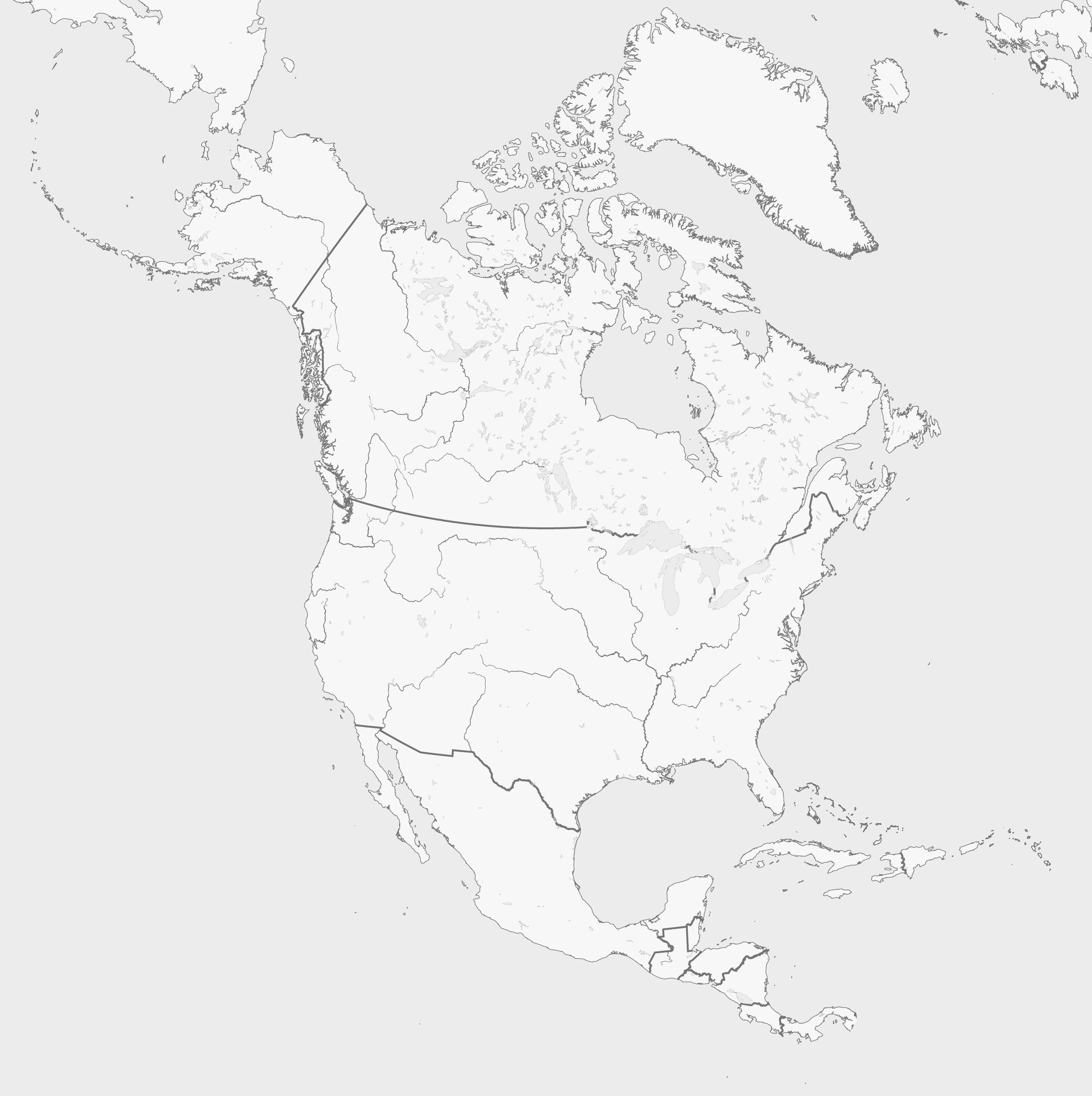
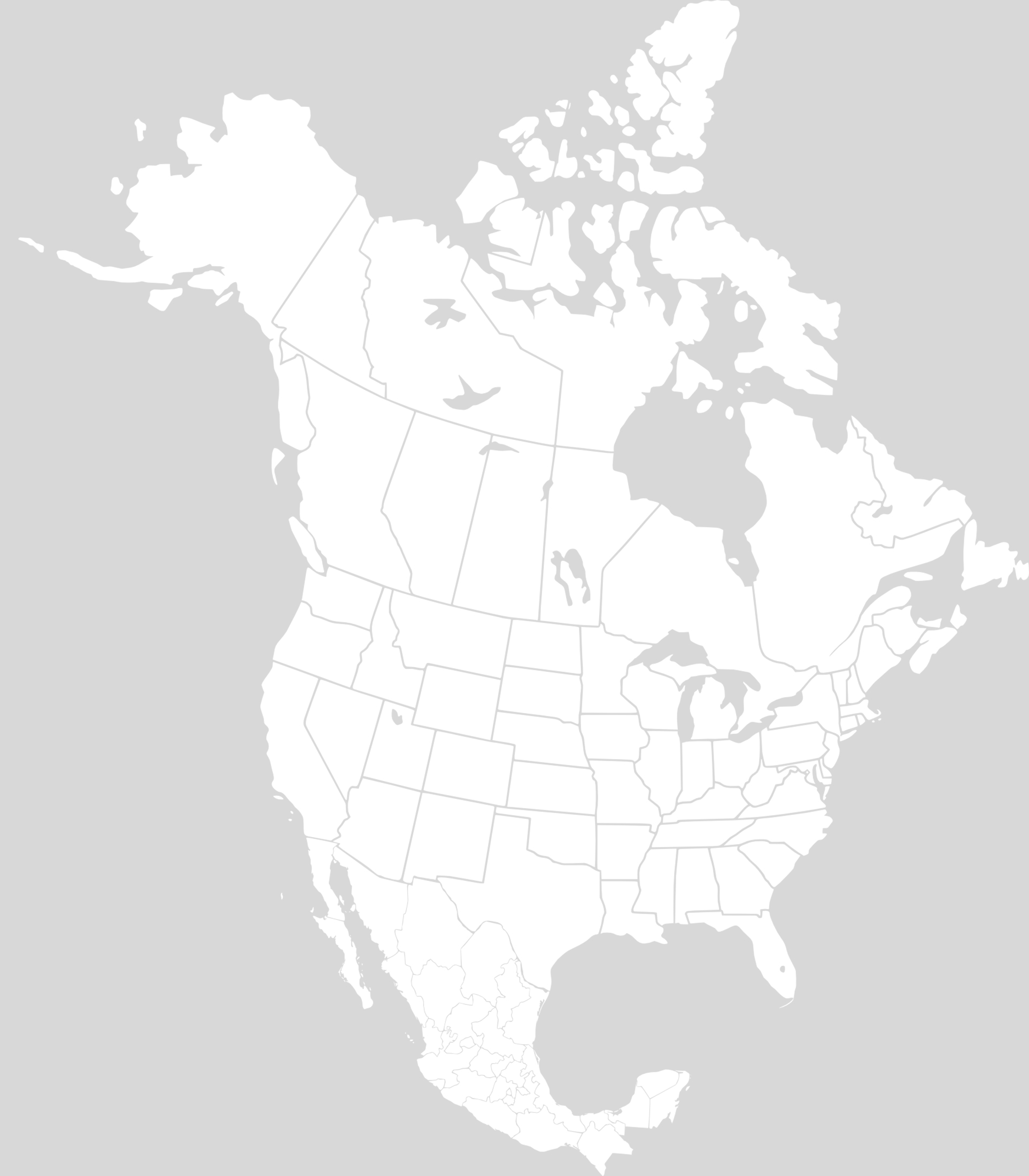
8. North America Blank Map
For students and educators, we offer a Blank Map—perfect for practice and memory tests.
9. North America Blank Map With States
For students and educators, we offer a Blank Map—perfect for practice and memory tests.
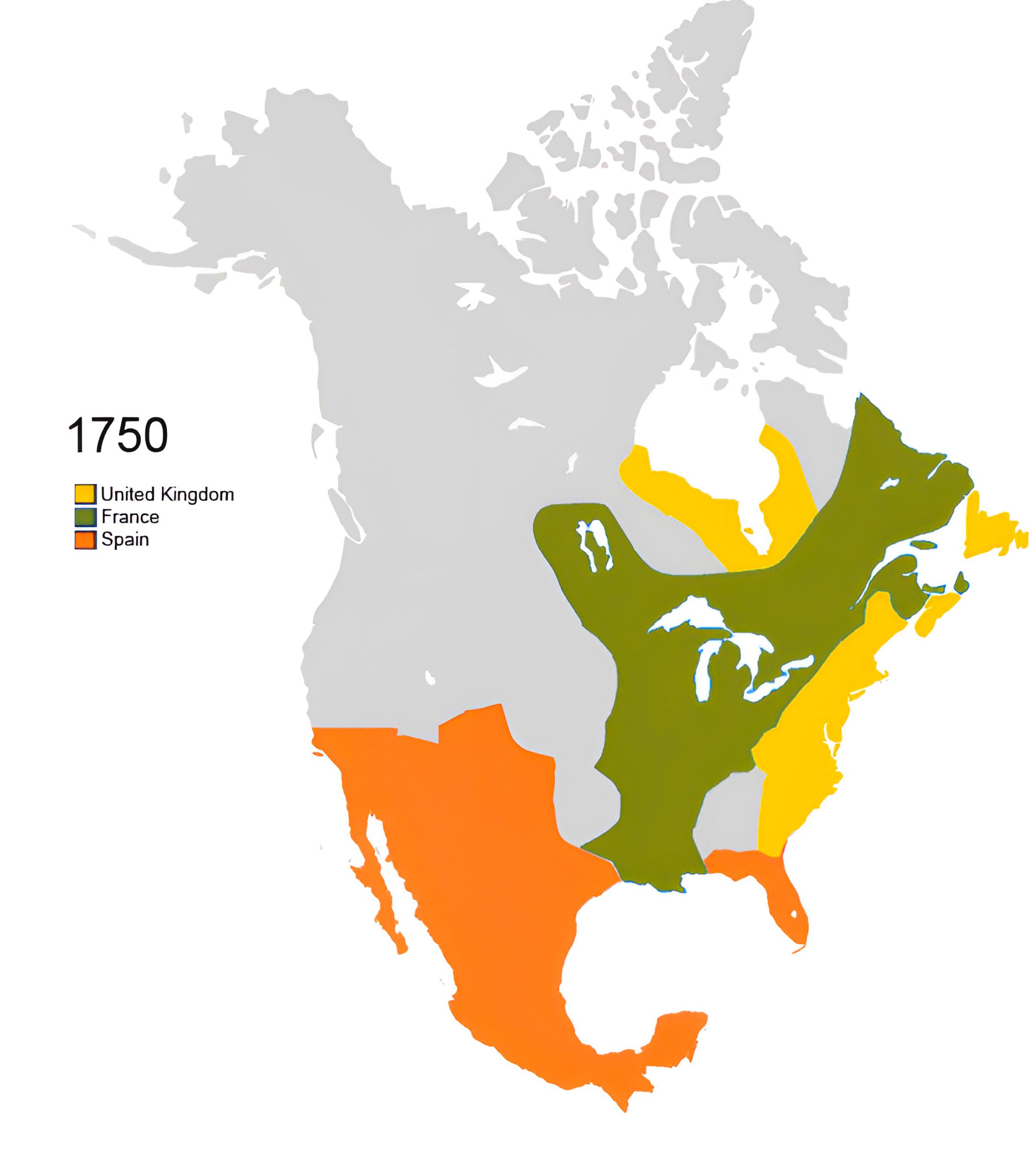
10. North America Colonial Map (1750 – Vector)
The North America Colonial Map (1750 – Vector) offers a crisp, vector-based depiction of the continent during the mid-18th century, capturing territorial boundaries, major landmarks, and the colonial footprint of the era. A digital journey back in time for history and map enthusiasts alike.
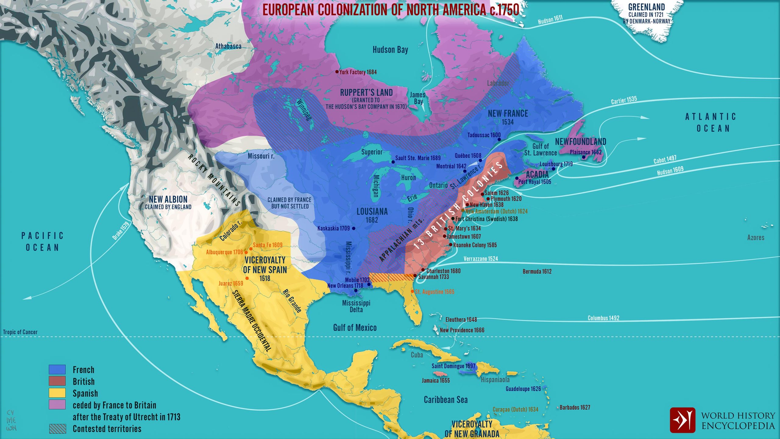
11. North America Colonial Map (1750)
Travel back in time and explore the colonial histories of North America.
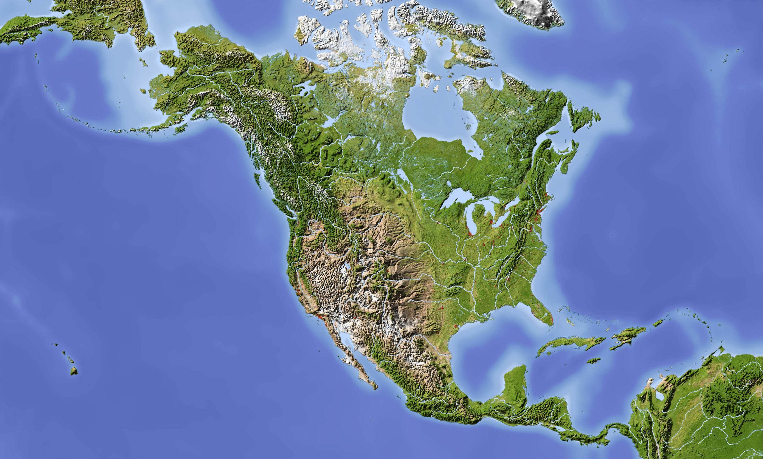
12. North America Relief Map
Our Relief Map offers a three-dimensional view, providing an artistic representation of North America’s terrains.
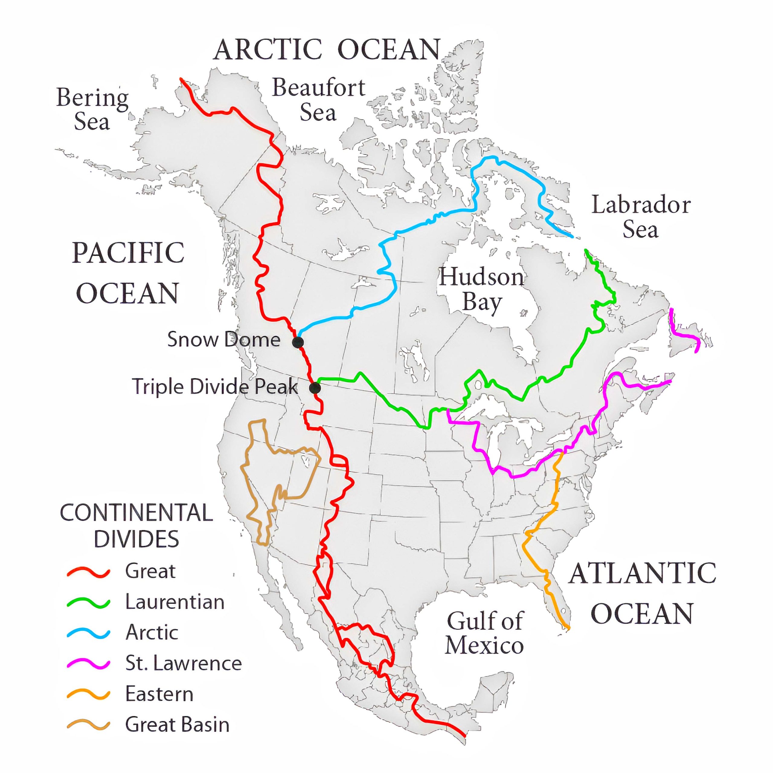
13. Hydrological Divides of North America Watersheds Map
The Hydrological Divides of North America Watersheds Map provides a detailed visualization of the continent’s water divides, marking boundaries between drainage basins. An invaluable tool for understanding the flow and convergence of North America’s water resources.
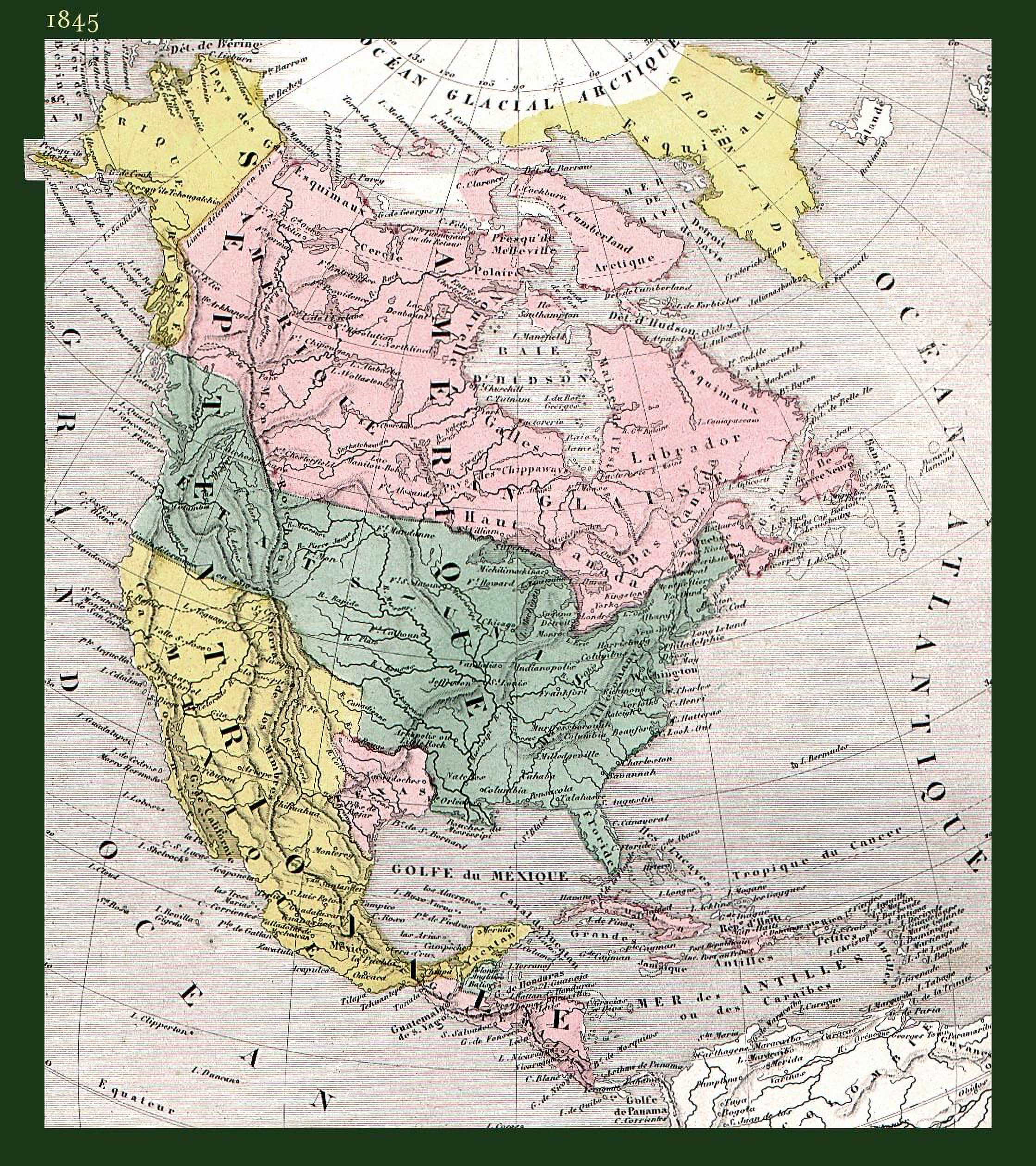
14. North America Historical Map (1845)
Journey through the annals of time, understanding the evolving borders and historical events with our Historical Map.
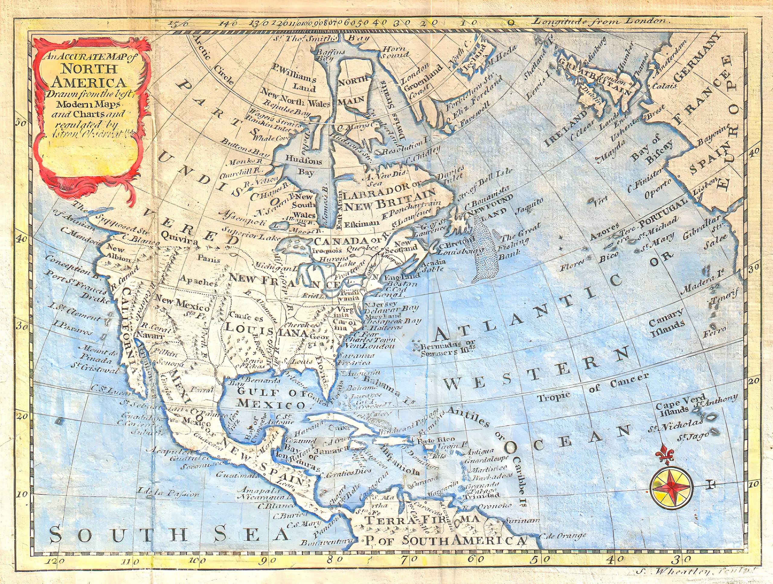
15. North America Historical Map (1747 – Bowen Map)
This 1797 map of North America, copied from Bowen’s 1747 version, was subtly altered by Wheatley who removed Bowen’s name. Showcasing Colonial North America, it features a misshapen Florida, mentions the Apache Indians, and includes mythical elements like the “Strait of Annian.” Used in D. Fenning’s 1797 guide, it also points to undiscovered parts of Canada and the Caribbean (Source Wikipedia).
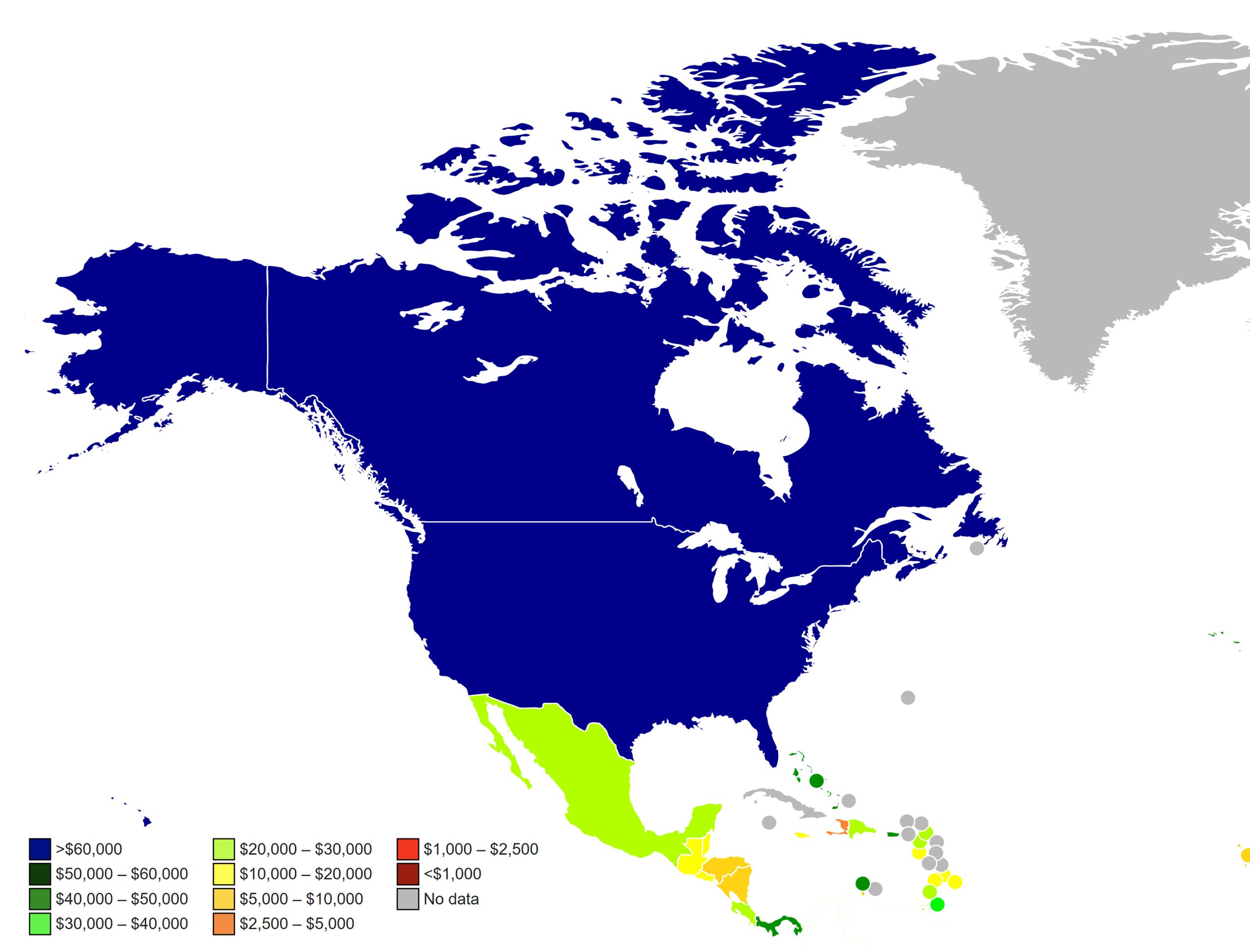
16. North America Countries by GDP (PPP) Per Capita Map (2023)
Grasp the economic powerhouses, their prosperity scales, and contrasts across the continent.
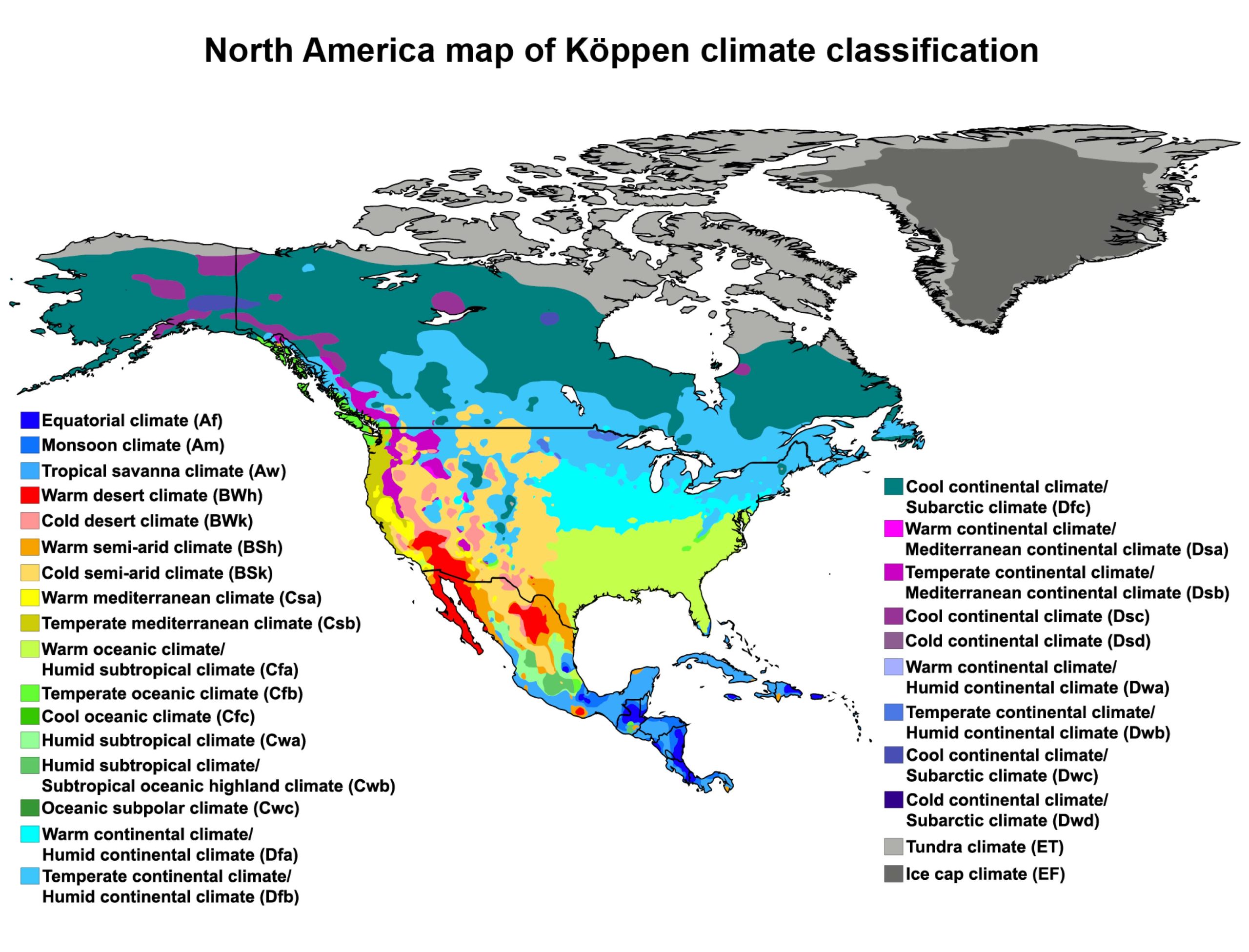
17. North America Climate Map
Understand the diverse weather patterns and climatic zones of North America.
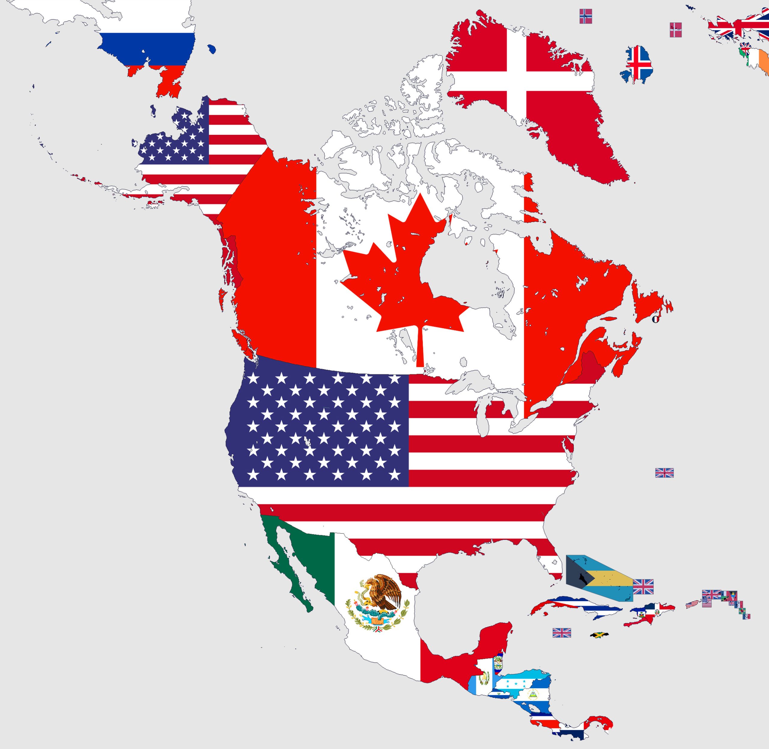
18. North America Flag Map
Express your patriotism with our Flag Map, showcasing each country’s flag in its territorial boundary.
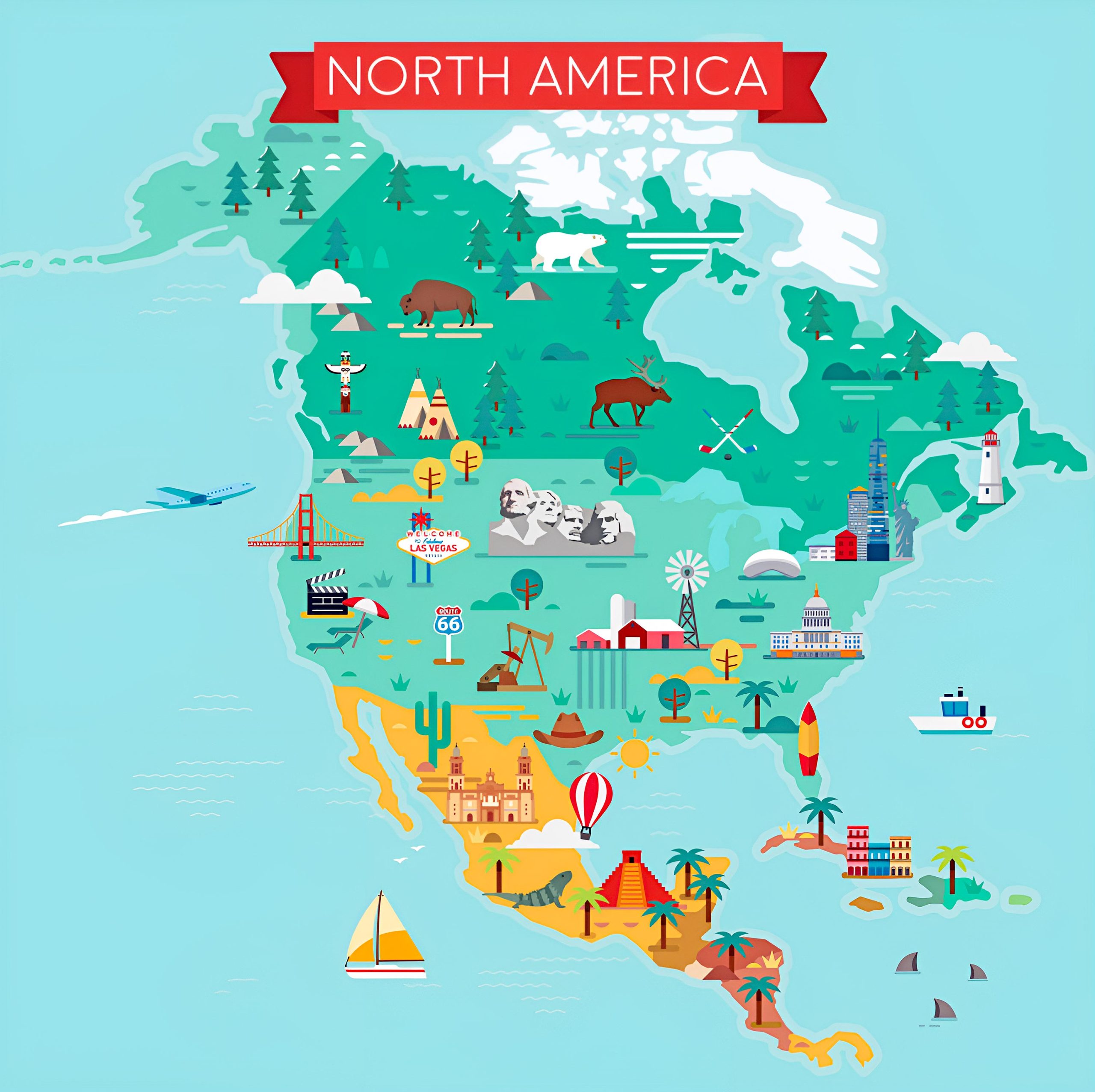
19. North America Travel (Tourist) Map
Keen on exploring tourist hotspots? Our Travel Map highlights the must-visit places.
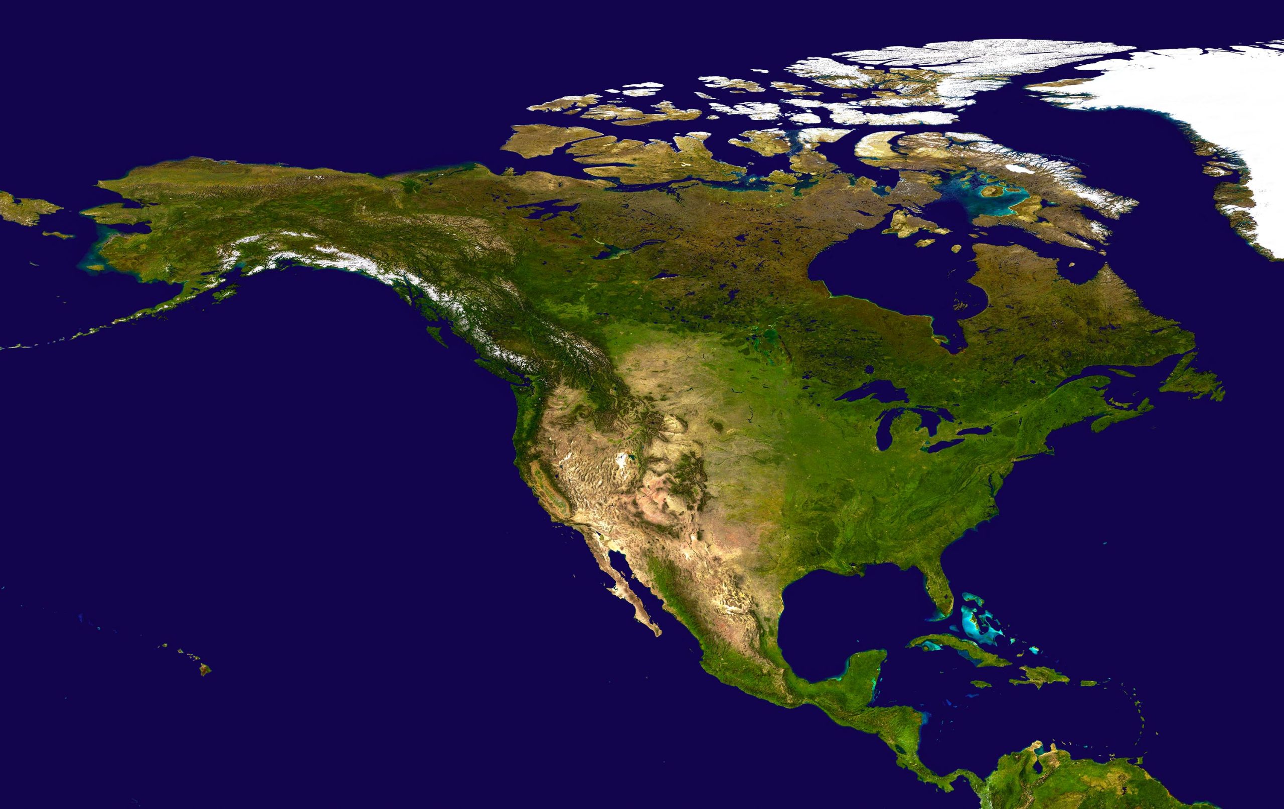
20. North America Earth Satellite 3D Map
Experience a digital elevation model, offering a mesmerizing 3D visualization satellite of Europe’s terrains.
Feel free to explore these pages as well:
- North America Historical Map ↗️
- North America Earth Map ↗️
- North America Satellite Map ↗️
- Physical Map of North America ↗️
- Political Map of North America ↗️
- Map of North America ↗️
To truly grasp the complexity and beauty of North America, one must not only traverse its lands but also understand the stories its maps tell. From the physical landscapes that have shaped civilizations, to the political borders that have seen countless historical events, and the rich cultural tapestry highlighted through linguistic diversities, these maps serve as a silent testament to the ever-evolving narrative of this continent. As we conclude our journey today, we hope you leave with a deeper appreciation for North America, armed with the knowledge and perspectives these maps have unveiled. May your future adventures, whether on foot or through the pages of a map, be filled with discovery and wonder.
Where is North America in the World Map? Show Google interactive map, satellite map, where is the country located. Get direction by driving, walking, bicycling, public transportation and travel with street view.
