A collection of Canada Maps; View a variety of Canada physical, political, administrative, relief map, Canada satellite image, higly detalied maps, blank map, Canada world and earth map, Canada’s regions, provinces, cities, road, maps and atlas.
Canada Map with Provinces
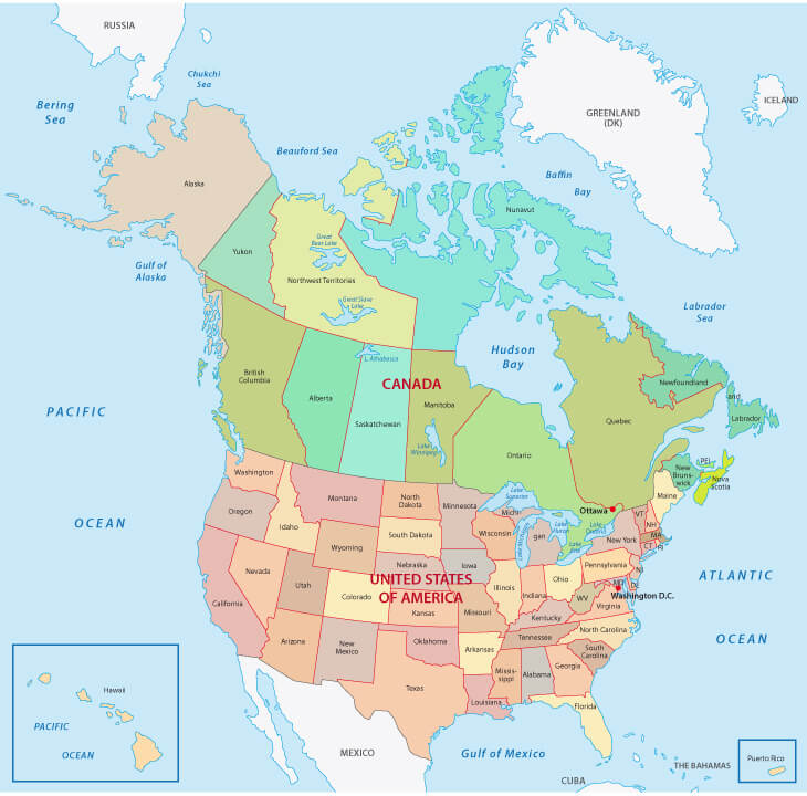
 Canada country map with national state borders and provinces: This map of Canada vividly illustrates the country’s vast and diverse landscape, which is divided into its national provinces and territories, from the expansive wilderness of the Yukon and Northwest Territories in the north to the bustling cities of Ontario and Quebec in the south. Canada’s major territories are British Columbia, Alberta, and Manitoba, and the major cities are Toronto, Vancouver, and Montreal.
North America Map with Canada
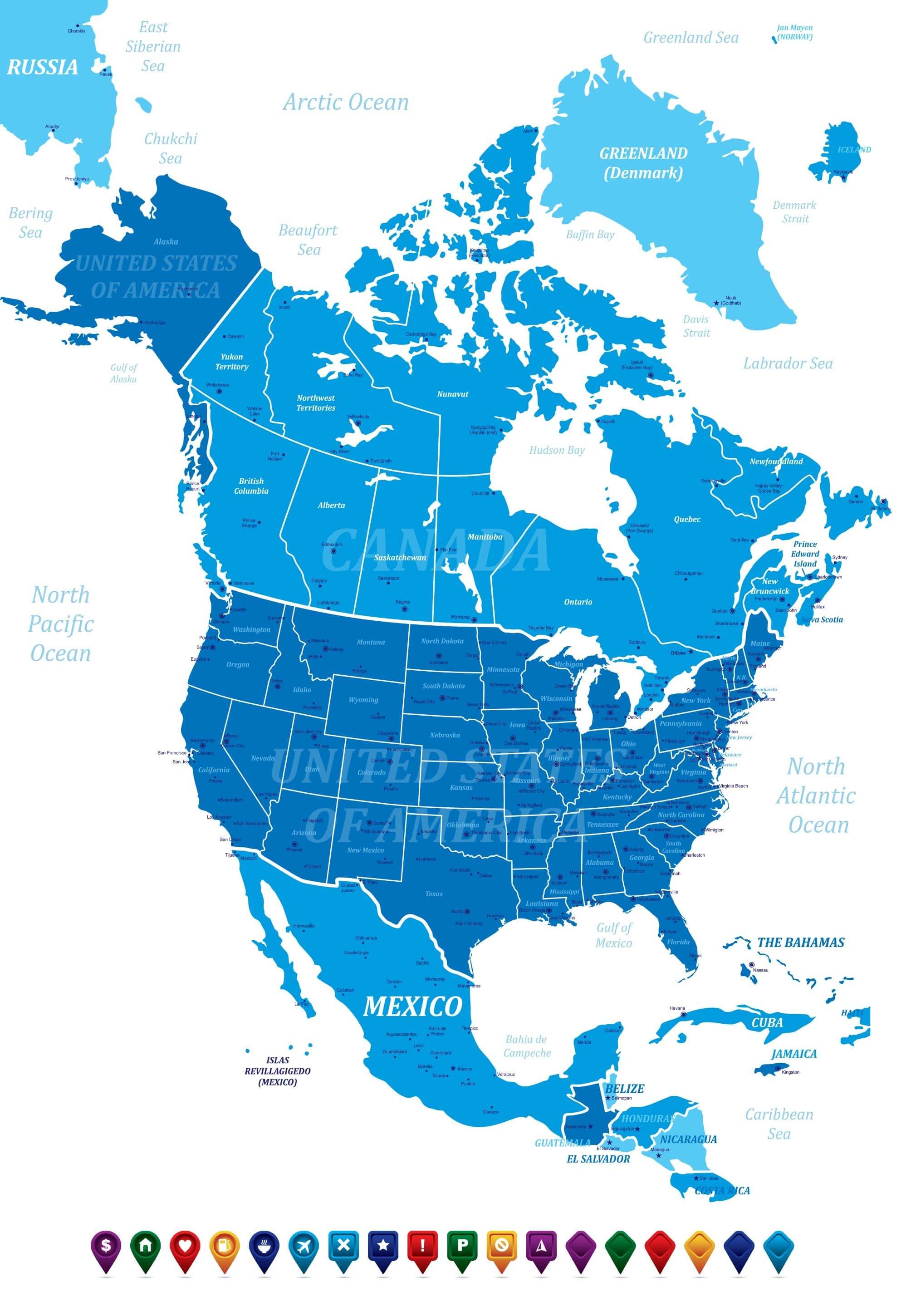 North America Map with Canada, American Countries, Cities, and States: The map shows the United States of America and Canada with its states. It is a political map that includes Mexico, the Central American countries, Cuba, Jamaica, the Bahamas, and countries in the Caribbean. The map of North America highlights these countries’ major cities and states. It shows the vast land areas with country and state boundaries, from the icy Arctic regions of Canada to the warm, tropical climates of Central America.
Canada Provinces Territories Map

Map of provinces and territories of Canada
Canada Map USA, North America
North America, USA Map with Canada
Canada territories Map
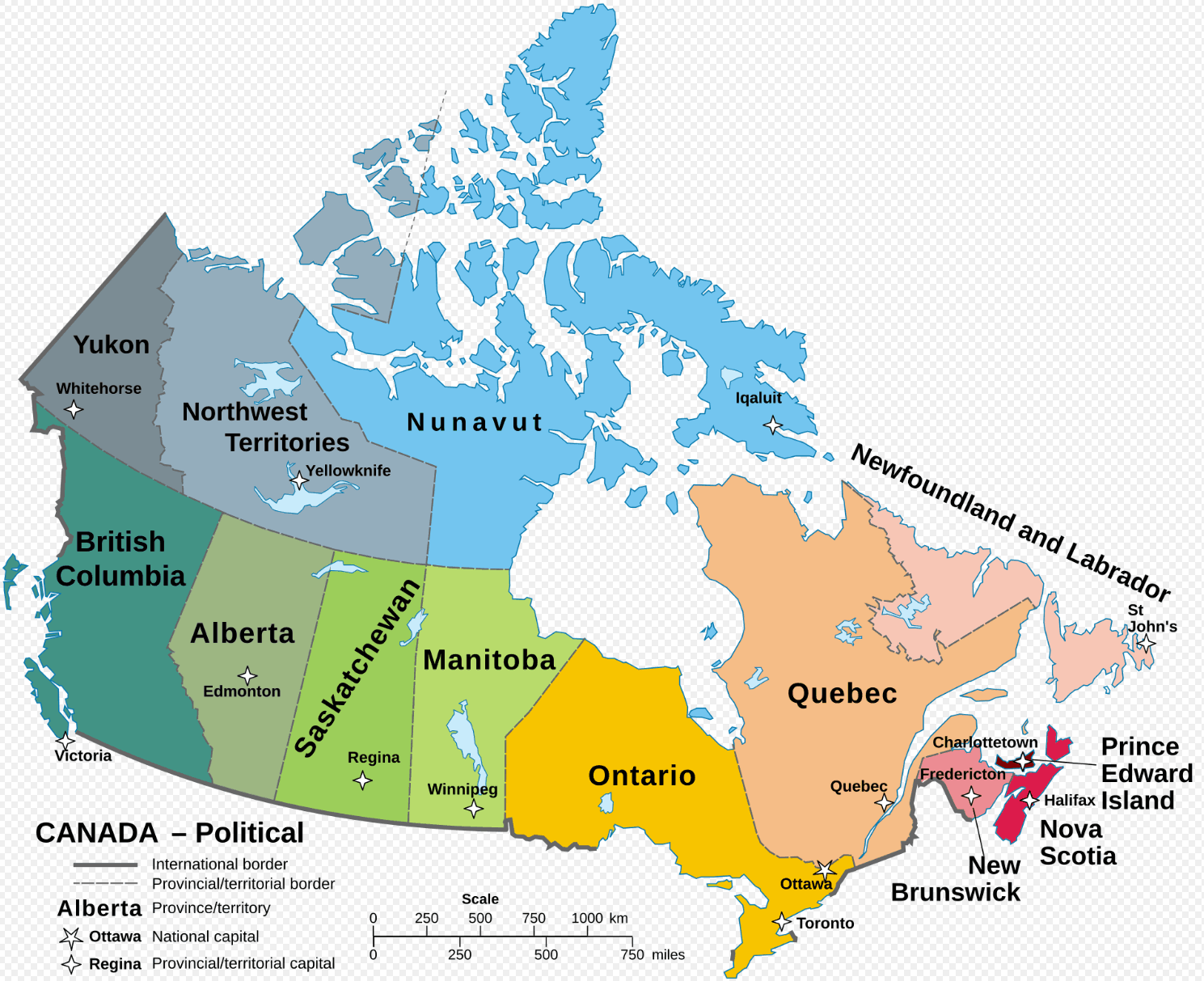
This map of Canada shows the country’s political divisions, highlighting its territories. In the northern regions, large territories like Yukon, Northwest Territories, and Nunavut are shown, known for their vast, sparsely populated landscapes. The southern regions display the more densely populated provinces like British Columbia, Alberta, Ontario, and Quebec, which are home to major cities like Vancouver, Edmonton, Toronto, and Montreal.
Detailed Map of Canada
Vintage Map of Canada with flag
 Vintage Map of Canada with flag. Highly detailed vector illustration.
Canada Map
 Canada Map with states and borders.
Detailed Map of Canada
 Map of Canada with detailed illustration
Canada Administrative Map
Canada Administrative Map with states border and major cities of Canada.
Canada States Map with United States
 Canada States Map with national border and United States country border map with US states.
Where is Canada in the World?
Show Google map, satellite map, where is the country located.
Get direction by driving, walking, bicycling, public transportaion and travel with street view.
Feel free to explore these pages as well:
A Collection of Canada Maps ↗️
Vancouvers top 10 places to visit↗️
10 must visit cities from the 2023 liveability index↗️