- Advertisement -
Where is Angola, geography of Angola, enlargeable topographic map of Angola, including political maps, physical map, cities map, satellite images of Angola, location, itinerary, atlas, border map, cities maps and find more travel maps.
Angola atlas

Angola cities map

Angola location map

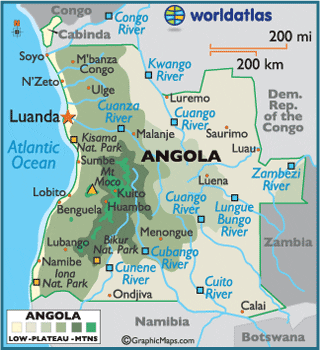
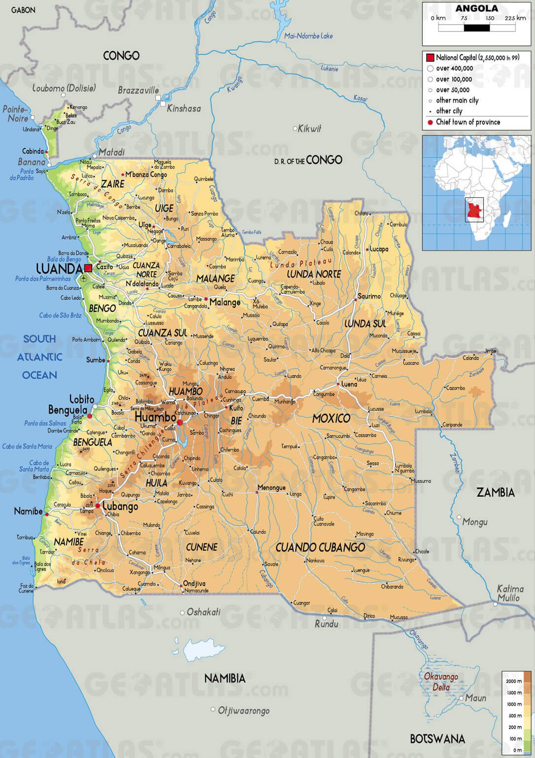
Angola physical map

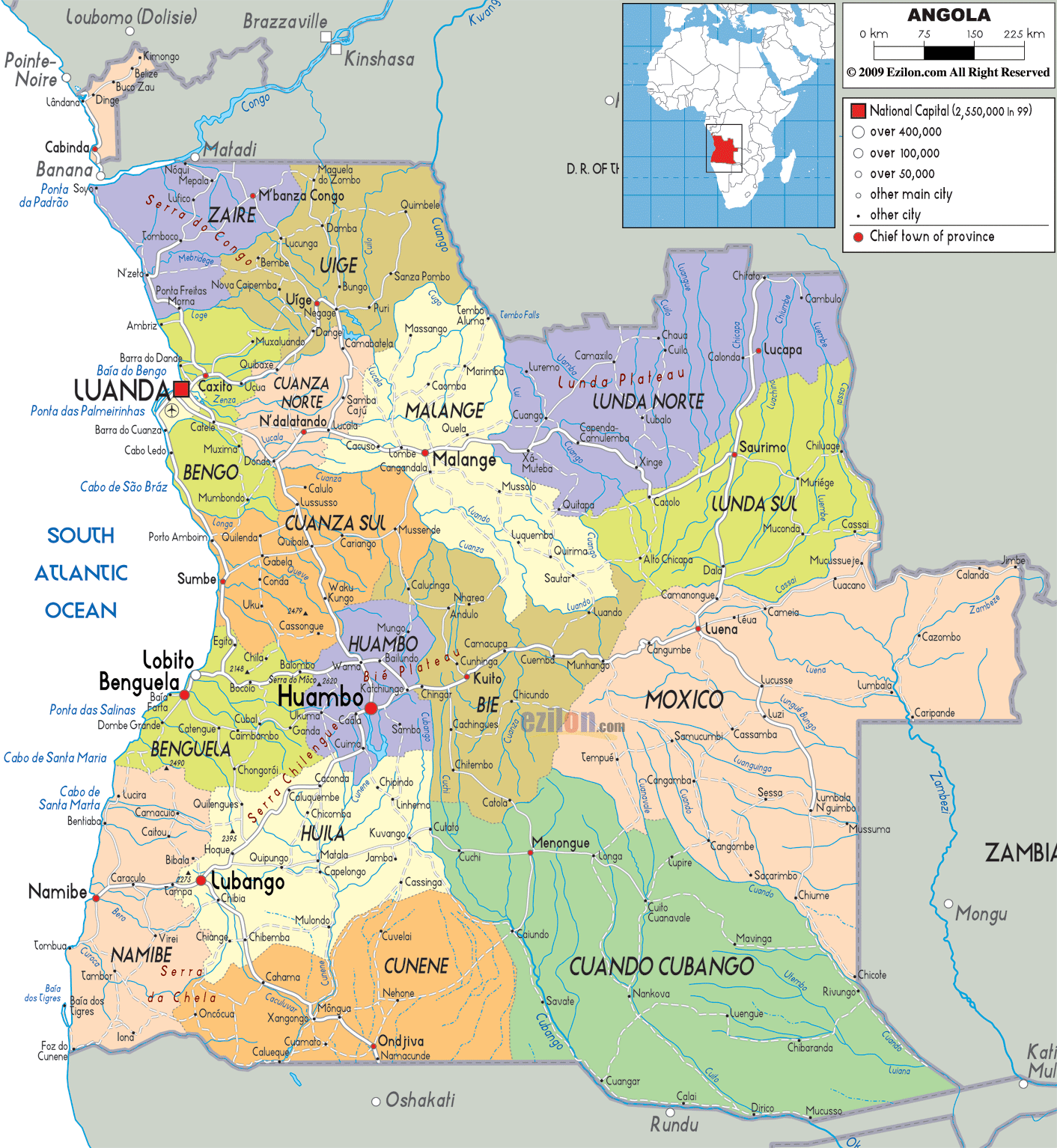
Angola political map

Angola river map
Angola road map

Map of Angola

Where is Angola in the World

Angola Earth Map

Angola google map

Angola Map Africa

Angola map cities

Angola map physical
Angola Map

Angola provinces map

Angola relief map

Angola Maps

Physical Map of Angola

Political Map of Angola

Cities Map of Angola
- Advertisement -