South America, a land where ancient rainforests meet majestic mountain ranges, where vibrant cities resonate with a blend of colonial and modern influences, and where stories from ancient civilizations intertwine with present-day narratives. As diverse as its ecosystems are the tales of its people, traditions, and histories. Delve deep into the heart of this enchanting continent with our meticulously curated collection of maps. Whether you’re a scholar, a wanderer, a history buff, or simply a curious soul, these maps promise to be your perfect companion in understanding and appreciating the multifaceted gem that is South America.
1. South America Physical Map
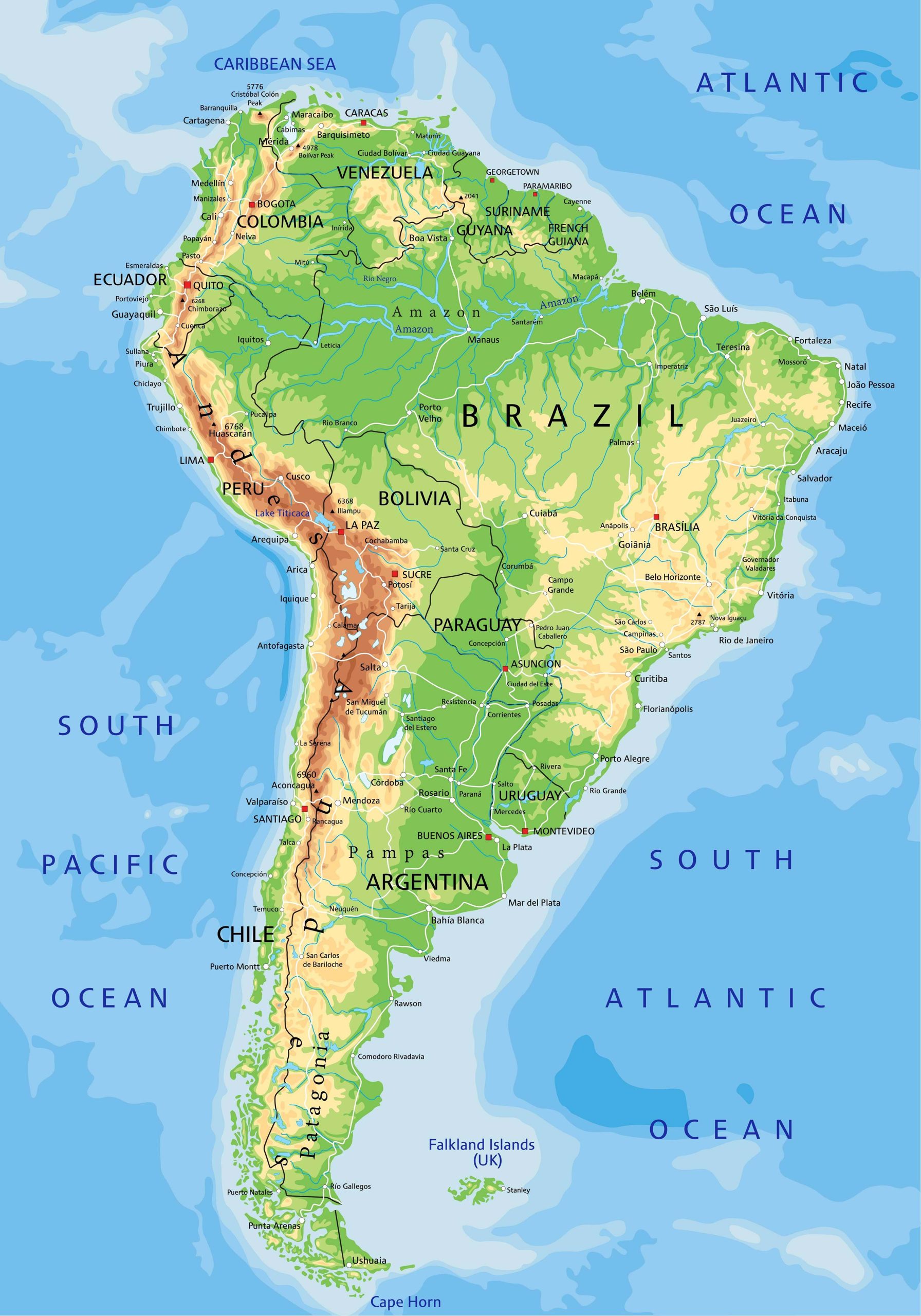
Capture South America’s landforms, mountains, and plains. Discover the towering Andes mountain range, the sprawling Amazon basin, and more.
2. South America Political Map
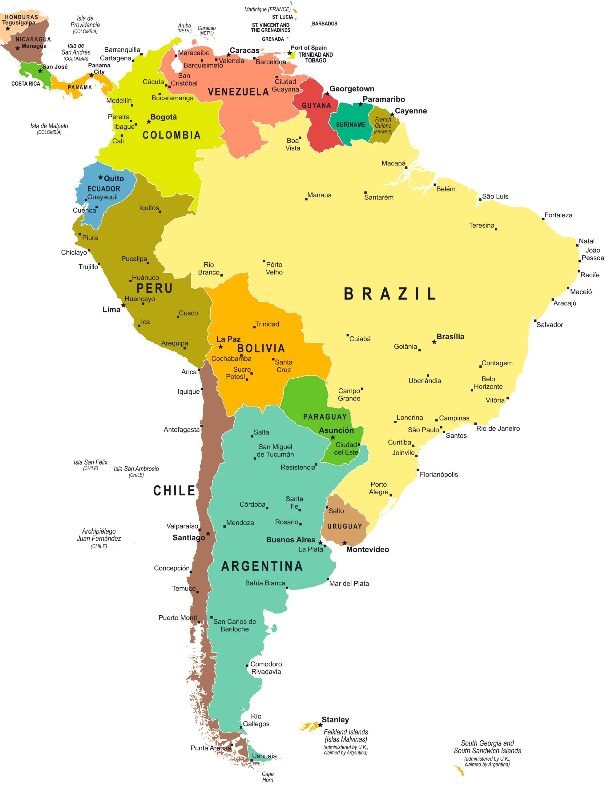
An overview of the countries and territories of South America, showcasing their borders and governance.
3. South America Topographic Map
Dive deeper into the geographical features, highlighting elevations, depressions, hills, valleys, and more.
4. South America Geological Map
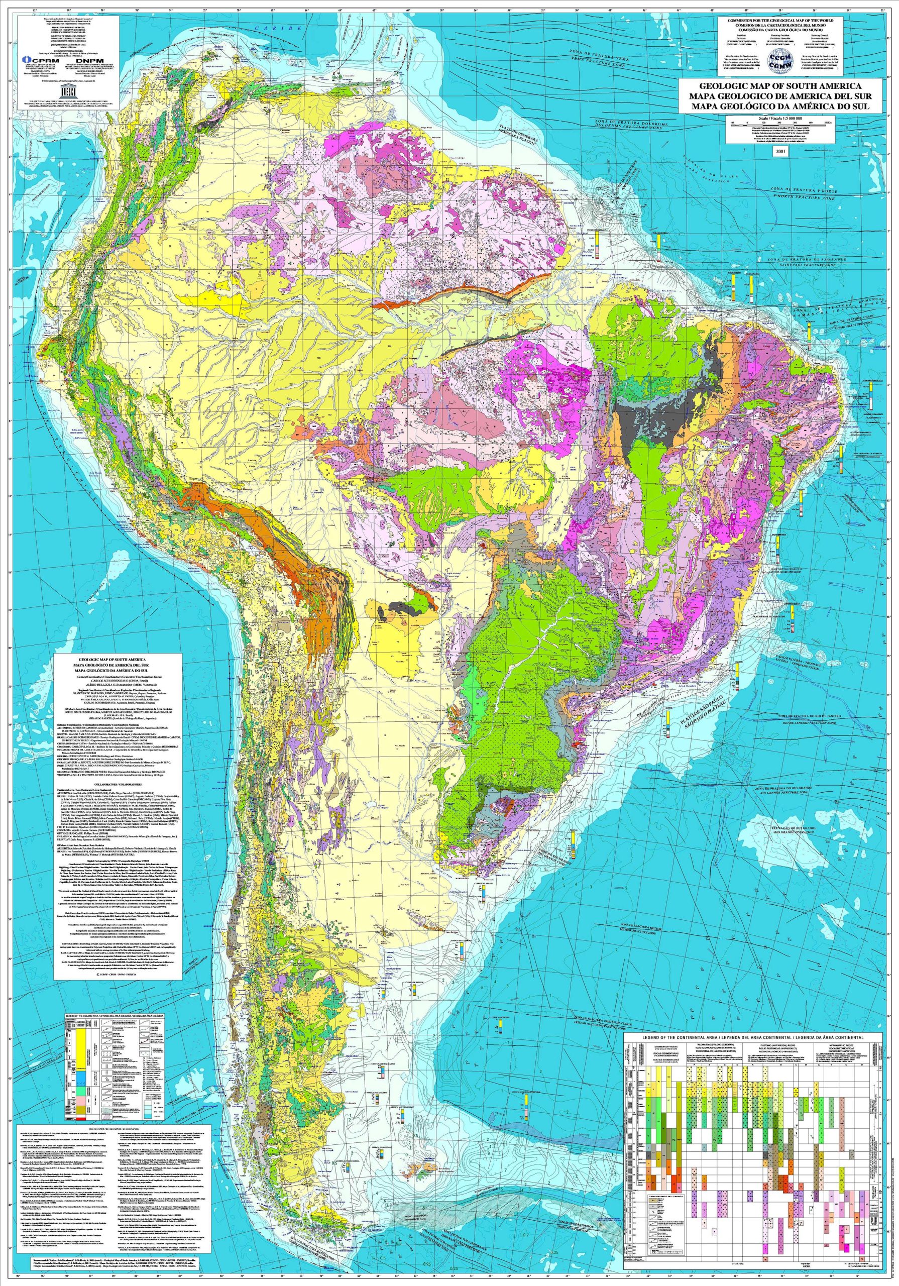
Delve into the rock formations and underlying structures of the continent, essential for geologists and mining enthusiasts.
5. Countries, Capitals and Major Cities of the South America Map
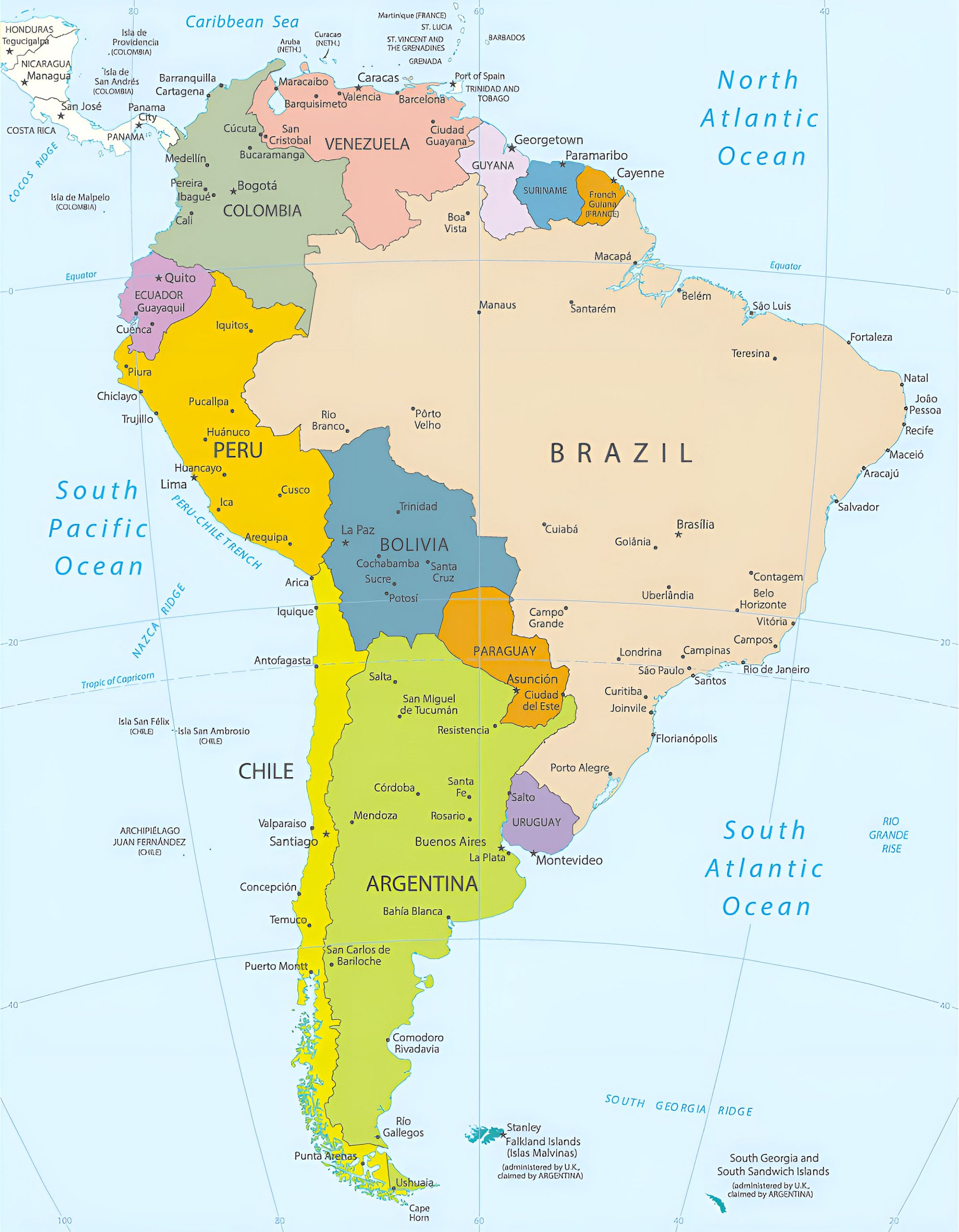
A one-stop guide to the political units and major urban centers in South America.
6. Latin America Regions Map (North & South America)
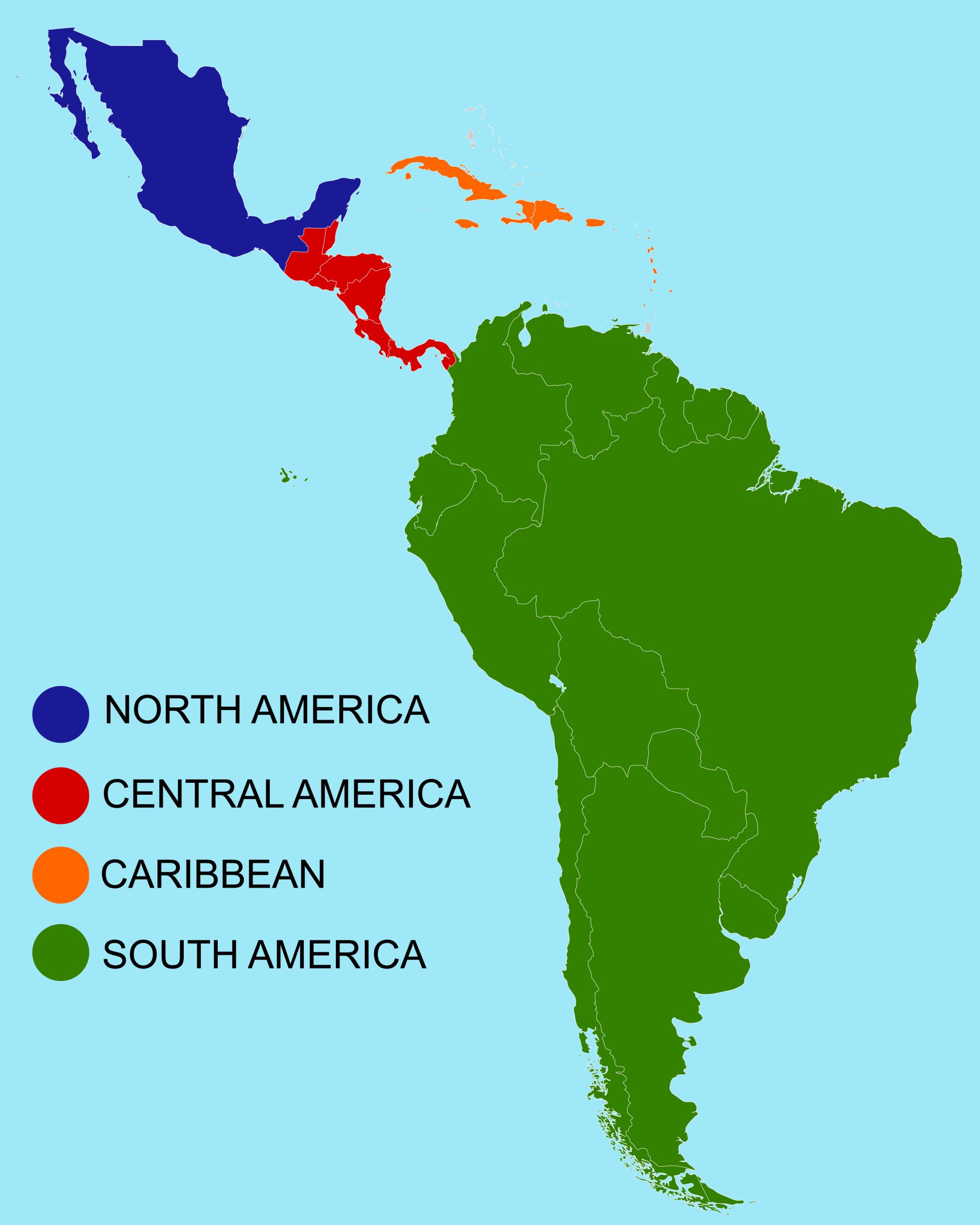
Journey through the vibrant tapestry of Latin America with our comprehensive regions map, spanning both North and South America. A must-watch for geography buffs and curious minds alike!
7. South America Blank Map
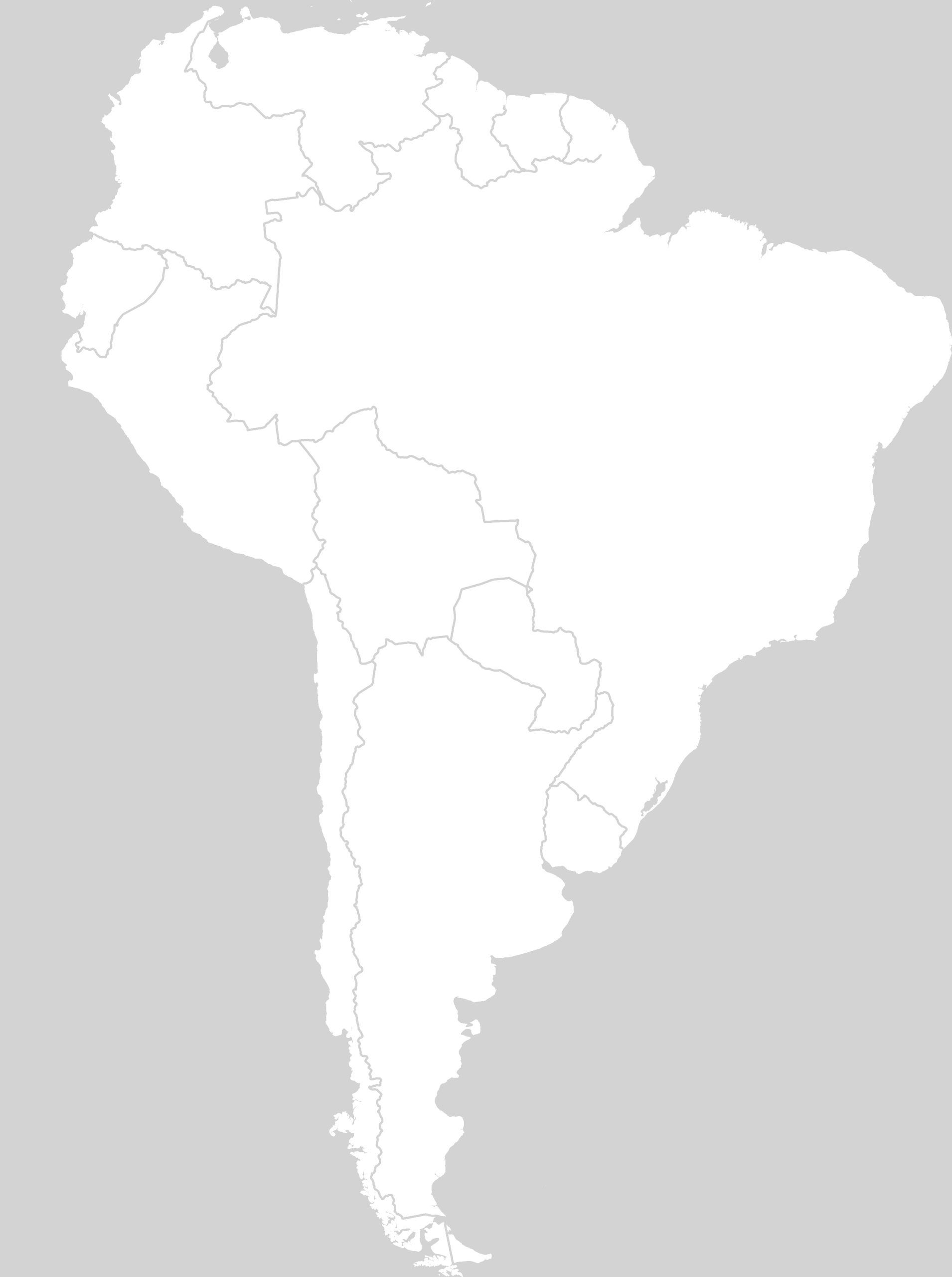
Ideal for educators and students, this offers a clean slate for memory drills, quizzes, or personal annotations.
8. South America Rivers Blank Map
For students and educators, we offer a Blank Map—perfect for practice and memory tests.
9. South America Colonial Map (1870)
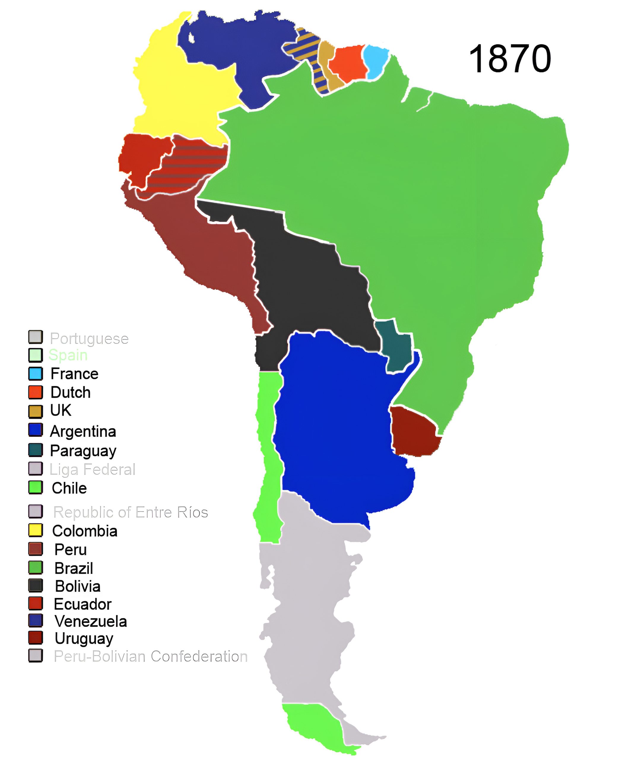
Take a trip back in time to view the colonial divisions from various empires that once ruled over South America.
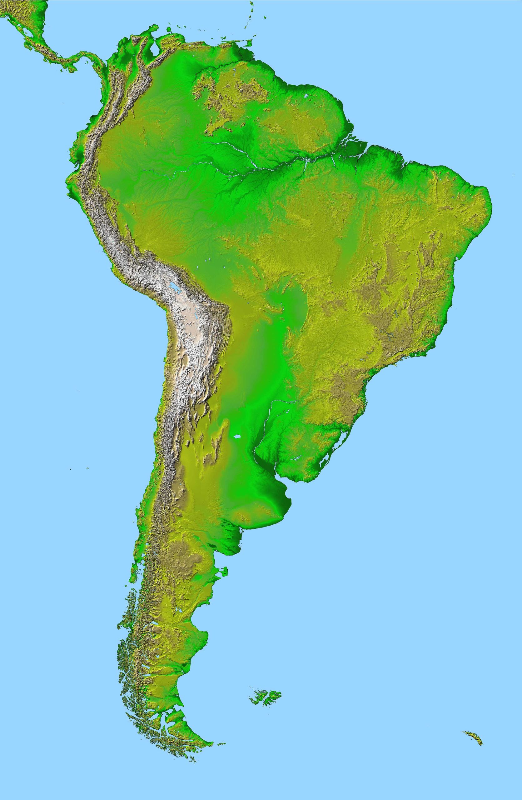
10. South America Relief Map
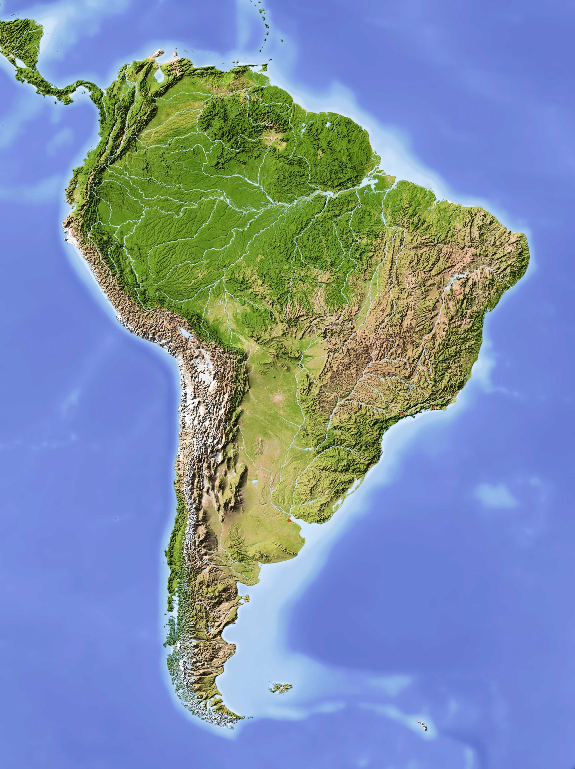
A 3D representation of South America’s terrains, capturing the physical landscape in remarkable detail.
11. South America Groundwater Resources Map
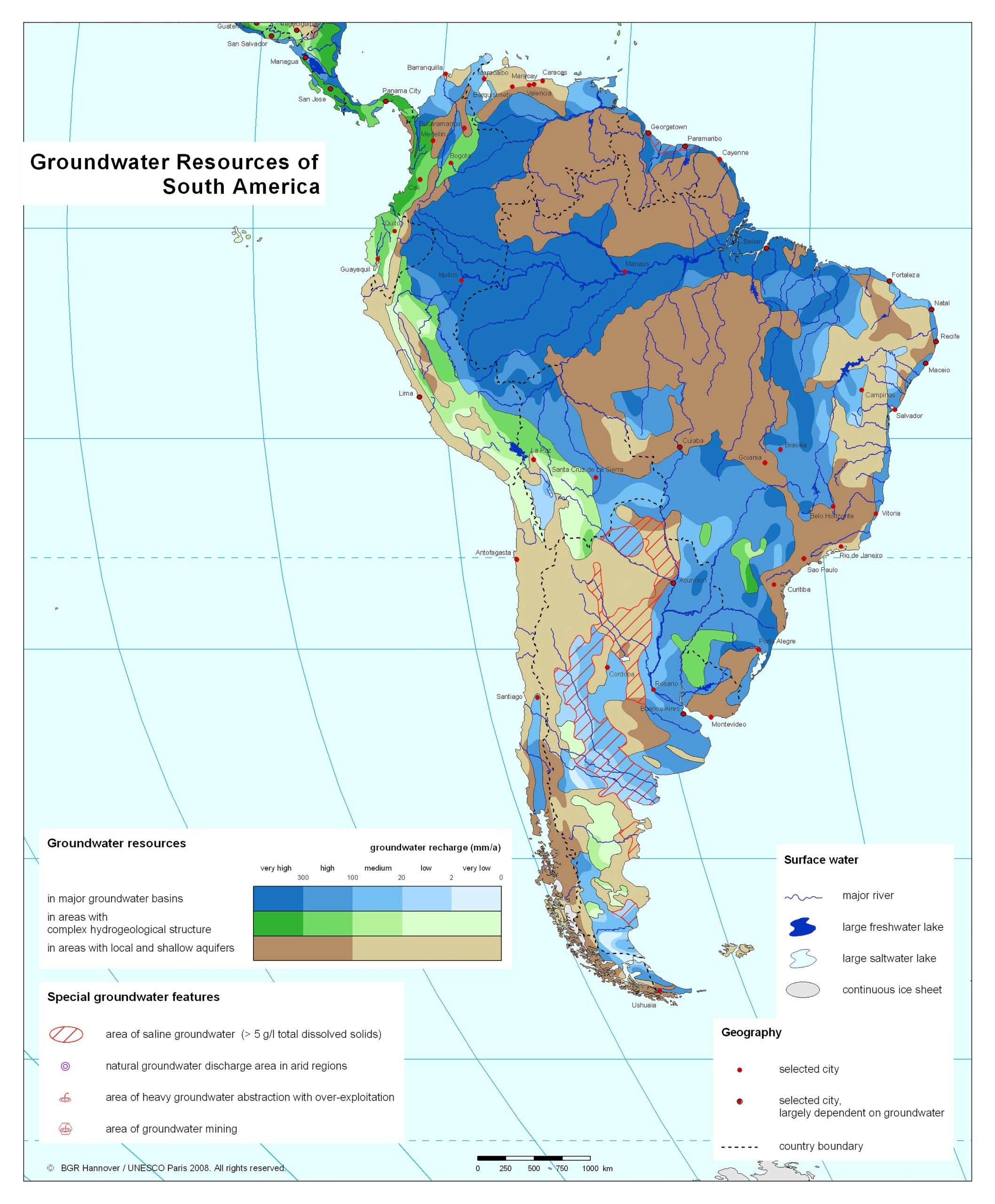
The Hydrological Divides of North America Watersheds Map provides a detailed visualization of the continent’s water divides, marking boundaries between drainage basins. An invaluable tool for understanding the flow and convergence of North America’s water resources.
12. South America Historical Map
Unravel the chronicles of South America, from ancient civilizations to modern nation-states.
13. South America Historical Geography Map (1750 – Robert de Vaugondy)
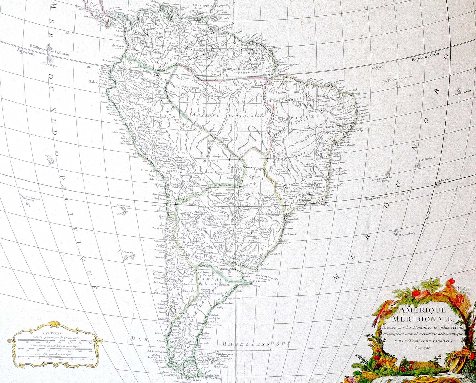
Dive into the 1750 map of South America by the esteemed geographer, Robert de Vaugondy. This cartographic gem from the 18th century beautifully encapsulates the continent’s contours and settlements of the era, providing a rare glimpse into historical perceptions and insights.
14. South America Countries by GDP (PPP) Per Capita Map (2019)
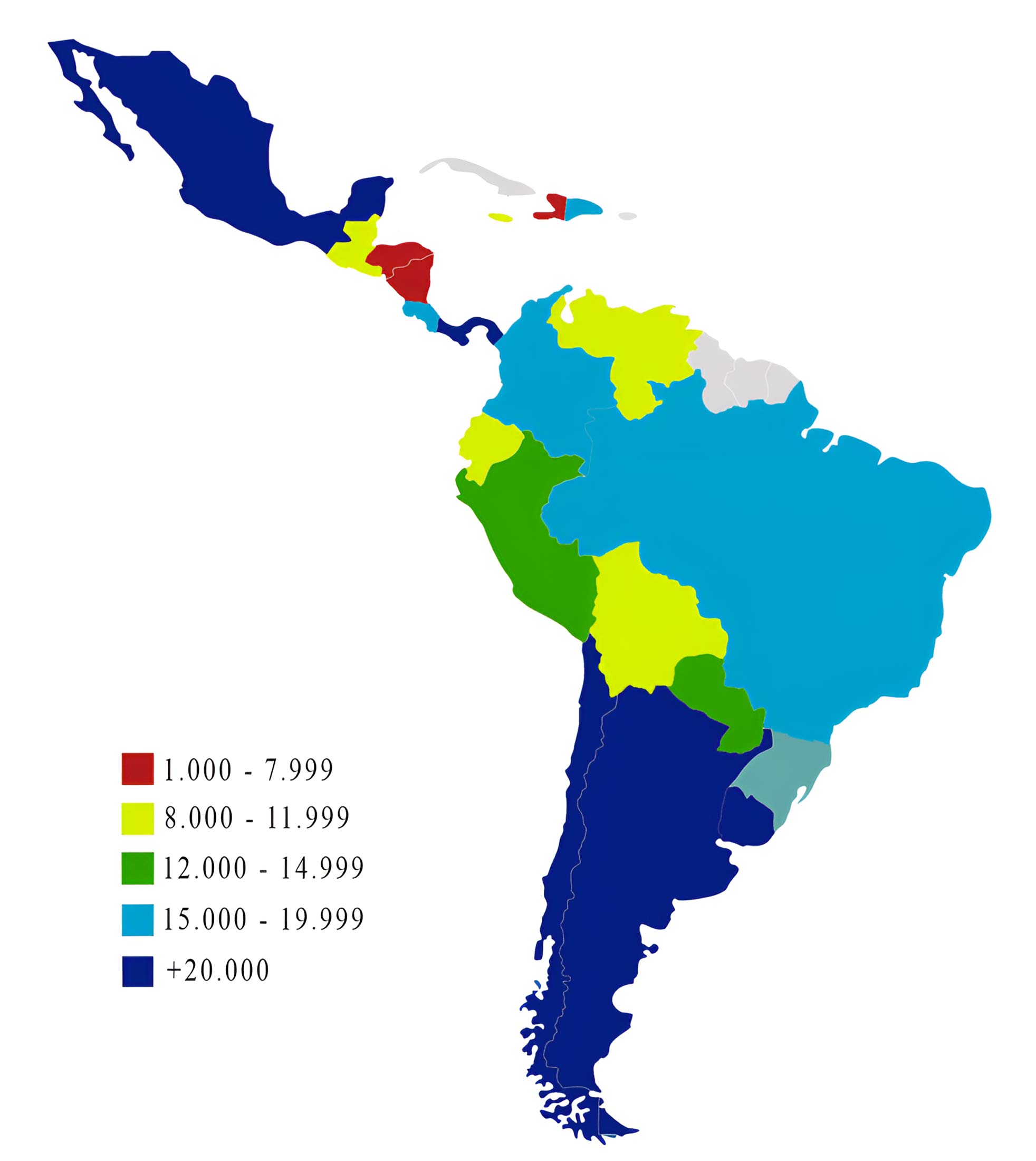
Visualize the economic prowess of South American nations with this GDP-centric map.
15. South America Climate Map (1980 – 2016)
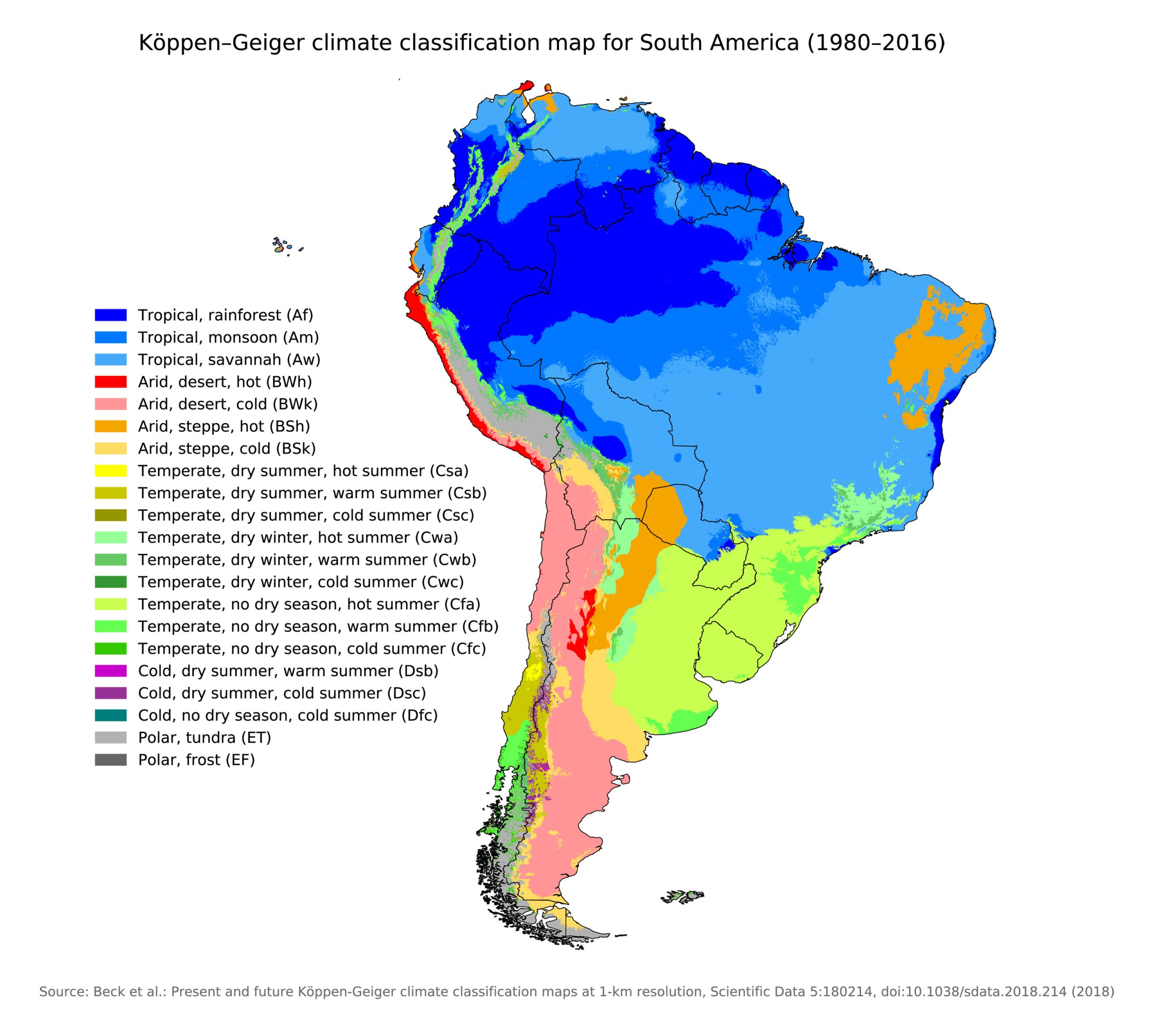
Navigate through the diverse climatic zones of the continent, from the tropical rainforests to the chilly Andean heights.
16. South America Flag Map
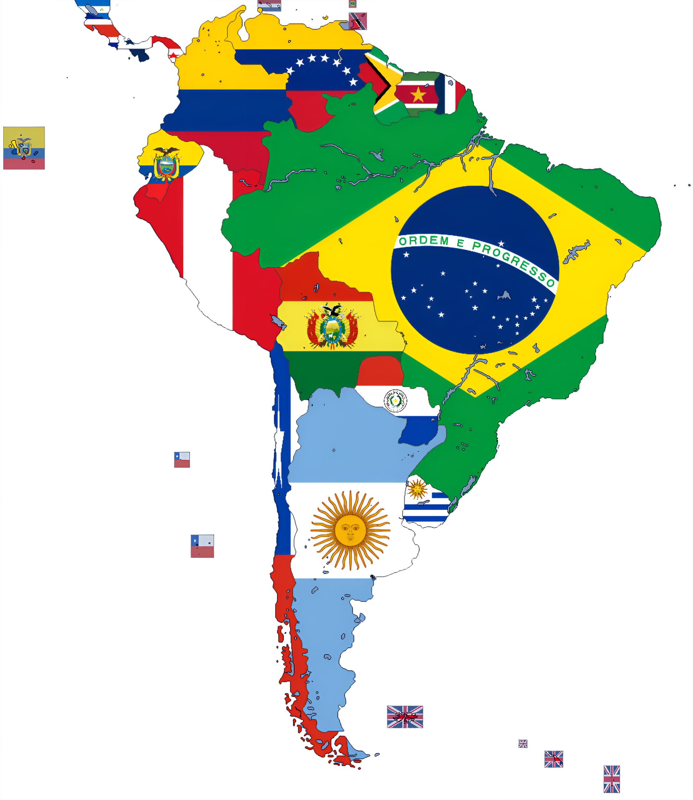
Celebrate the unique flags of each country, depicted within their respective borders.
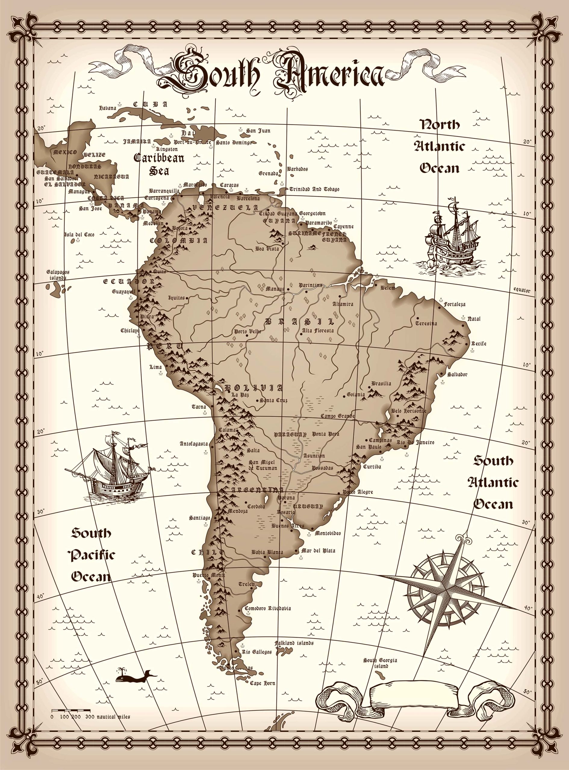
17. South America Travel (Tourist) Map
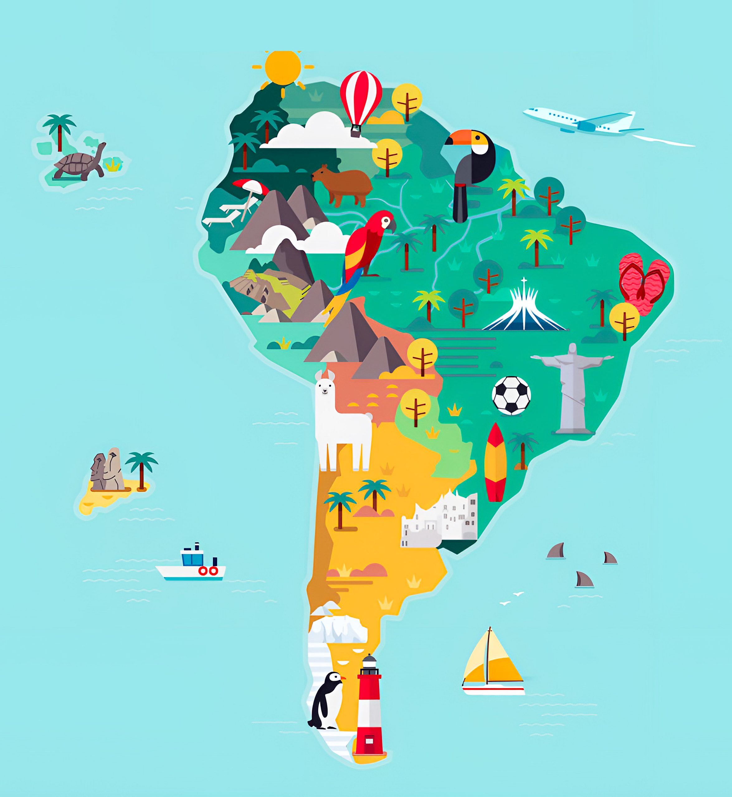
Catered to adventurers, highlighting must-visit spots, scenic routes, and hidden gems.
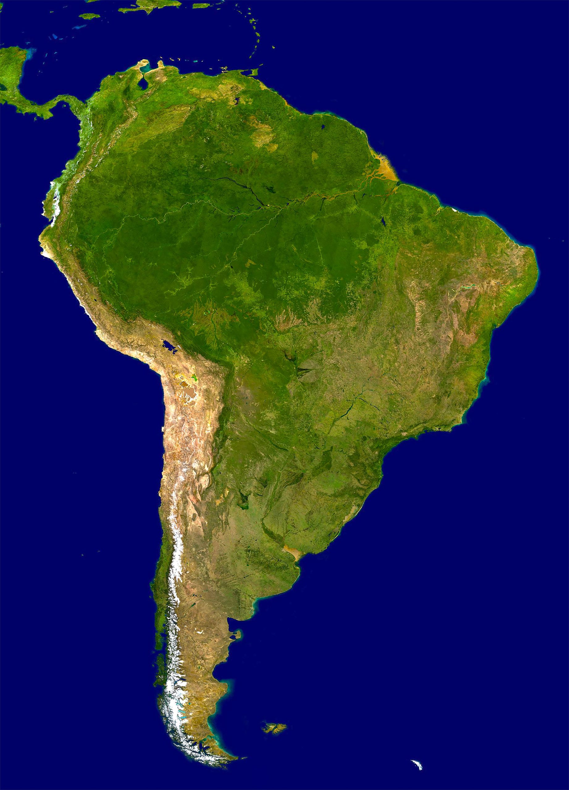
20. South America Earth Satellite Map
A bird’s eye view of the continent, as seen from space. Witness the beauty of South America from a cosmic perspective.
Feel free to explore these pages as well:
- A Collection of North America Maps ↗️
- Map of Brazil ↗️
- Argentina Map ↗️
- Map of South America ↗️
- A Collection of Europe Maps ↗️
- Map of World ↗️
Happy mapping and exploring! Let the diverse landscapes and stories of South America not only guide your next adventure or research project but also inspire a deeper connection and appreciation for a continent that has continuously shaped the course of history, culture, and human exploration. Embrace the journey of discovery, and let South America’s vastness and variety captivate your heart and mind.