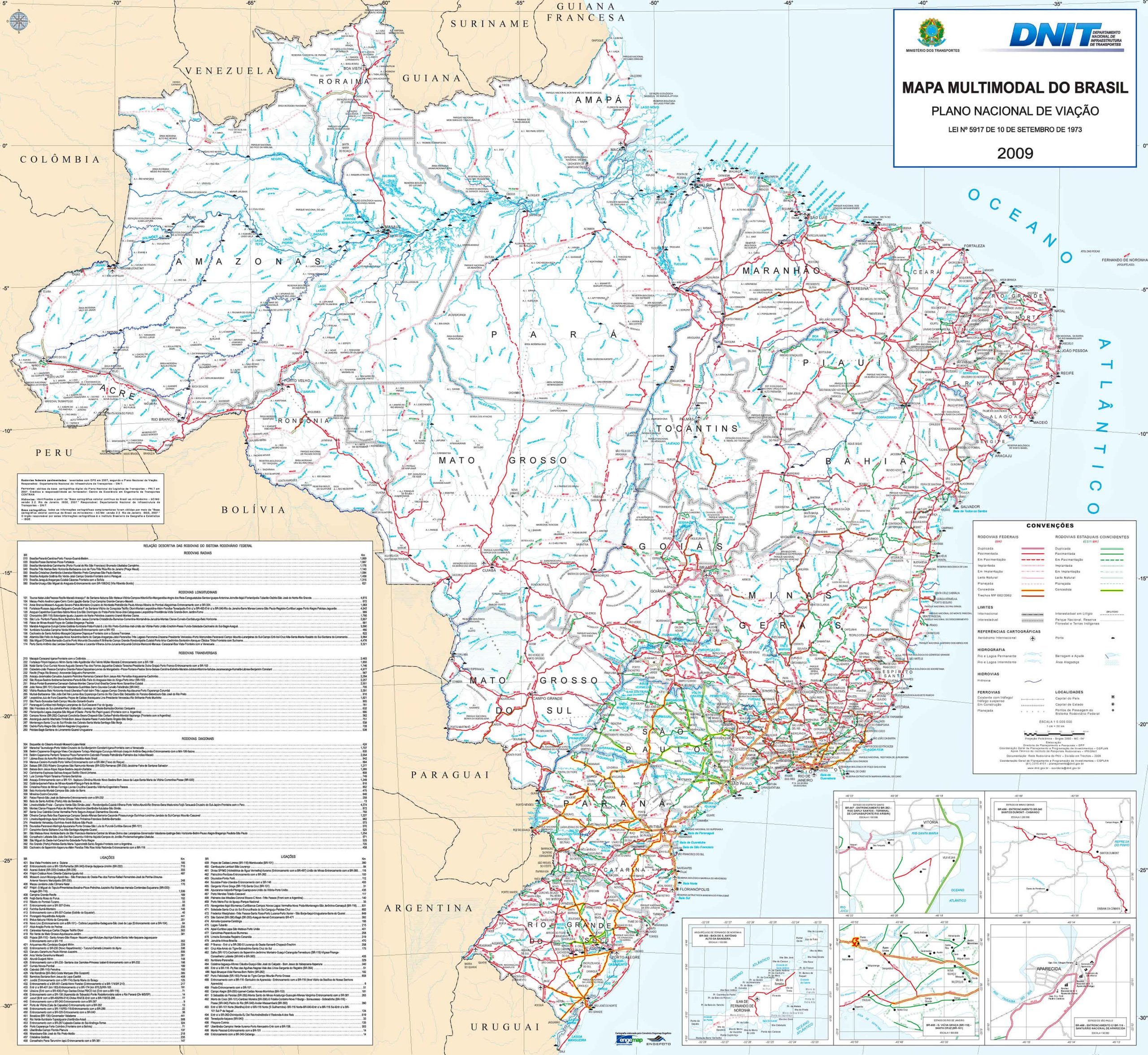
Welcome to our fascinating exploration of Brazil through maps! This blog post is designed to take you on a visual and informative journey across various aspects of Brazil, one of the most vibrant and diverse countries in the world. From its stunning physical landscapes to its rich political history, we’ll discover Brazil in a way you’ve never seen before. Whether you’re a geographer, a student, a traveler, or just someone with a keen interest in learning about different parts of the world, this collection of maps promises a comprehensive understanding of Brazil’s multifaceted nature.
1. Brazil Physical Map
Brazil’s physical map reveals a country of diverse landscapes. From the Amazon Rainforest in the north to the rolling hills and plains in the south, this map vividly illustrates the natural terrain that makes Brazil an ecological treasure.
2. Brazil Political Map
The political map of Brazil shows its 26 states and the Federal District of Brasília, the capital. It provides insights into the country’s political boundaries and how they intersect with its geography, highlighting major cities like São Paulo and Rio de Janeiro.
3. Brazil Topographic Map
A topographic map of Brazil offers a detailed representation of the country’s physical features, including elevation and landforms. It’s fascinating to see the contours of the Amazon Basin and the highlands in the southeast.
4. Brazil Relief Map
The relief map brings Brazil’s topography to life. It accentuates features such as the Pantanal wetlands, the vast Amazon basin, and the sharp escarpments along the coast, providing a 3D perspective of the terrain.
5. Brazil Geological Map
Brazil’s geological map is a window into its ancient past. It details the various rock formations and mineral resources, crucial for understanding the country’s mining potential, especially in regions like Minas Gerais.
6. Brazil Cities (Urban) Map
This map showcases Brazil’s major urban centers. It highlights the sprawling cities like São Paulo, the iconic landscapes of Rio de Janeiro, and emerging cities like Curitiba, reflecting the urbanization of this vast country.
7. Brazil Historical Map
The historical map traces Brazil’s evolution from a Portuguese colony to a modern nation. It offers a glimpse into the colonial era, the shifting borders over centuries, and the development of its current form.
8. Brazil Regions Map
Brazil is divided into five distinct regions: North, Northeast, Central-West, Southeast, and South. This map illustrates these regions, each with unique cultural and geographical identities.
9. Brazil Administrative Divisions Map
This map details Brazil’s administrative divisions, showing its states and main cities. It’s essential for understanding the country’s local governance and regional distinctions.
10. Brazil Transit Map
The transit map provides an overview of Brazil’s extensive transportation network, including major airports, bus terminals, and port facilities, highlighting the connectivity within this vast nation.
11. Brazil Road Map
A comprehensive road map is crucial in a country where road travel is prevalent. It shows major highways and roads, including the famous BR-101 that runs along the coastline.
12. Brazil Train-Railway Map
Despite a limited railway network, this map details the existing train lines in Brazil, important for cargo transport and some passenger services, particularly in the densely populated Southeast.
13. Brazil Climatic Map
Brazil’s climatic map displays its varied climate zones, from the tropical north to the temperate zones in the south. It’s fascinating to see how climate influences the country’s ecology and lifestyle.
14. Brazil Blank Map
A blank map of Brazil is a versatile tool, ideal for educational purposes or for anyone interested in sketching out their journey or areas of interest within the country.
15. Brazil Flag Map
The flag map merges Brazil’s geography with its national symbol. It’s a patriotic representation showcasing the country’s identity through its iconic green, yellow, blue, and white flag.
16. Brazil Travel-Tourist Map
This map is a treasure for travelers, highlighting Brazil’s top tourist destinations, cultural landmarks, natural wonders like the Iguaçu Falls, and the famous beaches of Rio de Janeiro.
17. Map of Brazil’s Location in the World Map
This map puts Brazil in a global context, showing its position in South America and its borders with other countries, emphasizing its role in regional and global affairs.
18. Brazil Earth Satellite Map
An Earth satellite map offers a breathtaking view of Brazil from space, showcasing its vast green cover, sprawling cities, and the intricate coastline, reminding us of its role in global ecology.
Feel free to explore these pages as well:
Top 10 Best Rio de Janeiro Experiences ↗️
Your Essential Guide of Sao Paulo 10 Best Visit Spots ↗️
A Collection of South America Maps ↗️
Our journey across Brazil through these diverse maps has been enlightening, revealing the many layers that make up this incredible country. Each map tells a story, from the dense rainforests of the Amazon to the bustling streets of São Paulo. We hope this collection has sparked your curiosity and offered you a deeper understanding of Brazil’s geography, history, and culture. Until next time, keep exploring and discovering the wonders our world has to offer through the unique lens of maps!


