Navigate Hungary with Ease: Hungary’s comprehensive map collection makes exploring Hungary’s roads, cities, and borders easy. Featuring detailed political, physical, and satellite maps, this collection is an excellent resource for travelers, educators, and geography enthusiasts alike.
Brief information about Hungary
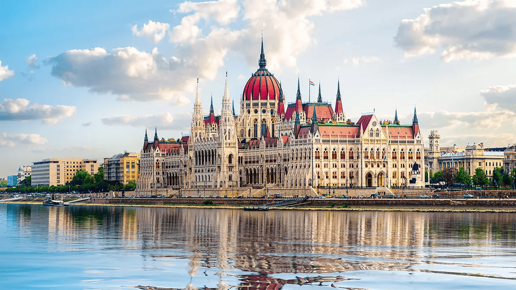
Hungary is a beautiful country located in Central Europe, known for its rich history, vibrant culture, and stunning architecture. Its capital, Budapest, is often called the “Paris of the East” because of its grand buildings, historic thermal baths, and the breathtaking views along the Danube River. Visitors can explore landmarks like Buda Castle, the Hungarian Parliament, and the iconic Chain Bridge, while enjoying the city’s famous thermal spas.
Hungary Physical Map with Cities
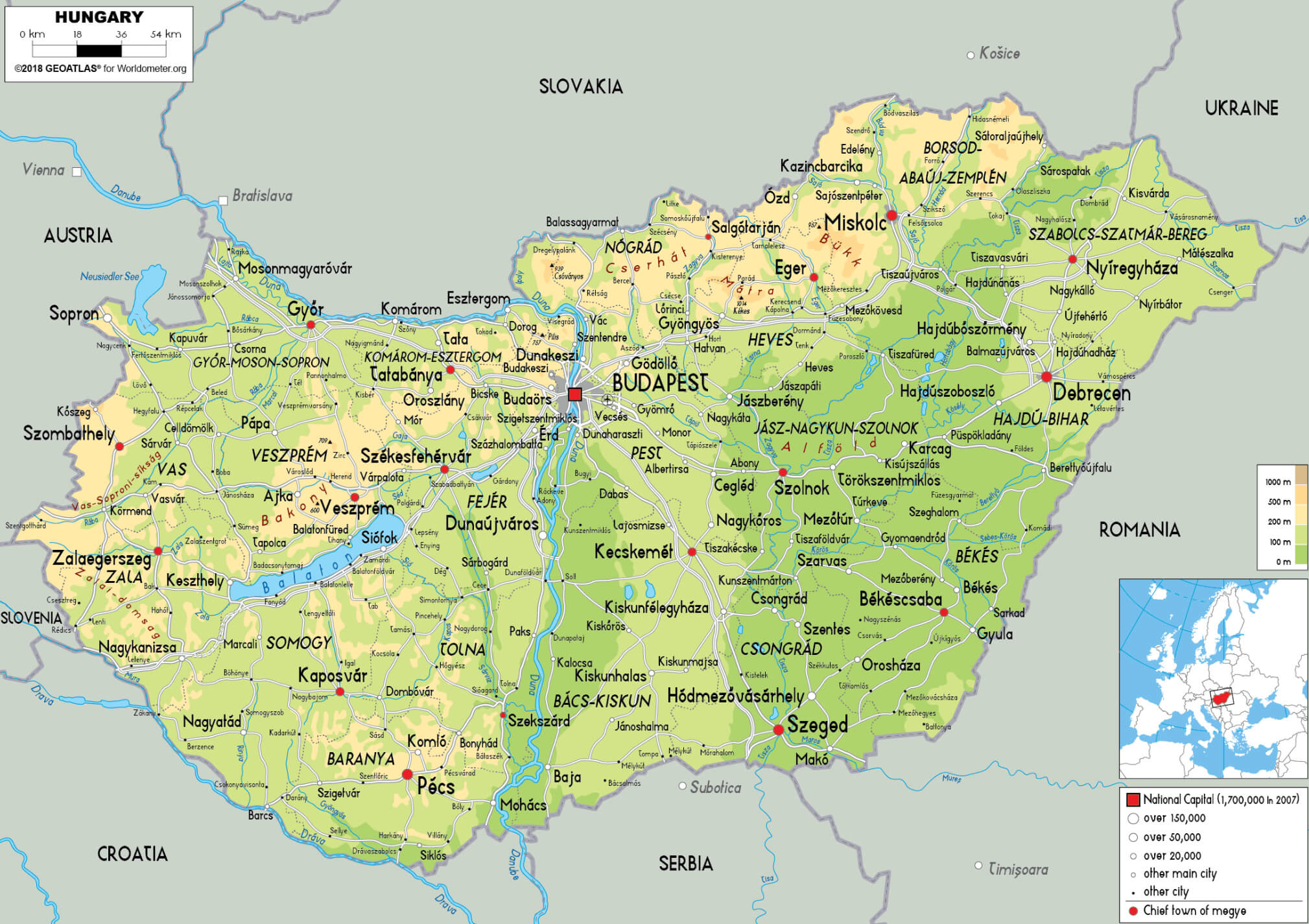 This map of Hungary shows both its physical geography and its major cities. The map highlights the country’s varied terrain, including mountains, rivers, and plains, while also pinpointing key cities like Budapest, Debrecen, Szeged, and Pécs. Major geographic features such as the Danube River, which runs through Budapest, and Lake Balaton, the largest lake in Central Europe, are also visible, reflecting Hungary’s rich natural and urban landscape.
Beyond Budapest, Hungary offers a variety of experiences. From the scenic Lake Balaton, a popular summer getaway, to charming small towns like Eger and Pécs, the country has something for every traveler. Hungary’s cuisine is also a highlight, with dishes like goulash, lángos, and chimney cakes that showcase the nation’s flavorful and hearty food traditions.
Where is located Hungary on the World Map
Hungary is a landlocked country in Central Europe, surrounded by several neighboring nations. To its north is Slovakia, while Austria lies to the west, and Romania to the east. Hungary also shares borders with Croatia, Slovenia, Serbia, and Ukraine, making it well-connected within the region. Its central location in Europe places it at the heart of both historical trade routes and modern travel destinations.
The country is positioned in the Carpathian Basin, a large and fertile area that has been home to various civilizations throughout history. The Danube River, one of Europe’s major rivers, flows through the country, including its capital, Budapest, which sits along its banks. This strategic location has historically made Hungary a cultural and political crossroads in Europe.
Hungary’s central European position also gives it a temperate climate, with warm summers and cold winters. Its geographical placement has allowed it to serve as a gateway between Western and Eastern Europe, contributing to its rich cultural diversity and historical significance.
Here are some statistical information about Hungary:
Hungary Location Map
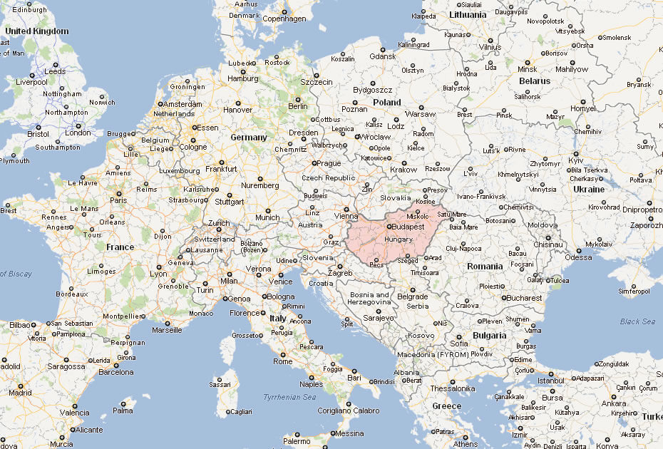
This map shows Hungary’s major cities, including Budapest, and its location in Central Europe, bordered by countries like Slovakia, Austria, and Romania.
Hungary Map
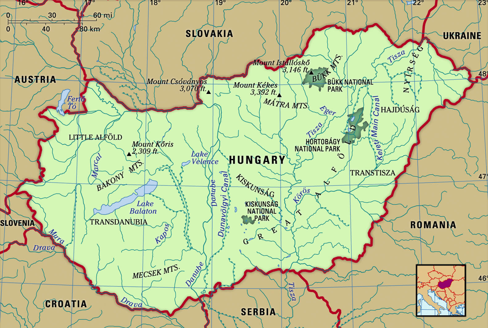
Physical Map of Hungary
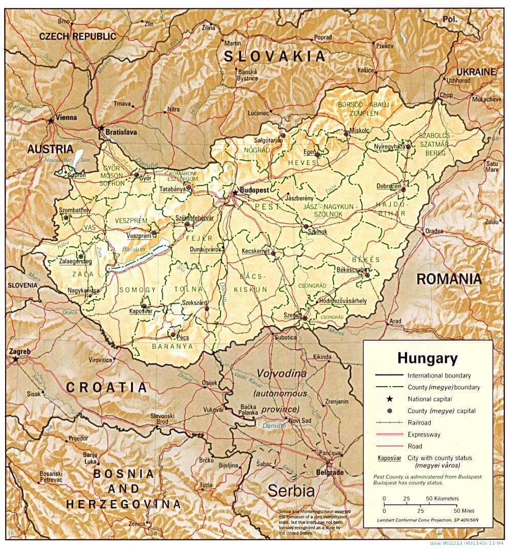
This is a physical map showing Hungary’s location in Central Europe, along with its terrain and borders with countries like Slovakia, Austria, Romania, and Serbia.
Political Map of Hungary
This map of Hungary highlights major cities, rivers like the Danube, and its borders with neighboring countries such as Slovakia, Austria, and Romania.
Hungary Road Maps
Hungarian Language Map
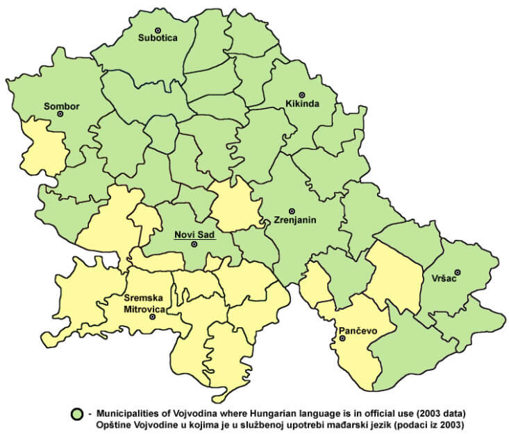 This map shows the municipalities in the Vojvodina region of Serbia where the Hungarian language was officially in use as of 2003. Vojvodina is a multi-ethnic and multi-lingual autonomous province, and Hungarian is one of the officially recognized minority languages due to the substantial Hungarian community residing there, particularly in the northern and central parts of the region. The areas marked in green represent municipalities where Hungarian has official status alongside Serbian, meaning that in these regions, public institutions provide services in Hungarian as well as Serbian.
Hungary Provinces Map
Hungary Regions Map
 This map of Hungary displays its various regions, highlighting key cities such as Budapest, Győr, Szeged, Miskolc, and Debrecen. Each region is delineated with clear boundaries, showcasing the geographic and administrative divisions within the country. The map offers a comprehensive view of Hungary’s topography and its major urban centers, providing insight into the regional structure of the nation.
Hungary Rivers Map
 This
This
Hungary Cities Map
This is a map of Hungary showing major cities, rivers, and its borders with neighboring countries. The capital, Budapest, is located in the center, with key cities like Debrecen, Szeged, and Pécs also marked.
Map of Hungary
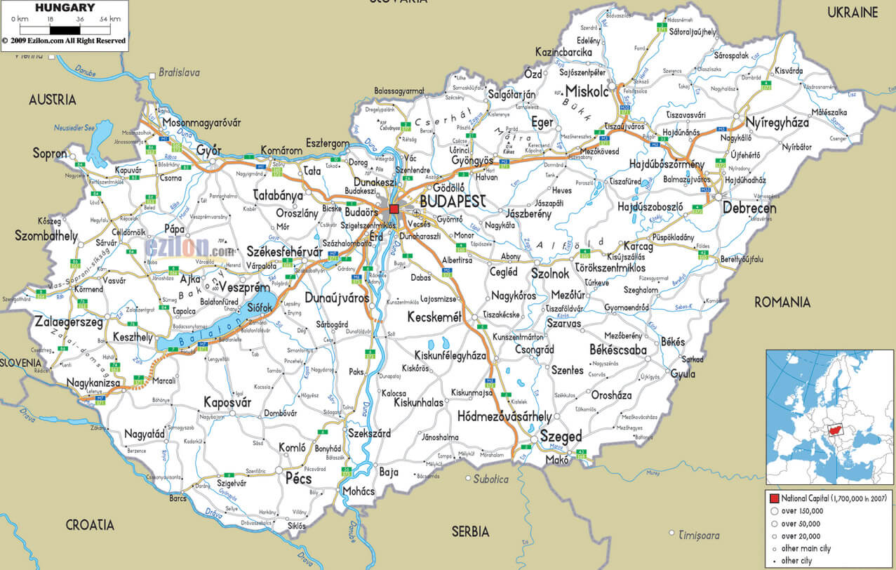
This is a political map of Hungary, highlighting major cities, road networks, and borders with neighboring countries like Austria, Slovakia, Romania, and Serbia. The capital, Budapest, is centrally located, with other prominent cities such as Szeged, Debrecen, and Pécs marked on the map.
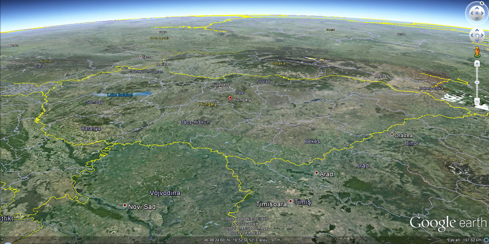
Hungary Earth Map
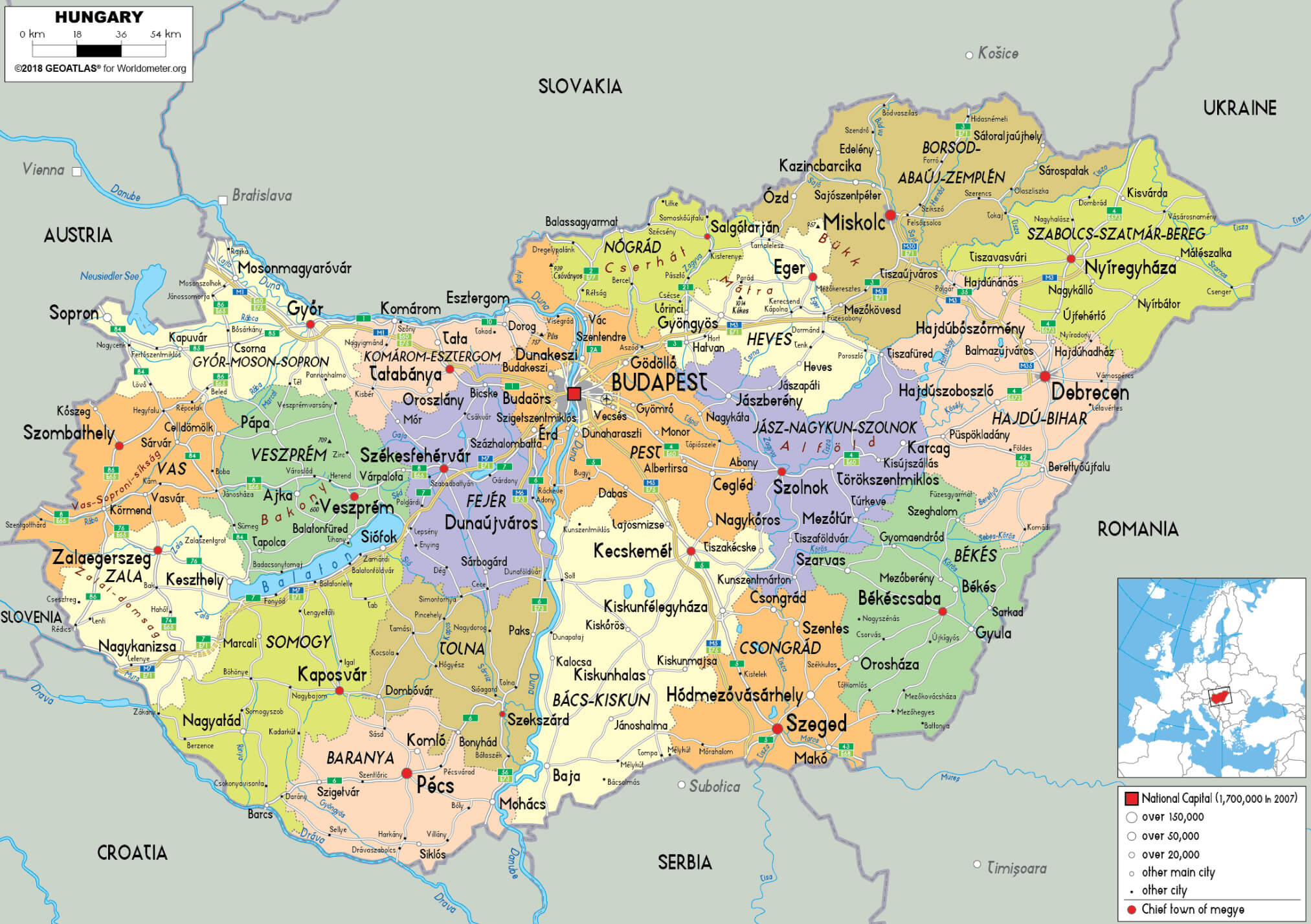
Hungary Geographic Map
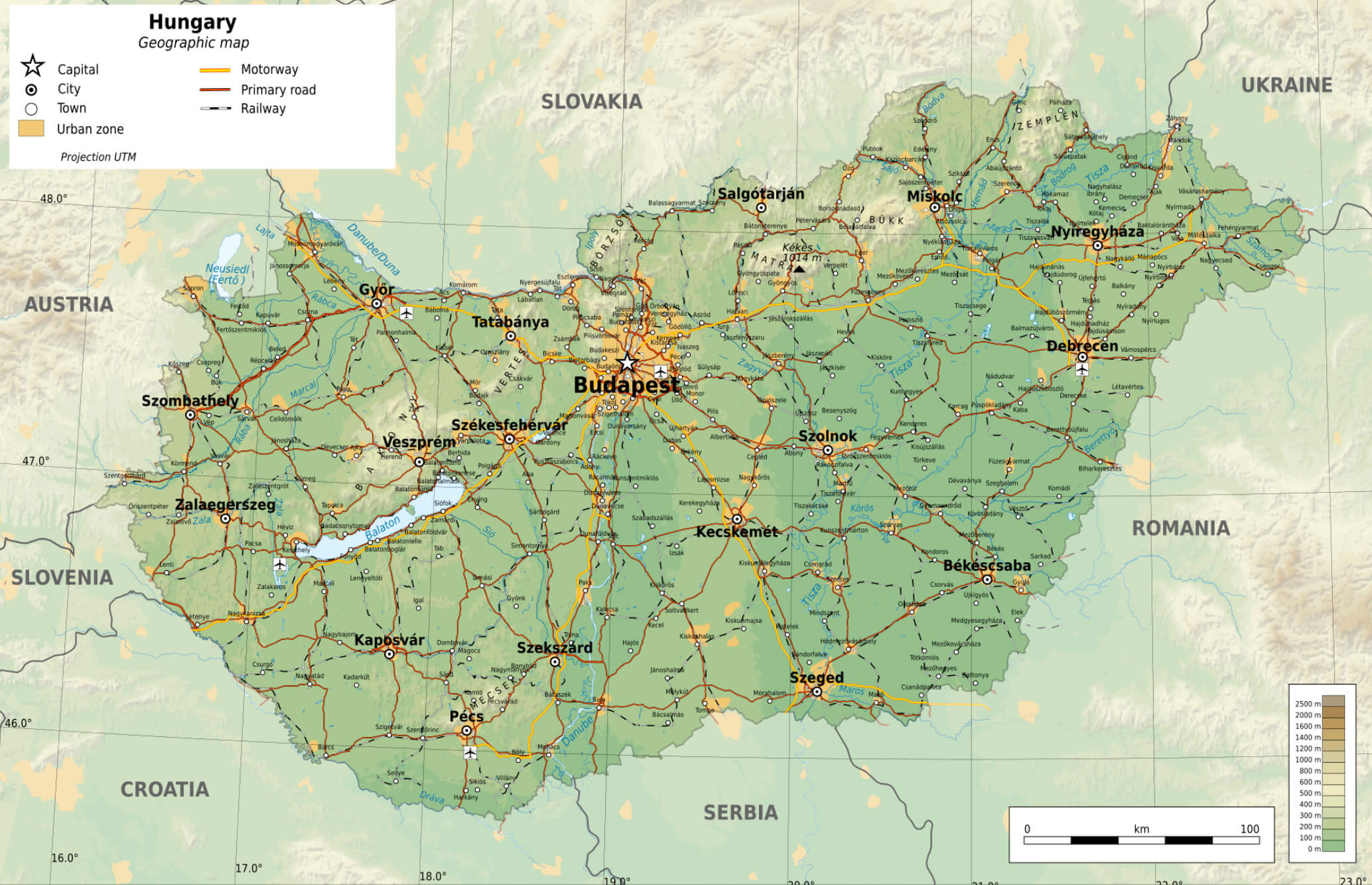 This map of Hungary provides a detailed geographic overview, highlighting the country’s major cities, highways, major roads and railways. Budapest, the capital, is shown as the central hub, connected to other major cities such as Debrecen, Szeged, and Pécs. The map also shows Hungary’s proximity to neighboring countries, including Austria, Slovakia, Romania, Serbia and Croatia. Major natural features such as Lake Balaton, the largest lake in Central Europe, are clearly marked. The map provides a comprehensive view of Hungary’s transportation and geographic structure.
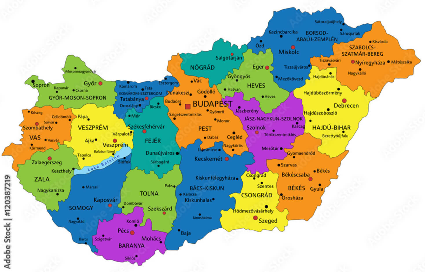
Hungary Counties Map
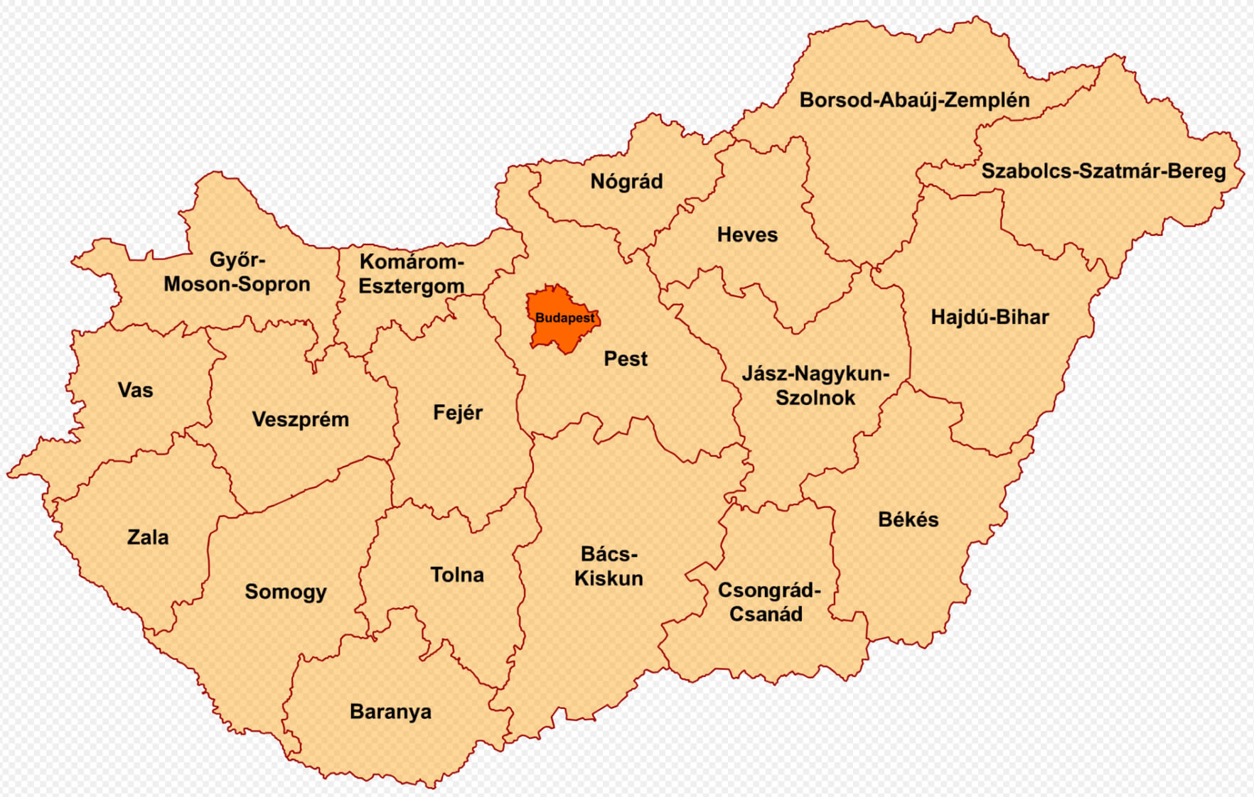 This map illustrates the administrative divisions of Hungary, highlighting its 19 counties, each with its own boundaries. Budapest, the capital, is shown separately as an independent entity. The counties, such as Győr-Moson-Sopron, Bács-Kiskun, and Baranya, among others, form the basic regional administrative framework of the country.
Roman Provinces Map Carpathian Basin 2nd Century AD Hungary
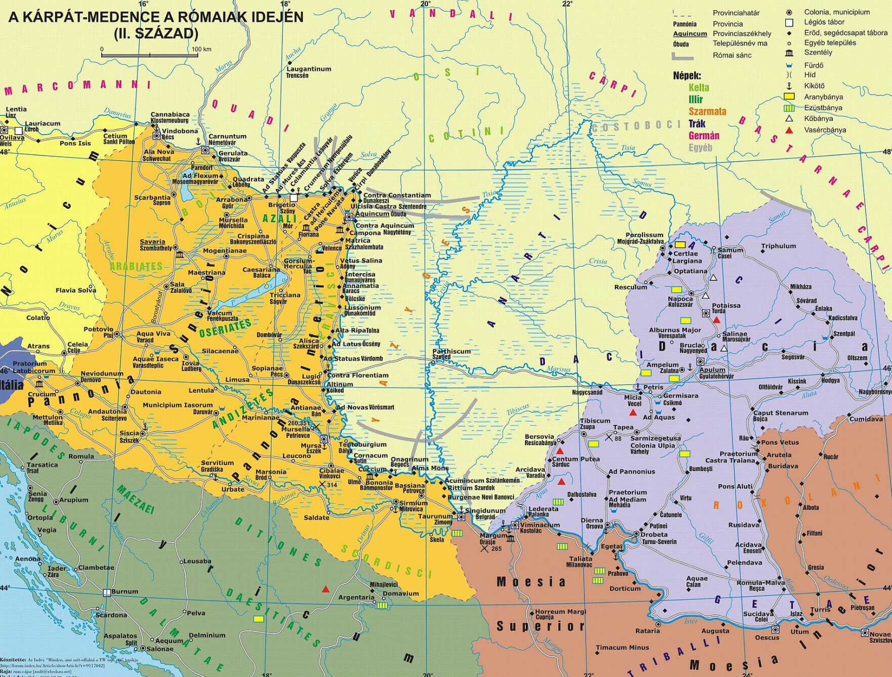 This map illustrates the Roman provinces and territories in the Carpathian Basin during the 2nd century AD, including areas that are part of modern-day Hungary. It highlights the major Roman settlements, fortifications, and provincial boundaries of the time. The map also shows neighboring regions such as Dacia, Moesia, and Pannonia that were under Roman influence, as well as other cultural groups such as the Celts and Germanic tribes. The complex layout reflects the expansion of the Roman Empire and the diverse ethnic landscape in this part of Europe during the Roman period.
Kingdom of Hungarian Map between 1941 and 1944
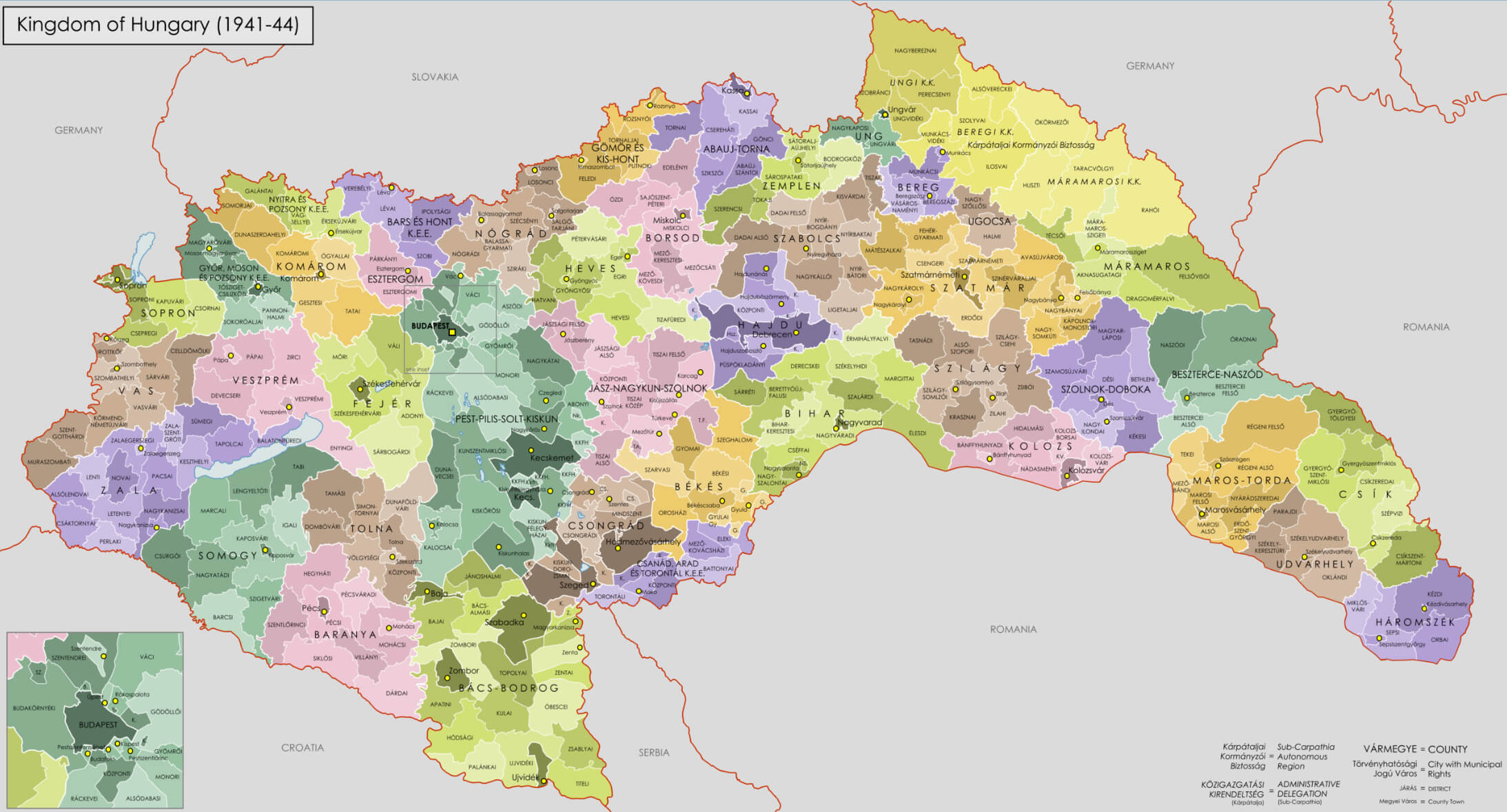 The map depicts the Kingdom of Hungary between 1941 and 1944, a period during which Hungary was allied with the Axis powers in World War II. This historical map highlights Hungary’s territorial expansion during the war, showing the annexation of regions such as northern Transylvania and parts of present-day Slovakia, Romania, and Yugoslavia. The map includes various counties, which were administrative divisions at the time, reflecting Hungary’s control over these areas before post-war borders were established.
Map of Hungary Europe
Map of Hungary World

Where is Hungary on the Europe Map?
Show Google map, satellite map, where is the country located.
Get directions by driving, walking, bicycling, public transportation and travel with street view.
Feel free to explore these pages as well:
- Budapest: The Pearl of the Danube – A Traveler’s Guide to Hungary’s Enchanting Capital ↗️
- Unveiling Budapest: The Top 10 Experiences You Can’t Miss ↗️
- Hungary Map ↗️
- Map of Europe ↗️
- Europe Map ↗️
- A Collection of Europe Maps ↗️