Explore Croatia’s breathtaking landscapes and rich history with this detailed collection of maps. Whether you’re a traveler, geography enthusiast, or history buff, this map collection will guide you through Croatia’s fascinating topography and landmarks.
Brief information about Croatia
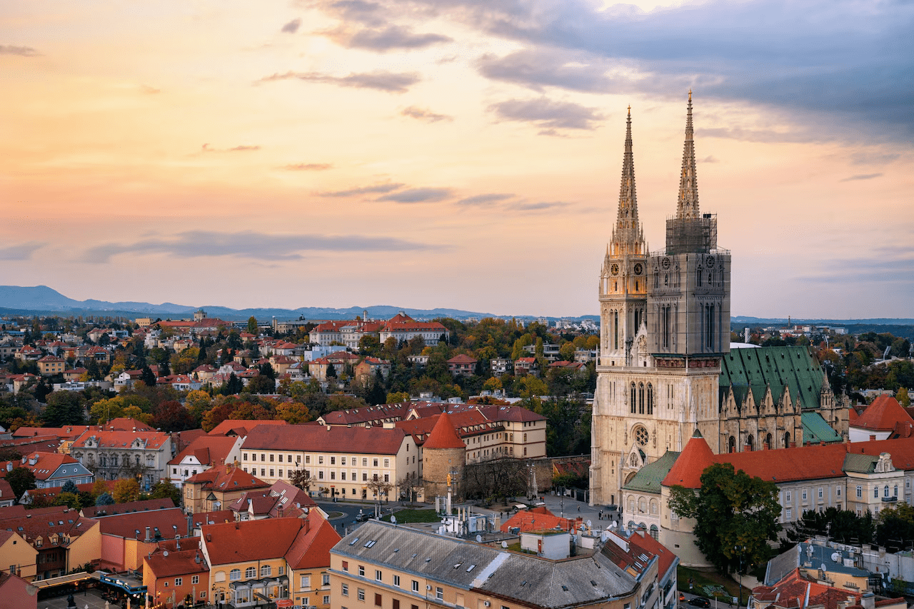
Croatia, located in southeastern Europe, is renowned for its stunning landscapes and rich cultural heritage. Bordered by the Adriatic Sea, this country boasts a picturesque coastline dotted with over a thousand islands. The capital, Zagreb, serves as the cultural and political hub, while iconic destinations like Dubrovnik and Split draw tourists from all over the world, with their well-preserved medieval architecture and historical significance.
Croatia Physical Map
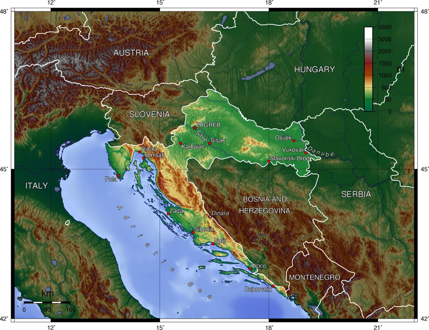
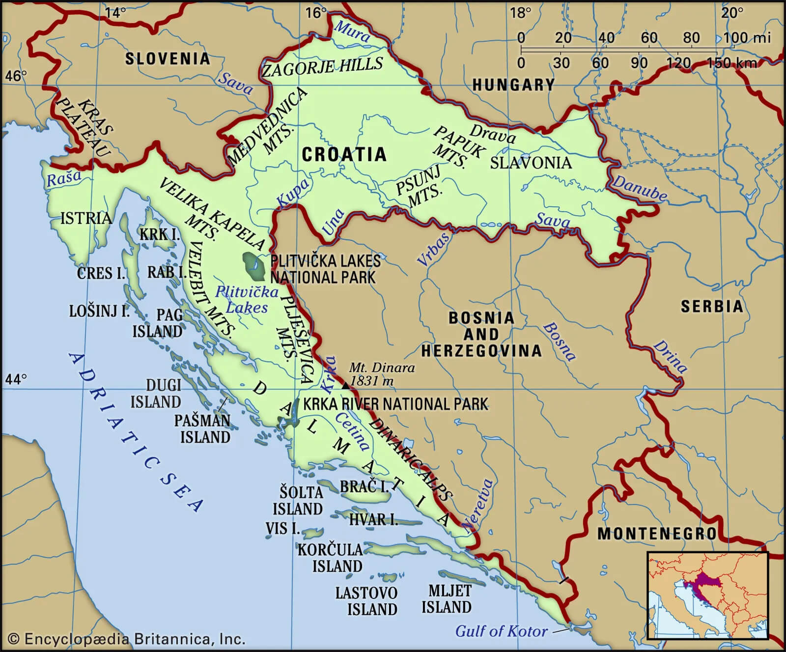
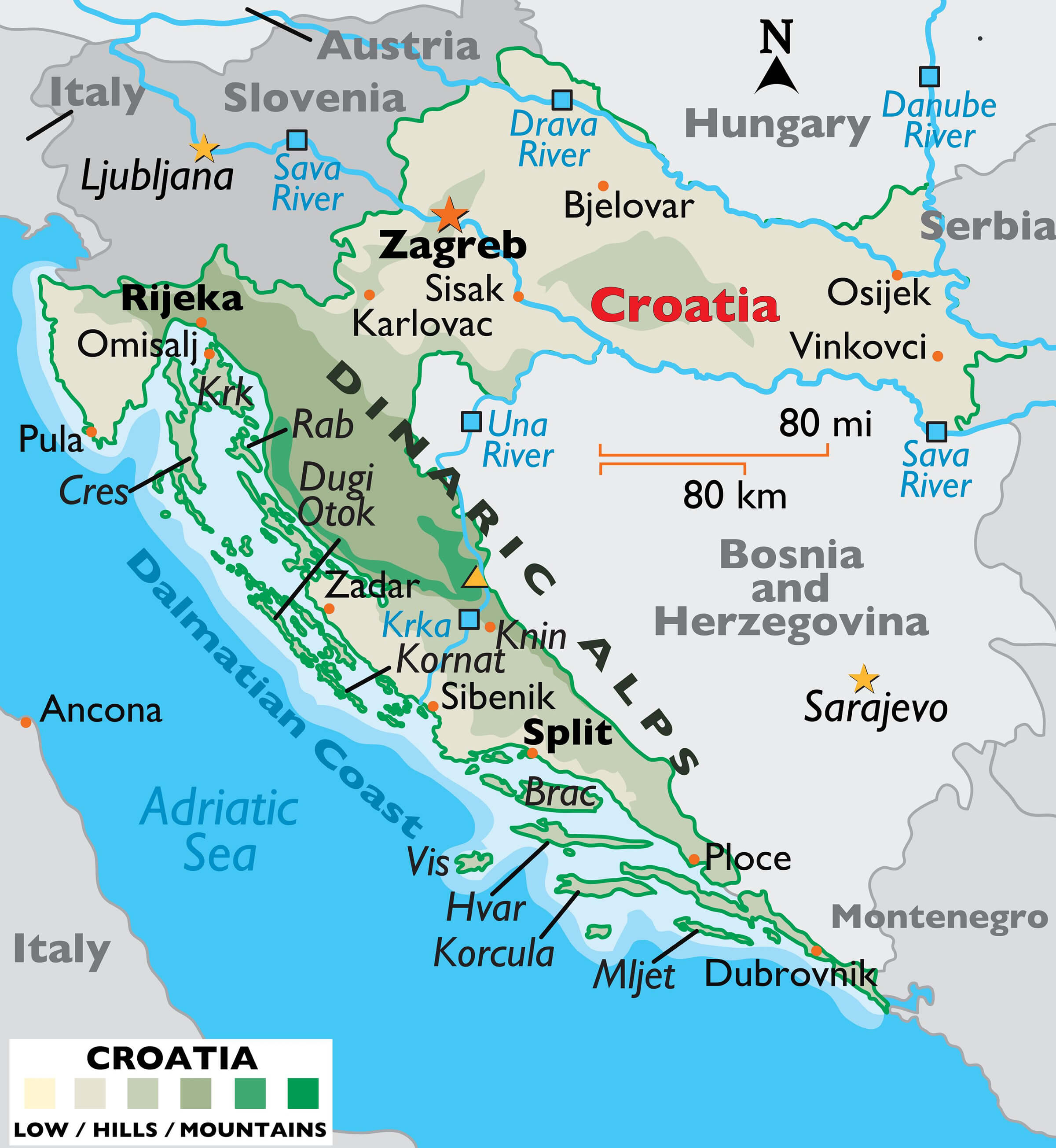
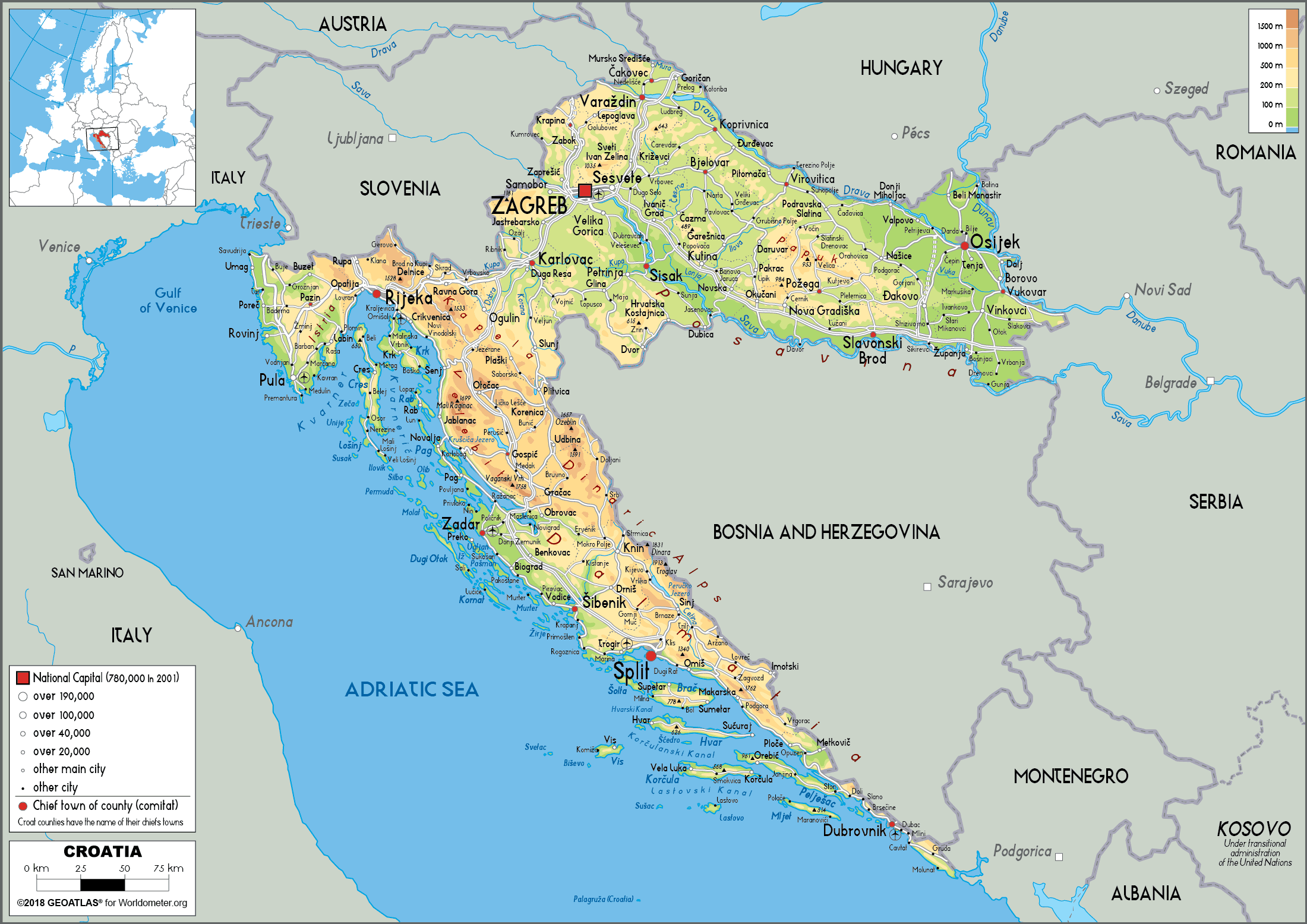 This physical map of Croatia shows the country’s varied geography, including mountainous regions, plains and a long Adriatic coast with cities such as Split, Dubrovnik and Zadar. The map highlights major rivers such as the Sava and Drava, and the Dinaric Alps that run parallel to the coast, emphasising Croatia’s varied terrain from the inland hills to the coastal areas. The detailed layout provides a clear view of key geographical features and their locations throughout the country.
In addition to its coastal beauty, Croatia is home to several UNESCO World Heritage sites, including the Plitvice Lakes National Park, famous for its cascading lakes and vibrant biodiversity. The country’s history reflects a blend of different cultural influences, from Roman to Ottoman, which is evident in its architecture and cuisine. Croatia’s strategic location and growing tourism industry have made it a prime destination for travelers seeking both adventure and relaxation.
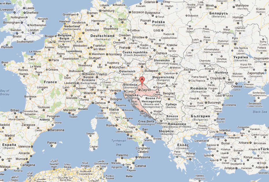
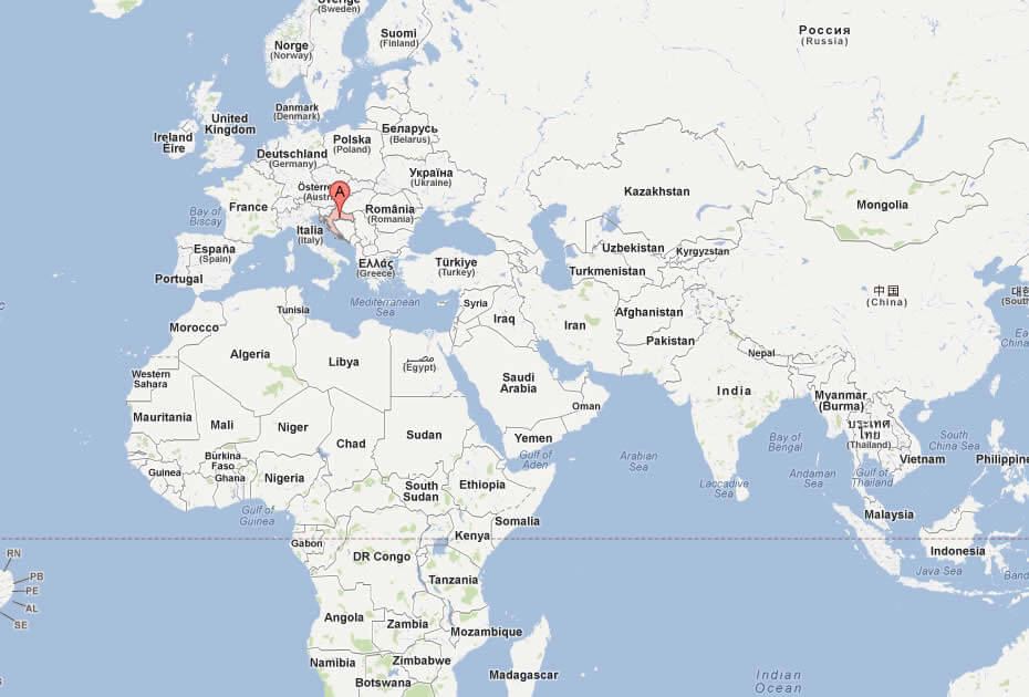
Where is located Croatia on the World Map
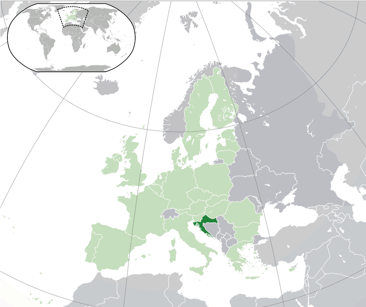
Croatia is located in southeastern Europe, along the Adriatic Sea. It shares borders with Slovenia, Hungary, Serbia, Bosnia and Herzegovina, and Montenegro, while facing Italy across the sea. Its location bridges Central Europe and the Mediterranean, giving it a unique mix of influences.
Croatia’s coastline, stretching over 1,700 kilometers, is famous for its clear waters and over 1,000 islands, making it a prime destination for tourism and sailing. Inland, the country offers diverse landscapes, from mountains to fertile plains near the Danube River.
On the world map, Croatia may appear small, but its strategic location makes it a cultural and geographical crossroads, connecting different parts of Europe and the Mediterranean.
Here are some statistical information about Croatia:
Map of Croatia
Croatia Road Map
This map focuses on Croatia’s road network, showing major highways and routes connecting cities like Zagreb, Rijeka, Split, and Dubrovnik. It also highlights the neighboring countries of Slovenia, Bosnia and Herzegovina, and Hungary, along with Croatia’s Adriatic coast and key islands such as Cres and Hvar.
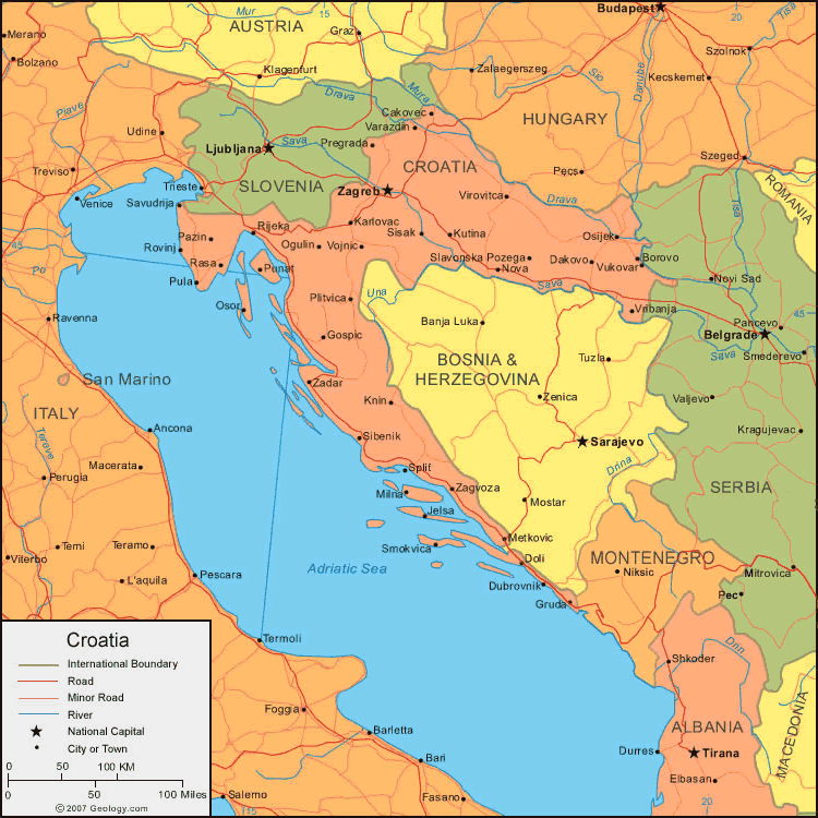
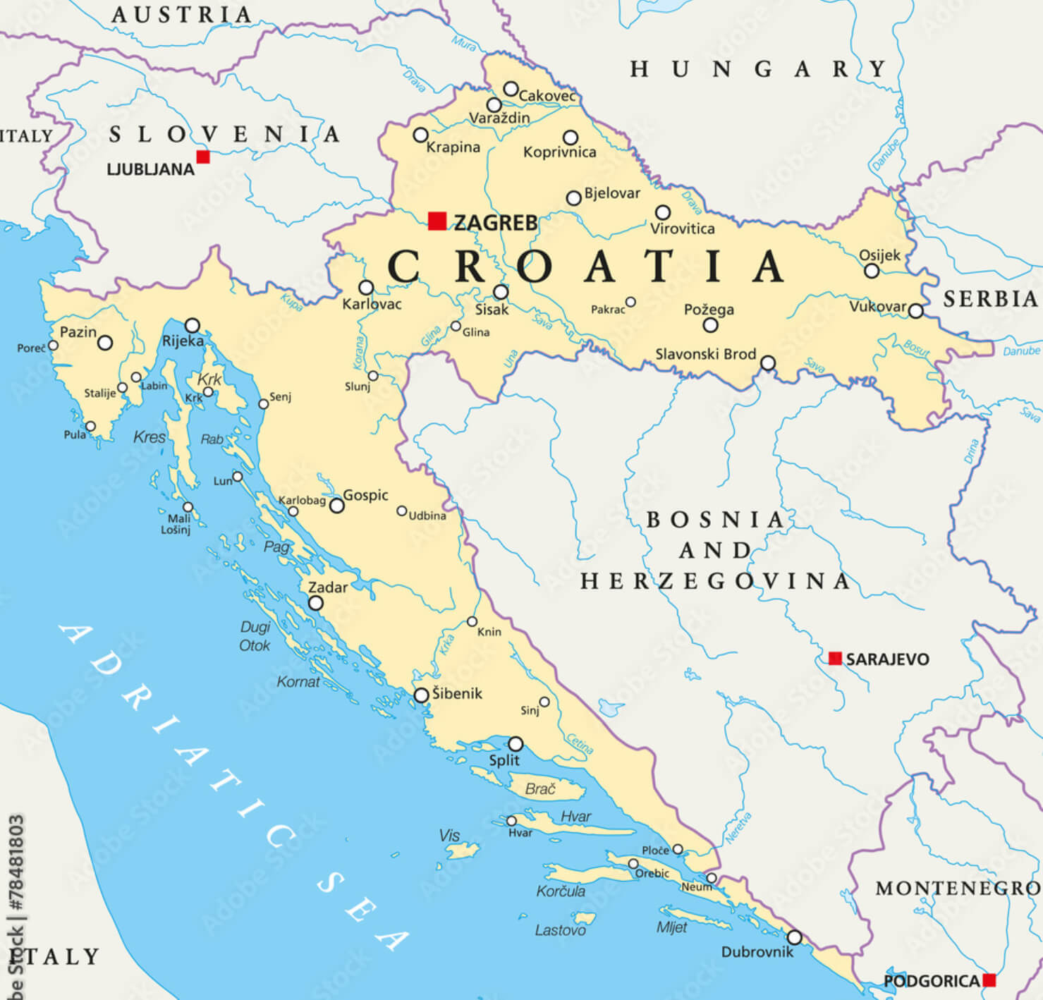
Croatia Political Map
This political map shows Croatia and its major cities, including Zagreb, Rijeka, Split, and Dubrovnik, along with the administrative boundaries and neighboring countries like Slovenia, Hungary, Serbia, and Bosnia and Herzegovina. The Adriatic Sea and key islands such as Hvar and Korcula are also prominent, highlighting Croatia’s coastal geography.
Old Map of Croatia
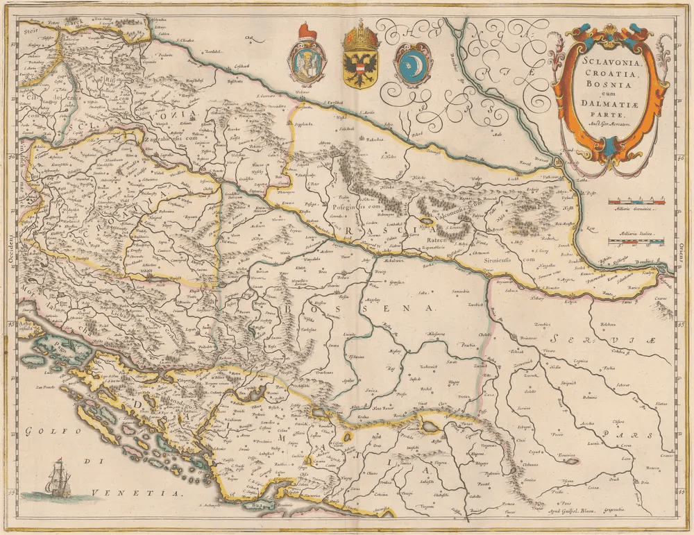
This old map depicts Slavonia, Croatia, Bosnia, and Dalmatia, along with parts of modern-day Serbia. Key cities, rivers, and mountains are highlighted, and the Adriatic Sea is labeled as the Gulf of Venice, reflecting Venetian influence along the Dalmatian coast.Croatia Animals Map
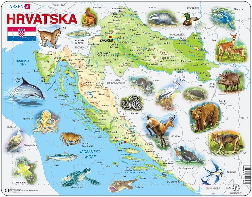
This map showcases the wildlife of Croatia, with illustrations of native animals like the brown bear, lynx, wild boar, and marine life such as the dolphin and octopus. It highlights various species across regions from the Adriatic Sea to inland areas, emphasizing Croatia’s rich biodiversity.
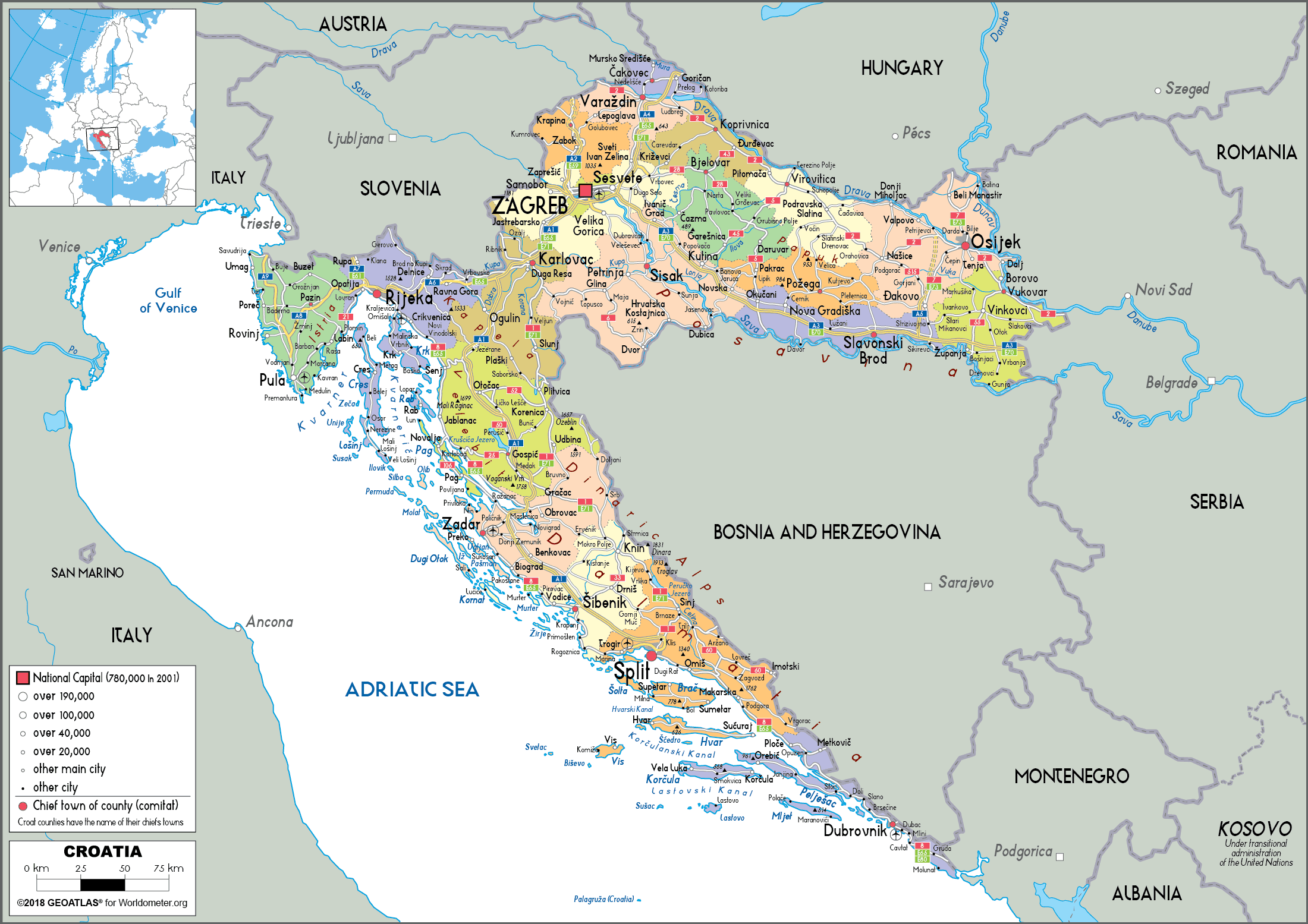
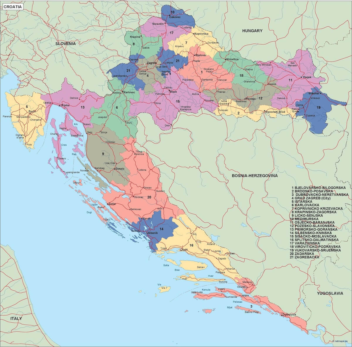
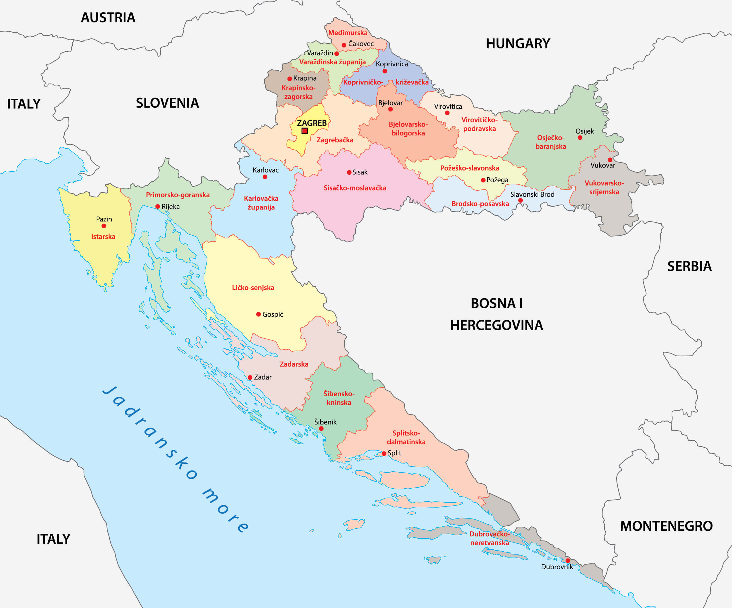
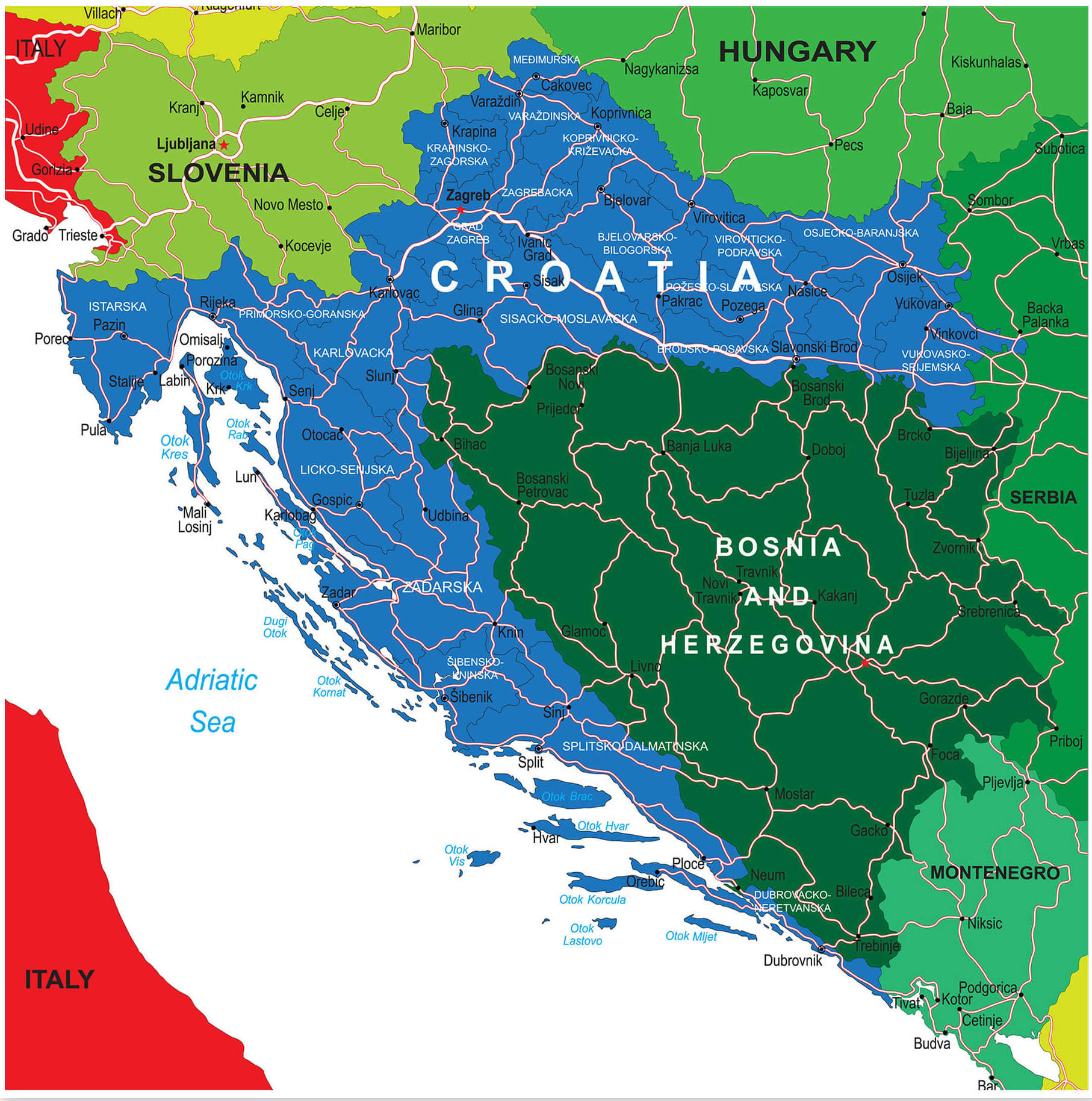
Croatia Administrative Map
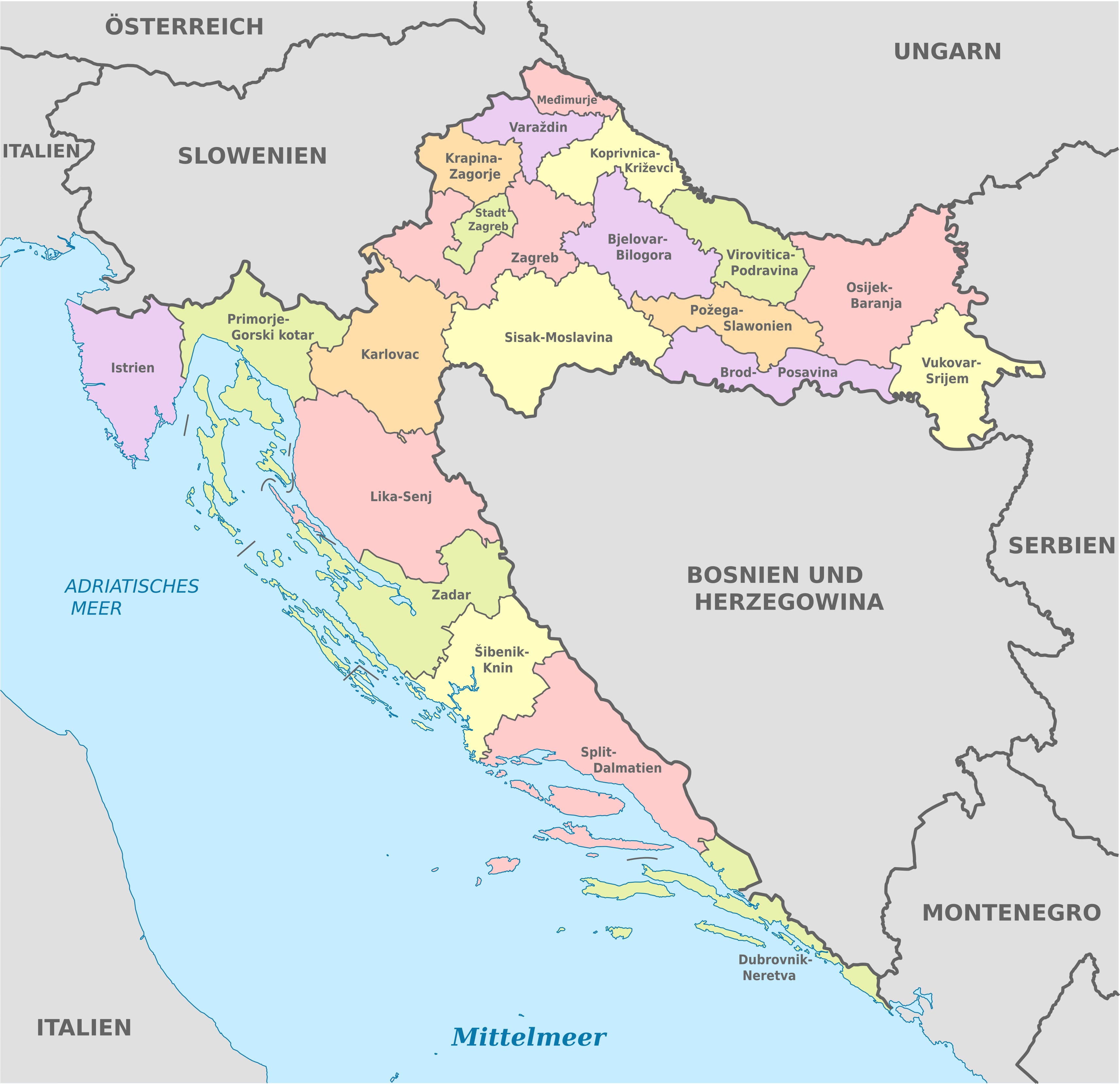
This map outlines the administrative regions of Croatia, highlighting its various counties, such as Istria, Split-Dalmatia, and Zagreb. The map also shows Croatia’s neighboring countries, including Slovenia, Hungary, Serbia, and Bosnia and Herzegovina, along with its coastline on the Adriatic Sea.
Croatia Topography Map
Croatia Cities Map
 This map of Croatia highlights the different cities in the country, including major urban centres such as Zagreb, Split and Dubrovnik. The map provides a clear view of the geographical distribution of Croatia’s cities, from the coastal regions along the Adriatic Sea to the more inland areas. It serves as a useful reference for understanding the location of cities in relation to each other and to surrounding countries, making it ideal for travel planning or geographical study.
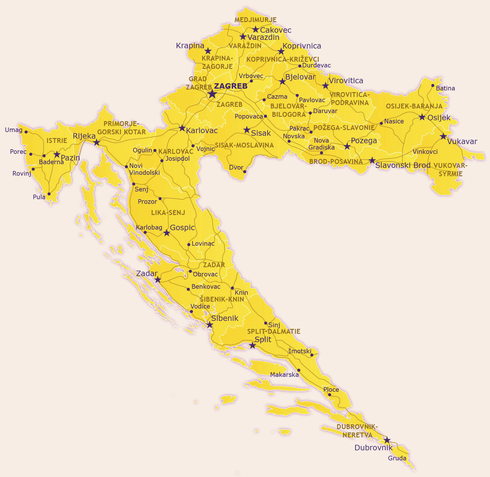
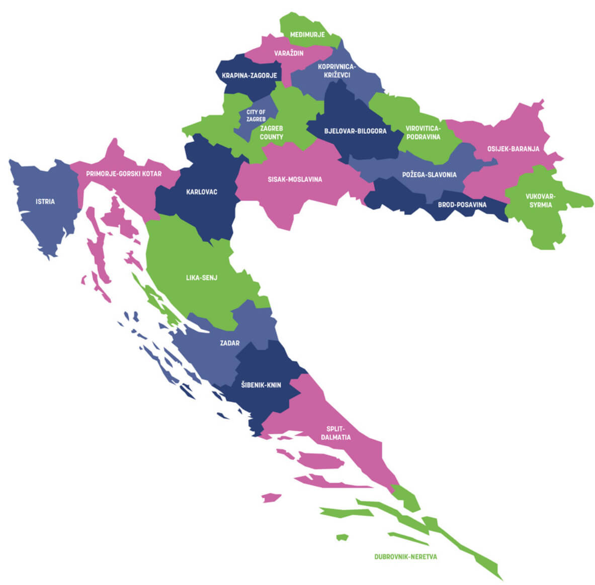
Croatia Provinces Map
 This map of Croatia shows the administrative divisions of the country, including the different provinces and their borders. It shows each province in a different colour, making it easy to distinguish between regions such as Istria, Zagreb, Split-Dalmatia and others. The map also includes major cities and towns, as well as neighbouring countries such as Slovenia, Hungary and Bosnia and Herzegovina. This provides a clear overview of Croatia’s regional organisation and geographical layout.
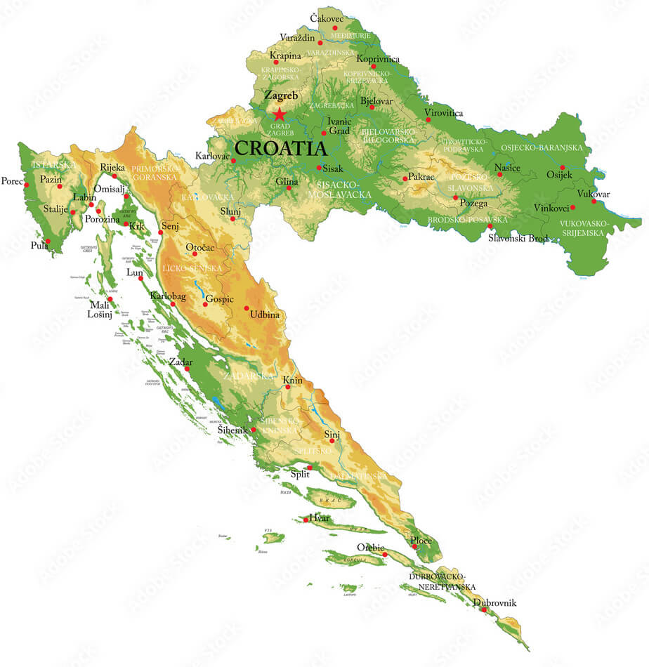
Croatia Elevation Map
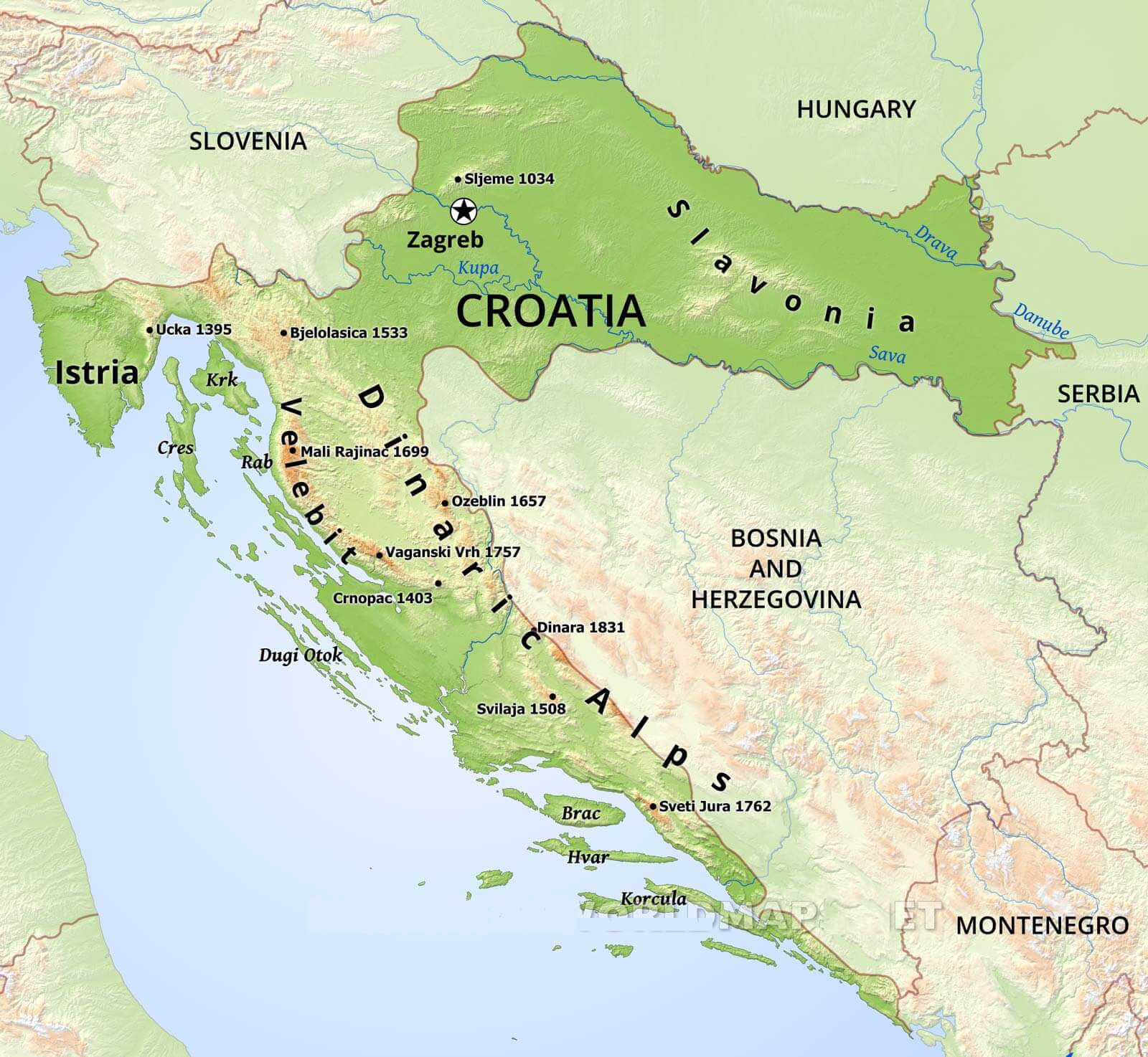 This Croatia elevation map highlights the diverse topography of the country, showcasing key mountain ranges such as the Dinaric Alps and Velebit, with peaks like Dinara (1831 m) and Vaganski Vrh (1757 m). It also illustrates the lower-lying regions of Slavonia in the east and the coastal areas along the Adriatic Sea, where islands like Krk, Brac, and Korcula are visible. The map provides an excellent overview of Croatia’s geographical variation, from high mountain peaks to coastal plains.
Croatia Vector Map with Regions
 This map of Croatia highlights the different regions of the country in different colours, such as Istria, Zagreb County and Split-Dalmatia. Each region is clearly labelled, making it easy to identify the different areas within the country, from the coastal areas such as Zadar and Split-Dalmatia to the inland regions such as Varaždin and Sisak-Moslavina. The map offers a clear view of the regional divisions, providing a simplified representation of Croatia’s administrative areas.
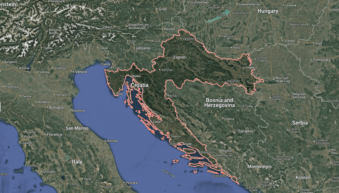
Satellite Map of Croatia
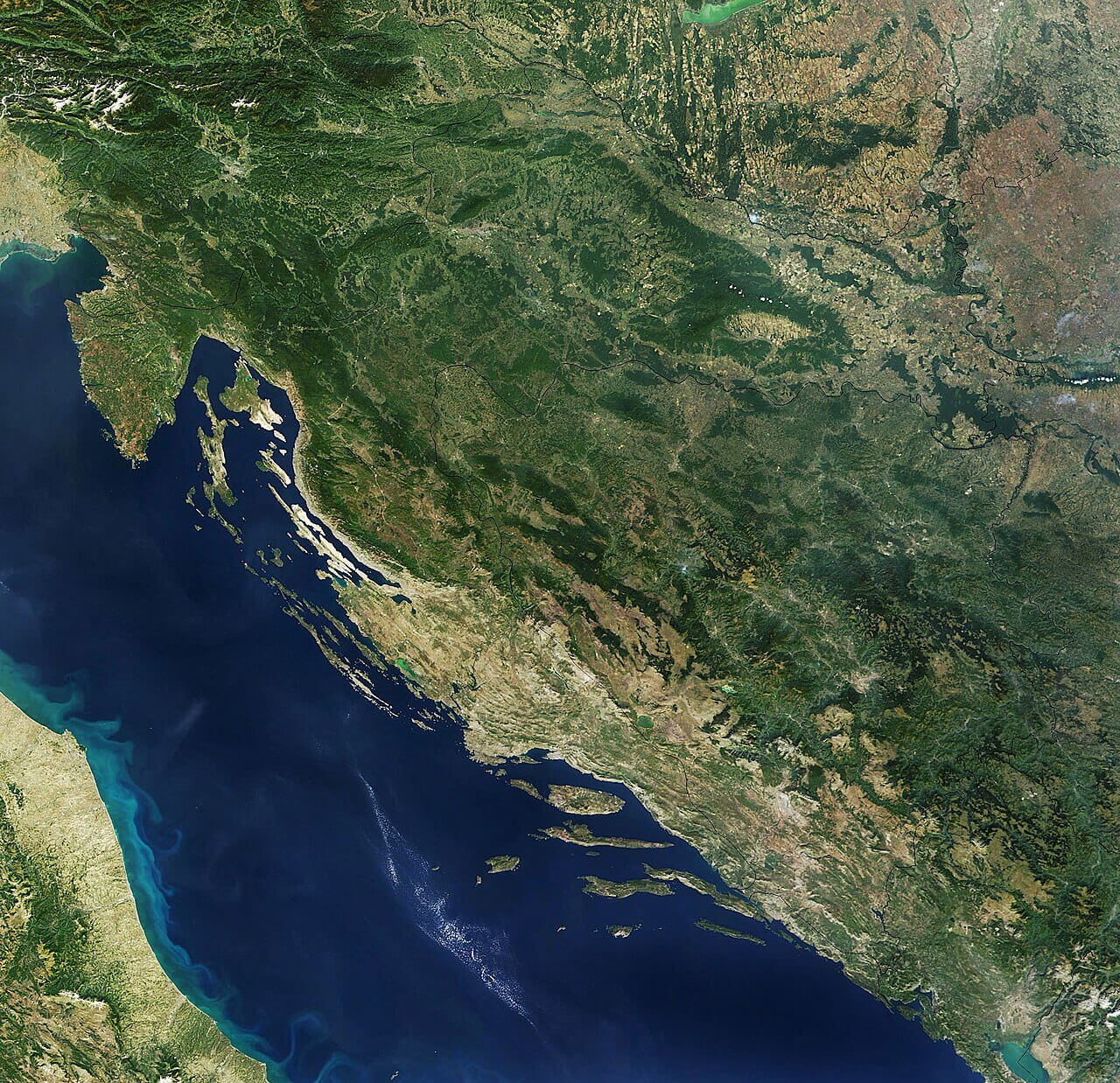 This satellite map of Croatia offers a stunning view of the country’s diverse landscape, showcasing its extensive Adriatic coastline, rugged mountains, and green interiors. The image captures the natural beauty of the Croatian coastline, dotted with islands and surrounded by the deep blue waters of the Adriatic Sea, as well as the more forested and hilly inland regions. The map highlights the geographical variety, from the Istrian Peninsula in the northwest to the Dalmatian coast in the south, providing a detailed perspective of Croatia’s topography.
Kingdom of Croatia Map in 925 Reign of King Tomislav
Croatia Rivers Map
 This map highlights the rivers of Croatia, showing major waterways such as the Sava, Drava and Danube. These rivers flow through the eastern and northern parts of the country, providing important water resources and defining parts of Croatia’s borders with neighbouring countries such as Hungary and Serbia. The map also shows major mountain ranges and islands along the Adriatic coast, contributing to the country’s diverse geographical landscape.
Croatia Climate Map
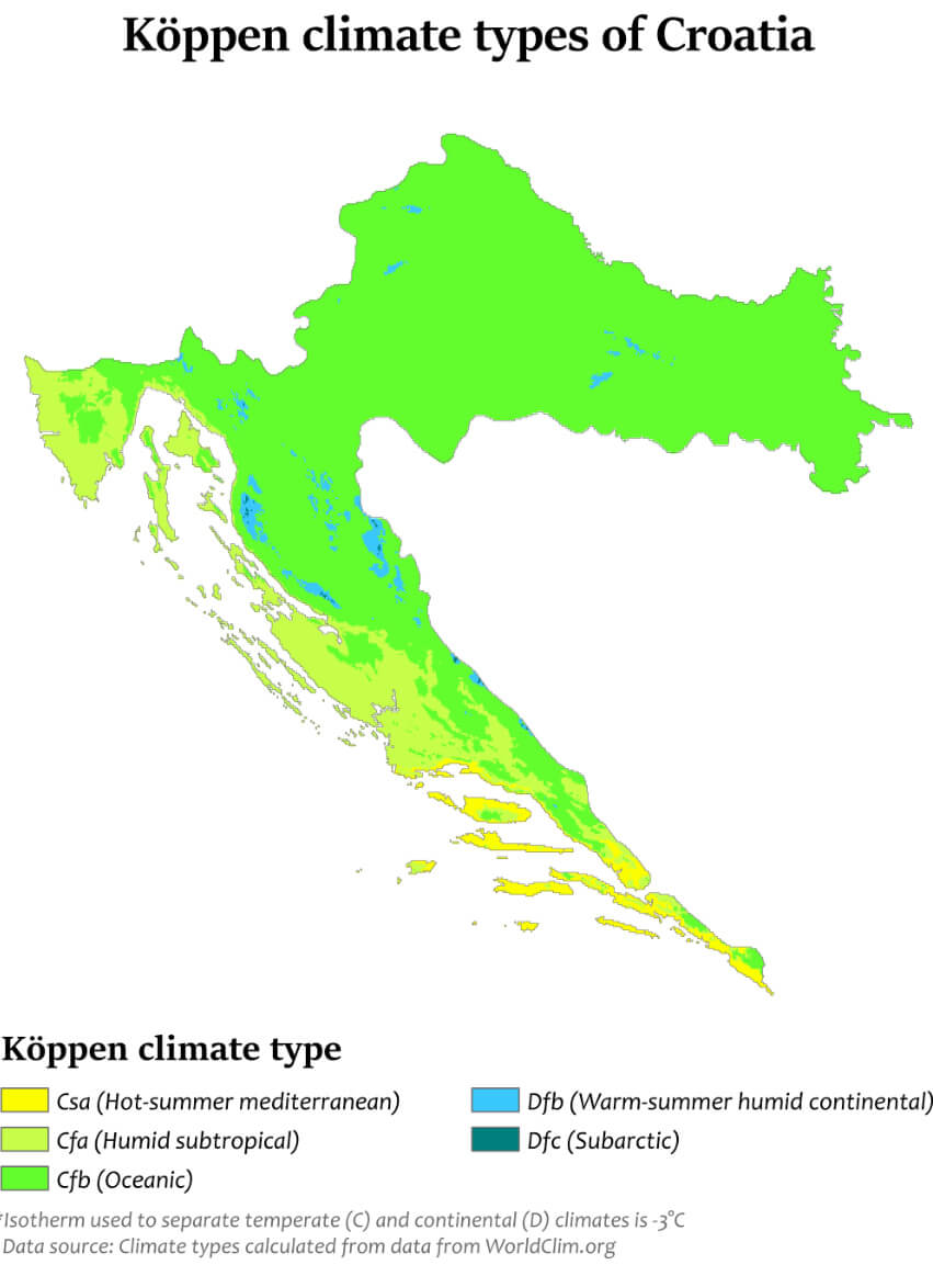 This map of Croatia shows the distribution of different Köppen climate types across the country. The map highlights the variation from the hot-summer Mediterranean climate (Csa) along the coastal areas to the humid subtropical (Cfa) and warm-summer humid continental (Dfb) climates further inland. The coastal regions, including the Dalmatian coast, benefit from a Mediterranean climate, making them ideal for tourism with hot, dry summers and mild winters. In contrast, areas closer to the northern and eastern regions experience more continental weather patterns, with cooler summers and colder winters.
Croatia Religious Map
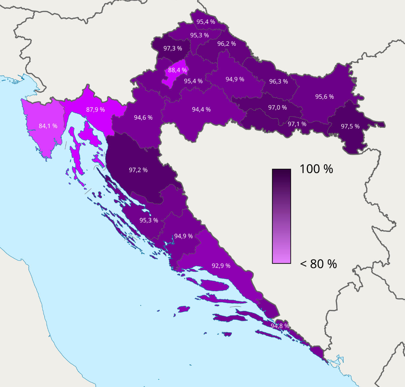 This map of Croatia shows the religious distribution in different regions, showing the percentage of people who identify with particular religions. The different shades, from light to dark, probably represent the concentration of religious affiliation, with darker shades indicating regions with higher percentages. This type of map helps to visualise the predominant faiths in different areas, providing insights into the cultural and social landscape of the country.
Croatia Population Density Map
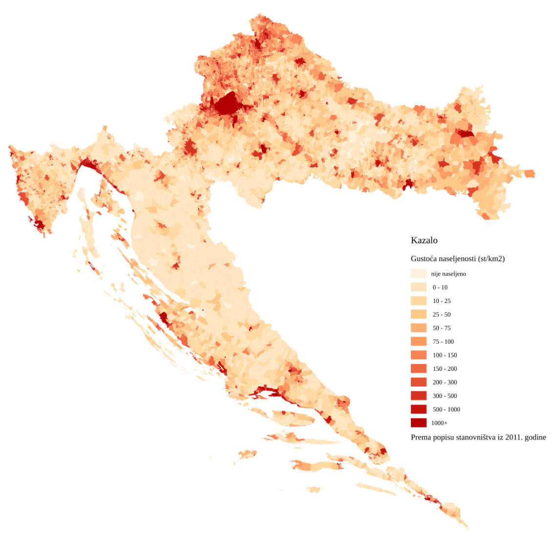 This map illustrates Croatia’s population density, showing areas with varying numbers of people per square kilometre. Darker shades represent regions with higher population concentrations, while lighter shades indicate sparsely populated areas. The densest areas are around major cities such as Zagreb, highlighting its role as a central hub, while rural and mountainous regions have significantly lower densities.
Croatia Regions Map
 This map of Croatia highlights its regions, showing the administrative boundaries and capitals of each area. It shows major cities such as Zagreb, Split and Dubrovnik, as well as neighbouring countries such as Slovenia, Hungary, Serbia, Bosnia and Herzegovina and Montenegro. The map is useful for understanding the geographical divisions of Croatia and its position on the Balkan Peninsula.
Croatia Country Map with Rivers
Croatia Main Cities Map with Zagreb
 This map highlights the main cities in Croatia, with a focus on the capital, Zagreb. It also depicts major locations such as Split, Rijeka, Zadar, and Dubrovnik, showcasing the strategic positioning of these cities along the Adriatic coast and inland. The map provides a clear view of Croatia’s connections with neighboring countries like Slovenia, Hungary, Serbia, Bosnia and Herzegovina, and Montenegro
Croatia Physical Map with Cities
 This physical map of Croatia with cities highlights the country’s varied terrain, including its mountainous regions, coastal areas along the Adriatic Sea, and major urban centers such as Zagreb, Split, and Dubrovnik. The map shows how the Dinaric Alps stretch across the country, contributing to the rugged landscapes, especially in the western and southern regions, while the flatter plains are more prominent in the east, around Slavonia. This geographical diversity is essential for understanding the country’s climate, natural beauty, and regional differences
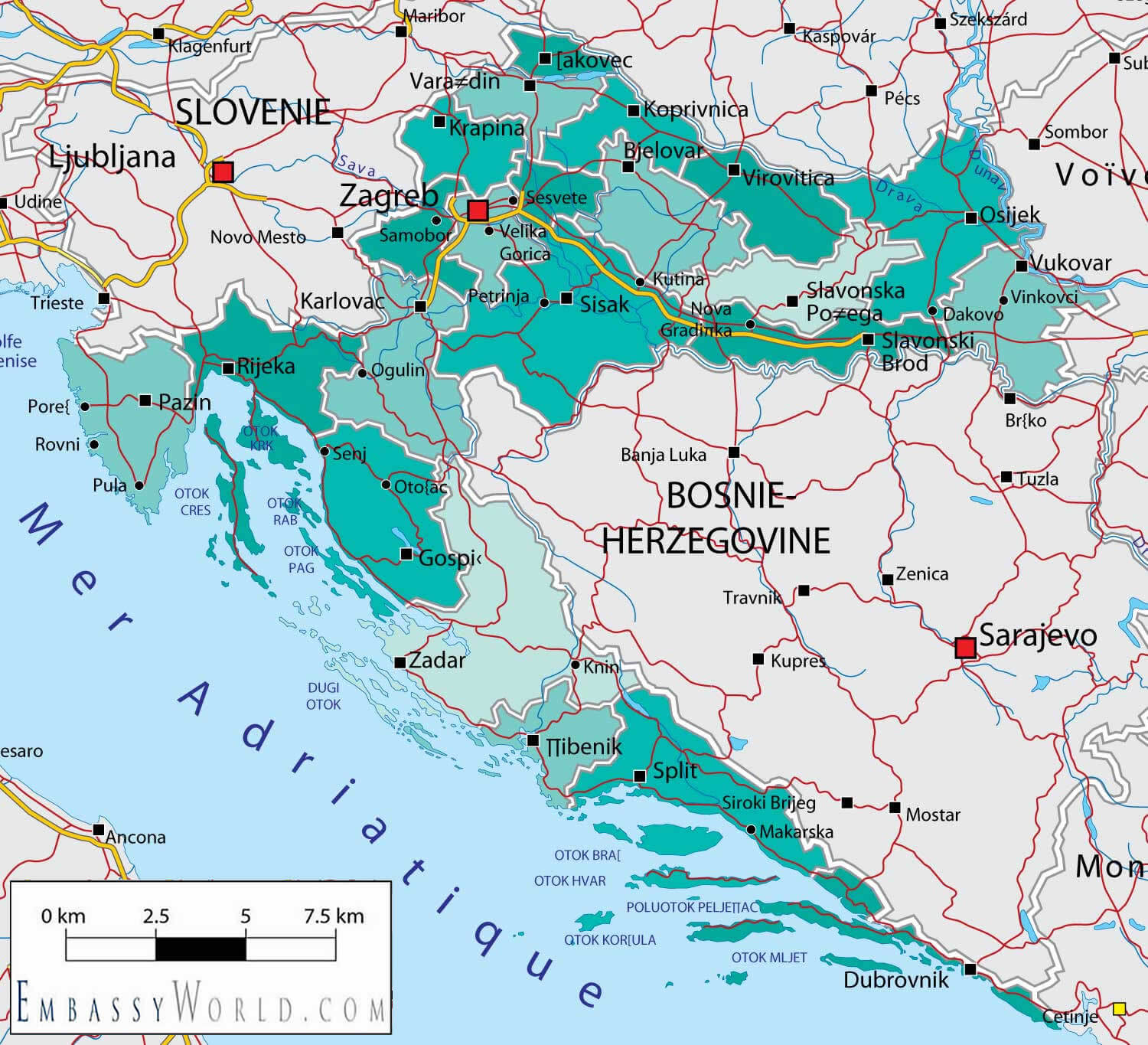
Croatia Map with Balkan Countries
 This map shows Croatia and its neighbouring Balkan countries, including Slovenia, Bosnia and Herzegovina, Serbia, Montenegro and Italy. It provides a detailed view of the borders, regional divisions and geographical connections within the Adriatic region, giving a clear perspective of Croatia’s position within the Balkan Peninsula. The map also shows the relationship between Croatia’s coastal and inland regions, emphasising the country’s strategic location along the Adriatic coast.
Croatia Satellite Map
Map of Croatia Europe
Map of Croatia World
Where is Croatia on the Europe?
Show Google map, satellite map, where is the country located.
Get directions by driving, walking, bicycling, public transportation and travel with street view.
Feel free to explore these pages as well:
- Italy Map ↗️
- Map of Italy ↗️
- The 10 Best Things to Do in Venice ↗️
- Map of Europe ↗️
- Europe Map ↗️
- A Collection of Europe Maps ↗️