Map of Oklahoma

HomeMapsMap of Oklahoma
- Advertisement -

A collection maps of Oklahoma; View a variety maps of Oklahoma physical, political, relief map. Satellite image of Oklahoma, higly detalied maps, blank map of Oklahoma, US and Earth. And find more Oklahoma’s country, regions, topography, cities, road, rivers, national, directions maps and USA state atlas.

Oklahoma Administrative Map

Oklahoma Administrative Map
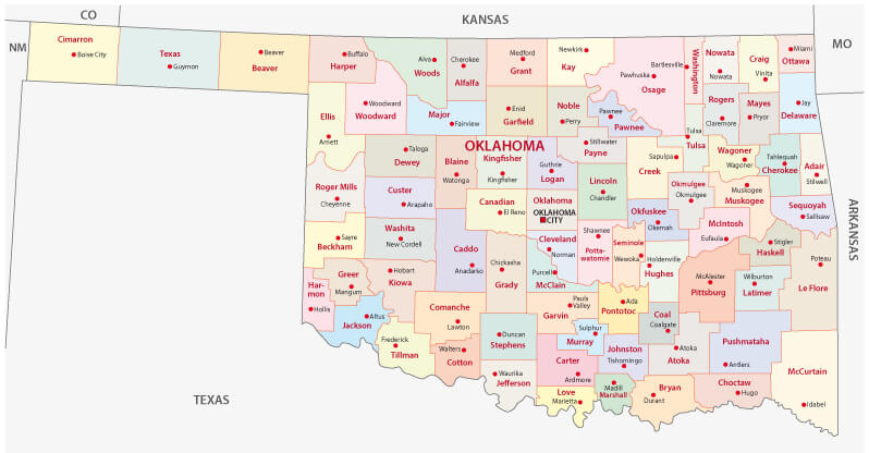
Oklahoma administrative map with main cities and counties.

Oklahoma Blank Map

Oklahoma Blank Map
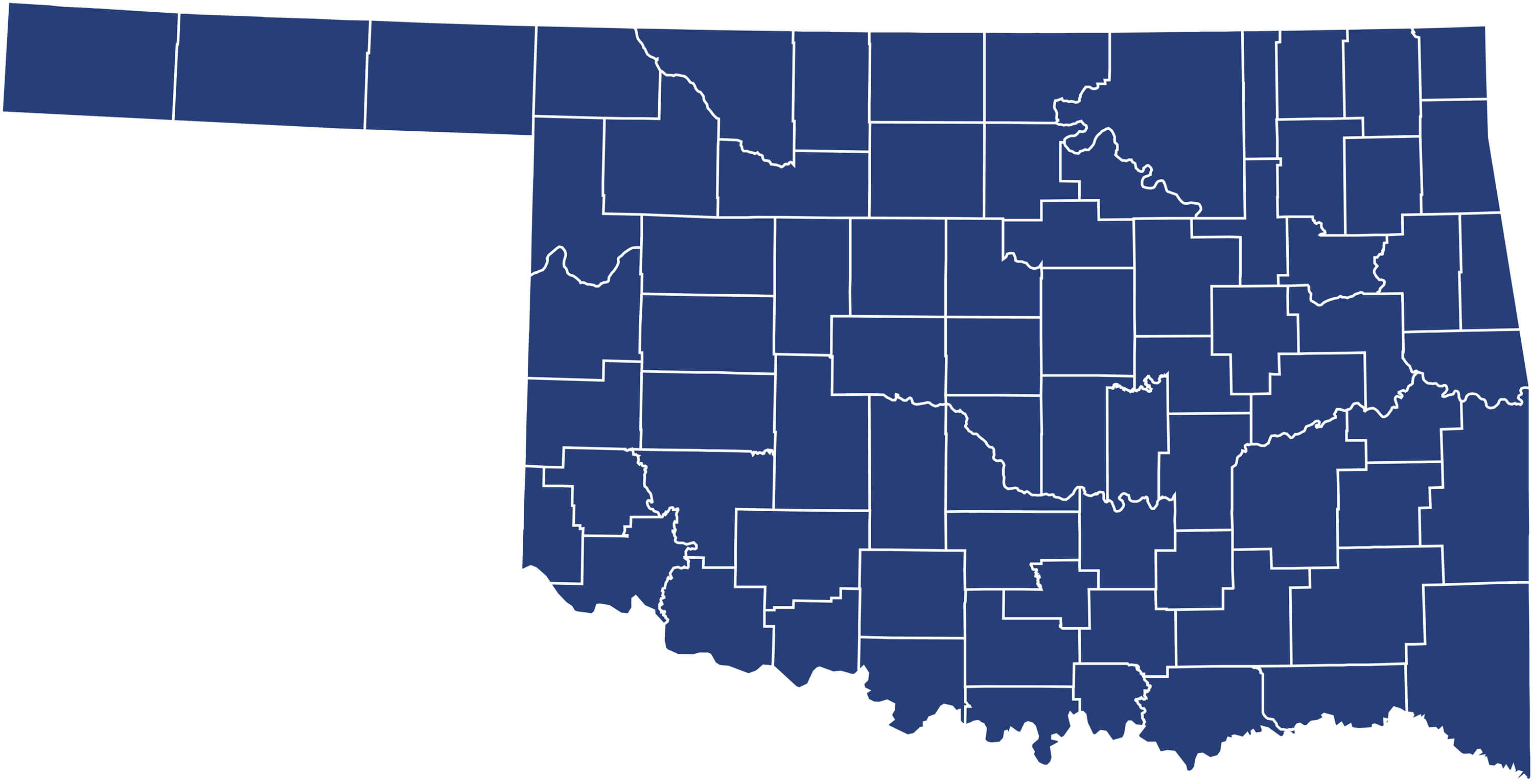
Oklahoma Blank Map with counties, United States.

Oklahoma City Map

Oklahoma City Map


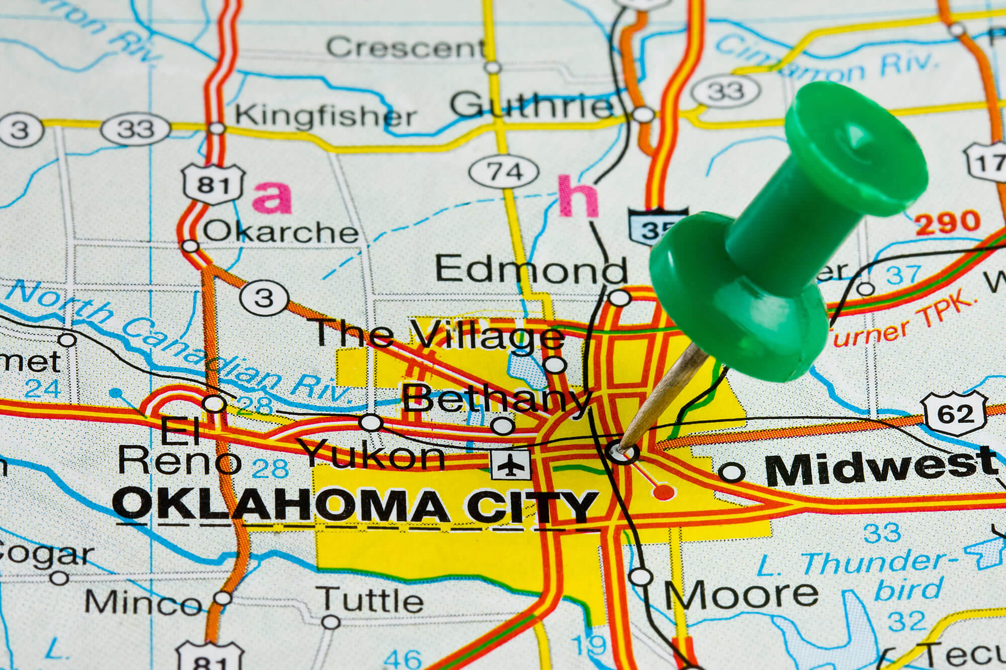
Oklahoma City highlighted with push pin on atlas or map.

Where is Oklahoma in the World?

Show Google map, satellite map, where is the country located.

Get direction by driving, walking, bicycling, public transportaion and travel with street view.

[gmap-embed id=”2019″]

Oklahoma Maps and Photos

- Advertisement -
Previous article
Next article

Discover

Sponsor

Latest Posts

Canada Cities Map

Explore Canada's cities, towns and road networks with our detailed maps. Discover largest cities by population, economic regions and provincial capitals. Learn about Canada's...

France Political Map

Political maps of France provide a comprehensive overview of the country's regions, cantons, cities, roads, administrative divisions and population density. These maps also highlight...

Map of Norway

Explore a comprehensive collection of maps of Norway, including physical, political, and relief maps. You’ll find detailed satellite images, blank maps, and various topographical...

Bangladesh Map

Explore political, physical and satellite maps of Bangladesh with its cities, rivers, topography, elevation, relief and terrain. Discover its location in Asia and in...

Eaton Map in Los Angeles

The Eaton Fire is an ongoing wildfire currently burning in the Altadena area of Los Angeles County, Southern California. It ignited on the evening...