Map of Kentucky

HomeMapsMap of Kentucky
- Advertisement -

A collection maps of Kentucky; View a variety maps of Kentucky physical, political, relief map. Satellite image of Kentucky, higly detalied maps, blank map of Kentucky, US and Earth. And find more Kentucky’s country, regions, topography, cities, road, rivers, national, directions maps and USA state atlas.

Kentucky Road Map
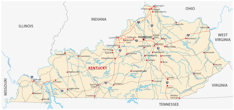
Kentucky Road Map
Kentucky road map with counties and cities, USA.

Map of Kentucky
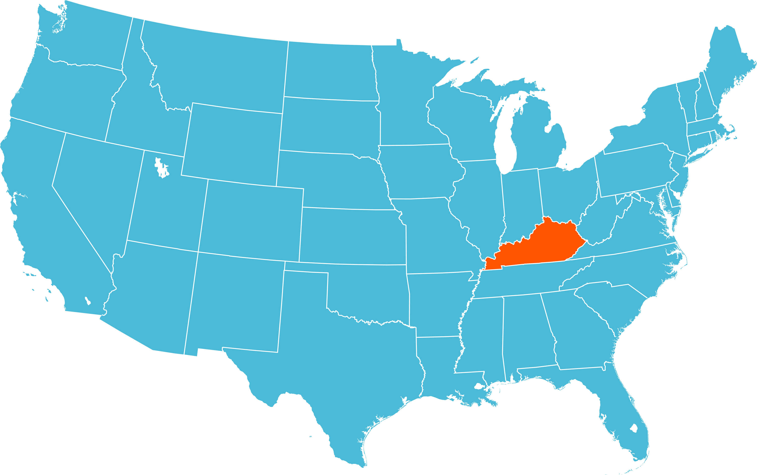
Map of Kentucky
Map of Kentucky, United States.

Kentucky Detailed Map
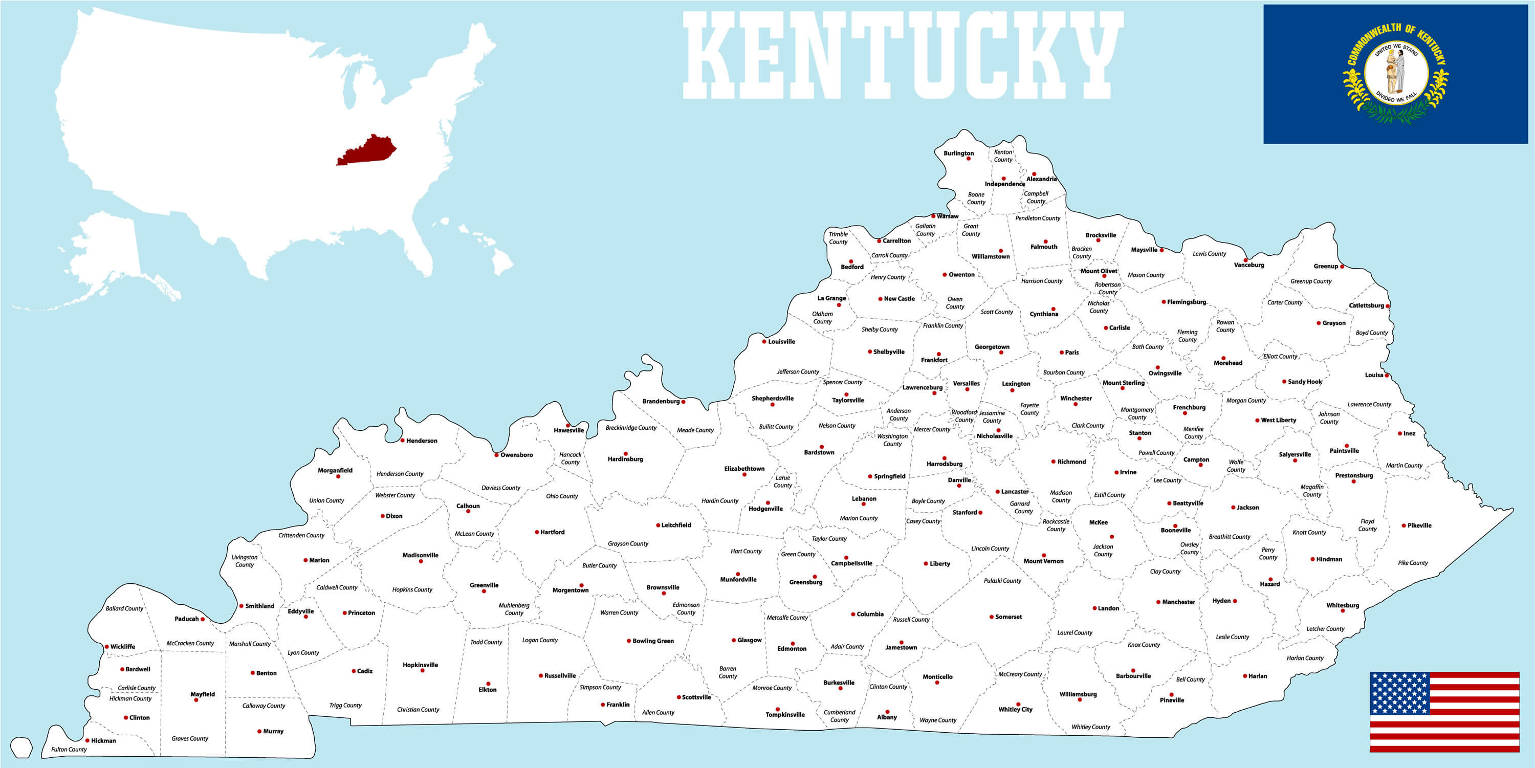
Kentucky Detailed Map


A large and detailed map of the State of Kentucky with all counties and main cities, USA.

Kentucky Administrative Map
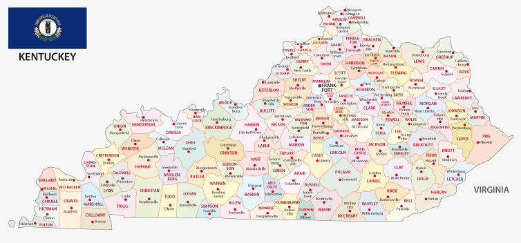
Kentucky Administrative Map
Administrative map with flag of the US state kentucky

Where is Kentucky in the World?

Show Google map, satellite map, where is the country located.

Get direction by driving, walking, bicycling, public transportaion and travel with street view.

[gmap-embed id=”2005″]

Kentucky Maps and Photos

- Advertisement -
Previous article
Next article

Discover

Sponsor

Latest Posts

Top Places to Visit in Athens & Things to do in Athens

Top 10 places to visit in Athens; The Acropolis of Athens, Syntagma Square, The National Library of Greece, The Zappeion Hall, The Acropolis Museum,...

Best Mediterranean Cruises Routes 2020 & Best Time to Cruise

Discover the beauty of the Mediterranean's islands, beaches, cities, and bays with all-inclusive cruise deals for 2019/2020. Visit charming ports, enjoy breathtaking coastlines, and...

South Ossetia Map

Explore South Ossetia with detailed maps, including its location in Europe and the world. Discover political, physical and terrain maps, major cities and its...

Discover Moorish Andalucia, Spain 1

Visit Southern Spain's marvellous region of Andalusia. Explore 8th-15th centuries Moorish rule of Andalusia, Granada Cathedral, Christian Triump Granada, Costa Del Sol, St. Nicolas...

Map of North Carolina

A collection maps of North Carolina; View a variety maps of North Carolina physical, political, relief map. Satellite image of North Carolina, higly detalied...